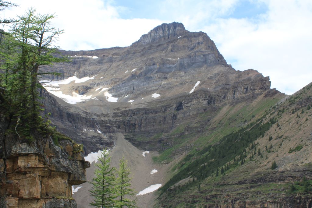
Mount Niblock is a mountain in Banff National Park near Lake Louise, Alberta, Canada.
The mountain was named in 1904 after John Niblock, a superintendent with the Canadian Pacific Railway. Niblock was an early promoter of tourism in the Rockies and influenced the naming of some of the CPR stops in Western Canada.
Mt. Niblock is a popular scramble in the Lake Louise area and is sometimes combined in the same day with Mount Whyte (2,983 m (9,787 ft)), although the latter is a more difficult scramble. The best time for climbing Mt. Niblock is July through September when the normal route is usually free of snow. Attempting it in the spring or early summer may include significant avalanche hazard.
To access Mt. Niblock, follow the trail as it begins near Chateau Lake Louise, passes Mirror Lake and then Lake Agnes. Follow the right hand shore line trail to the far end of the lake until it begins its left turn towards the Big Beehive. Here an obvious path can be found leading to the lower scree slopes and short cliffs. A more detailed route description can be found in Scrambles in the Canadian Rockies.
There's a trail called Mount Niblock Route leading to the summit.
We use GPS information embedded into the photo when it is available.
3D mountains overlay
Adjust mountain panorama to perfectly match your photos because recorded by camera photo position might be imprecise.
Move tool
Rotate tool
Zoom
More customization
Choose which peak labels should make into the final photo and what photo title should be.
Next
Photo Location
Satellitte
Flat map
Relief map
Latitude
Longitude
Altitude
OR
Latitude
°'''
Longitude
°'''
Apply
Register Peak
Peak Name
Latitude
Longitude
Altitude
Register
Teleport
PeakVisor
This 3D model of Sagarmatha National Park in Nepal was made using the PeakVisor app topographic data. The mobile app features higher precision models worldwide, more topographic details, and works offline. Download PeakVisor maps today.
Download OBJ model
PeakVisor
The download should start shortly. If you find it useful please consider supporting the PeakVisor app.
PeakVisor for iOS and Android
Be a superhero of outdoor navigation with state-of-the-art 3D maps and mountain identification in the palm of your hand!