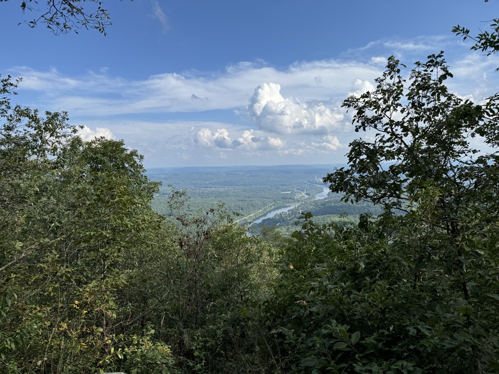
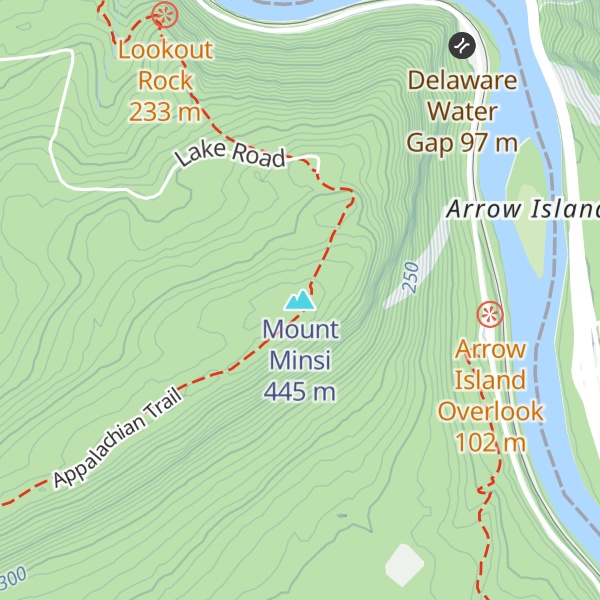
Mount Minsi forms the Pennsylvania side of the Delaware Water Gap, and is the eastern extent of the Blue Mountain. It is composed of sandstone and conglomerates of the Shawangunk Formation.
There's a trail called Appalachian National Scenic Trail leading to the summit. Mount Minsi is one of the 311 peaks along the multi-day Appalachian Trail.
By elevation Mount Minsi is
# 4 out of 9 in Delaware Water Gap National Recreation Area # 27 out of 45 in Monroe County # 3 out of 38 in Northampton County # 6 out of 8 in the Kittatinny Mountains
By prominence Mount Minsi is
# 3 out of 9 in Delaware Water Gap National Recreation Area # 14 out of 45 in Monroe County # 10 out of 38 in Northampton County # 5 out of 8 in the Kittatinny Mountains
We use GPS information embedded into the photo when it is available.
3D mountains overlay
Adjust mountain panorama to perfectly match your photos because recorded by camera photo position might be imprecise.
Move tool
Rotate tool
Zoom
More customization
Choose which peak labels should make into the final photo and what photo title should be.
Next
Photo Location
Satellitte
Flat map
Relief map
Latitude
Longitude
Altitude
OR
Latitude
°'''
Longitude
°'''
Apply
Register Peak
Peak Name
Latitude
Longitude
Altitude
Register
Teleport
PeakVisor
This 3D model of Sagarmatha National Park in Nepal was made using the PeakVisor app topographic data. The mobile app features higher precision models worldwide, more topographic details, and works offline. Download PeakVisor maps today.
Download OBJ model
PeakVisor
The download should start shortly. If you find it useful please consider supporting the PeakVisor app.
PeakVisor for iOS and Android
Be a superhero of outdoor navigation with state-of-the-art 3D maps and mountain identification in the palm of your hand!