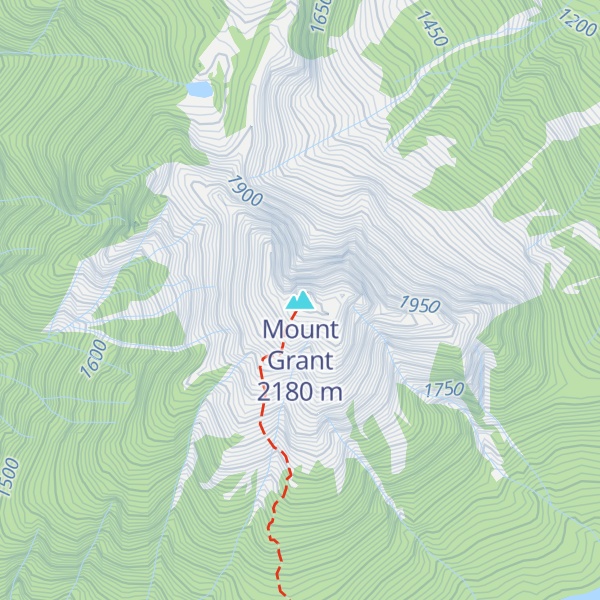
Mount Grant is a 2,180-metre (7,150-foot) mountain summit located in the Canadian Cascades of southwestern British Columbia, Canada. It is situated 12 km (7 mi) southeast of Hope, and 15 km (9 mi) northwest of Silvertip Mountain. The peak was first climbed June 15, 1951, by Paul Binkert, John Booth, Dick Chambers, Jim Irving, Don Montgomery, and Jim Teevan. The peak was named for Captain John M. Grant of the Royal Engineers by Fred Beckey in his Cascade Alpine Guide. Precipitation runoff from the peak drains into tributaries of the Fraser River.
There's a trail called Mount Grant Trail leading to the summit.
By elevation Mount Grant is
# 74 out of 269 in the Skagit Range
By prominence Mount Grant is
# 57 out of 370 in Fraser Valley Regional District # 26 out of 269 in the Skagit Range
We use GPS information embedded into the photo when it is available.
3D mountains overlay
Adjust mountain panorama to perfectly match your photos because recorded by camera photo position might be imprecise.
Move tool
Rotate tool
Zoom
More customization
Choose which peak labels should make into the final photo and what photo title should be.
Next
Photo Location
Satellitte
Flat map
Relief map
Latitude
Longitude
Altitude
OR
Latitude
°'''
Longitude
°'''
Apply
Register Peak
Peak Name
Latitude
Longitude
Altitude
Register
Teleport
PeakVisor
This 3D model of Sagarmatha National Park in Nepal was made using the PeakVisor app topographic data. The mobile app features higher precision models worldwide, more topographic details, and works offline. Download PeakVisor maps today.
Download OBJ model
PeakVisor
The download should start shortly. If you find it useful please consider supporting the PeakVisor app.
PeakVisor for iOS and Android
Be a superhero of outdoor navigation with state-of-the-art 3D maps and mountain identification in the palm of your hand!