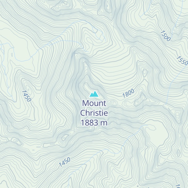
Mount Christie is high peak in the Olympic Mountains of Washington in Olympic National Park. Mount Christie is located in the Queets-Quinault group. Precipitation on Mt. Christie drains into the Elwha River on the north side, and into the Quinault River on the south side.
The mountain was named to honor James Halbold Christie, who was the leader of the Seattle Press Expedition which first explored the unknown interior of the range in 1889–1890. The massif has several peaks, and the large Christie Glacier resides in the north cirque below the main summit.
By elevation Mount Christie is
# 53 out of 113 in Jefferson County # 61 out of 144 in Olympic National Park # 68 out of 284 in the Olympic Mountains
By prominence Mount Christie is
# 87 out of 3574 in the Northwest U.S. Coast Ranges # 11 out of 113 in Jefferson County # 10 out of 144 in Olympic National Park # 15 out of 284 in the Olympic Mountains
We use GPS information embedded into the photo when it is available.
3D mountains overlay
Adjust mountain panorama to perfectly match your photos because recorded by camera photo position might be imprecise.
Move tool
Rotate tool
Zoom
More customization
Choose which peak labels should make into the final photo and what photo title should be.
Next
Photo Location
Satellitte
Flat map
Relief map
Latitude
Longitude
Altitude
OR
Latitude
°'''
Longitude
°'''
Apply
Register Peak
Peak Name
Latitude
Longitude
Altitude
Register
Teleport
PeakVisor
This 3D model of Sagarmatha National Park in Nepal was made using the PeakVisor app topographic data. The mobile app features higher precision models worldwide, more topographic details, and works offline. Download PeakVisor maps today.
Download OBJ model
PeakVisor
The download should start shortly. If you find it useful please consider supporting the PeakVisor app.
PeakVisor for iOS and Android
Be a superhero of outdoor navigation with state-of-the-art 3D maps and mountain identification in the palm of your hand!


.jpg)