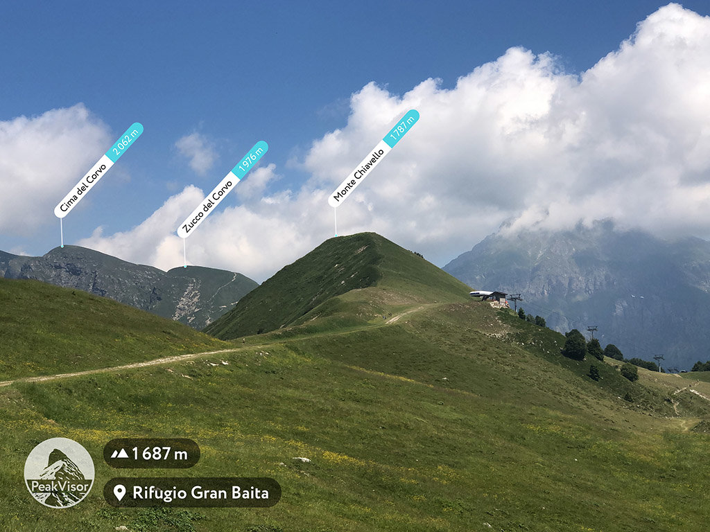
At an elevation of 1,787 m (5,863 ft.), and with a prominence of 107 m (351 ft.), Monte Chiavello forms part of the Bergamasque Alps and Prealps. It is situated near the town of Introbio, in the Lecco province of Lombardy, Italy.
Hiking Monte Chiavello can be a short, fun activity for the whole family. Visitors can make use of a cable car, which takes one close to the ski lifts. Hikers who do not wish to end their trek at the ski lifts can take the route that goes past the Nava Huts.
The ski lift takes visitors to a ridge from where the summit can be accessed. The route is safe for snowboarding and skiing.
The nearest mountain hut is Rifugio Centro Fondo located 969m/3 180ft SSW of the summit.
We use GPS information embedded into the photo when it is available.
3D mountains overlay
Adjust mountain panorama to perfectly match your photos because recorded by camera photo position might be imprecise.
Move tool
Rotate tool
Zoom
More customization
Choose which peak labels should make into the final photo and what photo title should be.
Next
Photo Location
Satellitte
Flat map
Relief map
Latitude
Longitude
Altitude
OR
Latitude
°'''
Longitude
°'''
Apply
Register Peak
Peak Name
Latitude
Longitude
Altitude
Register
Teleport
PeakVisor
This 3D model of Sagarmatha National Park in Nepal was made using the PeakVisor app topographic data. The mobile app features higher precision models worldwide, more topographic details, and works offline. Download PeakVisor maps today.
Download OBJ model
PeakVisor
The download should start shortly. If you find it useful please consider supporting the PeakVisor app.
PeakVisor for iOS and Android
Be a superhero of outdoor navigation with state-of-the-art 3D maps and mountain identification in the palm of your hand!