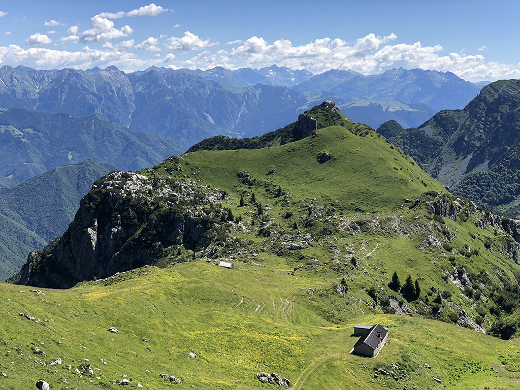
At an elevation of 1,886 m (6,188 ft.), and with a prominence of 75 m (246 ft.), Monte Cantardo forms part of the Bergamasque Alps and Prealps. It is situated near the town of Cremeno, in the Bergamo province of Lombardy, Italy.
Monte Cantardo lies between the Val d’Ancogno and Valle Secca and is also known as Monte di San Contardo. This mountain is dedicated to Saint Contardo, who is the patron saint of Broni, where he died.
The earliest known records of Monte Cantardo date back to 1214; a parchment depicts the acreages of land owned by the Cluniac Monastery. Documentation from 1336 and 1481 mentions a small church built for San Michele Arcangelo, which was taken over by the military in later years and used as a fortress.
The nearest mountain hut is Rifugio Nicola located 1 590m/5 216ft WSW of the summit.
We use GPS information embedded into the photo when it is available.
3D mountains overlay
Adjust mountain panorama to perfectly match your photos because recorded by camera photo position might be imprecise.
Move tool
Rotate tool
Zoom
More customization
Choose which peak labels should make into the final photo and what photo title should be.
Next
Photo Location
Satellitte
Flat map
Relief map
Latitude
Longitude
Altitude
OR
Latitude
°'''
Longitude
°'''
Apply
Register Peak
Peak Name
Latitude
Longitude
Altitude
Register
Teleport
PeakVisor
This 3D model of Sagarmatha National Park in Nepal was made using the PeakVisor app topographic data. The mobile app features higher precision models worldwide, more topographic details, and works offline. Download PeakVisor maps today.
Download OBJ model
PeakVisor
The download should start shortly. If you find it useful please consider supporting the PeakVisor app.
PeakVisor for iOS and Android
Be a superhero of outdoor navigation with state-of-the-art 3D maps and mountain identification in the palm of your hand!