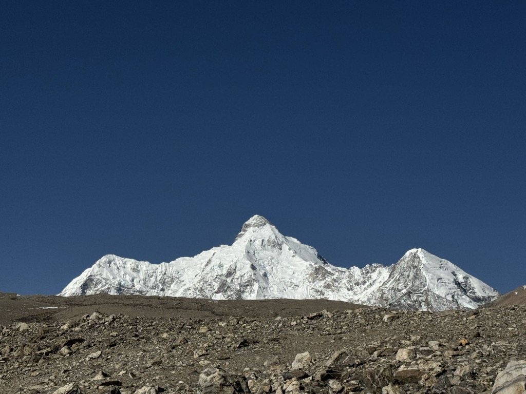
Molamenqing (Chinese: Phola Gangchen) is an eastern outlier of Shishapangma, the 14th-highest peak in the world. Both are in the Jugal Himal, a subrange of the Himalaya in Tibet. (This range is contiguous with, and often considered a part of, the Langtang Himal.) Its elevation is also given as 7,661 m (25,135 ft); the elevation given here is from a Chinese survey. Molamenqing is little-known, partly since it does not have much independent stature. Its topographic prominence, i.e. its rise above the saddle connecting it with Shishapangma, is only 430 metres, which is relatively small for a Himalayan peak, although large enough for it to qualify in some reckonings as an independent peak.
Molamenqing did enjoy a temporary fame in the early 1980s. At the time it was one of the highest unclimbed peaks in the world (using a prominence cutoff low enough to qualify it as a separate summit). A team from New Zealand applied to the Chinese authorities to climb the peak, and became one of the first Western teams to be allowed to climb in Tibet since before World War II. The team succeeded in making the first, and so far the only, ascent of the mountain. They started from the east side of the peak, but their long route went via the north side of Shishapangma and approached the summit from the west.
The Himalayan Index lists no other attempts on this peak.
By elevation Molamenqing is
# 16 out of 127 in Qomolangma National Nature Preserve # 18 out of 936 in Tibet # 26 out of 12241 in China # 2 out of 34 in Nyalam County # 43 out of 3458 in the Himalayas
By prominence Molamenqing is
# 60 out of 127 in Qomolangma National Nature Preserve # 15 out of 34 in Nyalam County
We use GPS information embedded into the photo when it is available.
3D mountains overlay
Adjust mountain panorama to perfectly match your photos because recorded by camera photo position might be imprecise.
Move tool
Rotate tool
Zoom
More customization
Choose which peak labels should make into the final photo and what photo title should be.
Next
Photo Location
Satellitte
Flat map
Relief map
Latitude
Longitude
Altitude
OR
Latitude
°'''
Longitude
°'''
Apply
Register Peak
Peak Name
Latitude
Longitude
Altitude
Register
Teleport
PeakVisor
This 3D model of Sagarmatha National Park in Nepal was made using the PeakVisor app topographic data. The mobile app features higher precision models worldwide, more topographic details, and works offline. Download PeakVisor maps today.
Download OBJ model
PeakVisor
The download should start shortly. If you find it useful please consider supporting the PeakVisor app.
PeakVisor for iOS and Android
Be a superhero of outdoor navigation with state-of-the-art 3D maps and mountain identification in the palm of your hand!