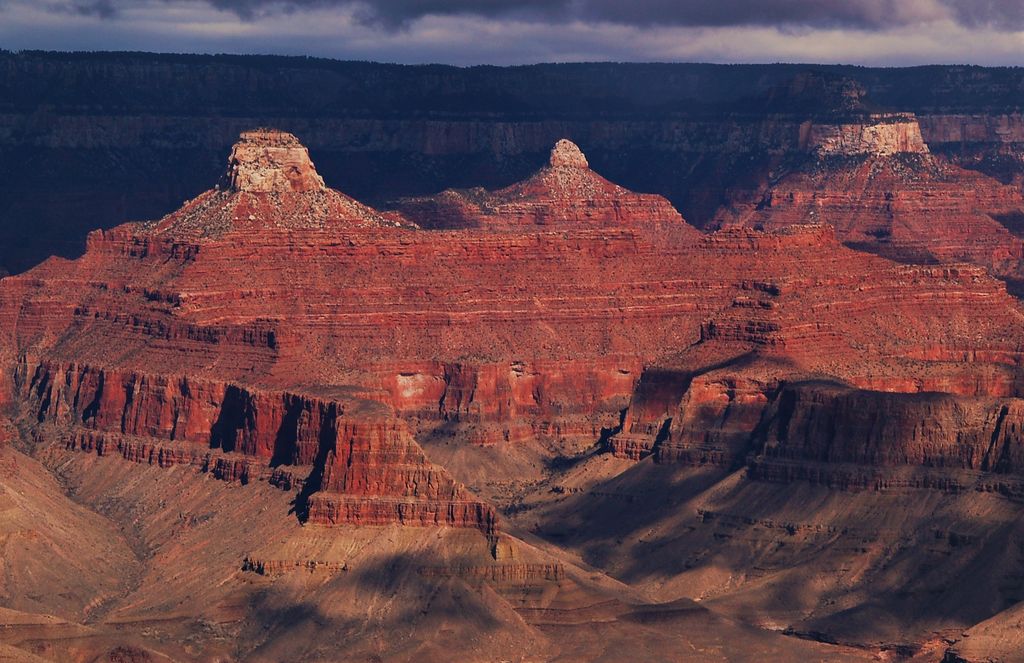
Manu Temple is a 7,184-foot-elevation (2,190-meter) summit located in the Grand Canyon, in Coconino County of northern Arizona, United States. It is situated one mile south of the North Rim's Widforss Point, 1.5 miles (2.4 km) northeast of parent Buddha Temple, and three miles southwest of the North Rim's Bright Angel Point. Topographic relief is significant as it rises nearly 3,600 feet (1,100 meters) in two miles above Bright Angel Canyon to the east, and 2,200 feet in less than one mile above Haunted Canyon to the immediate west. Its neighbors include Brahma Temple and Deva Temple to the east on the opposite side of Bright Angel Canyon. From the South Rim of the canyon it may be difficult to discern Manu Temple from the walls of the Kaibab Plateau one mile behind it, but when the lighting and atmosphere are favorable, this butte of great proportions can be seen clearly defined.
Manu Temple was named by George Wharton James for the Hindu lawgiver Manu, in keeping with Clarence Dutton's practice of naming features in the Grand Canyon after mythological deities. This geographical feature's name was officially adopted in 1906 by the U.S. Board on Geographic Names.
According to the Köppen climate classification system, Manu Temple is located in a Cold semi-arid climate zone. Precipitation runoff from Manu Temple drains south into the Colorado River via Bright Angel Creek on its east side, and Phantom Creek on the west side.
By elevation Manu Temple is
# 78 out of 280 in Grand Canyon National Park # 97 out of 203 in the Kaibab Plateau
By prominence Manu Temple is
# 64 out of 280 in Grand Canyon National Park # 48 out of 203 in the Kaibab Plateau
We use GPS information embedded into the photo when it is available.
3D mountains overlay
Adjust mountain panorama to perfectly match your photos because recorded by camera photo position might be imprecise.
Move tool
Rotate tool
Zoom
More customization
Choose which peak labels should make into the final photo and what photo title should be.
Next
Photo Location
Satellitte
Flat map
Relief map
Latitude
Longitude
Altitude
OR
Latitude
°'''
Longitude
°'''
Apply
Register Peak
Peak Name
Latitude
Longitude
Altitude
Register
Teleport
PeakVisor
This 3D model of Sagarmatha National Park in Nepal was made using the PeakVisor app topographic data. The mobile app features higher precision models worldwide, more topographic details, and works offline. Download PeakVisor maps today.
Download OBJ model
PeakVisor
The download should start shortly. If you find it useful please consider supporting the PeakVisor app.
PeakVisor for iOS and Android
Be a superhero of outdoor navigation with state-of-the-art 3D maps and mountain identification in the palm of your hand!