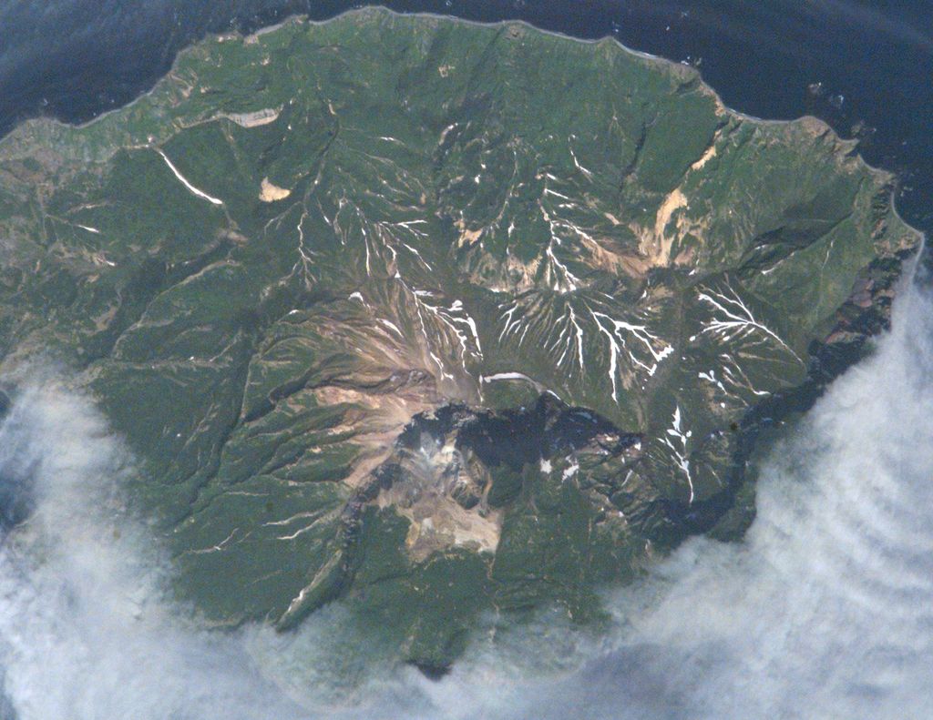
Kuntomintar (Russian: Кунтоминтар) is a Pleistocene andesitic stratovolcano located at the southern end of Shiashkotan Island, Kuril Islands, Russia. Kumtomintar is a high point on a small volcanic ridge with mellow slopes on all side except the north west side. The mountain is home to many steep drainages, waterfalls, and some small ponds. The volcano consists of a central cone that fills a 4-4.5 km caldera and its crater is at 1280 feet, is below the main peak, on the north west side, some periods of time hot water drains from the crater into the ocean via creek. A second caldera is situated on the west side and is breached to the west.
In 1872, an Ainu village was reportedly destroyed by an eruption, but it was later found to be located near Sinarka volcano (Gorshkov, 1970). Kuntomintar has only exhibited continuous solfataric activity since the postglacial period, originating from the east wall of the inner caldera and a nearby hot sulfur spring.
By elevation Kuntomintar is
# 59 out of 184 in Severo-Kurilsky District
By prominence Kuntomintar is
# 16 out of 184 in Severo-Kurilsky District # 44 out of 1891 in Sakhalin Oblast
We use GPS information embedded into the photo when it is available.
3D mountains overlay
Adjust mountain panorama to perfectly match your photos because recorded by camera photo position might be imprecise.
Move tool
Rotate tool
Zoom
More customization
Choose which peak labels should make into the final photo and what photo title should be.
Next
Photo Location
Satellitte
Flat map
Relief map
Latitude
Longitude
Altitude
OR
Latitude
°'''
Longitude
°'''
Apply
Register Peak
Peak Name
Latitude
Longitude
Altitude
Register
Teleport
PeakVisor
This 3D model of Sagarmatha National Park in Nepal was made using the PeakVisor app topographic data. The mobile app features higher precision models worldwide, more topographic details, and works offline. Download PeakVisor maps today.
Download OBJ model
PeakVisor
The download should start shortly. If you find it useful please consider supporting the PeakVisor app.
PeakVisor for iOS and Android
Be a superhero of outdoor navigation with state-of-the-art 3D maps and mountain identification in the palm of your hand!