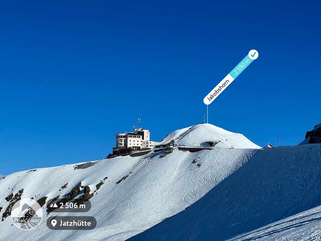
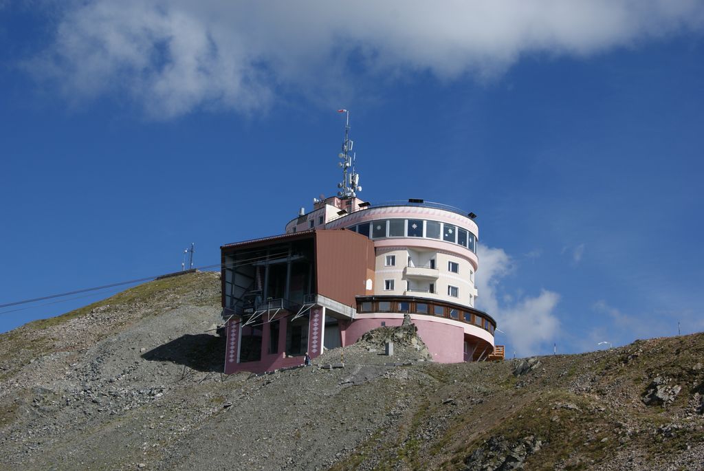
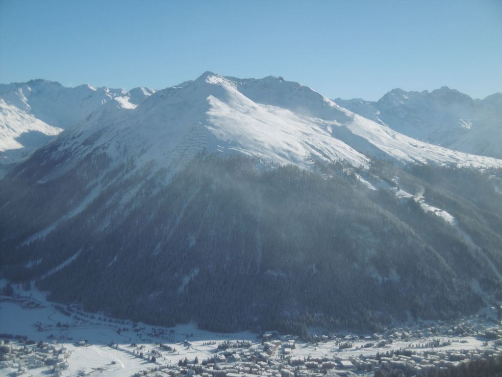
The Jakobshorn (2,590 metres (8,500 ft)) is a mountain of the Albula Alps, overlooking Davos in the Swiss canton of Graubünden. It is also one of the five skiing regions of the Davos Klosters Mountains, offering 14 pistes.
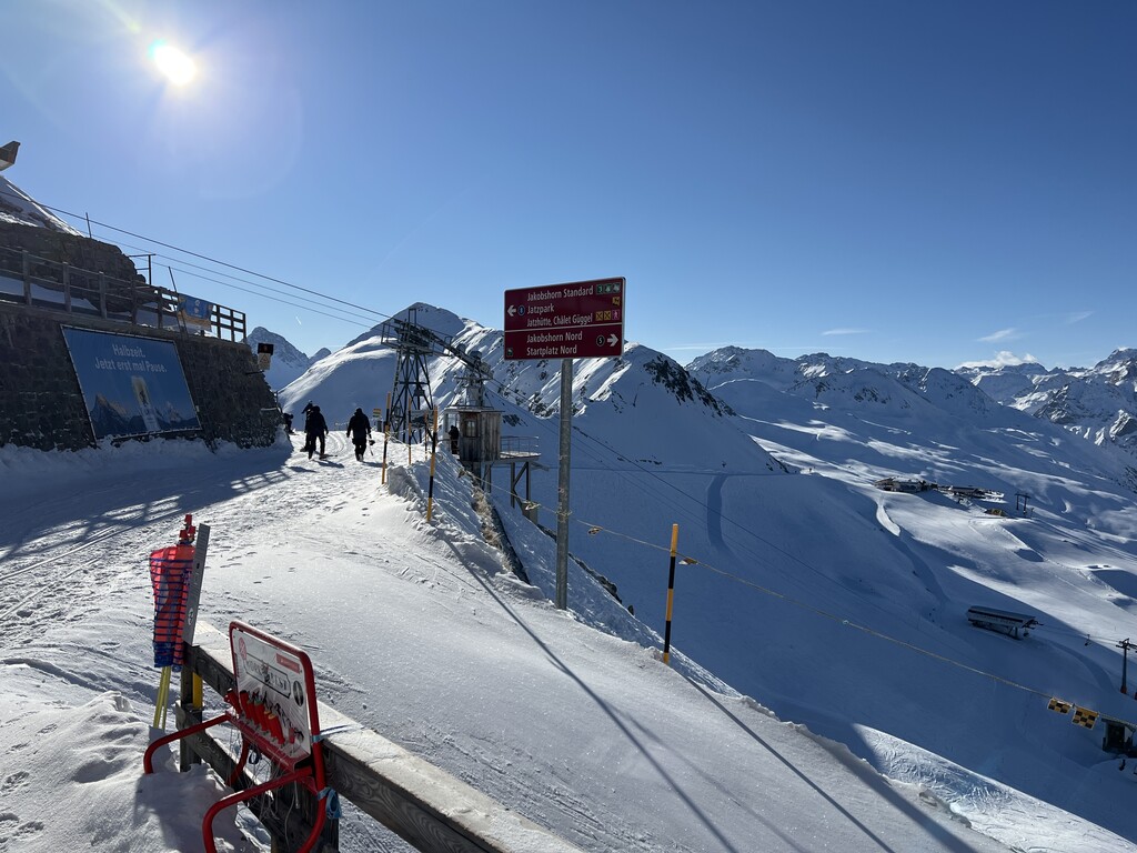
Located at the northern end of the range between the Dischmatal and Sertigtal, the Jakobshorn is served by a two-part cable car running from Davos Platz. Once on the mountain there are three chairlifts, one short cable car, and one T-Bar.
Since 1995 there has also been a two-person chair-lift, running from near the base station to the near the bottom of Usser Isch.
There are a variety of pistes on the Jakobshorn—blue, red and black—and the mountain is renowned for being a centre for snowboarding; Bolgen provides an illuminated super pipe.
Pistes are very wide and the area is popular with novice skiers, there are however a number of black terrains for the more adventurous skier. The main two lifts also open during the summer, from July–October, and there are many walks on the Jakobshorn.
The Jakobshorn is also a favoured take-off point for hang-gliders and snowkiters.
There's a trail called Clavadeler leading to the summit. Jakobshorn is one of the 2 peaks along the Jakobshorn - Ischalp.
The nearest mountain hut is Jatzhütte located 696m/2 285ft SSE of the summit.
We use GPS information embedded into the photo when it is available.
3D mountains overlay
Adjust mountain panorama to perfectly match your photos because recorded by camera photo position might be imprecise.
Move tool
Rotate tool
Zoom
More customization
Choose which peak labels should make into the final photo and what photo title should be.
Next
Photo Location
Satellitte
Flat map
Relief map
Latitude
Longitude
Altitude
OR
Latitude
°'''
Longitude
°'''
Apply
Register Peak
Peak Name
Latitude
Longitude
Altitude
Register
Teleport
PeakVisor
This 3D model of Sagarmatha National Park in Nepal was made using the PeakVisor app topographic data. The mobile app features higher precision models worldwide, more topographic details, and works offline. Download PeakVisor maps today.
Download OBJ model
PeakVisor
The download should start shortly. If you find it useful please consider supporting the PeakVisor app.
PeakVisor for iOS and Android
Be a superhero of outdoor navigation with state-of-the-art 3D maps and mountain identification in the palm of your hand!