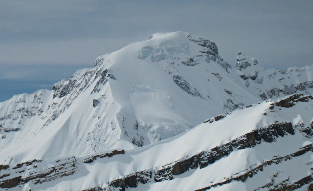
Icefall Peak is a 3,195-metre (10,482-foot) mountain summit located in the Canadian Rockies of British Columbia, Canada. Icefall Peak is situated on the Bush Mountain massif, and the nearest higher neighbor is Rostrum Peak, 2 km (1.2 mi) to the south-southeast. The peak was named in 1918 by the Interprovincial Boundary Survey for an icefall on its eastern flank, and was officially adopted in 1924 when approved by the Geographical Names Board of Canada. The first ascent of the mountain was made in 1954 by S.B. Hendricks, D. Hubbard, Dr. and Mrs. E.K. Karcher, and A.E. Peterson.
By elevation Icefall Peak is
# 72 out of 767 in Columbia-Shuswap Regional District
We use GPS information embedded into the photo when it is available.
3D mountains overlay
Adjust mountain panorama to perfectly match your photos because recorded by camera photo position might be imprecise.
Move tool
Rotate tool
Zoom
More customization
Choose which peak labels should make into the final photo and what photo title should be.
Next
Photo Location
Satellitte
Flat map
Relief map
Latitude
Longitude
Altitude
OR
Latitude
°'''
Longitude
°'''
Apply
Register Peak
Peak Name
Latitude
Longitude
Altitude
Register
Teleport
PeakVisor
This 3D model of Sagarmatha National Park in Nepal was made using the PeakVisor app topographic data. The mobile app features higher precision models worldwide, more topographic details, and works offline. Download PeakVisor maps today.
Download OBJ model
PeakVisor
The download should start shortly. If you find it useful please consider supporting the PeakVisor app.
PeakVisor for iOS and Android
Be a superhero of outdoor navigation with state-of-the-art 3D maps and mountain identification in the palm of your hand!