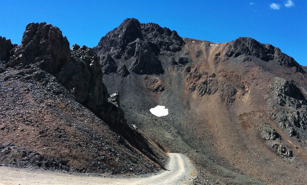
Hurricane Peak is a 13,447-foot-elevation (4,099-meter) mountain summit located in San Juan County of southwest Colorado, United States. It is situated equidistant between the historic towns of Ouray and Silverton, and is approximately nine miles west of the Continental Divide. It is part of the San Juan Mountains which are a subset of the Rocky Mountains. Topographic relief is significant as the north aspect rises 1,200 feet (370 meters) above Lake Como in one-half mile. Neighbors include Abrams Mountain 3.4 miles to the north, Red Mountain 2.2 miles to the west, and Tuttle Mountain 1.4 mile to the north. The Mountain Queen Mine, which is located on the east slope of Hurricane Peak at the head of California Gulch, is one of the oldest workings in the area and was most active from 1878 to 1880. The mountain's name, which has been officially adopted by the United States Board on Geographic Names, was in use in 1906 when Henry Gannett published it in the Gazetteer of Colorado.
By elevation Hurricane Peak is
# 33 out of 96 in San Juan County # 99 out of 732 in the San Juan Mountains
We use GPS information embedded into the photo when it is available.
3D mountains overlay
Adjust mountain panorama to perfectly match your photos because recorded by camera photo position might be imprecise.
Move tool
Rotate tool
Zoom
More customization
Choose which peak labels should make into the final photo and what photo title should be.
Next
Photo Location
Satellitte
Flat map
Relief map
Latitude
Longitude
Altitude
OR
Latitude
°'''
Longitude
°'''
Apply
Register Peak
Peak Name
Latitude
Longitude
Altitude
Register
Teleport
PeakVisor
This 3D model of Sagarmatha National Park in Nepal was made using the PeakVisor app topographic data. The mobile app features higher precision models worldwide, more topographic details, and works offline. Download PeakVisor maps today.
Download OBJ model
PeakVisor
The download should start shortly. If you find it useful please consider supporting the PeakVisor app.
PeakVisor for iOS and Android
Be a superhero of outdoor navigation with state-of-the-art 3D maps and mountain identification in the palm of your hand!