The Hohberghorn (4,218 m) is a mountain in the Pennine Alps in Switzerland. It lies towards the northern end of the Nadelgrat, a high-level ridge running roughly north–south, north of the Dom, above the resort of Saas-Fee to the east, and the Mattertal to the west.
It was first climbed by R. B. Heathcote, with guides Franz Biner, Peter Perren and Peter Taugwalder on, in August 1869 via the west gully above the Hohberg Glacier to the Stecknadeljoch.
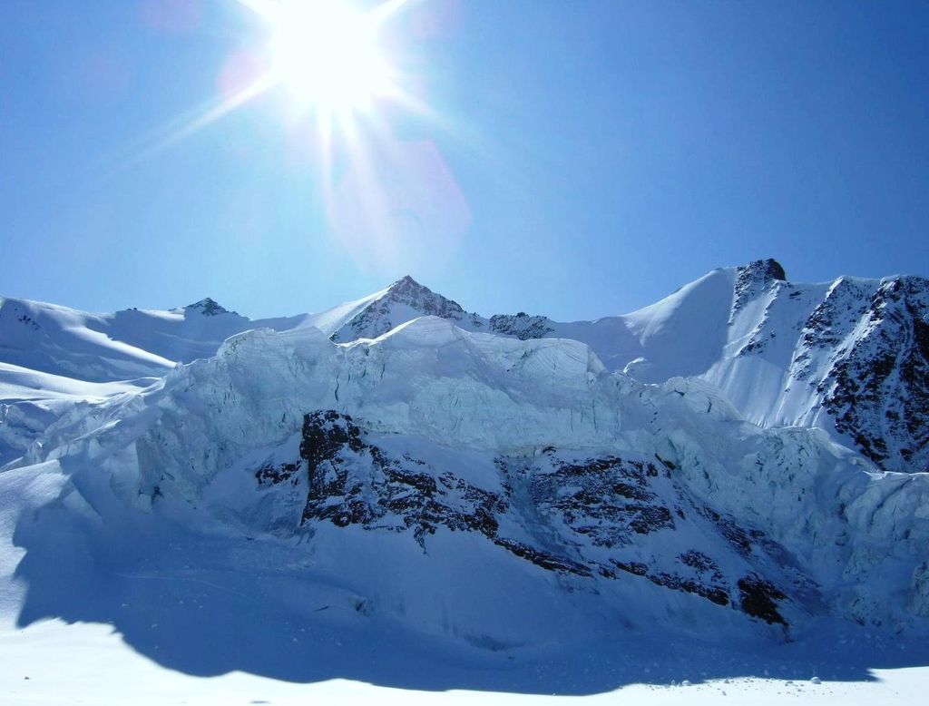
Its north-east face, not as long or as steep as that on the neighbouring Lenzspitze, is 320 m and at an average angle of 50 degrees, and might be considered as excellent training for the latter.
There's a difficult alpine trail (T6) called Nadelgrat leading to the summit.
By elevation Hohberghorn is
# 49 out of 60693 in the Alps # 31 out of 1787 in Valais/Wallis # 28 out of 345 in Visp # 31 out of 10817 in Switzerland # 31 out of 2009 in the Pennine Alps
We use GPS information embedded into the photo when it is available.
3D mountains overlay
Adjust mountain panorama to perfectly match your photos because recorded by camera photo position might be imprecise.
Move tool
Rotate tool
Zoom
More customization
Choose which peak labels should make into the final photo and what photo title should be.
Next
Photo Location
Satellitte
Flat map
Relief map
Latitude
Longitude
Altitude
OR
Latitude
°'''
Longitude
°'''
Apply
Register Peak
Peak Name
Latitude
Longitude
Altitude
Register
Teleport
PeakVisor
This 3D model of Sagarmatha National Park in Nepal was made using the PeakVisor app topographic data. The mobile app features higher precision models worldwide, more topographic details, and works offline. Download PeakVisor maps today.
Download OBJ model
PeakVisor
The download should start shortly. If you find it useful please consider supporting the PeakVisor app.
PeakVisor for iOS and Android
Be a superhero of outdoor navigation with state-of-the-art 3D maps and mountain identification in the palm of your hand!