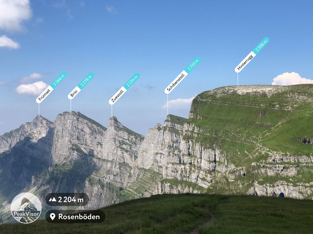
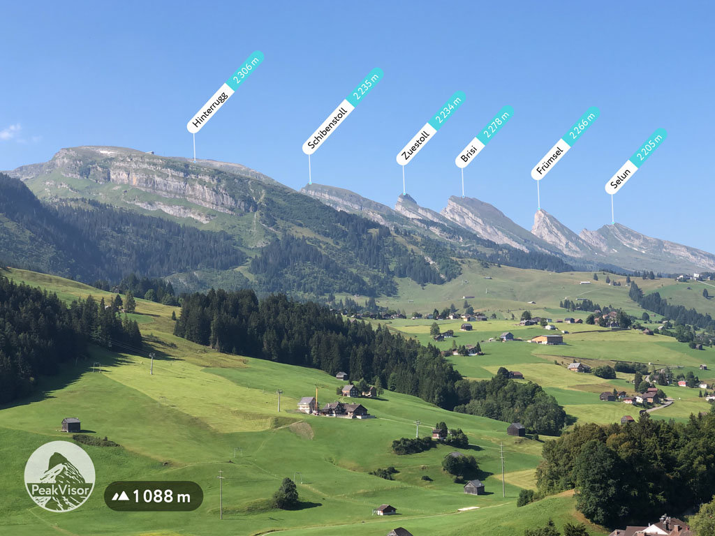
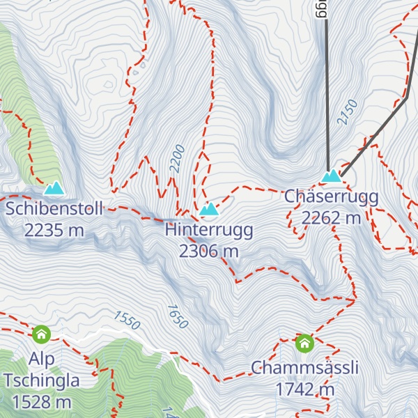
The Hinterrugg (or Hinderrugg) is the highest peak of the Churfirsten group, located in the Appenzell Alps. It overlooks the town of Walenstadt and the lake in the canton of St. Gallen. The summit is easily accessible via the Chäserrugg cable car station (2,262 metres), above Unterwasser in Toggenburg.
The Hinterrugg is a well-known location for BASE jumping.
There's a hiking trail (T1) leading to the summit.
The nearest mountain hut is Alp Tschingla located 980m/3 217ft WSW of the summit.
By elevation Hinterrugg is
# 11 out of 133 in Wahlkreis Toggenburg # 94 out of 250 in Wahlkreis Sarganserland
By prominence Hinterrugg is
# 37 out of 1882 in the Swiss Prealps # 6 out of 498 in Sankt Gallen # 4 out of 133 in Wahlkreis Toggenburg # 4 out of 250 in Wahlkreis Sarganserland
We use GPS information embedded into the photo when it is available.
3D mountains overlay
Adjust mountain panorama to perfectly match your photos because recorded by camera photo position might be imprecise.
Move tool
Rotate tool
Zoom
More customization
Choose which peak labels should make into the final photo and what photo title should be.
Next
Photo Location
Satellitte
Flat map
Relief map
Latitude
Longitude
Altitude
OR
Latitude
°'''
Longitude
°'''
Apply
Register Peak
Peak Name
Latitude
Longitude
Altitude
Register
Teleport
PeakVisor
This 3D model of Sagarmatha National Park in Nepal was made using the PeakVisor app topographic data. The mobile app features higher precision models worldwide, more topographic details, and works offline. Download PeakVisor maps today.
Download OBJ model
PeakVisor
The download should start shortly. If you find it useful please consider supporting the PeakVisor app.
PeakVisor for iOS and Android
Be a superhero of outdoor navigation with state-of-the-art 3D maps and mountain identification in the palm of your hand!