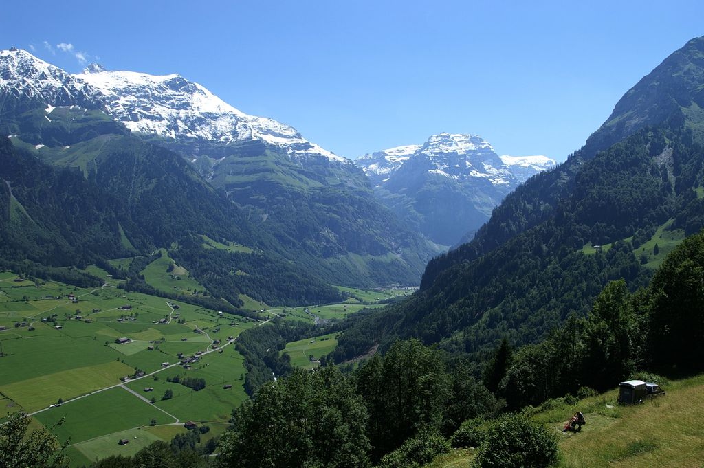
The Selbsanft is a mountain massif in the Glarus Alps, overlooking the village of Linthal in the canton of Glarus. The Selbsanft is a large mountain massif consisting of several summits of which the highest is named Hideri Schibe. The massif is a buttress of the Bifertenstock and forms, along with Schiben, the ridge that separates the valleys of the Sand (west) and Limmernsee (east). A small glacier lies east of the summit.
The five main summits are, from north to south, the Vorder Selbsanft, also known as Hauserhorn (2,750 metres (9,022 ft), there are higher summits between the Vorder and Mittler Selbsanft, though), Mitttler Selbsanft, also known in Grison as Plattas Alvas (2,949 metres (9,675 ft)), the Hinter Selbsanft (3,028 metres (9,934 ft)), the highest peak of the Selbsanft triple. In a broader sense, the Vorderi Schibe (2,987 metres (9,800 ft)) and the Hinderi Schibe (3,083 metres (10,115 ft)), the highest summit of this massif, re also part of the massif.
The mountain lies within the municipality of Glarus Süd.
By elevation Hinter Selbsanft is
# 54 out of 812 in the Glarus Alps # 23 out of 363 in Glarus
By prominence Hinter Selbsanft is
# 66 out of 812 in the Glarus Alps # 36 out of 363 in Glarus
We use GPS information embedded into the photo when it is available.
3D mountains overlay
Adjust mountain panorama to perfectly match your photos because recorded by camera photo position might be imprecise.
Move tool
Rotate tool
Zoom
More customization
Choose which peak labels should make into the final photo and what photo title should be.
Next
Photo Location
Satellitte
Flat map
Relief map
Latitude
Longitude
Altitude
OR
Latitude
°'''
Longitude
°'''
Apply
Register Peak
Peak Name
Latitude
Longitude
Altitude
Register
Teleport
PeakVisor
This 3D model of Sagarmatha National Park in Nepal was made using the PeakVisor app topographic data. The mobile app features higher precision models worldwide, more topographic details, and works offline. Download PeakVisor maps today.
Download OBJ model
PeakVisor
The download should start shortly. If you find it useful please consider supporting the PeakVisor app.
PeakVisor for iOS and Android
Be a superhero of outdoor navigation with state-of-the-art 3D maps and mountain identification in the palm of your hand!