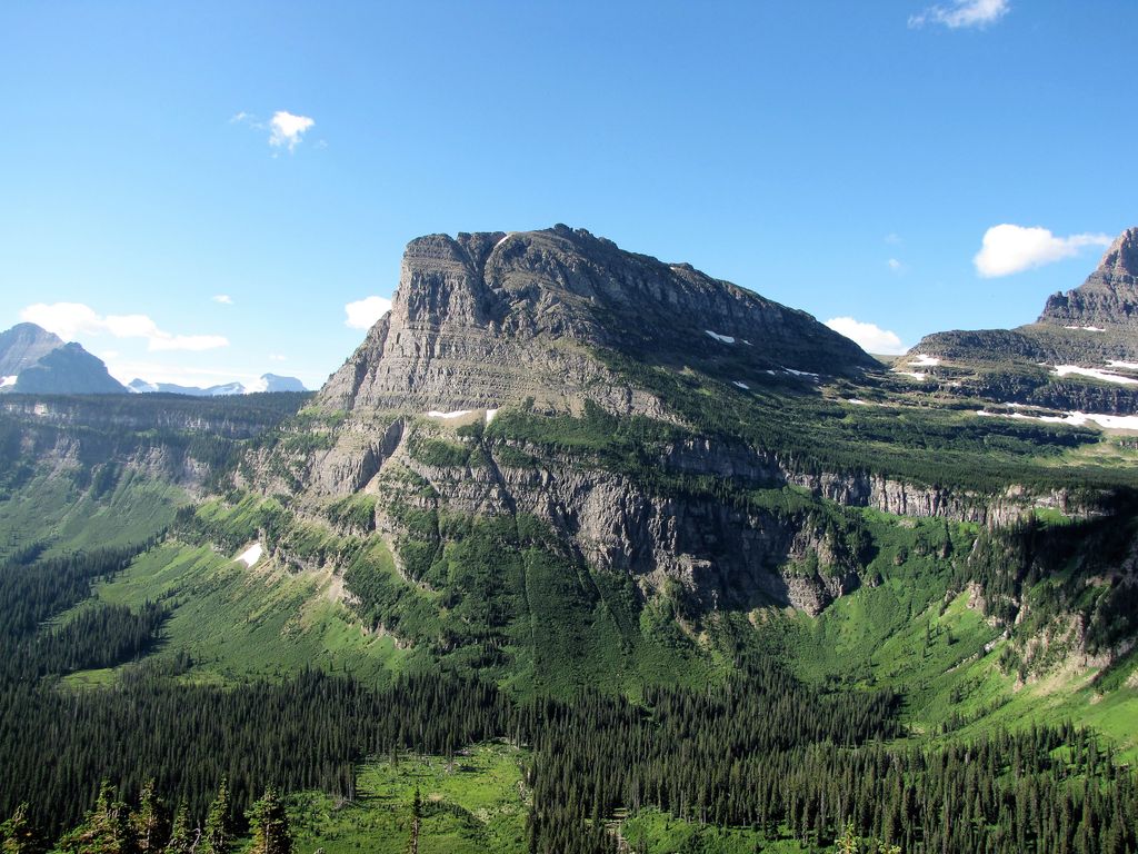
Heavy Runner Mountain (8,016 feet (2,443 m)) is located in the Lewis Range, Glacier National Park in the U.S. state of Montana. The summit is a little over a mile east-northeast of Reynolds Mountain and is easily seen from the Going-to-the-Sun Road as well as Logan Pass. The mountain is named for the Blackfeet Indian Chief, Heavy Runner, who was massacred along with most of his encampment by Col. Eugene M. Baker's detachment on the Marias River on January 23, 1870.
We use GPS information embedded into the photo when it is available.
3D mountains overlay
Adjust mountain panorama to perfectly match your photos because recorded by camera photo position might be imprecise.
Move tool
Rotate tool
Zoom
More customization
Choose which peak labels should make into the final photo and what photo title should be.
Next
Photo Location
Satellitte
Flat map
Relief map
Latitude
Longitude
Altitude
OR
Latitude
°'''
Longitude
°'''
Apply
Register Peak
Peak Name
Latitude
Longitude
Altitude
Register
Teleport
PeakVisor
This 3D model of Sagarmatha National Park in Nepal was made using the PeakVisor app topographic data. The mobile app features higher precision models worldwide, more topographic details, and works offline. Download PeakVisor maps today.
Download OBJ model
PeakVisor
The download should start shortly. If you find it useful please consider supporting the PeakVisor app.
PeakVisor for iOS and Android
Be a superhero of outdoor navigation with state-of-the-art 3D maps and mountain identification in the palm of your hand!