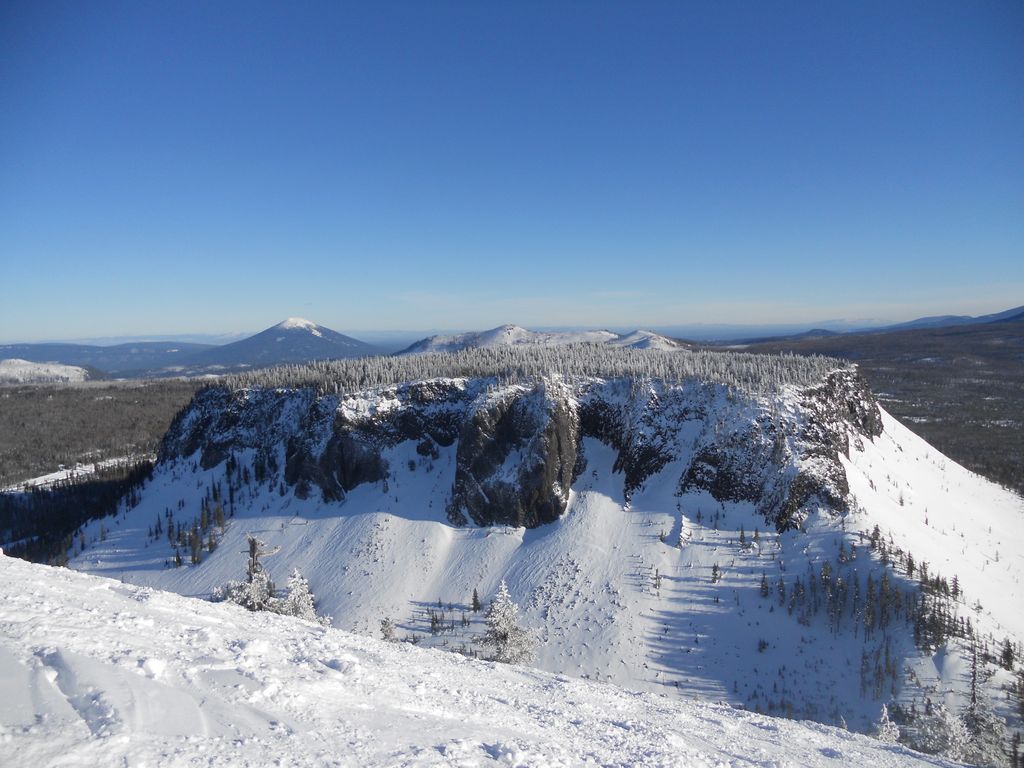
Hayrick Butte is a tuya, a type of subglacial volcano, in Linn County, Oregon. Located in the Willamette National Forest near Santiam Pass, it lies adjacent to the cinder cone Hoodoo Butte, which has a ski area. Hayrick Butte likely formed when lava erupted underneath an overlying glacier or ice sheet, producing the flat top with near-vertical walls along the ice-contact margin as the lava cooled and hardened. Hayrick Butte has a nearly flat plateau about 0.5 miles (0.80 km) across and steep walls rising about 700 feet (0.21 km) above its surroundings. A cartographer accidentally switched the names for nearby Hoodoo Butte and Hayrick Butte; the word "hoodoo" usually refers to rock piles and pinnacles like those observed at Hayrick Butte.
Compared to Hoodoo, Hayrick is less popular for recreation, though it can be climbed, and there are hiking, snowshoeing, and snowmobile routes surrounding the butte. Its north-facing slope has subalpine forests with mountain hemlock and fir, which are common in the Cascades.
We use GPS information embedded into the photo when it is available.
3D mountains overlay
Adjust mountain panorama to perfectly match your photos because recorded by camera photo position might be imprecise.
Move tool
Rotate tool
Zoom
More customization
Choose which peak labels should make into the final photo and what photo title should be.
Next
Photo Location
Satellitte
Flat map
Relief map
Latitude
Longitude
Altitude
OR
Latitude
°'''
Longitude
°'''
Apply
Register Peak
Peak Name
Latitude
Longitude
Altitude
Register
Teleport
PeakVisor
This 3D model of Sagarmatha National Park in Nepal was made using the PeakVisor app topographic data. The mobile app features higher precision models worldwide, more topographic details, and works offline. Download PeakVisor maps today.
Download OBJ model
PeakVisor
The download should start shortly. If you find it useful please consider supporting the PeakVisor app.
PeakVisor for iOS and Android
Be a superhero of outdoor navigation with state-of-the-art 3D maps and mountain identification in the palm of your hand!