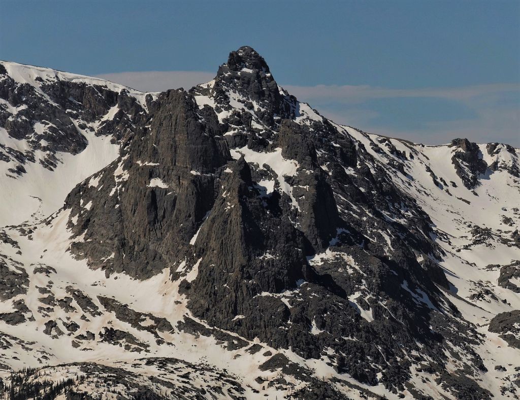
Hayden Spire is a 12,480+ foot elevation (3,800 meter) pillar located in Rocky Mountain National Park, in Larimer County, Colorado, United States. It is situated 12 miles west of the community of Estes Park in Hayden Gorge, along a short spur on the Continental Divide. Hayden Spire is part of the Front Range which is a subset of the Rocky Mountains. It is the highest tower in a cluster of spires which can be viewed from Forest Canyon Overlook along the Trail Ridge Road. Topographic relief is significant as the north aspect rises 2,100 feet (640 meters) above Hayden Gulch in one-half mile. Neighbors include Terra Tomah Mountain two miles to the north, and Mount Julian 1.8 mile to the northwest.
We use GPS information embedded into the photo when it is available.
3D mountains overlay
Adjust mountain panorama to perfectly match your photos because recorded by camera photo position might be imprecise.
Move tool
Rotate tool
Zoom
More customization
Choose which peak labels should make into the final photo and what photo title should be.
Next
Photo Location
Satellitte
Flat map
Relief map
Latitude
Longitude
Altitude
OR
Latitude
°'''
Longitude
°'''
Apply
Register Peak
Peak Name
Latitude
Longitude
Altitude
Register
Teleport
PeakVisor
This 3D model of Sagarmatha National Park in Nepal was made using the PeakVisor app topographic data. The mobile app features higher precision models worldwide, more topographic details, and works offline. Download PeakVisor maps today.
Download OBJ model
PeakVisor
The download should start shortly. If you find it useful please consider supporting the PeakVisor app.
PeakVisor for iOS and Android
Be a superhero of outdoor navigation with state-of-the-art 3D maps and mountain identification in the palm of your hand!