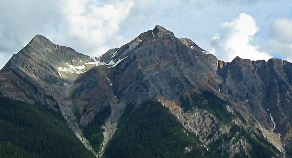
Hagen Peak is a 2,635-metre (8,645 ft) double summit mountain located on the western boundary of Yoho National Park in the Canadian Rockies of British Columbia, Canada. The mountain is situated 36 km (22 mi) northeast of Golden in the Blaeberry Valley, and less than 13 km (8.1 mi) from the Continental Divide. The mountain was named after Canadian Army Private Alfred G. Hagen of Field, BC, who was serving with the 10th Canadian Infantry Brigade when he was killed in 1944 World War II action, during the liberation of Calais, France. The mountain's name was officially adopted July 5, 1961, when approved by the Geographical Names Board of Canada.
By elevation Hagen Peak is
# 86 out of 108 in Yoho National Park # 16 out of 21 in the Van Horne Range
By prominence Hagen Peak is
# 50 out of 108 in Yoho National Park # 16 out of 21 in the Van Horne Range
We use GPS information embedded into the photo when it is available.
3D mountains overlay
Adjust mountain panorama to perfectly match your photos because recorded by camera photo position might be imprecise.
Move tool
Rotate tool
Zoom
More customization
Choose which peak labels should make into the final photo and what photo title should be.
Next
Photo Location
Satellitte
Flat map
Relief map
Latitude
Longitude
Altitude
OR
Latitude
°'''
Longitude
°'''
Apply
Register Peak
Peak Name
Latitude
Longitude
Altitude
Register
Teleport
PeakVisor
This 3D model of Sagarmatha National Park in Nepal was made using the PeakVisor app topographic data. The mobile app features higher precision models worldwide, more topographic details, and works offline. Download PeakVisor maps today.
Download OBJ model
PeakVisor
The download should start shortly. If you find it useful please consider supporting the PeakVisor app.
PeakVisor for iOS and Android
Be a superhero of outdoor navigation with state-of-the-art 3D maps and mountain identification in the palm of your hand!