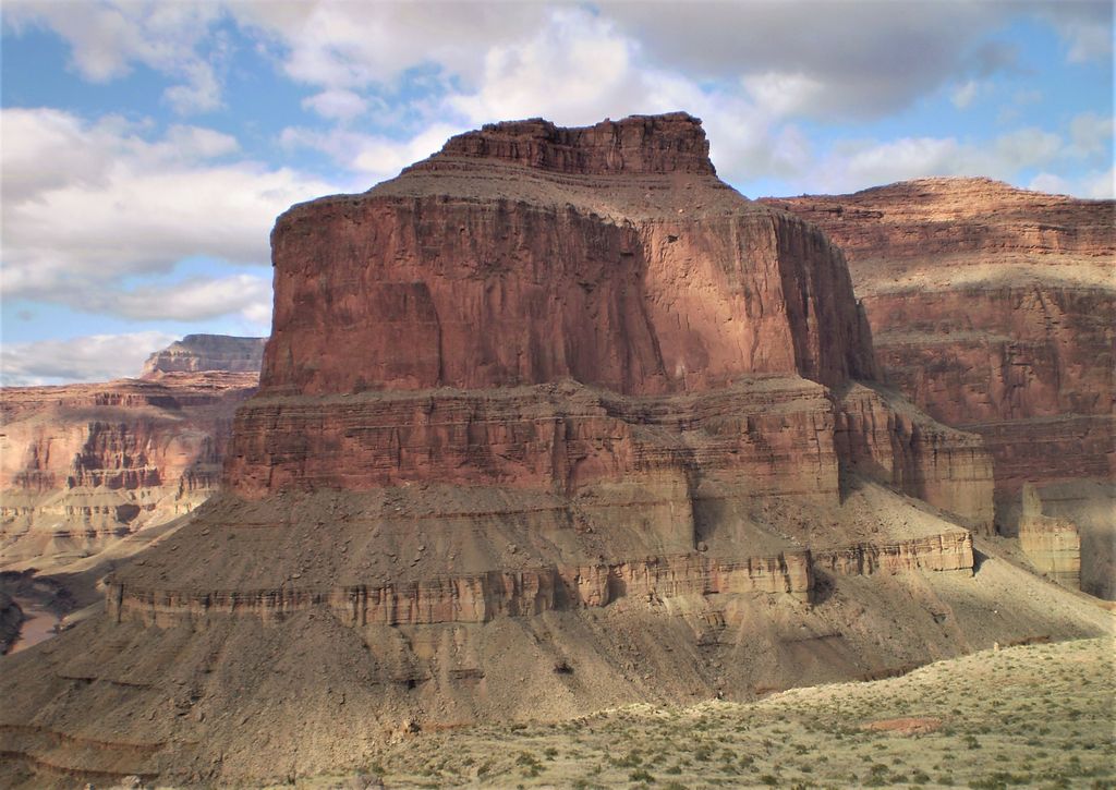
Explorers Monument is a 4,572-foot-elevation (1,394-meter) summit located in the Grand Canyon, in Coconino County of northern Arizona, US. It is situated 3.5 miles due west of Mount Huethawali, within a meander of the Colorado River. It towers over 2,400 feet (730 meters) directly above the river, providing rafters a view of this landmark. Explorers Monument is topped by rock of the Pennsylvanian-Permian Supai Group which overlays cliff-forming Mississippian Redwall Limestone, which in turn overlays Cambrian Tonto Group. According to the Köppen climate classification system, Explorers Monument is located in a cold semi-arid climate zone.
We use GPS information embedded into the photo when it is available.
3D mountains overlay
Adjust mountain panorama to perfectly match your photos because recorded by camera photo position might be imprecise.
Move tool
Rotate tool
Zoom
More customization
Choose which peak labels should make into the final photo and what photo title should be.
Next
Photo Location
Satellitte
Flat map
Relief map
Latitude
Longitude
Altitude
OR
Latitude
°'''
Longitude
°'''
Apply
Register Peak
Peak Name
Latitude
Longitude
Altitude
Register
Teleport
PeakVisor
This 3D model of Sagarmatha National Park in Nepal was made using the PeakVisor app topographic data. The mobile app features higher precision models worldwide, more topographic details, and works offline. Download PeakVisor maps today.
Download OBJ model
PeakVisor
The download should start shortly. If you find it useful please consider supporting the PeakVisor app.
PeakVisor for iOS and Android
Be a superhero of outdoor navigation with state-of-the-art 3D maps and mountain identification in the palm of your hand!