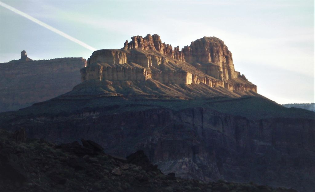
Dox Castle is a 4,780-foot-elevation (1,460-meter) summit located in the Grand Canyon, in Coconino County of northern Arizona, US. It is situated four miles north-northeast of Havasupai Point, two miles northwest of Evans Butte, and 2.5 miles southwest of Holy Grail Temple, where it towers 2,500 feet (760 meters) above the Colorado River.
Dox Castle was named by William Wallace Bass and George Wharton James for Virginia Dox (1851–1941), who was the first white woman to visit this part of the Grand Canyon in 1891. Holy Grail Temple was originally named Bass Tomb by Virginia Dox, for William Bass, Dox's guide into the canyon. Impressed by her, Bass named Dox Castle shortly after she left. This butte's name was officially adopted in 1908 by the U.S. Board on Geographic Names. According to the Köppen climate classification system, Dox Castle is located in a cold semi-arid climate zone, with precipitation runoff draining west to the Colorado River via Shinumo Creek.
Dox Castle is composed of Cambrian rock from the Tonto Group, overlaying the Proterozoic Unkar Group at river level. Levi F. Noble named the Dox Formation because of exposures in a tributary to Shinumo Creek below Dox Castle.
By prominence Dox Castle is
# 79 out of 875 in Coconino County # 38 out of 280 in Grand Canyon National Park # 28 out of 203 in the Kaibab Plateau
We use GPS information embedded into the photo when it is available.
3D mountains overlay
Adjust mountain panorama to perfectly match your photos because recorded by camera photo position might be imprecise.
Move tool
Rotate tool
Zoom
More customization
Choose which peak labels should make into the final photo and what photo title should be.
Next
Photo Location
Satellitte
Flat map
Relief map
Latitude
Longitude
Altitude
OR
Latitude
°'''
Longitude
°'''
Apply
Register Peak
Peak Name
Latitude
Longitude
Altitude
Register
Teleport
PeakVisor
This 3D model of Sagarmatha National Park in Nepal was made using the PeakVisor app topographic data. The mobile app features higher precision models worldwide, more topographic details, and works offline. Download PeakVisor maps today.
Download OBJ model
PeakVisor
The download should start shortly. If you find it useful please consider supporting the PeakVisor app.
PeakVisor for iOS and Android
Be a superhero of outdoor navigation with state-of-the-art 3D maps and mountain identification in the palm of your hand!