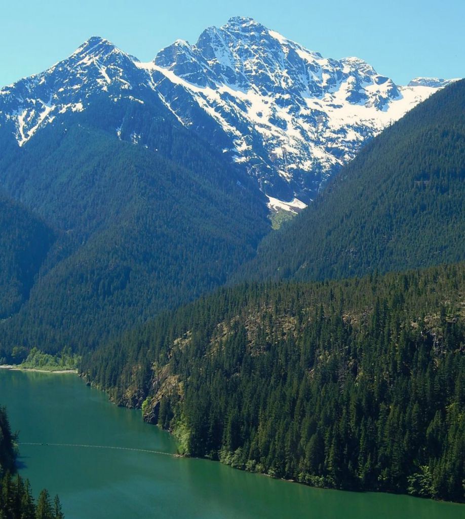
Colonial Peak is a mountain in the North Cascades of Washington, United States. It rises steeply from the southwest bank of Thunder Arm of Diablo Lake, one of the artificial reservoirs on the Skagit River. It is part of a group of peaks that form the northern end of a chain running south through prized climbing destinations such as Eldorado Peak, Forbidden Peak, and Goode Mountain. Colonial Peak takes its name from the Colonial mining claim on its slopes.
Like many North Cascade peaks, Colonial Peak is more notable for its large, steep rise above local terrain than for its absolute elevation. For example, it rises 6,560 feet (2,000 m) above Thunder Arm in only 2.3 horizontal miles (3.7 km). Its rise over the Skagit river on the northwest is even greater, but not as steep.
Colonial Peak was first climbed on July 31, 1931, by William Degenhardt and Herbert Strandberg of the Seattle Mountaineers. The standard route is the West Ridge, accessed from Colonial Glacier; the approach is via the Pyramid Lake Trail, starting from near Diablo Dam on the North Cascades Highway.
By elevation Colonial Peak is
# 47 out of 227 in Whatcom County # 67 out of 123 in North Cascades National Park
By prominence Colonial Peak is
# 56 out of 227 in Whatcom County # 40 out of 123 in North Cascades National Park
We use GPS information embedded into the photo when it is available.
3D mountains overlay
Adjust mountain panorama to perfectly match your photos because recorded by camera photo position might be imprecise.
Move tool
Rotate tool
Zoom
More customization
Choose which peak labels should make into the final photo and what photo title should be.
Next
Photo Location
Satellitte
Flat map
Relief map
Latitude
Longitude
Altitude
OR
Latitude
°'''
Longitude
°'''
Apply
Register Peak
Peak Name
Latitude
Longitude
Altitude
Register
Teleport
PeakVisor
This 3D model of Sagarmatha National Park in Nepal was made using the PeakVisor app topographic data. The mobile app features higher precision models worldwide, more topographic details, and works offline. Download PeakVisor maps today.
Download OBJ model
PeakVisor
The download should start shortly. If you find it useful please consider supporting the PeakVisor app.
PeakVisor for iOS and Android
Be a superhero of outdoor navigation with state-of-the-art 3D maps and mountain identification in the palm of your hand!