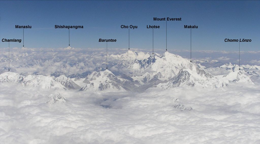
Chomo Lonzo (Chinese: 珠穆隆索峰; pinyin: Zhūmùlóngsuǒ Fēng) is a mountain in Tibet, 5 km northeast of Makalu in the Mahalungur (Mohalingor) or Khumbu Himalayas. Alternate spellings of the same name include Chomolonzo, Chomolönzo, Chomo Lönzo, Jomolönzo, and Lhamalangcho.
Chomo-Lonzo has three distinct summits. The Southern, main peak (7804m) is joined via a ~ 7250m saddle to the Central peak (7565m), which is joined via a ~7050m saddle to a ~7200m North (or North West) peak.
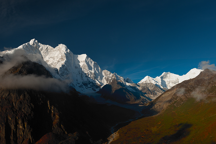
While from Nepal the mountain is overpowered by nearby Makalu, the fifth-highest peak in the world, the three peaks are a very impressive and dominating sight from the Kangshung valley in Tibet. Chomo-Lonzo translates to “bird goddess” and from the East the mountain indeed brings to mind a 3 km high eagle with spread wings.
By elevation Chomolonzo is
# 13 out of 127 in Qomolangma National Nature Preserve # 13 out of 936 in Tibet # 20 out of 12241 in China # 12 out of 64 in Tingri County # 29 out of 3458 in the Himalayas
By prominence Chomolonzo is
# 42 out of 127 in Qomolangma National Nature Preserve # 23 out of 64 in Tingri County
We use GPS information embedded into the photo when it is available.
3D mountains overlay
Adjust mountain panorama to perfectly match your photos because recorded by camera photo position might be imprecise.
Move tool
Rotate tool
Zoom
More customization
Choose which peak labels should make into the final photo and what photo title should be.
Next
Photo Location
Satellitte
Flat map
Relief map
Latitude
Longitude
Altitude
OR
Latitude
°'''
Longitude
°'''
Apply
Register Peak
Peak Name
Latitude
Longitude
Altitude
Register
Teleport
PeakVisor
This 3D model of Sagarmatha National Park in Nepal was made using the PeakVisor app topographic data. The mobile app features higher precision models worldwide, more topographic details, and works offline. Download PeakVisor maps today.
Download OBJ model
PeakVisor
The download should start shortly. If you find it useful please consider supporting the PeakVisor app.
PeakVisor for iOS and Android
Be a superhero of outdoor navigation with state-of-the-art 3D maps and mountain identification in the palm of your hand!