Available for connected Garmin and Suunto accounts.
Scan the QR code and open PeakVisor on your phone
Càrn a' Chlamain map
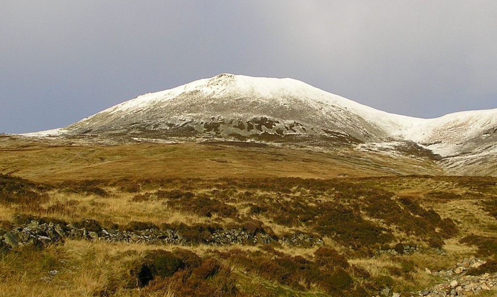
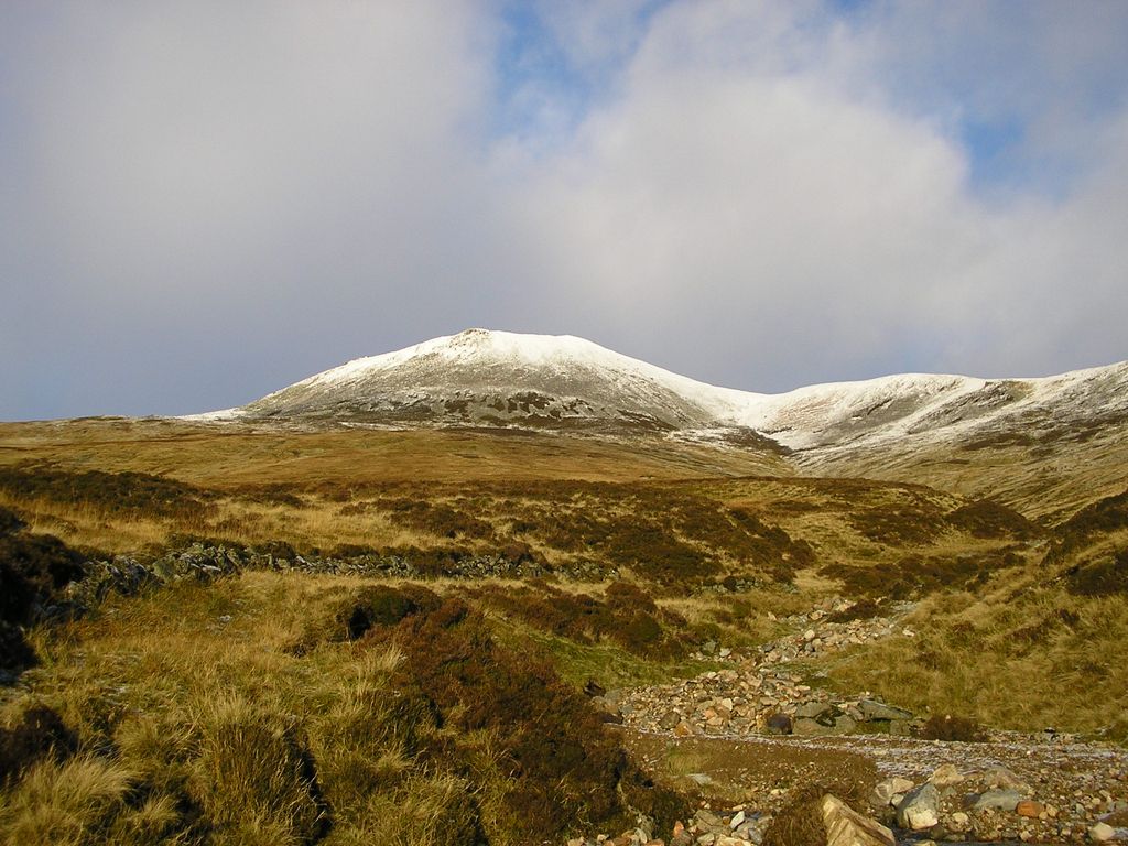
Càrn a' Chlamain
G
G
Add photo
964 m
Elevation
Elevation is the altitude of a place above sea level.
319 m
Prominence
Peak’s prominence is the least vertical to be covered to get from the summit to any other higher terrain.
Proportional Prominence694 m
Munro
Mountains in Scotland with a height of over 914 m / 3 000 ft bear a special name, the Munros. They are named after Sir Hugh Munro, the 4th Baronet (1856–1919), who produced the first list of such hills, known as Munro’s Tables, in 1891.
Càrn a' Chlamain (Gaelic: Càrn a' Chlamhain) is a Scottish mountain situated roughly 12 kilometres north of Blair Atholl in the Forest of Atholl. It is the highest point of an undulating plateau lying northeast of Glen Tilt. The River Tarf, a tributary of the Tilt, rises on the northwestern slopes before curving round the northern side of the plateau, whilst a further Tilt tributary marks the plateau's western boundary.
The summit of Càrn a' Chlamain is a prominent boulder covered dome rising up from the surrounding moorland.
The hill is almost invariably climbed from Glen Tilt. The most common route starts at Forest Lodge in Glen Tilt, from where a stalker's path climbs the steep side of the glen in a succession of zig-zags before crossing the plateau to the summit. As there is no public vehicular access to Forest Lodge the 10 kilometres from Old Blair must be undertaken on foot or bicycle.
One alternative route to the summit follows the southeast ridge; this may be joined about 3 km down the glen from Forest Lodge.
There's a hiking trail (T2) leading to the summit.
By elevation Càrn a' Chlamain is
# 43 out of 1062 in Perth and Kinross
By prominence Càrn a' Chlamain is
# 32 out of 1062 in Perth and Kinross # 19 out of 1071 in Cairngorms National Park
We use GPS information embedded into the photo when it is available.
3D mountains overlay
Adjust mountain panorama to perfectly match your photos because recorded by camera photo position might be imprecise.
Move tool
Rotate tool
Zoom
More customization
Choose which peak labels should make into the final photo and what photo title should be.
Next
Photo Location
Satellitte
Flat map
Relief map
Latitude
Longitude
Altitude
OR
Latitude
°'''
Longitude
°'''
Apply
Register Peak
Peak Name
Latitude
Longitude
Altitude
Register
Teleport
PeakVisor
This 3D model of Sagarmatha National Park in Nepal was made using the PeakVisor app topographic data. The mobile app features higher precision models worldwide, more topographic details, and works offline. Download PeakVisor maps today.
Download OBJ model
PeakVisor
The download should start shortly. If you find it useful please consider supporting the PeakVisor app.
PeakVisor for iOS and Android
Be a superhero of outdoor navigation with state-of-the-art 3D maps and mountain identification in the palm of your hand!