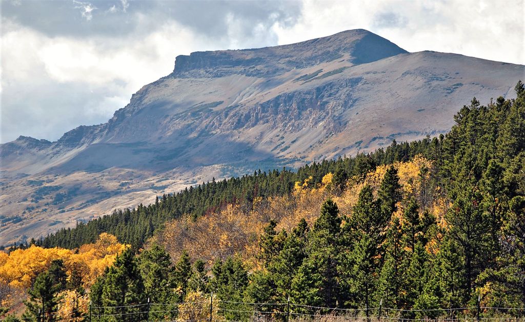
Calf Robe Mountain is a 7,948-foot-elevation (2,423-meter) mountain summit located in Glacier National Park in the U.S. state of Montana. It is situated on the Continental Divide in the Lewis Range, and can be seen from Highway 2 midway between Marias Pass and East Glacier Park. The summit is set on the border shared by Flathead County and Glacier County. Topographic relief is significant as the east aspect rises 2,500 feet (760 meters) in one mile. The immediate area between the mountain and highway is known for its aspen and beaver dams.
We use GPS information embedded into the photo when it is available.
3D mountains overlay
Adjust mountain panorama to perfectly match your photos because recorded by camera photo position might be imprecise.
Move tool
Rotate tool
Zoom
More customization
Choose which peak labels should make into the final photo and what photo title should be.
Next
Photo Location
Satellitte
Flat map
Relief map
Latitude
Longitude
Altitude
OR
Latitude
°'''
Longitude
°'''
Apply
Register Peak
Peak Name
Latitude
Longitude
Altitude
Register
Teleport
PeakVisor
This 3D model of Sagarmatha National Park in Nepal was made using the PeakVisor app topographic data. The mobile app features higher precision models worldwide, more topographic details, and works offline. Download PeakVisor maps today.
Download OBJ model
PeakVisor
The download should start shortly. If you find it useful please consider supporting the PeakVisor app.
PeakVisor for iOS and Android
Be a superhero of outdoor navigation with state-of-the-art 3D maps and mountain identification in the palm of your hand!