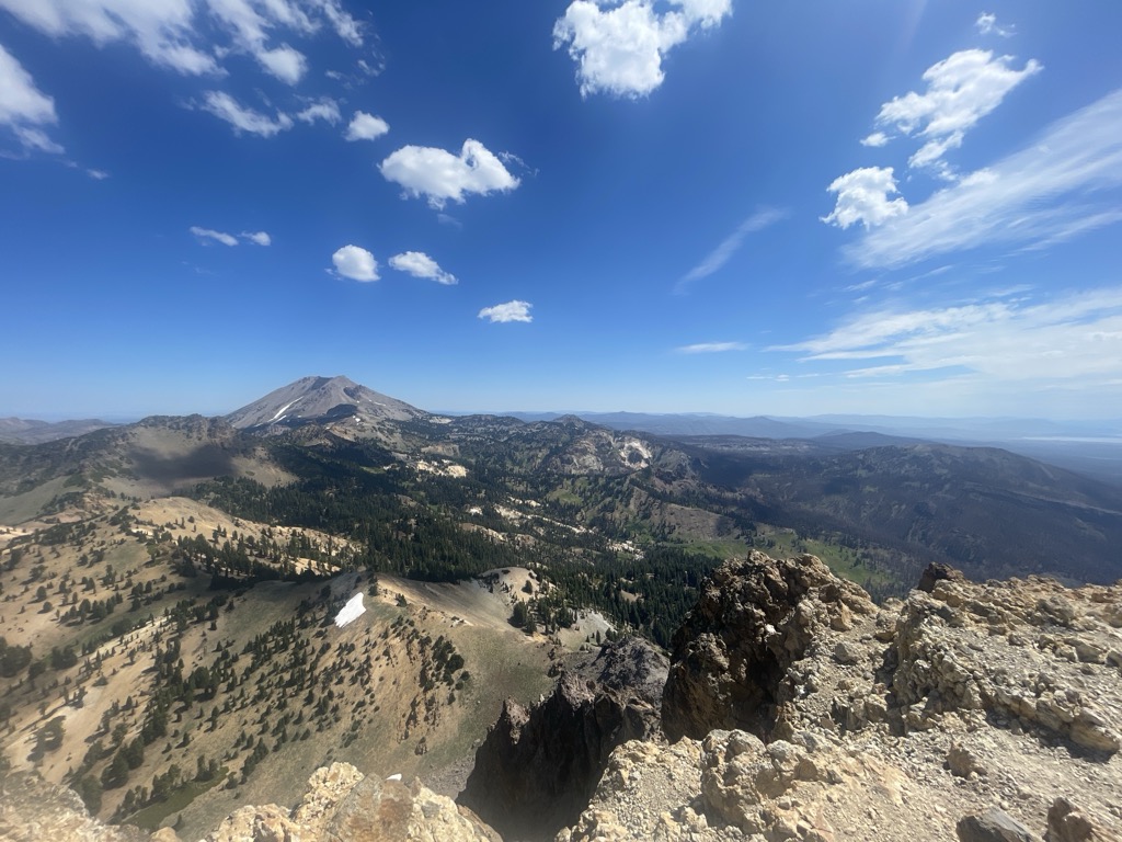
Mount Tehama (also called Brokeoff Volcano or Brokeoff Mountain) is an eroded andesitic stratovolcano in the Cascade Volcanic Arc and the Cascade Range in Northern California. Part of the Lassen volcanic area, its tallest remnant, Brokeoff Mountain, is itself the second highest peak in Lassen Volcanic National Park and connects to the park's highest point, Lassen Peak. Located on the border of Tehama County and Shasta County, Brokeoff's peak is the highest point in the former. The hikers that summit this mountain each year are treated to "exceptional" views of Lassen Peak, the Central Valley of California, and many of the park's other features. On clear days, Mount Shasta can also be seen in the distance.
Brokeoff Volcano was active from 590,000 to 387,000 years ago, during which period it erupted numerous flows with compositions ranging from basaltic andesite to dacite. At its peak, Brokeoff Volcano reached an estimated height of 3,350 metres (10,990 ft) and had a basal circumference of approximately 12 kilometres (7.5 mi). At approximately 313,000 years ago volcanism began shifting to the northeast of Brokeoff Volcano, with volcanism currently focused around the modern Lassen Peak. Following the end of volcanism at Brokeoff Volcano, cooling magma beneath the surface continued to drive hot, highly reactive hydrothermal fluids circulating near the central vent of the volcano. These hydrothermal fluids chemically weathered the volcanic rocks near the central vent, making them particularly susceptible to physical erosion. Glaciers and streams were able to rapidly erode the hydrothermally altered rocks near the central vent, creating the deep Mill Canyon and exposing deep into the core of the ancient volcano.
Many of the lava flows along the flanks of Brokeoff Volcano were not as extensively chemically weathered, resulting in the flanks of much of the volcano being preserved. Remnants of the flanks of Brokeoff Volcano include Brokeoff Mountain, Mount Conard, Pilot Pinnacle, Mount Diller, and Diamond Peak.
There's a trail called Brokeoff Mountain Trail leading to the summit.
By elevation Brokeoff Mountain is
# 63 out of 4345 in the Cascade Range # 1 out of 168 in Tehama County # 2 out of 299 in Shasta County # 1 out of 32 in Lassen Volcanic Wilderness # 2 out of 39 in Lassen Volcanic National Park
By prominence Brokeoff Mountain is
# 11 out of 168 in Tehama County # 55 out of 299 in Shasta County # 5 out of 32 in Lassen Volcanic Wilderness # 7 out of 39 in Lassen Volcanic National Park
We use GPS information embedded into the photo when it is available.
3D mountains overlay
Adjust mountain panorama to perfectly match your photos because recorded by camera photo position might be imprecise.
Move tool
Rotate tool
Zoom
More customization
Choose which peak labels should make into the final photo and what photo title should be.
Next
Photo Location
Satellitte
Flat map
Relief map
Latitude
Longitude
Altitude
OR
Latitude
°'''
Longitude
°'''
Apply
Register Peak
Peak Name
Latitude
Longitude
Altitude
Register
Teleport
PeakVisor
This 3D model of Sagarmatha National Park in Nepal was made using the PeakVisor app topographic data. The mobile app features higher precision models worldwide, more topographic details, and works offline. Download PeakVisor maps today.
Download OBJ model
PeakVisor
The download should start shortly. If you find it useful please consider supporting the PeakVisor app.
PeakVisor for iOS and Android
Be a superhero of outdoor navigation with state-of-the-art 3D maps and mountain identification in the palm of your hand!