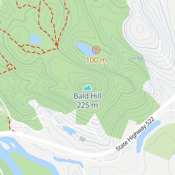
Bald Hill is a 737-foot (225 m) hill in Snohomish County, Washington. The Skykomish River once flowed north of the hill but at some point in recent geologic history was diverted to its present course on the south side of the hill, moving the confluence with the Snoqualmie River (creating the Snohomish River) several miles upstream. In 1952, most of Bald Hill and adjacent Devils Butte were Washington State Forest land. As of 2016, Devils Butte is part of Lord Hill Regional Park, and the Bald Hill area was still listed by Washington State Department of Natural Resources as State Forest Trust, formerly Forest Board Trust land.
We use GPS information embedded into the photo when it is available.
3D mountains overlay
Adjust mountain panorama to perfectly match your photos because recorded by camera photo position might be imprecise.
Move tool
Rotate tool
Zoom
More customization
Choose which peak labels should make into the final photo and what photo title should be.
Next
Photo Location
Satellitte
Flat map
Relief map
Latitude
Longitude
Altitude
OR
Latitude
°'''
Longitude
°'''
Apply
Register Peak
Peak Name
Latitude
Longitude
Altitude
Register
Teleport
PeakVisor
This 3D model of Sagarmatha National Park in Nepal was made using the PeakVisor app topographic data. The mobile app features higher precision models worldwide, more topographic details, and works offline. Download PeakVisor maps today.
Download OBJ model
PeakVisor
The download should start shortly. If you find it useful please consider supporting the PeakVisor app.
PeakVisor for iOS and Android
Be a superhero of outdoor navigation with state-of-the-art 3D maps and mountain identification in the palm of your hand!