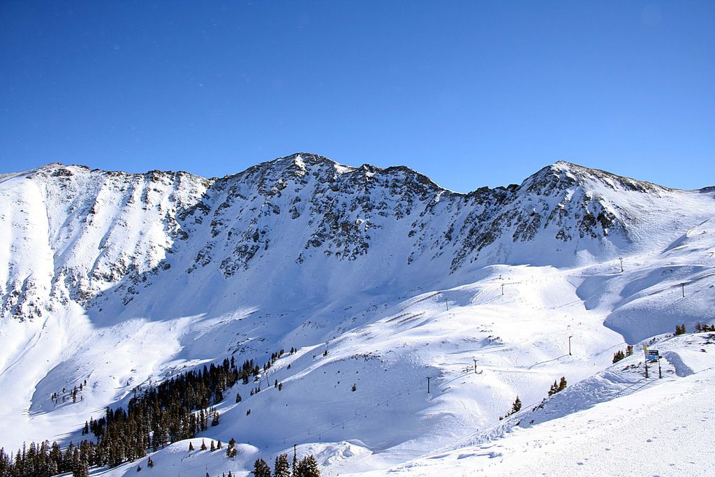
Arapahoe Basin ( ə-RAP-ə-hoh; often shortened to A-Basin, or simply The Basin) is an alpine ski area in the Rocky Mountains of the United States, in the Arapaho National Forest of Colorado. Arapahoe Basin is known for its extended season and its extreme terrain. Arapahoe Basin is located south of Loveland Pass on U.S. Highway 6 in Summit County. The resort's terrain spans over 1,400 acres, serving up a mix of groomed runs, moguls, cornices, and glades. It features a lift-served vertical drop of 2,270 feet and is served by 9 lifts, with easy access to 145 trails. Additionally, there is a significant amount of hike-to terrain which expands the in-bounds area appeal.
There is also an abundance of non-winter activities available.
By elevation Arapahoe Basin is
# 65 out of 1075 in the Front Range # 33 out of 270 in White River National Forest # 31 out of 110 in Summit County
We use GPS information embedded into the photo when it is available.
3D mountains overlay
Adjust mountain panorama to perfectly match your photos because recorded by camera photo position might be imprecise.
Move tool
Rotate tool
Zoom
More customization
Choose which peak labels should make into the final photo and what photo title should be.
Next
Photo Location
Satellitte
Flat map
Relief map
Latitude
Longitude
Altitude
OR
Latitude
°'''
Longitude
°'''
Apply
Register Peak
Peak Name
Latitude
Longitude
Altitude
Register
Teleport
PeakVisor
This 3D model of Sagarmatha National Park in Nepal was made using the PeakVisor app topographic data. The mobile app features higher precision models worldwide, more topographic details, and works offline. Download PeakVisor maps today.
Download OBJ model
PeakVisor
The download should start shortly. If you find it useful please consider supporting the PeakVisor app.
PeakVisor for iOS and Android
Be a superhero of outdoor navigation with state-of-the-art 3D maps and mountain identification in the palm of your hand!