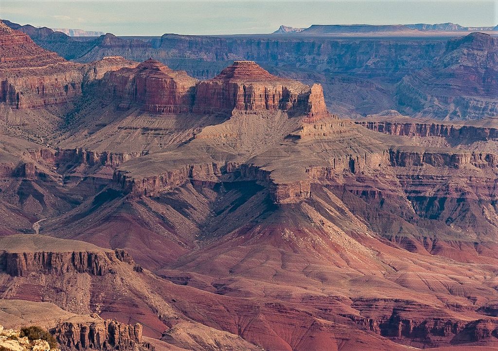
Apollo Temple is a 6,252-foot-elevation (1,906-meter) summit located in the Grand Canyon, in Coconino County of northern Arizona, in the southwestern United States. It is situated four miles due east of Cape Royal on the canyon's North Rim, four miles northeast of Vishnu Temple, and a half-mile south-southeast of Venus Temple, which is the nearest higher neighbor. Topographic relief is significant as it rises over 3,600 feet (1,100 meters) above the Colorado River in less than two miles.
Apollo Temple is named for Apollo, god of the sun in Greek and Roman mythology. This name was applied in 1902 by geologist François E. Matthes, in keeping with Clarence Dutton's tradition of naming geographical features in the Grand Canyon after mythological deities. This feature's name was officially adopted in 1906 by the U.S. Board on Geographic Names.
The top of Apollo Temple is composed of lower strata of the Pennsylvanian-Permian Supai Group. This overlays the cliff-forming layer of Mississippian Redwall Limestone, which in turn overlays Cambrian Tonto Group. According to the Köppen climate classification system, Apollo Temple is located in a Cold semi-arid climate zone. Precipitation runoff from Apollo Temple drains south to the Colorado River via Unkar and Basalt Creeks.
There's a trail called Apollo Temple Route leading to the summit.
By prominence Apollo Temple is
# 72 out of 280 in Grand Canyon National Park # 52 out of 203 in the Kaibab Plateau
We use GPS information embedded into the photo when it is available.
3D mountains overlay
Adjust mountain panorama to perfectly match your photos because recorded by camera photo position might be imprecise.
Move tool
Rotate tool
Zoom
More customization
Choose which peak labels should make into the final photo and what photo title should be.
Next
Photo Location
Satellitte
Flat map
Relief map
Latitude
Longitude
Altitude
OR
Latitude
°'''
Longitude
°'''
Apply
Register Peak
Peak Name
Latitude
Longitude
Altitude
Register
Teleport
PeakVisor
This 3D model of Sagarmatha National Park in Nepal was made using the PeakVisor app topographic data. The mobile app features higher precision models worldwide, more topographic details, and works offline. Download PeakVisor maps today.
Download OBJ model
PeakVisor
The download should start shortly. If you find it useful please consider supporting the PeakVisor app.
PeakVisor for iOS and Android
Be a superhero of outdoor navigation with state-of-the-art 3D maps and mountain identification in the palm of your hand!