Available for connected Garmin and Suunto accounts.
Scan the QR code and open PeakVisor on your phone
An Socach map
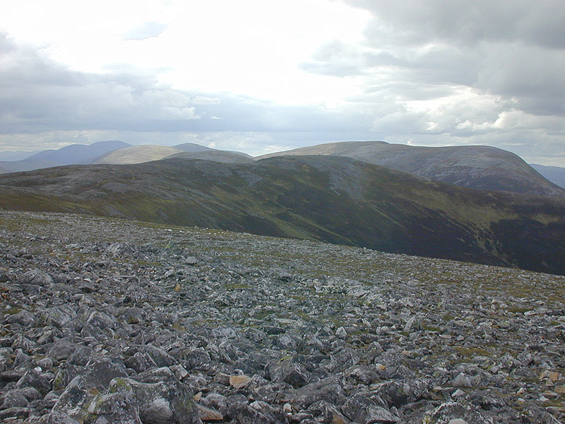
An Socach
N
Add photo
944 m
Elevation
Elevation is the altitude of a place above sea level.
186 m
Prominence
Peak’s prominence is the least vertical to be covered to get from the summit to any other higher terrain.
Proportional Prominence524 m
Munro
Mountains in Scotland with a height of over 914 m / 3 000 ft bear a special name, the Munros. They are named after Sir Hugh Munro, the 4th Baronet (1856–1919), who produced the first list of such hills, known as Munro’s Tables, in 1891.
An Socach is a Scottish mountain situated some three miles (5 km) west of the A93 road from Perth to Braemar. It is located at grid ref. 080800 on Ordnance Survey sheet 43. The summit altitude is 944 m (3,097 ft). The name may derive from the Gaelic Soc, meaning the snout or beak, leading to the projecting place by analogy with the shape of a snout. Other sources state that it in fact means 'the sow'.
The hill has an elongated, round form, and the Munro bagger is advised that the highest top is in fact at its western end and is not the 938 m (3,077 ft) eastern summit as shown on certain OS maps. The hill may be climbed from Glen Ey to the north or from the top of the Glenshee Ski Centre to the east. The Glenshee route involves a descent into Baddoch Burn, and so more climbing is required than the Glen Ey route, which is longer.
There's a trail leading to the summit.
By elevation An Socach is
# 67 out of 1430 in Aberdeenshire
By prominence An Socach is
# 44 out of 1430 in Aberdeenshire # 64 out of 1071 in Cairngorms National Park
We use GPS information embedded into the photo when it is available.
3D mountains overlay
Adjust mountain panorama to perfectly match your photos because recorded by camera photo position might be imprecise.
Move tool
Rotate tool
Zoom
More customization
Choose which peak labels should make into the final photo and what photo title should be.
Next
Photo Location
Satellitte
Flat map
Relief map
Latitude
Longitude
Altitude
OR
Latitude
°'''
Longitude
°'''
Apply
Register Peak
Peak Name
Latitude
Longitude
Altitude
Register
Teleport
PeakVisor
This 3D model of Sagarmatha National Park in Nepal was made using the PeakVisor app topographic data. The mobile app features higher precision models worldwide, more topographic details, and works offline. Download PeakVisor maps today.
Download OBJ model
PeakVisor
The download should start shortly. If you find it useful please consider supporting the PeakVisor app.
PeakVisor for iOS and Android
Be a superhero of outdoor navigation with state-of-the-art 3D maps and mountain identification in the palm of your hand!