Scan the QR code and open PeakVisor on your phone
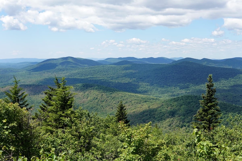
The West Canada Lake Wilderness is a protected area located in Hamilton County in the northern part of the US state of New York. As it encompasses numerous bodies of water and 40 named mountains within the Adirondacks, the West Canada Lake Wilderness is a true haven for outdoor adventure. The highest and most prominent peak in the wilderness is Snowy Mountain, (3,904 ft/1190 m).
Designated as a wilderness area in 1972, the West Canada Lake Wilderness is a protected area in the Adirondack Park that stretches across 168,920 acres (68,359 ha) of upstate New York in the eastern US.
The wilderness encompasses part of the watershed of the Hudson River as well as three designated primitive areas. Of these three areas, West Canada Mountain Primitive Area is the largest with a total area of 2,935 acres (1,188 ha).
The terrain in the wilderness area varies from swamps and rolling hills to steep rugged mountains, the majority of which are between 2,000 ft (610 m) to 3,000 ft (914 m) in elevation. Some areas of the wilderness do not have established trail systems, either, which makes the region one of the more remote sections of the Adirondacks.
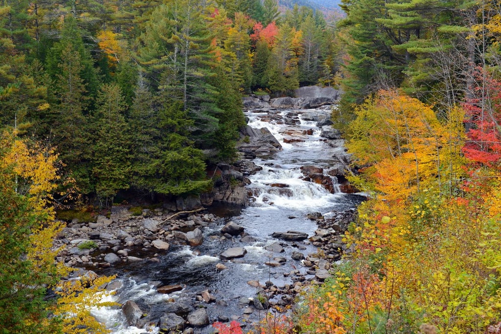
There are over 200 natural bodies of water in the area, too, that range in size from beaver ponds to lakes. This abundance of water has long drawn fishermen to the area that is now the West Canada Lake Wilderness.
Three main lakes occupy the wilderness area—West Lake, South Lake, and Mud Lake. Together, they form the headwaters of the West Canada Creek, a significant tributary of the Mohawk River. The wilderness boundary includes the southern slopes of Snowy Mountain but not the summit. Panther Mountain, Buell Mountain, and Lewey Mountain are the next three tallest peaks in the area.
A significant issue for the wilderness is the lack of a comprehensive management plan. One key area of local concern is that visitors tend to overcrowd certain trails and overnight spots in the wilderness. There is fear among local residents that high usage levels of the wilderness area’s trails and campsites could degrade the landscape if this sort of activity continues to go unregulated in the future.
That being said, the West Canada Lake Wilderness is located in a heavily protected area and it is situated within close proximity of a number of other outdoor recreation destinations. Other notable destinations in the region include the Silver Lake Wilderness, Jessup River Wild Forest, Ferris Lake Wild Forest, Black River Wild Forest, Independence River Wild Forest, and Five Ponds Wilderness.
The Adirondack dome that underlies these mountains formed over the course of the past 15 to 20 million years. This dome is approximately 1 mi (1.6 km) high and 160 mi (257 km) wide, so it covers a significant portion of Upstate New York. That said, the Adirondacks are actually a relatively young mountain range that’s made up of very old rocks.
The rocks in the Adirondacks tell a story that begins over 1 billion years ago. This story starts with the formation of a shallow sea, followed by the peak-rising Grenville Orogeny and millions of years of erosion.
Further tectonic plate collisions (as a result of the Taconic and Alleghanian orogeny) and the separation of the supercontinent Pangea created the igneous and metamorphic rocks that are now found in the Adirondacks. To this day, the Adirondacks continue to rise at an estimated 1 ft (0.3 m) per century.
The presence of glaciers significantly impacted the landscape of upstate New York. Much of the region was glaciated during the Pleistocene.
As these glaciers expanded across the landscape, they picked up rocks and debris. They also eroded away at the landscape, carving out the range’s many valleys and rounding over its peaks in the process. These glaciers also deposited rocks called erratics and created other features such as moraines.
Numerous bodies of water formed as these glaciers shifted, melted, and deposited debris. Historically, this debris alternated between damming up river valleys and breaking to release gravel and sand downstream.
The regular changes in the area’s meltwater drainage system resulted in the formation of some of the many bodies of water that exist in the West Canada Lake Wilderness region to this day.
The region of the West Canada Lake Wilderness features multiple small lakes that are located on a high elevation plateau.
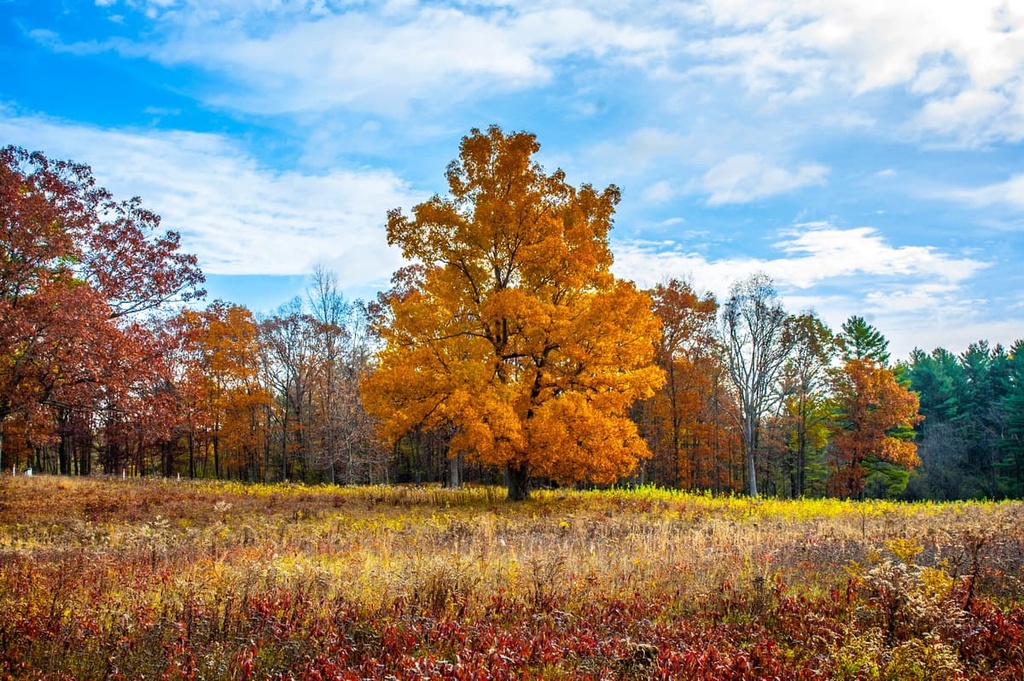
The forests in the region are composed primarily of balsam fir and red spruce. Many areas in the southern portion of the wilderness and in the Snowy Range were bought by the state and protected at the end of the 1800s. As a result, some sections of old-growth forest remain in the wilderness area.
However, the northern sections of the wilderness were logged by the paper industry and were only acquired by the state in the 1920s. Although natural succession is replenishing the forest, the forest in the northern part of the wilderness is younger as a result of these recent logging events.
Water is a significant feature of the ecosystem in the wilderness area as it flows through the region’s many streams, lakes, ponds, and wetlands. These bodies of water provide habitats for many aquatic and semi-aquatic animals, such as brook trout.
Moose, black bears, beavers, coyotes, river otters, white-tailed deer, and little brown bats all live in the temperate forest of the wilderness area. Bald eagles, loons, peregrine falcons, ospreys, great horned owls, great blue herons, wild turkeys, and eastern bluebirds are some of the many birds that are commonly seen here, too.
Acid rain wreaked havoc on the wilderness area during the 1980s. As a result of declining pH levels in multiple lakes, including the well-known Brooktrout Lake, many of the region’s aquatic ecosystems became uninhabitable and many fish populations died off.
After numerous lawsuits and the implementation of policies to address air pollution throughout the region, pH levels began to return to normal in the lakes and rivers of the Adirondacks. In 2005, Brooktrout Lake became the first lake to be restocked with fish in the wilderness area.
The land of the West Canada Creek Wilderness is part of the traditional territory of the Onʌyoteˀa·ká· (otherwise known as the People of the Standing Stone or the Oneida) and the Kanienʼkehá꞉ka (also known as the Keepers of the Eastern Door or the Mohawk). Both the Oneida and the Mohawk are member Tribes of the Haudenosaunee (Iroquois Confederacy).
An abundance of natural resources and navigable waterways made the region an appealing place to hunt, travel, and settle for many Tribal nations. However, European contact beginning in the 1600s brought disease and firearms to the region and shifted the dynamic between tribes. During the American Revolution, the Mohawk sided with the British and the Oneida fought alongside the Americans.
Sections of what is now the West Canada Lake Wilderness were logged for paper mills around the turn of the twentieth century. After World War II, the area was commonly used for hunting camps and other similar purposes.
During this time, Louis Seymour (also known as French Louis), a French-Canadian immigrant to the region, became an iconic guide in the West Canada Lake Wilderness area. He built cabins across the wilderness and his personal cabin sat on the eastern side of West Lake. Many of these cabins still exist to this day, as does the old dam on Cedar Lake, which was constructed in 1904 by loggers.
The West Canada Lake Wilderness was formally designated in 1972. As of the time of writing, there is no official management plan in place for the wilderness area. However, the New York State Department of Environmental Conservation (DEC) is in the process of developing a management plan for the area to ensure its well-being for generations to come.
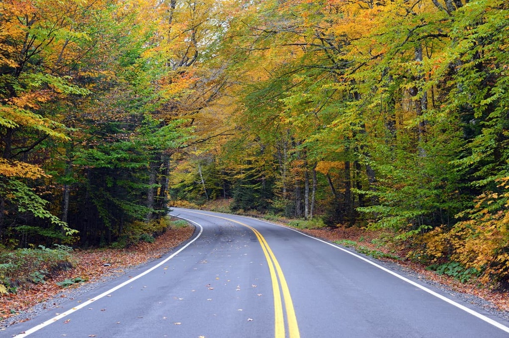
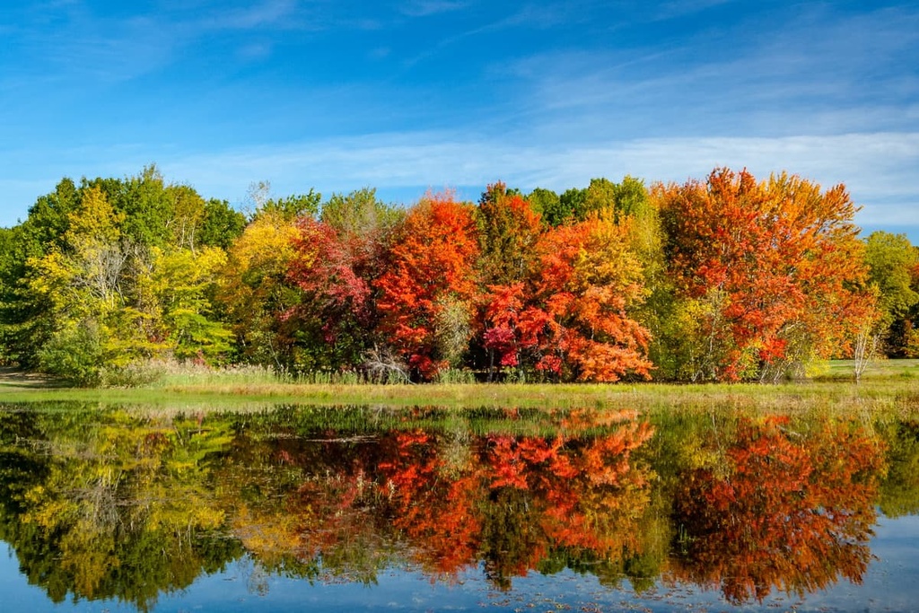
Some portions of the West Canada Lake Wilderness area have numerous trails, lean-tos, and primitive camping sites available for visitors to enjoy, making them great places to check out for overnight trips. The wilderness area is most commonly visited in late summer and fall, as these seasons let you avoid the cold, icy, and buggy parts of winter, spring, and early summer.
With that in mind, here are some of the best hikes in the West Canada Lakes Wilderness to check out during your next trip to the region.
Approximately 23 miles (37 km) of the 139 mi (223 km) long Northville-Placid Trail run through the West Canada Lake Wilderness.
You can either start your thru-hike on the Northville-Placid Trail at the route’s southern terminus in Northville or at its northern terminus in Lake Placid. Or, if you just want to hike a section of the trail, you can pick up the path near the southern part of the West Canada Lake Wilderness on Haskell Road in Piseco.
Alternatively, you can reach the trail via the Northville-Placid Wakely Dam Trailhead or the Spruce Lake Trailhead. Many of the other hikes in the West Canada Lakes Wilderness also meet up with the Northville-Placid Trail (such as the Cedar Lakes Trail, French Louie Trail, Brooktrout Lake Trail, and Otter Brook Lake Trail), so your trekking options are nearly limitless in the region.
This 7.1 mi (11.4 km) out and back trail to the top of Snowy Mountain gains just over 2,100 ft (640 m) in elevation. It is a very popular area for hiking in summer and snowshoeing in winter, so be prepared to encounter other trekkers during your adventures on this trail.
Although this trail can be challenging at times, it offers a stunning view of the surrounding region from the fire tower on the summit of Snowy Mountain. The trailhead for this hike is located on NY State Route 30 between Indian Lake and Speculator.
The French Louis to West Lake Trail is an 18.8 mi (30.3 km) out-and-back hike that gains 1,885 ft (565 m) in elevation. This trail is doable as a day trip, but many hikers opt to camp along the way to split the journey into two solid hiking days.
The best times to hike this trail are in summer and fall when there is less mud and fewer bugs in the area. The autumn months also provide an opportunity to see the beautiful fall foliage that the Adirondacks are so famous for.
One of the best aspects of the French Louis to West Lake Trail is that the path provides easy access to the region’s many lakes as you hike. This makes it a nice option for the anglers among us (don’t forget to acquire a fishing permit before your trip) and it also makes it a great choice for people who enjoy swimming and lounging around by the water during their adventures.
The trailhead for this hike is located off of NY State Route 30 between Indian Lake and Speculator. You can start this hike from the trailhead for Pillsbury Mountain and follow the path westward toward Pillsbury Lake.
There are plenty of camping opportunities available in the West Canada Lake Wilderness Area. Here are some of the main options to consider as you plan your trip to the region.
The West Canada Lake Wilderness is home to dozens of tent sites and lean-tos that are available on a first-come, first-served basis. Many of these campsites are located along the Northville-Placid Trail, and you can find a list of campsites in the wilderness on the DEC website.
Additionally, you can camp in most non-impacted sites in the wilderness, so long as you are at least 150 ft (46 m) from the nearest road, trail, river, or lake. If you plan to camp for more than 3 nights in the wilderness area or in a group of 10 or more people, you will need to get a permit from a Forest Ranger.
Although there aren’t many campgrounds located in the West Canada Lakes Wilderness Area itself, there are plenty of developed campgrounds in the general region. Some of the closest campgrounds to the wilderness include:
These campgrounds are all operated by the DEC. They all tend to be quite busy during the summer months, so be sure to make a reservation well in advance of your trip to avoid disappointment. You can make reservations for most sites online via ReserveAmerica.
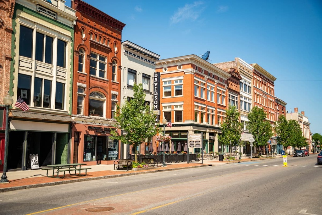
If you’re looking for a place to stay near the West Canada Lake Wilderness that offers a few different amenities for visitors, Albany, Syracuse, and Saratoga Springs are all great options that are located within a few hours' drive from the mountains. Here’s what you need to know about each city before your next trip to the region.
The city of Albany lies two hours away by car from the West Canada Lakes wilderness and has a population just shy of 100,000 people. Albany, the capital of New York, was originally established as a small Dutch settlement.
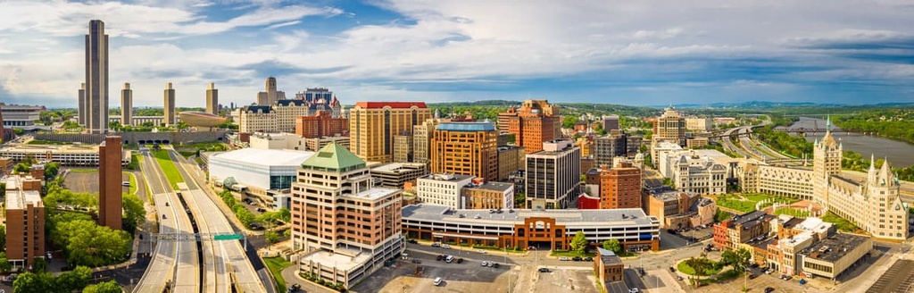
While in Albany, you can visit the state capitol building or browse the history, art, and science museums in the city’s downtown area. There are many local parks and outdoor spaces in Albany, too, such as the Albany Pine Bush Preserve, the Erie Canal National Heritage Corridor, and the Pine Hollow Arboretum.
The restaurant scene in Albany is also known for its locally-owned kitchens and craft beverage producers. From international cuisines to pub food, the city of Albany has it all. Staying the night in Albany is easy, too, as you can choose from fancy hotels, budget motels, or cozy and historic B&Bs for your trip to the city.
Syracuse is a city located around 2.5 hours away by car from the West Canada Lakes Wilderness Area. The city is home to around 142,500 people, so it’s one of the largest communities in Central New York.
Although Syracuse is best known for its namesake university and its many sports teams, there’s plenty to do in the city itself. For example, Syracuse is home to numerous art galleries and museums. While in Syracuse, you can also dive into the local history with a walking tour that explains how the salt industry shaped the city into the urban area that we see today.
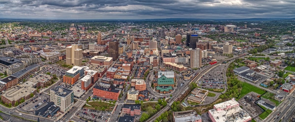
If you’re looking to get outside while in the area, visit Chittenango Falls State Park, go apple picking in the fall, head to a local golf course, or grab a bike and explore the city on wheels.
Additionally, Syracuse’s restaurants are particularly well known for their fresh ingredients and gourmet brunch menus, so there’s plenty to appease the foodies among us in this great city. Of all the eateries in Syracuse to check out during your travels, be sure to put the Salt City Market at the top of your list. The market is a food hall with an incredible selection of international dishes, so it’s a must-visit for any hungry traveler.
The town of Saratoga Springs is located just under two hours away from the West Canada Lake Wilderness and is home to around 28,000 people.
When in Saratoga Springs, be sure to visit the town’s local galleries, battlefields, and other historic sites. You can also take in the town’s natural beauty along trails in the Wilton Wildlife Preserve & Park.
Saratoga Springs is perhaps best known for its namesake racecourse, which hosts thoroughbred races on a regular basis. The summer months are a particularly busy time at this historic race track, so it’s a great place to check out if you’re in the region and want a fun activity that the whole family can enjoy.
Dining and accommodation options are easy to find in Saratoga Springs, too. While in the city, you can enjoy international flavors, custom cocktails, pet-friendly patio dining, and more. Accommodation options in the city run the gamut from rental cabins and homey B&Bs to family-run motels and chain hotels.