Scan the QR code and open PeakVisor on your phone
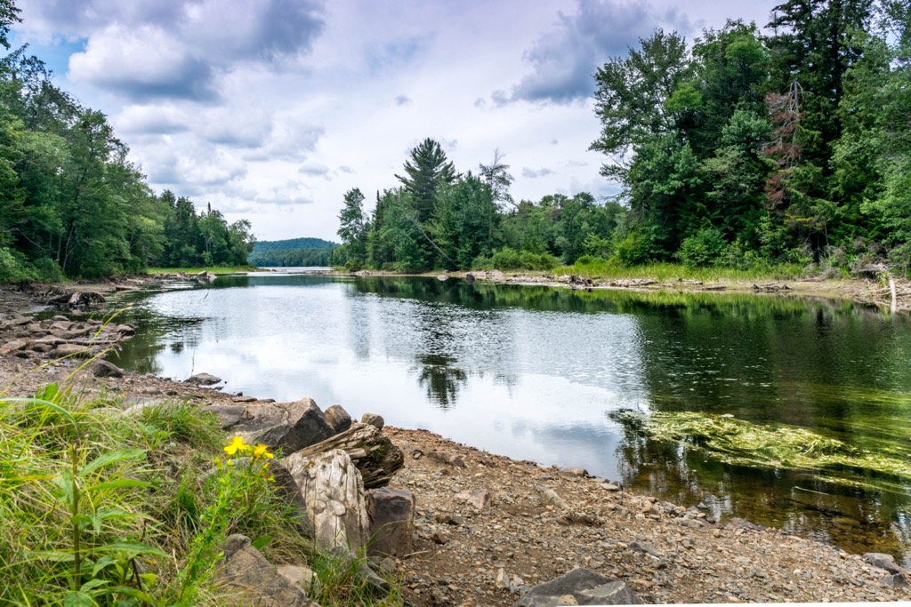
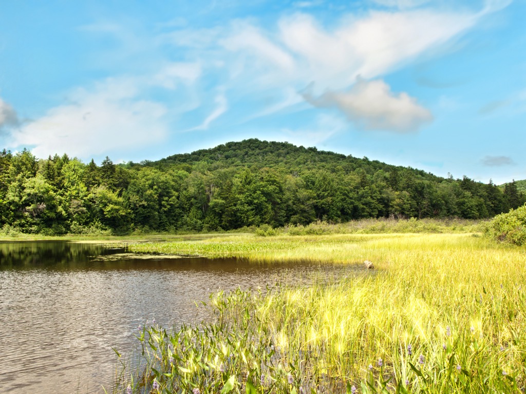
A forested landscape punctuated by lakes and streams, Ferris Lake Wild Forest is a protected area that encompasses 147,454 acres (59,673 ha) of terrain in the Adirondack Park of upstate New York, USA. The wild forest includes the Oxbow Tract Conservation Easement and 32 named mountains. The highest mountain in the wild forest is Panther Mountain (2,723 ft/830 m) and the most prominent is Morehouse Mountain (2,625 ft/800 m).
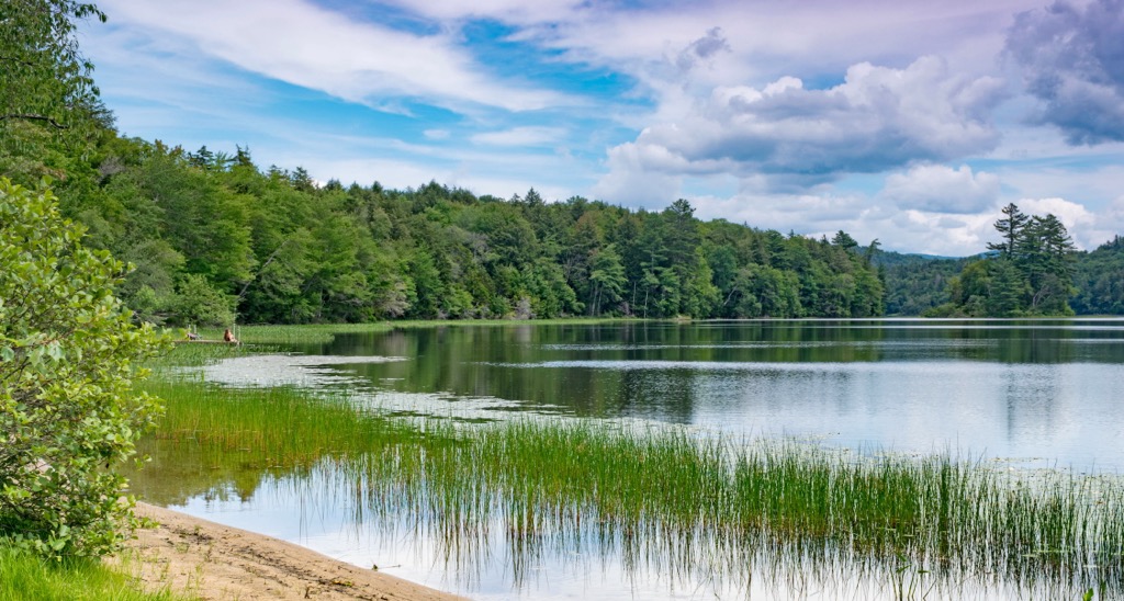
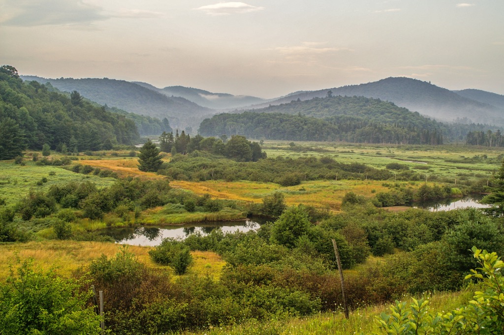
Ferris Lake Wild Forest is part of the Adirondacks in upstate New York. It covers 147,454 acres (59,673 hectares) of old-growth spruce forest as well as ponds, lakes, streams, and over 100 miles (160 km) of multi-use trails.
The forest lies in Fulton, Hamilton, and Herkimer counties. Neighboring it to the north are the Silver Lake Wilderness, West Canada Lake Wilderness, Little Moose Mountain Wilderness, and Black River Wild Forest. The forest is also part of the Adirondack Park, which is a 6 million acre (2.4 million ha) forest preserve.
Within the forest, there are around 14.6 mi (23.5 km) of designated hiking trails, 117 mi (188 km) of snowmobile trails (many of which are multi-use), 97 primitive campsites, a boat launch, and nearly 11 mi (17.5 km) of roads.
The Oxbow Tract Conservation Easement occupies 732 acres (296 ha) of terrain on the eastern edge of the forest. Recreation use is more limited in the easement, but it does give visitors water access at Shake Place and the nearby parking area as well as to upstream portions of the west branch of the Sacandaga River.
The Adirondacks differ geologically from other nearby mountain ranges in the eastern US, such as the Appalachians.
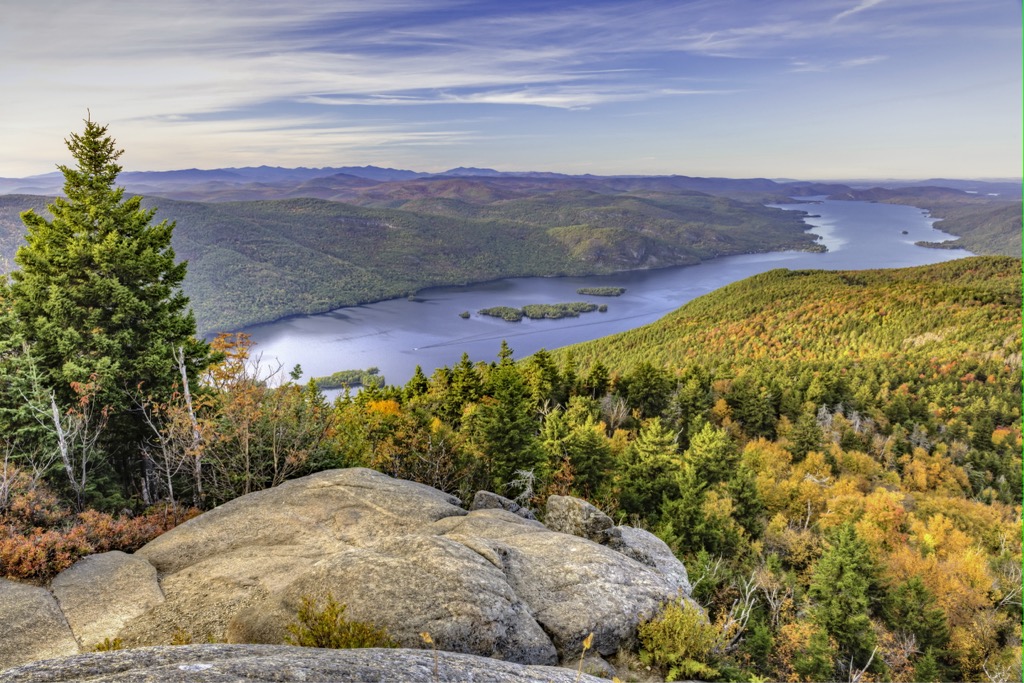
In fact, the Adirondacks rose in a circular dome shape that’s about 160 mi (260 km) wide and 1 mi (1.5 km) high. The dome itself emerged about 5 million years ago, but the rocks in the range are up to 1 billion years old.
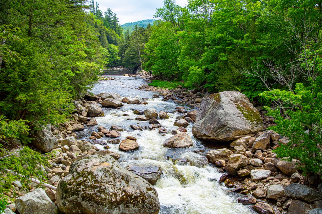
Glaciers significantly shaped the Adirondacks over the millennia, crushing and lifting rock and sediment as they moved across the landscape. As they melted, these glaciers also left behind rocky debris known as erratics, which you can still see strewn across the landscape in the range.
Glaciers were also responsible for the creation of many of the ponds in the region. Large blocks of ice would detach from glaciers and become embedded in the Earth’s surface. As the ice thawed, the depressions it left behind were filled with water, creating the small, circular ponds commonly throughout the range to this day.
The mineral soil in the region is young, having developed only since the last glacial maximum about 11,000 years ago. Soils in the region are typically thin, sandy, and infertile, with the exception being forest soils that have been enriched by organic debris.
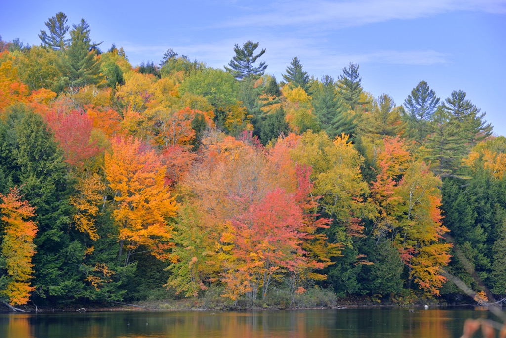
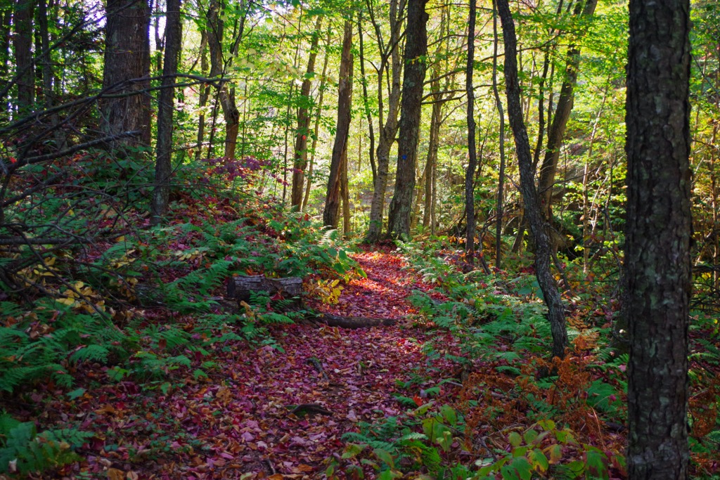
The low mountains and hills in the Ferris Lake Wild Forest are typically covered by spruce, birch, beech, maple, and pine trees. Snowberries, mayflowers, and Indian cucumber are several common plants that can be found on the forest floor, too.
Lakes, ponds, and streams support an abundance of fish in the wild forest, including trout, bass, landlocked salmon, pickerel, perch, and sunfish. Newts, frogs, and salamanders are found near the water and on the moist forest floor, too.
Black-capped chickadees, blue jays, robins, ravens, juncos, wild turkeys, and grouse are among the most common birds in the forest. Mammals often seen in the area include white-tailed deer, raccoons, foxes, coyotes, bobcats, black bears, river otters, beavers, minks, hares, squirrels, and muskrats.
The Adirondacks and central New York are the traditional territory of the Iroquois Confederacy, and more specifically, the Oneida (Onᐱyoteʔa∙ká) and the Mohawk (Kanien’kehá:ka).
Traditionally, the Oneida lived a semi-sedentary lifestyle where they grew maize but also migrated to take advantage of seasonal resources. They sided with the colonists during the American revolution, creating friction between the neighboring Iroquois tribe, the Mohawk, who sided with the British.
The Mohawk are another Iroquoian people with ancestral ties to the region. Similar to the Oneida, the Mohawk traditionally grew maize, but they also traveled across the region to hunt and fish.
The Adirondack Park, and all the wild forests it encompasses, was created in the late 1800s. Following the Civil War, logging increased to support post-war reconstruction. The lands in what is now the Ferris Lake Wild Forest were heavily logged to support the lumber and tanning industries.
Around this same time, there was some mining activity in the region, particularly around Salisbury Center where there were a few active iron mines. Nearly all of the mines in the region closed by the early twentieth century.
However, at the end of the nineteenth century, the region had also started to become a popular tourist destination. One of the Adirondacks’ first resort hotels, called Canada Lake House, was constructed in the area near Canada Lake. It was later replaced by other luxury resorts, though many of them have since burned down.
By the end of the nineteenth century, conservationists in New York recognized the importance of preserving forests and watersheds, so they pushed for greater protections for the state’s forests. By the early twentieth century, the Adirondack Park had been established in the state of New York.
The land that’s now part of the Ferris Lake Wild Forest was acquired by the state in different parcels. It is managed as a wild forest due to its wilderness-like characteristics and relatively high level of human activity. The New York State Department of Environmental Conservation (DEC) is still in the process of finalizing an area management plan for the region.
The Ferris Lake Wild Forest offers a number of opportunities for outdoor recreation. In the region, there are opportunities for short hikes that bring you to lakes that are popular for fishing and paddling.
Some of the most notable trails in the region are located along the Piseco-Powley Road as there are beautiful old-growth spruce forests located nearby. Note that many of the trails in the wild forest are multi-use, so you may share your path with hikers, bikers, equestrians, and even skiers and snowmobiles during the winter months.
The NY Department of Environmental Conservation website has a full list of the hiking, snowmobiling, fishing, and boating locations within the Ferris Lake Wild Forest. Here’s a look at some of the most popular trails in the region:
There are a number of opportunities for camping within the Ferris Lake Wild Forest. As of the time of writing, the wild forest is home to around 97 primitive campsites, which you can get details on at the DEC website.
The DEC also typically allows at-large primitive camping in the wild forest so long as you are at least 150 feet (46 m) from all roads, trails, and bodies of water. You may need to get a permit for backcountry camping in the wild forest, so consult the DEC website for the latest guidance.
Alternatively, there are a number of developed campgrounds in the region around the Ferris Lake Wild Forest. Some of these campgrounds include:
Most of the campgrounds in the area charge a fee for overnight stays. Advanced reservations are highly recommended (wherever they’re accepted) during the busy summer months.
As a general rule, you can make reservations for DEC campgrounds (where accepted) on ReserveAmerica. But you should consult the DEC for up-to-date information about each campground and any restrictions that are in place during your stay.
Although the Ferris Lake Wild Forest is known for its rugged terrain, it’s located within driving distance of a number of major towns and cities. Here’s a quick look at some of the main communities in the region.
Home to only 360 people, the small town of Speculator is located on the shores of Lake Pleasant, and it offers visitors all of the basic amenities and gear that they may need while enjoying the outdoors.
Visitors to Speculator have no shortage of ways to get outside as there are opportunities for hiking, biking, paddling, fishing, and boating in the forests and lakes near town. The town also offers a small selection of eateries, such as diners and grills. Accommodation options, such as motels and rental homes, can be found in and around Speculator, too.
Albany is located a 1.5-hour drive to the southeast of the Ferris Lake Wild Forest and is home to around 97,000 people. The state capital began as a small Dutch settlement and has since grown into a vibrant small city surrounded by New York’s natural beauty.
Known for its craft beverages, historic buildings, and top-notch museums, the city of Albany has a lot to offer. Visitors to Albany have a wide choice of accommodation options, from camping to historic inns and fancy hotels. There are also plenty of great restaurants and places to eat for hungry hikers in Albany.
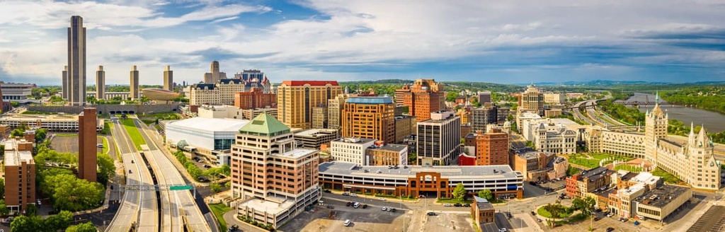
Plus, even though Albany is a relatively large city, it’s well-connected to some of the region’s best outdoor recreation destinations. Albany is located just a short drive from the forests, mountains, streams, and lakes of the Adirondacks, so there are plenty of opportunities to get outside and experience the surrounding landscape while in the city.
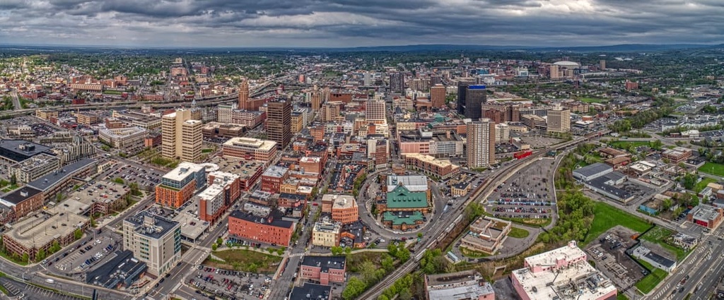
Situated just under 2 hours to the west of the Ferris Lake Wild Forest by car, Syracuse is a city of around 143,000 people. Syracuse is perhaps best known for its namesake university and its sports teams.
While in the city, there are plenty of restaurants for visitors to choose from, including farm-to-table dining options, classic American comfort foods, and the Salt City Market. Syracuse also hosts festivals year-round, is packed with galleries and theaters, and supports local artisans and farmers with its summer markets.