Scan the QR code and open PeakVisor on your phone
The Five Ponds Wilderness is an outdoor recreation destination situated in the northern region of the US state of New York. The wilderness is located in the northwestern region of Adirondack Park. The tallest and most prominent peak in the wilderness is Long Tom Mountain at 2,608 feet (795 m) tall with 873 feet (266 m) of prominence.
The Five Ponds Wilderness is situated in the northwestern region of Adirondack Park in Upstate New York. The wilderness is part of a network of protected areas which extend throughout Adirondack Park.
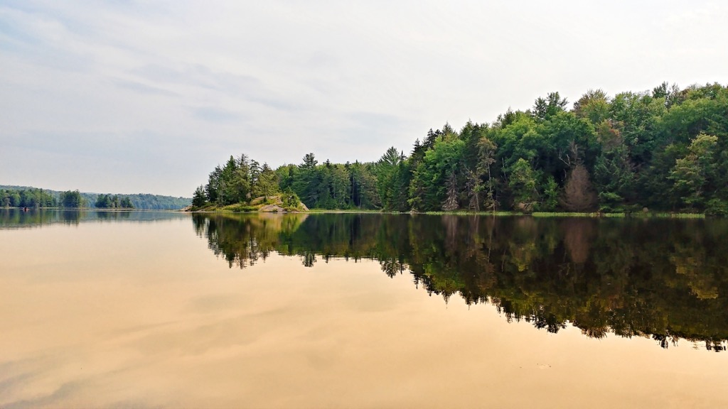
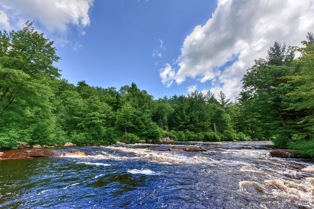
The wilderness spans 107,230 acres (43,394 ha) across the landscape within Saint Lawrence, Herkimer, and Hamilton counties. This forested terrain is marked by numerous lakes, ponds, and wetlands, marking one of the most remote wilderness areas in all of Adirondack Park.
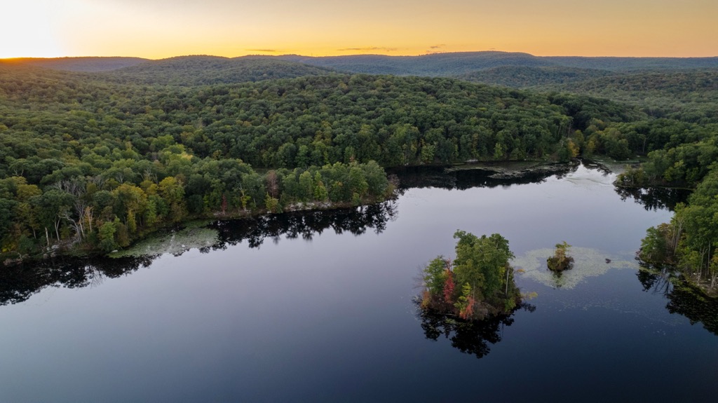
Marking the third largest wilderness area in the park, Five Ponds Wilderness is bound by multiple man-made lakes. North of the wilderness lies Cranberry Lake while Gull Lake and Lows Lake are situated to the east. The Stillwater Reservoir lies just south of the wilderness.
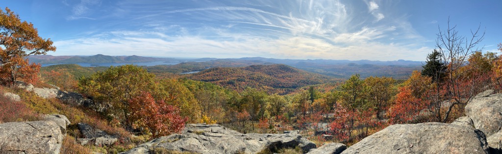
Compared to the surrounding terrain, the wilderness is relatively flat and does not feature many major peaks or ridgelines. The low and rolling landscape is interspersed with dozens of small lakes and ponds, contributing to the inaccessibility of the wilderness.
Widespread logging during the early twentieth century has shaped the forested sections, with a majority of the trees being relatively young and small in diameter. However, some sections of the wilderness are home to virgin timber, having been deemed difficult to reach and saving them from the logging that occurred.
Additionally, the Five Ponds Wilderness is located near a number of other parks and destinations for outdoor recreation. Directly north lies the Cranberry Lake Wild Forest while the Round Lake Wilderness and Horseshoe Lake Wild Forest are situated to the east. The Independence River Wild Forest and Pigeon Lake Wilderness lie to the south with Watson’s East Triangle Wild Forest to the west.
Despite its relatively flat terrain, the Five Ponds Wilderness is part of the Adirondack Mountains. The boundaries of Adirondack Park are loosely defined by this mountain massif that extends throughout much of the northern portion of the state.
The range forms a rough circular dome, encompassing 5,000 sq. miles (13,000 sq. km) of terrain throughout the region. Some of the oldest rocks in the region began forming as early as 2 billion years ago, originally located on the seafloor near the equator.
Roughly 1.5 to 1 billion years ago, during the Grenville Orogeny, the range was thrust upward, helping form the Adirondack Mountains and the Appalachian Mountains which extend throughout the eastern US. Hundreds of millions of years of erosion slowly carved out the landscape, transforming the sedimentary rock to metamorphic rock.
When looking at a topographic map, the Adirondack Mountains appear to be part of the greater Appalachian Mountains, though the two are geologically distinct from one another.
The Adirondack massif was further eroded around 600 million years ago when a shallow sea covered the region. Around 10 million years ago, a hotspot beneath the Earth’s crust thrust the range up even further. A repeated cycle of glaciation and glacial retreating further carved out the landscape, leaving behind the ridgelines, peaks, and wetlands visible today.
Major peaks that are located in the Five Ponds Wilderness include Long Tom Mountain, Summit Mountain, Cat Mountain, Webb Mountain, and Roundtop Mountain.
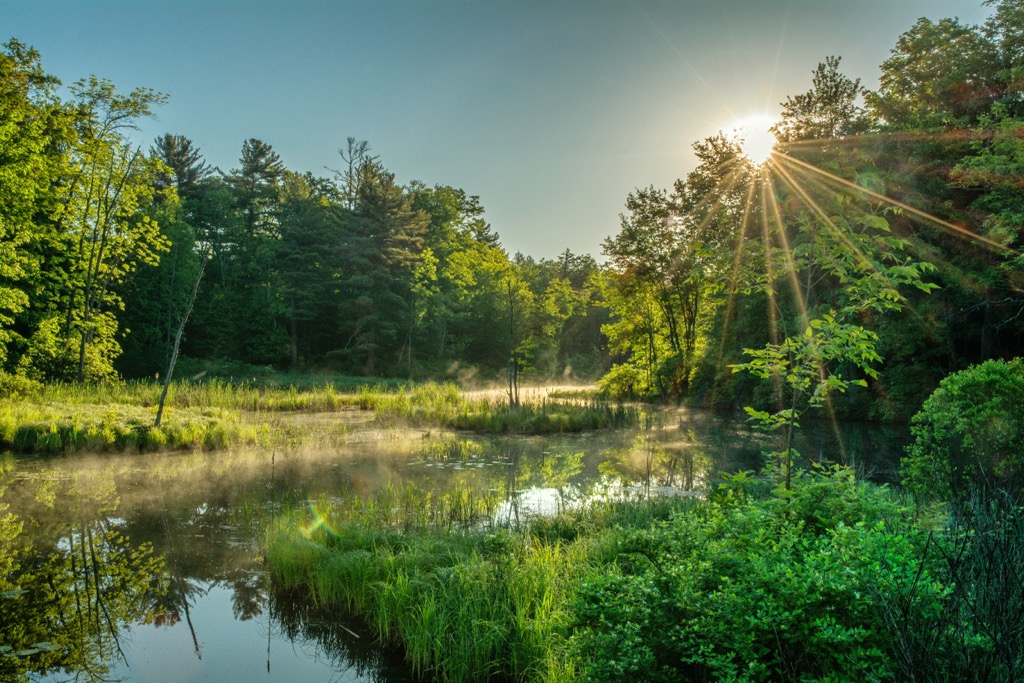
Flora and fauna found in the wilderness is similar to that found throughout Adirondack Park. The remote nature of the region has allowed a variety of species to thrive.
Forested sections are often populated by a mixed hardwood forest. Common tree species include American beech, sugar maple, red maple, and yellow bridge. Nearby ridgelines occasionally feature black spruce, red spruce, and balsam fir.
The inaccessibility of this region has allowed a few stands of old-growth forest to thrive, marking one of the only sections in all of the northeastern US.
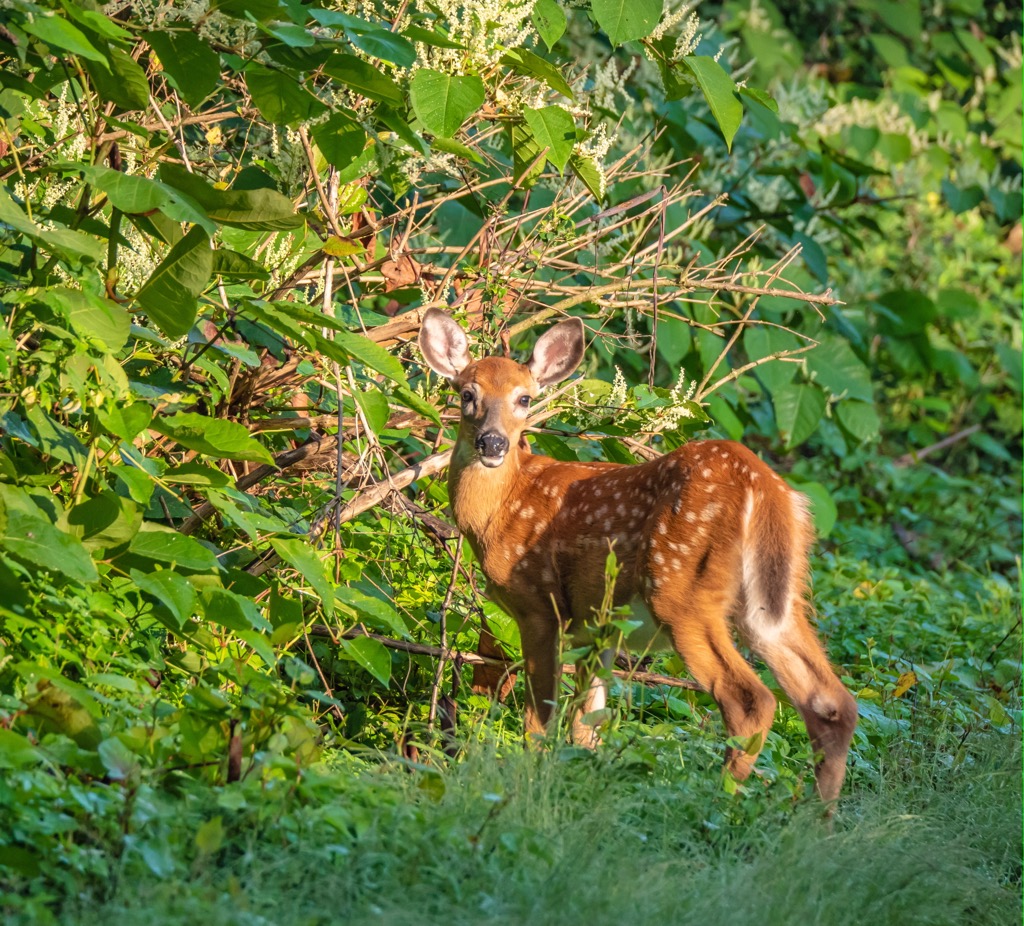
Larger mammals are more commonly found in other sections of Adirondack Park. Hikers may occasionally spot white-tailed deer, black bear, red fox, and eastern coyote in the area. More common mammals include fisher, muskrat, raccoon, mink, otter, and beaver.
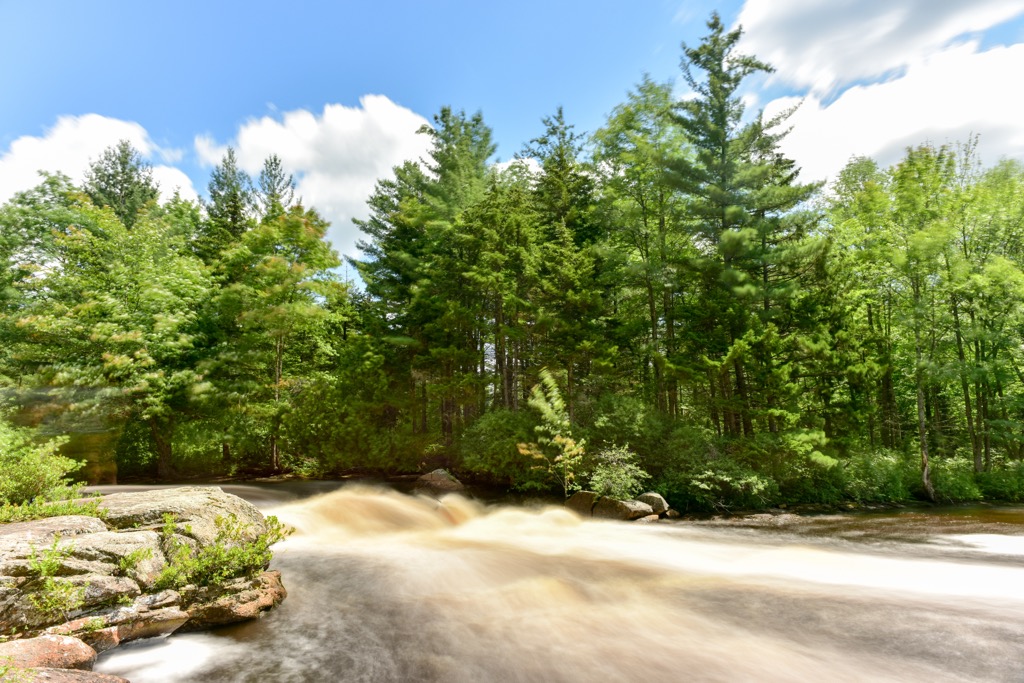
The plethora of lakes, ponds, and streams, help support various fish species, though native fish populations have diminished due to acidified water. Brook trout is the most common fish species in the region, though their numbers have declined in nearby Cranberry Lake after northern pike were introduced.
The land within and surrounding the Five Ponds Wilderness has been inhabited by humans for thousands of years. Artifacts dating back between 15,000 to 7,000 BCE have been uncovered in the region.
The main tribes with historical ties to this land are the Oneida (Onʌyoteˀa·ká) and Mohawk (Kanienʼkehá꞉ka). These fertile lands, coupled with the plethora of fresh water sources, helped make the Adirondack Mountains an incredibly hospitable place. Both the Oneida and Mohawk would later become two of the five original member nations of the Haudenosaunee (Iroquois Confederacy).
The Battle of Ticonderoga occurred in 1609, marking the first recorded battle that involved these Indigenous tribes and the Europeans. The battle began between the Haudenosaunee and the Innu, Algonquin, and Huron; with the French eventually allying with the Huron, Innu, and Algonquin.
Increased population of Europeans also brought infectious diseases such as measles and smallpox. These illnesses decimated the Indigenous peoples who had no natural immunity to them. During the American Revolutionary War, the Oneida attempted to remain neutral but were ultimately forced to work as scouts near Fort Stanwix.
The Treaty of Canandaigua was signed between the Haudenosaunee nations and the US at the end of the eighteenth century. The original treaty granted roughly 6 million acres (2.4 million ha) of land in present-day Upstate New York to the tribes.
Over the following decades, this land was drastically reduced in size by the US government, ultimately forcing many Oneida to relocate to present-day Wisconsin and parts of Canada. Today, the Oneida are organized into four nationally recognized nations, two in the US and two in Canada. This includes the Oneida Indian Nation in New York, the Oneida Nation of Wisconsin, Oneida at the Six Nations of the Grand River, and the Oneida Nation of the Thames.
In the decades following the American Civil War, the Adirondack Mountains were heavily logged. Only a small portion of forest was left standing due to its remote nature and inaccessibility.
In 1950, a massive storm known as the Big Blowdown featured winds over 100 mph (160 kph). Heavy rains and winds damaged many old-growth sections of forest. Acid rain in the region resulted in many of the lakes and ponds being inhospitable for native fish species.
Today the Five Ponds Wilderness features roughly 60 miles (96 km) of trails and a plethora of opportunities for fishing, trapping, hunting, and canoeing.
The Five Ponds Wilderness is home to a few hiking trails that can be used for outdoor recreation. Here are a few of the trails in the region that are worth checking out during your next visit.
This multi-day backpacking trip winds through both the Five Ponds Wilderness and the Cranberry Lake Wild Forest. True to its name, the loop trail circumnavigates Cranberry Lake. The route begins by following along the Oswegatchie River while passing numerous ponds in the wilderness.
The trail then loops through the forest landscape, featuring numerous climbs and descends throughout. Along the route hikers pass some of the tallest peaks in the region, hike along the shores of Cranberry Lake, and can take in views of some of the most remote terrain in the state.
This route is often completed over the course of many days. The loop totals 52 miles (84 km) in length and features 4,071 feet (1,241 m) of total elevation gain.
Cat Mountain marks the third most prominent peak in the wilderness, located just south of Cranberry Lake. The route to the summit begins relatively flat, featuring a few viewpoints of Cranberry Lake.
After passing Glasby Pond, the trail begins to steadily climb up to the summit of Cat Mountain. From the top, hikers have sweeping views of the forested landscape, lakes, and wetlands that define this region. This out and back trail is 10.6 miles (17 km) long and features 1,043 feet (318 m) of elevation gain.
This out and back trail is located in the eastern stretches of the wilderness, near Round Lake Wilderness and Horseshoe Lake Wild Forest. The route begins relatively flat, showcasing some of the wetlands and forested patches that define this region.
The trail then features a short and moderately steep climb up to the summit of Low’s Ridge. Hikers can see the rolling forested hillsides along with Bog River to the south. This hike is 6.7 miles (10.8 km) long and features 675 feet (206 m) of elevation gain.
Looking for a place to stay near the Five Ponds Wilderness? Here are some of the best cities and towns to check out in the region.
The haven of Clifton is located along the northern boundary of the Five Ponds Wilderness. Home to roughly 700 residents, the town is surrounded by the stunning beauty of Adirondack Park. With close proximity to both Lake Placid and Saranac Lake, the community is surrounded by the Oswegatchie River, Cranberry Lake, and Star Lake.
During the summer months, Clifton blossoms with tourists coming to enjoy its plethora of outdoor activities. While hiking trails surround the region, Clifton is known for its fishing, paddling, canoeing, and other water based activities.
Numerous small hamlets make up Clifton, offering a quaint experience that allows visitors to immerse themselves in the natural beauty of the region.

Located a two hours’ drive southwest of Clifton, lies the city of Syracuse, marking the closest major city to the wilderness. With a metro population of over 660,000 residents, Syracuse is the most populous city in Central New York.
Situated just south of the Seneca River, in the Finger Lakes region, the city lies less than an hour's drive from the shores of Lake Ontario.
Syracuse is home to the Erie Canal Museum and Everson Museum of Art, as well as numerous other museums and art galleries. Besides its proximity to opportunities for outdoor recreation, the city also features a thriving food scene and annual festivals including the Syracuse Jazz Festival, Polish Festival, and the Syracuse Shakespeare Festival.