
Scan the QR code and open PeakVisor on your phone
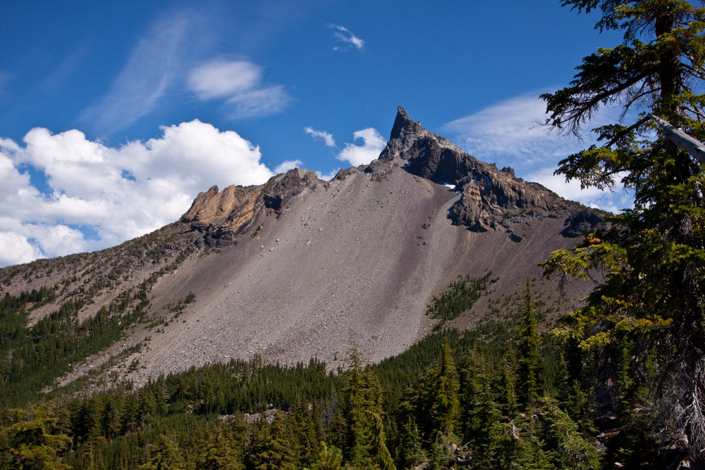
Umpqua National Forest is nestled on the Western side of the Cascade Mountain Range located in southwest Oregon. The region shares a border with nearby Crater Lake National Park. This national forest spans 983,129 acres and is home to a wide variety of wildlife. Elk, deer, black bear, and even cougars call this place home. There are 138 named mountains in Umpqua National Forest. The highest and the most prominent mountain is Mount Thielsen standing at 9,184 feet. This extinct shield volcano last erupted over 250,000 years ago, the structure has eroded to create its horn-like peak, making it a frequent target for lightning. It is estimated that there are over 535,000 acres of old growth forest within the region.
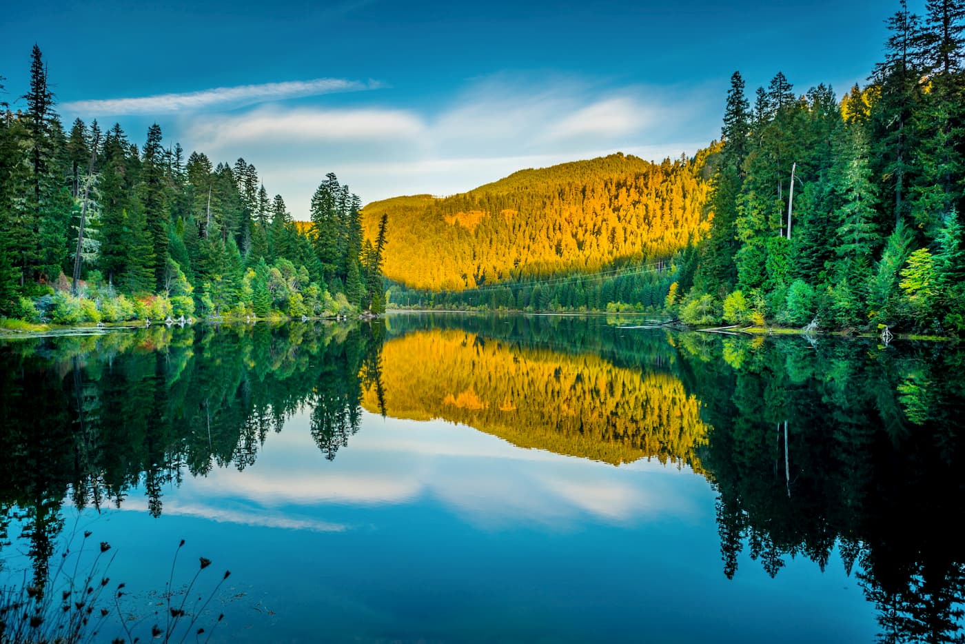
The name Umpqua comes from the ancestors of the indigenous population, the Umpqua, Southern Molala, Yoncalla, and Cow Creek Bank of Umpqua Tribes. There are over 350 miles of trails maintained for year-round usage along with 54 developed campsites. The North Umpqua Wild and Scenic River runs throughout the forest and provides ample spawning ground for winter steelhead, Chinook and Coho salmon, and sea-run cutthroat trout. The Umpqua National Forest also contains three wilderness areas; Boulder Creek, Rogue-Umpqua Divide, and Mount Thielsen .
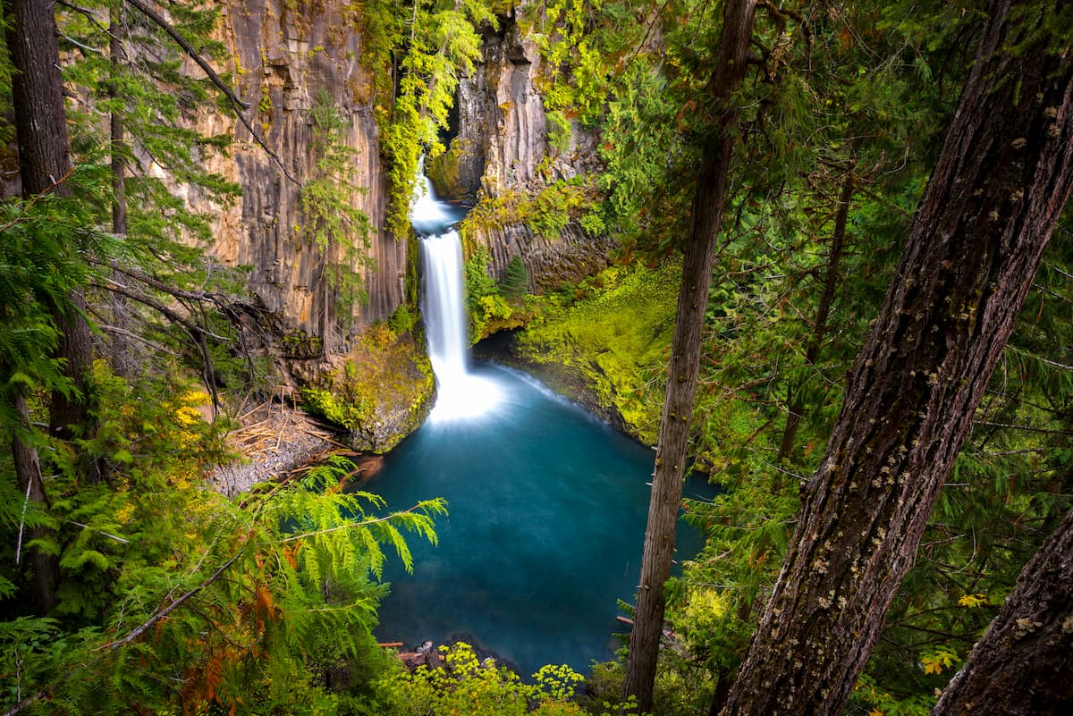
Umpqua National Forest is known for having breathtaking waterfalls throughout the area. One of the most popular, and most accessible, is Toketee Falls. This short hike is just 0.8-miles out and back but takes you to one of the most famous falls in the state. The falls was created by the North Umpqua River carving out a gorge in the lava flow, resulting in a waterfall that is 113 feet tall. The falls lead into a large deep pool before the rapids begin again.
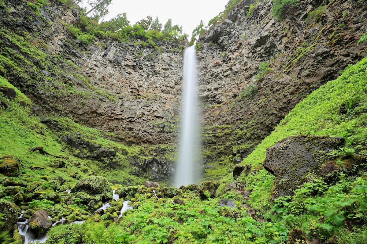
Watson falls is the third largest waterfall within the state of Oregon and is also very accessible. Standing at a staggering 272 feet, this short 0.6-mile hike is definitely worth stopping for.
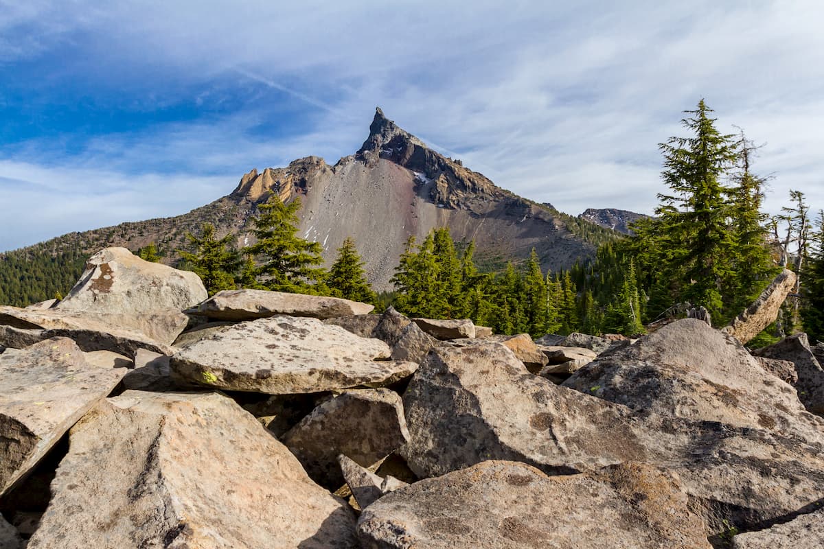
As the highest point within the forest, Mount Thielsen provides unparalleled views of the region. The total hike is 9.2 miles with 3,257 feet of elevation gain. The trail enters Mt. Thielsen Wilderness before joining with the Pacific Crest National Scenic Trail. From the PCT the trail then turns into a scramble trail as you work your way to the top of the peak. Once above the timberline here are no trail markers and hiking boots should be worn. From the summit, hikers can add their name to the climbing register found as they can see Three Sisters Wilderness to the north and Mount Shasta to the South. While the hike to the summit does not require specific mountaineering gear, it should be noted that the peak is known for frequent lightning strikes. Avoiding hiking if you spot cumulus cloud build up. Practice extreme caution while climbing this mountain as there are plenty of loose and weak rocks.
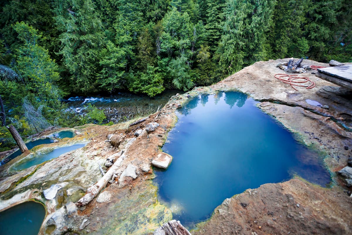
While the forest is known for staggering peaks and waterfalls, the Umpqua Hot Springs are equally breathtaking. A short 0.8-mile out and back trail trail off of the Umpqua National Scenic Byway, leads you to a series of hot spring pools on a cliff that overlooks the river below. The water in the pools, seeps in through an active fault with temperatures often between 100-115 degrees Fahrenheit. There is also a large tub that was installed amongst the natural pools with an open-air covering. Note that nudity is common at the hot springs.
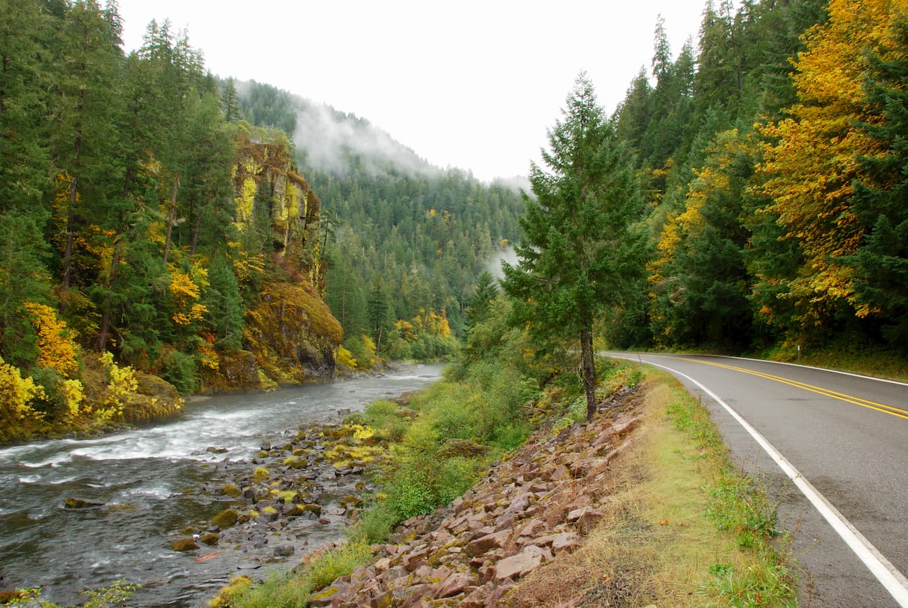
The Rogue-Umpqua National Scenic Byway is a great way to visit much of the Umpqua National Forest. The byway is 172 miles and takes you through Umpqua National Forest, Mount Thielsen Wilderness, Rogue River-Siskiyou National Forest, and right by Crater Lake National Park. Starting in Roseburg heading east, the road will provide a scenic drive while also being the starting point for many of the major hikes and sites within the forest.
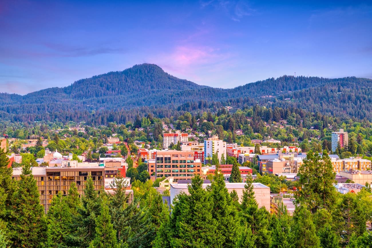
Eugene is the closest major city to the Umpqua National Forest, sitting an hour north of the start of the Rogue-Umpqua National Scenic Byway. Known as “Track Town, USA”, Eugene is a runner’s paradise. With a population of nearly 200,000, the city is the largest within central Oregon. The city is located two hours south of Portland, and just one hour south of Salem, Oregon’s state capitol. The town is known for its focus on environmentalism and abundance of recreation activities including biking, hiking, rafting, and of course, running. Eugene is also where the Nike corporation began. Be sure to check out the Lane County Farmers’ Market or grab a bite to eat at one of the many local restaurants.


volcano
oregon-9000ers
cascade-range-9000ers
western-state-climbers
western-state-climbers-star
chemeketan-18-nw
cascade-volcanoes-pin
volcano
oregon-9000ers
cascade-range-9000ers
western-state-climbers
western-state-climbers-star
chemeketan-18-nw
cascade-volcanoes-pin


