Scan the QR code and open PeakVisor on your phone
Tai Lam Country Park is a haven of wooded hills and tranquil lakes located in the Hong Kong Special Administrative Region of China. The park has 20 named peaks, the highest of which is Lin Fa Shan (578 m/ 1,896 ft) and the most prominent of which is Kau Keng Shan (507 m/ 1,663 ft).
Sprawled across a large part of western New Territories, Tai Lam Country Park is the second largest country park in Hong Kong, with an area of 5,412 hectares (13,373 acres) extending over the districts of Tuen Mun, Yuen Long and Tsuen Wan.
The eastern reaches of the park borders a suburban road, Route Twisk. On the other side of the road is Tai Mo Shan Country Park. A major transport artery, Tai Lam Tunnel, passes under the park to connect Yuen Long and Ting Kau in western New Territories.
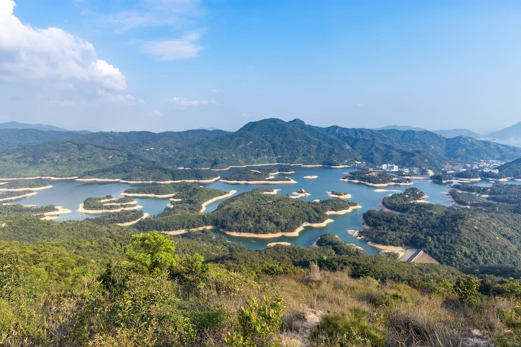
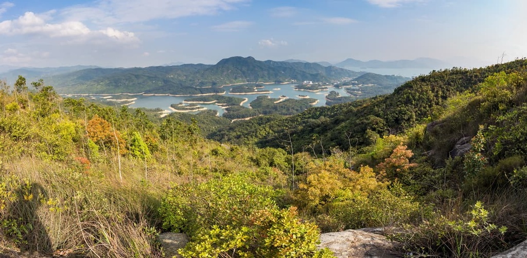
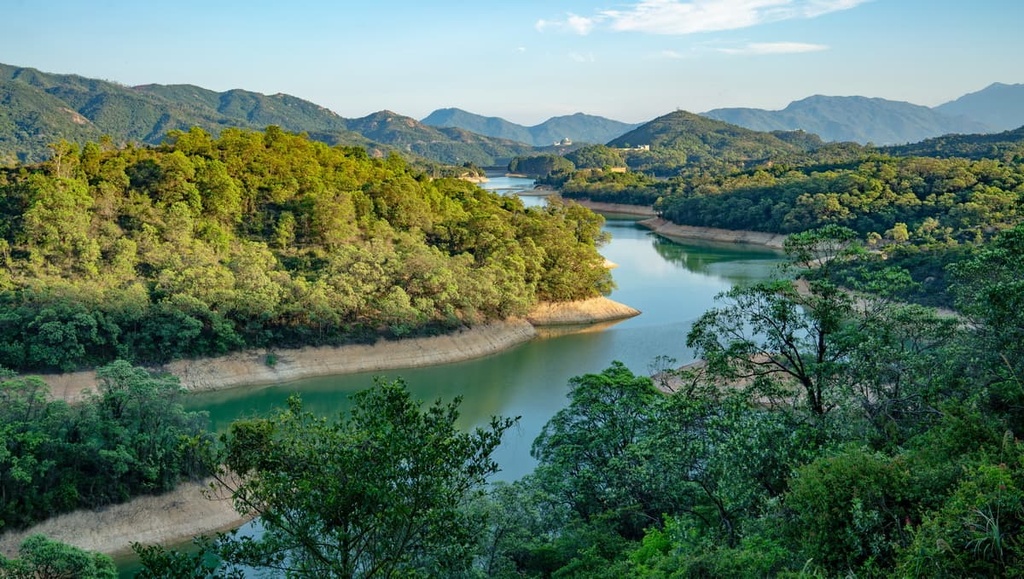
The landlocked park boasts a rich waterscape in the form of seven reservoirs and settlement basins fed by numerous streams. The biggest water body is Tai Lam Chung Reservoir, which is locally known as “Thousand Island Lake” since it is dotted with many islets that make it the top attraction in the park.
The park has 12 hiking trails and 9 mountain bike trails, more than any other country park in the city. The hiking trails include the last two sections of the 100-km (62-mi) MacLehose Trail.

Tai Lam Country Park is dominated by Jurassic granite that formed about 160 million years ago. The granite is marked by various features of weathering such as gullies, boulders, tors and denuded hilltops. Copious rainfall exacerbated the weathering, reducing some areas to badlands characterized by exposed crumbly soil and dendritic networks of erosion channels.
Vigorous erosion-control, mainly by means of revegetation, has successfully managed the erosion but the gullies still remain. The hilltops are covered with residues of granite decomposed into sand, silt and clay, while streams of boulders collect at the bottom.
The different components in granite do not weather at the same rate. In particular, quartz is harder than the other minerals and remains as parapets of resistant white veins on the hills, before it too eventually succumbs to the elements.
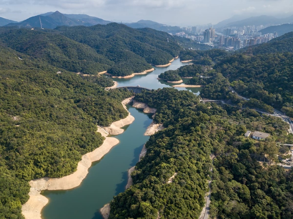
A linear fault called Tai Lam Fault runs through the park, trending in a northeast-southwest direction. Preferential erosion and heavy weathering along the fault has produced a straight valley that contains what is now Tai Lam Chung Reservoir.
The eastern side of the park is pockmarked with small disused pits, as the area around Lin Fa Shan was mined in the 1950s for tungsten (also known as wolfram) and other ores such as galena and pyrite.
Tungsten is a widely-used metal in the production of ammunition because of its high density and extreme thermal capacity. Soaring prices during the Korean War (1950–1953) were the reasons behind the mining activities in Lin Fa Shan, where up to 5,000 people were mining illegally alongside a licensed company in 1951.
The licensed company soon began to hire the illegal miners to work for them, though the operation was short-lived and closed down in 1957 following the collapse of ore prices. Nowadays, the scarred landscape is largely concealed by trees planted in recent decades.
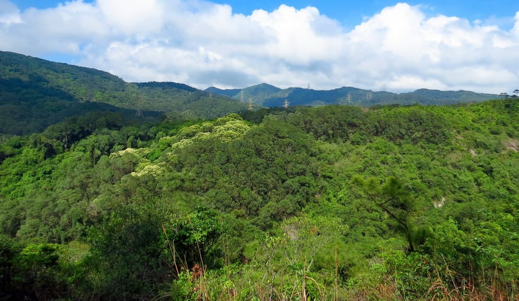
The land used to be badly degraded as a result of repeated deforestation by settlers, hill fires and natural erosion. Afforestation efforts since the completion of Tai Lam Reservoir in the 1950s have brought impressive results, restoring most of the barren landscape to a lush domain.
Most of the pioneer trees are exotic species, and the most common ones are slash pine (Pinus elliottii), Chinese red pine (Pinus massoniana), Brisbane box (Lophostemon confertus), swamp mahogany (Eucalyptus robusta) and Taiwan acacia (Acacia confusa).
Native trees like short-flowered machilus (Machilus breviflora), castanopsis (Castanopsis fissa) and oak species have also made a strong comeback.
The northern part of the park in Tai Tong, Yuen Long is known for its sweet gum (Liquidambar formosana) and Chinese tallow tree (Sapium sebiferum). Their foliage turns red in the colder months, which is quite an unusual sight in sub-tropical Hong Kong. They have been planted to replace the Taiwan acacia that used to colonize that area.
The park harbors over 120 species of butterflies, nearly half of the total number in the city. Approximately 9 of the species, such as centaur oak blue and metallic cerulean, have been classified as “very rare,” and 14 others as “rare”.
The reservoirs and settlement basins provide ideal habitat for different types of fish. In Tai Lam Chung Reservoir alone, nearly 40 species have been recorded, including the rice fish that is a species of conservation concern.
In terms of herpetofauna, there are about 20 species of snakes, lizards and frogs, such as the Chinese cobra, Chinese water skink, and Hong Kong cascade frog found in the park.
The fauna in the park also include birds like little egrets and wild ducks, as well as mammals such as pangolins, red muntjacs and civets.
On the southern side of the park near Yuen Tun Old Village, a small ecological garden features areas for freshwater life, butterflies, ferns, shrubs and carnivorous plants. The park also has a tree walk in Tai Tong and three nature trails.
There were seven villages in the area around what is now Tai Lam Country Park that were founded by ethnic Hakka people who migrated to Hong Kong from Guangdong province in mainland China. The oldest ones dated back to about 400 years ago. The villagers traditionally grew rice in the valley near the park.
Before the age of motor transport, the only way to reach the outside world was footpaths over the hills that linked up the settlements of Yuen Long and Tsuen Wan. Once important commuting routes in western New Territories, the paths are now popular hiking trails.
The construction of Tai Lam Chung Reservoir resulted in the relocation of two low-lying villages in the 1950s. Many of the other villages were also abandoned in the 1970s and 1980s as the villagers moved to more convenient locations. Only two villages are still inhabited.
The abandoned village of Yuen Tun was turned over to the Civil Aviation Service. Some of the old houses have been restored as a museum while the rest of the site is used as a training camp.
Tai Lam Chung Reservoir, completed in 1957, was a massive engineering project at that time. It was built to supply water to a booming population after World War II, and briefly believed to be the solution that would end the city’s water shortage once and for all.
That optimism did not last long. Even before the main dam was completed, its height was raised from the original plan of 50 m (164 ft) to 66.6 m (219 ft) to boost capacity. A few years later, the catchment area was extended and irrigation reservoirs were built in the vicinity.
Although more reservoirs were built in Hong Kong after Tai Lam Chung, it was imported water from mainland China that put an end to the water shortage. Tai Lam Chung is currently one of the three reservoirs that store the imported water on top of water that is collected locally.
Apart from a dozen hiking trails, the park also offers several barbecue areas and campsites. Here are some of the top sights and routes to check out during your next visit.
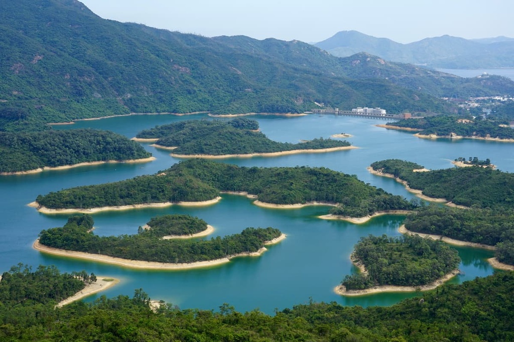
The valley filled by Tai Lam Chung Reservoir contains many hillocks that have turned into verdant islands of various shapes and sizes. Informally known as the “Thousand Island Lake,” the reservoir draws in crowds week after week and the trail can get congested.
The beauty of the islands has to be appreciated from well above. The best place to do so is Reservoir Islands Viewpoint, which is a short detour from Section 10 of the MacLehose Trail. With a maximum elevation of about 230 m (755 ft), the hike is suitable for most people.
Unfortunately, the high volume of visitors has led to trail degradation. Hikers are reminded to be respectful to the environment and stay on the official trail at all times.
This 12.5-km (7.8-mi) trail used to be a trading route connecting the agricultural center of Yuen Long and the market town of Tsuen Wan.
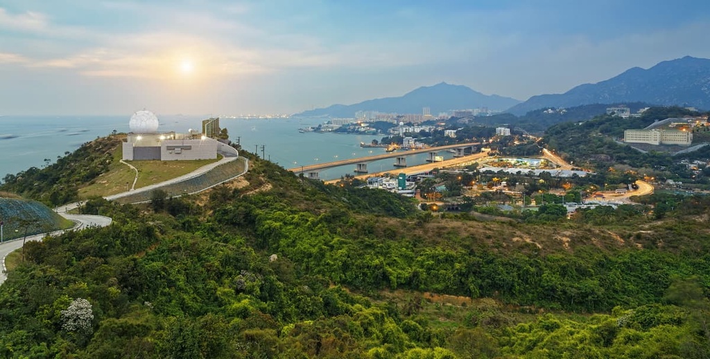
The southern part of the trail affords views of the iconic Tsing Ma Bridge, which spans over the Ma Wan Channel. Having a main span of 1,377 m (4,518 ft), Tsing Ma is the world’s longest suspension bridge that carries both rail and road traffic.
There are a few deserted villages along this trail, with decaying buildings overgrown with weeds and vines. The village of Tsing Fai Tong, however, has reversed that fate when a former villager moved back to set up a farm. It is free to visit the well-tended farm, where the water-lily pond and wisteria roof alone are worth the stop.
The area of Tai Tong in the northern end of the park has the highest concentration of sweet gum in the city. It is a seasonal attraction where the number of visitors is dictated by the color of the foliage.
The woods become jam-packed with visitors when the leaves turn red in the colder and drier months. The government keeps the public in the loop by posting a “red leaves index” which is updated weekly.
The trees and their fall foliage don’t seem like much when compared to what’s in Canada and Japan, but still get the locals excited considering they are not even supposed to grow in Hong Kong.
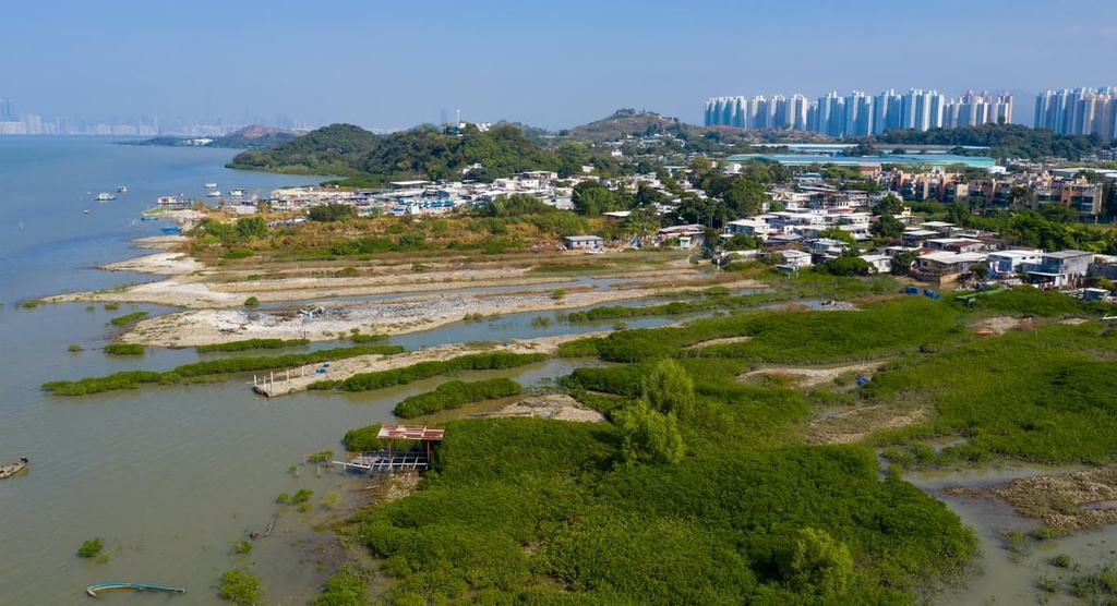
The northern side of Tai Lam Country Park is in Yuen Long, which is traditionally a major agricultural area as it contains the largest alluvial plain in Hong Kong. Despite rapid urbanization, you can still find sizable wetlands in Nam Sang Wai, oyster beds in Lau Fau Shan and old villages with fish ponds and farms.
The district of Tuen Mun contains the southern and western areas of the park. It is famous for its nice beaches and its Mediterranean-style resort complex, Gold Coast. There is also an industrial zone which includes a sludge incineration facility, T.PARK. Set in manicured gardens, it generates clean energy, which partly goes to heating a spa onsite.
The gateway neighborhood to the east is Tsuen Wan, which was historically a market town that was later taken over by factories. It has transformed into a multi-faceted community in recent decades with attractions like The Mills (revitalized from textile factories), Sam Tung Uk Museum and peaceful temples on idyllic Fu Yung Shan.