Scan the QR code and open PeakVisor on your phone
Tai Mo Shan Country Park is home to 5 named mountains, including the highest peak in Hong Kong—Tai Mo Shan (大帽山) at a height of 957 meters (3,140 ft). Despite its literal meaning of “big hat hill” in Chinese, locals usually call it “big mist hill” (大霧山), instead. Whether it is sunny or foggy, the park offers many opportunities to hikers and non-hikers alike.

Tai Mo Shan Country Park is located right at the geographical center of Hong Kong in the middle of New Territories. Covering an area of 1,440 hectares (3,560 acres), the park is connected to Tai Po Kau Nature Reserve to the east and Shing Mun Country Park to the south. The western side of the park borders on Tai Lam Country Park with the road Route Twisk in between, while the northern side meets Lam Tsuen Valley.
Apart from Tai Mo Shan, there are four more hills in the park, including Wo Yang Shan, also known as “fake Tai Mo Shan”. The closest urban area to the park is Tsuen Wan.
Tai Mo Shan is the most humid part of the city, as moisture from the sea traveling up the hillsides condenses into fog or clouds, lending it the informal name of “big mist hill” in Chinese. It receives 30% more rain than the rest of the city, and because of its elevation, is one of the very few places where temperatures are likely to drop below the freezing point on the coldest days. On the unusual occasion of frost forming on the peak, throngs of people drive up the hill to witness the rarity.
Being an extinct volcano, Tai Mo Shan is made up of predominantly volcanic rocks, which are relatively resistant to weathering and erosion. Specifically, the rocks are mainly coarse ash crystal tuffs rich in volcanic glass, and tend to weather more massively into boulders among deep residual soils, forming fields of large tors and lag boulders scattering on the hillside. The adjacent valleys to the south, west and southwest contain heavy deposits of alluvial soil.
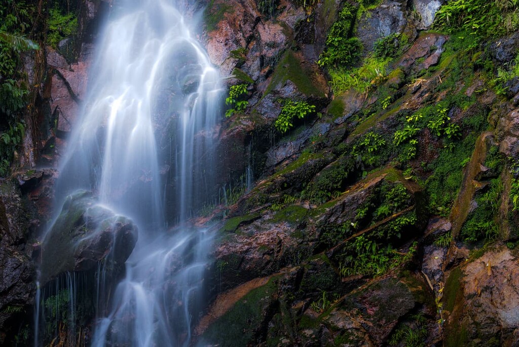
The park is also home to many streams and waterfalls fed by copious rainfall, including the Ng Tung Chai Waterfalls. As part of upstream Lam Tsuen River, the waterfalls were formed when water flows from hard crystal tuffs to softer granodiorite that erodes faster. Among this group of four cascades, the 35-meter (115-foot) main cascade is the longest in Hong Kong.
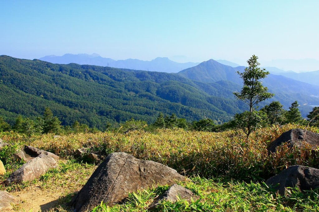
Elevation is the biggest limiting factor in Tai Mo Shan. Secondary forests with about 250 tree species thrive below 550 meters (1,800 ft) in elevation, while vegetation above that height is dominated by shrubs and grass, including silvergrass and aromatic madder.
The southeastern foothills were once covered by terraced tea plantations that produced a type of green tea known as “mist tea” or “cloud tea,” though the plantations were abandoned a century ago. A long history of farming and human use has left some areas badly eroded and infertile.
The special climatic and geographical conditions have created habitats for various endemic species, such as Hong Kong balsam (Impatiens hongkongensis) and the critically endangered two-tone twist orchid (Cirrhopetalum bicolor) which is only found in Tai Mo Shan on rocks close to streams. New discoveries still come up from time to time, like the lithophytic orchid (Gastrochilus kadooriei), which was first described in Hong Kong in 2014.
The area around Ng Tung Chai Waterfalls is an important breeding ground for dragonflies and butterflies, including common nawab, yellow orange tip, and white dragontail. Tai Mo Shan is also a haven for fireflies with some species unique to Hong Kong, such as the Tai Mo Shan elephant firefly (Lamprigera taimoshana).
The most conspicuous animal in the country park is feral cattle, while porcupines and wild boars are harder to spot. There are more than a hundred bird species including Bonelli’s eagle, Chinese francolin, upland pipit and vinous-throated parrotbill. Among the diverse wildlife are also turtles like the big-headed turtle, frogs such as the giant spiny frog and snakes like white-spotted slug snake and red-necked keelback.
The hillsides and foothills of Tai Mo Shan have been populated for at least 400 years. The first settlers had originally lived in the nearby Tsuen Wan area, which was prone to harassment from pirates at the time, so they moved to higher ground and founded the village of Chuen Lung on the southern slopes of Tai Mo Shan.
From the seventeenth century to the 1920s, villagers grew tea on a commercial scale on terraced plantations, along with subsistence crops like rice and vegetables.

In the 1950s, watercress became an important crop when the government prohibited planting of this water-loving vegetable in urban areas in order to curb the spread of malaria, resulting in some watercress farms relocating to Tai Mo Shan. It turned out that the growing conditions there were perfect for the watercress, which remains the most popular produce from the area.
To this day, more than 1,000 people live in Chuen Lung. Apart from village houses and farms, there are two old-fashioned Chinese restaurants, a traditional winery, a disused school and an abandoned Catholic chapel.
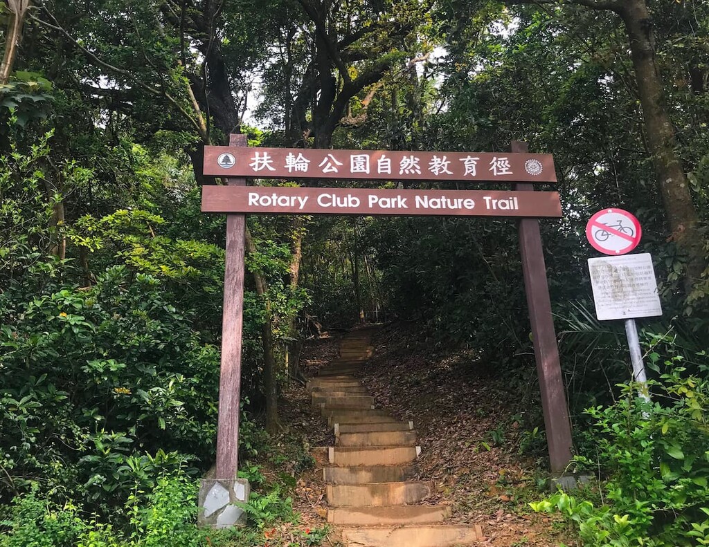
Despite being the highest peak in Hong Kong, Tai Mo Shan is very accessible with a network of trails crisscrossing the park. The area also boasts other attractions that are worth visiting in their own right.
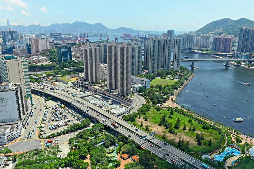
The summit and upper slopes of Tai Mo Shan afford unrivaled 360 degree views of almost all of Hong Kong, with interesting contrast between very different sides of the city. You will see cityscapes of densely packed high-rise buildings, rows upon rows of green hills meeting the sparkling sea, and traditional villages nestled in the sweeping plains. When the skies are very clear, the views stretch to Shenzhen and Shekou in Mainland China.
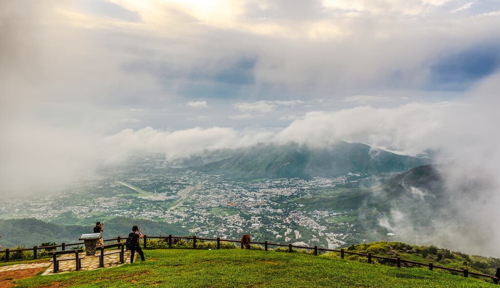
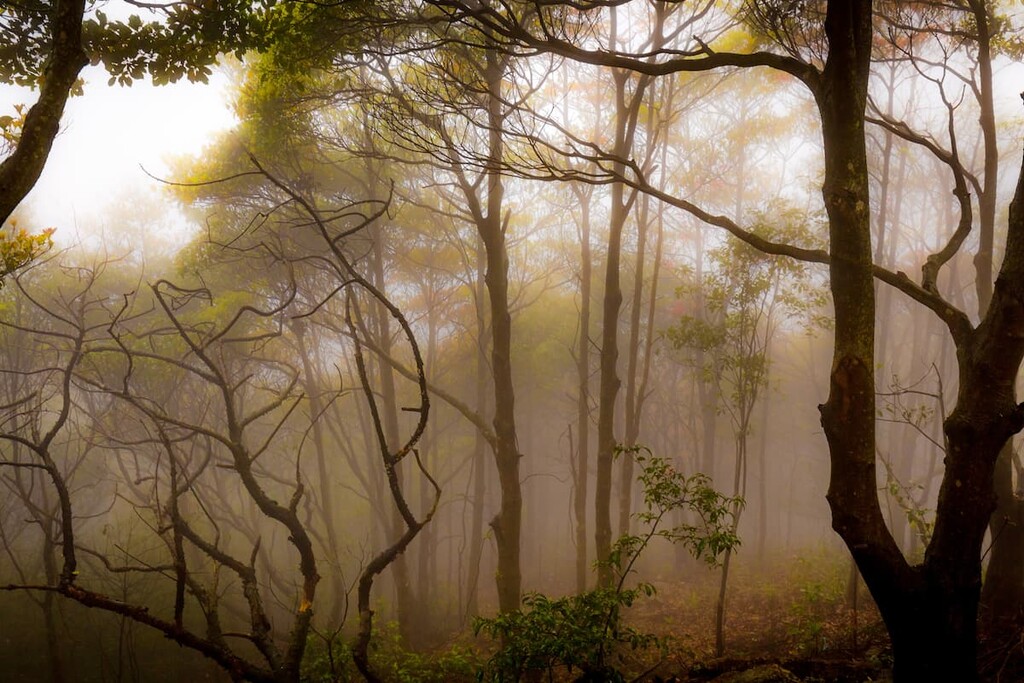
Sometimes the views may be even better with mist or clouds, but when visibility drops too low, people admire the atmosphere rather than the views. Watching the sun rising from a sea of clouds is a bucket list activity, and those who plan to do so may consider staying the night nearby at Rotary Club Campsite or YHA Sze Lok Yuen Tai Mo Shan Youth Hostel.
The highest point is the site of a weather radar station with a huge globe which is off-limits to the public. The summit is accessed by the MacLehose Trail Section 8 that leads to Route Twisk to the west and Lead Mine Pass in Shing Mun Country Park to the east. Cycling to the top is also an option.
To the west of the summit at 700 meters (2,300 ft) above sea level is Tai Mo Shan Lookout, another vantage point with stunning panoramic views. You can drive or take a taxi all the way up there, though it is quite easy to walk if you start at the visitor center which is only 1.5 km (0.9 mi) away.
Thought to be among the most beautiful in Hong Kong, this group of waterfalls is made up of the Long Falls (35 m/ 115 ft), Middle Falls, Well Falls and Straggling-hair Falls. Tucked in a ravine in the shadow of Tai Mo Shan, Ng Tung Chai is more easily approached from Tai Po than Tsuen Wan.
From the bus stop at Ng Tung Chai in Tai Po, it is a 6.5 km (4 mi) round-trip with about 500 meters (1,600 ft) of elevation gain. Alternatively, you can continue southward after the falls and either go up Tai Mo Shan or cross over to Shing Mun Country Park.
At 300 meters (980 ft) high on Tai Mo Shan, Chuen Lung is a popular starting point for hikes even though the village area is not part of the park. Rich in human history, the village is where hikers treat themselves to scrumptious dim sum and locally grown watercress in two self-serve Chinese restaurants.
The tea and food like tofu pudding are thought to have a special taste since they are made with pristine water from clear mountain streams. Many customers are non-hiking foodies who travel to Tai Mo Shan only to visit the restaurants, which open from 6 am till early afternoon.
Chuen Lung Village is a living museum that has not changed much in the past few decades. You can try different kinds of wine at a traditional Chinese winery and buy freshly-picked watercress directly from farmers (but be prepared to wait in line).
The Tai Mo Shan Country Park Visitor Centre and Rotary Club Campsite are just a short walk away. Other facilities in the area include family trails, barbeque pits and car parks.
Standing to the south of Tai Mo Shan at slightly lower than 800 m (2,600 ft), these two hills are far less visited than Tai Mo Shan, more strenuous to hike but also very scenic. The boulder-strewn summit of Miu Ko Toi houses a wildfire lookout, while Wo Yang Shan is known for its rock forests.
Hikers often start at Chuen Lung, passing Heung Shek Cemetery before ascending Mui Ko Toi and then Wo Yang Shan. From there you may head north-west to Tai Mo Shan, or head south to Lung Mun Country Trail which will take you either back to Chuen Lung or on to Shing Mun Country Park.

The main gateway neighborhood is Tsuen Wan, which was once an industrial district but has recently transformed into a multi-faceted community with attractions like The Mills (revitalized from textile factories), Sam Tung Uk Museum and peaceful temples on idyllic Fu Yung Shan.
From Tsuen Wan, take bus 51 or minibus 80 to Chuen Lung Village, or bus 51 to Tai Mo Shan Country Park Visitor Centre.
For Ng Tung Chai Waterfalls, it is more convenient to visit from Tai Po, a district with a history of a thousand years. Once an important market town, the urban area of Tai Po remains a vibrant community with busy streets and bargain goods.
Tai Po is also a popular base for outdoor activities because of its many nature reserves and beautiful coves. Other attractions include the Kadoorie Farm & Botanic Garden and the old village of Lam Tsuen.
From Tai Po Market, take bus 64K or minibus 25K to Ng Tung Chai.