
Scan the QR code and open PeakVisor on your phone
Pirin National Park has 95 named peaks. The highest is Vihren at 2,914 m. Other notable peaks include Kutelo 1, Kutelo 2 and Banski Suhodol.
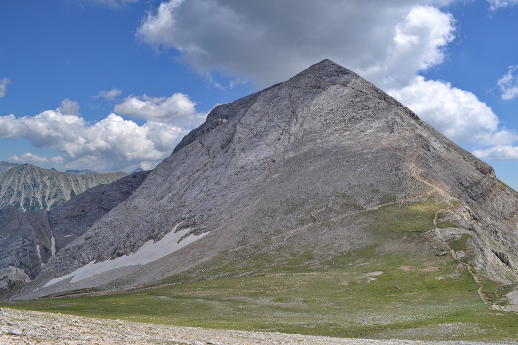
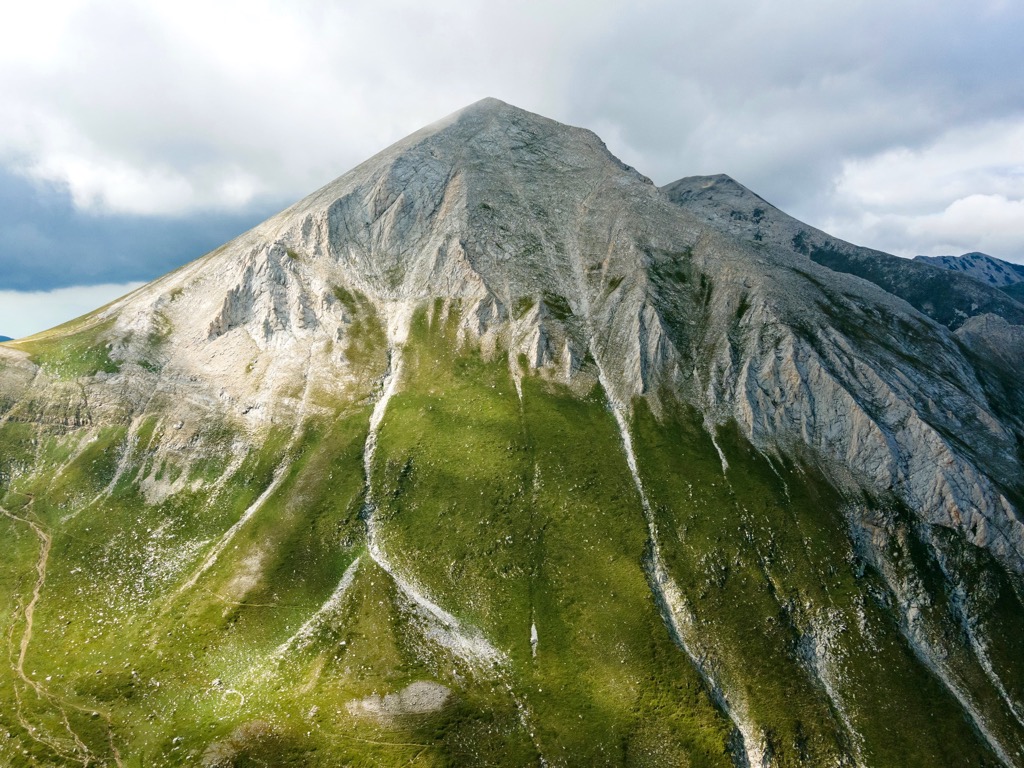
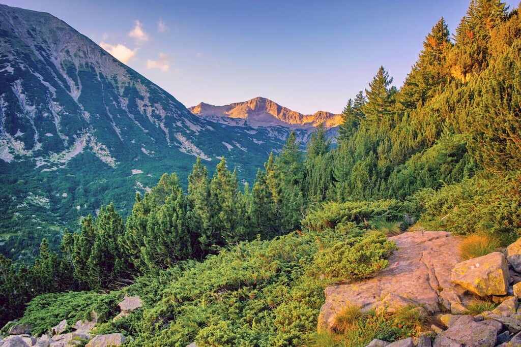
The Pirin National Park is an enormous presence in the southeastern region of Bulgaria. Whether you're skiing the slopes, hiking through the dense green forests, or climbing up to their picturesque peaks, Pirin National Park has something for everyone. There are 95 named mountains in Pirin National Park. The highest and the most prominent mountain is Vihren (2,914 m/ 9,560 ft).
Pirin National Park lies in Bulgaria. It was established in 1962, making it one of the oldest national parks in the country. The park territory has been expanding since then and today includes an area of 403 sq. km (250 sq. mi)
Pirin National Park includes the broader part of the Pirin massif. It is one of three national parks in Bulgaria, the others being Rila National Park and Central Balkan National Park. The park lies near the border with North Macedonia.
The park has a plethora of different ecosystems, lakes, and mountains. It has an elevation of 950 m to 2,914 m (3,116 ft to 9,560 ft) high, with Vihren (2,914 m/ 9,560 ft) as the highest peak in the national park, the second-highest summit of Bulgaria, and the third-largest of the Balkan Peninsula.
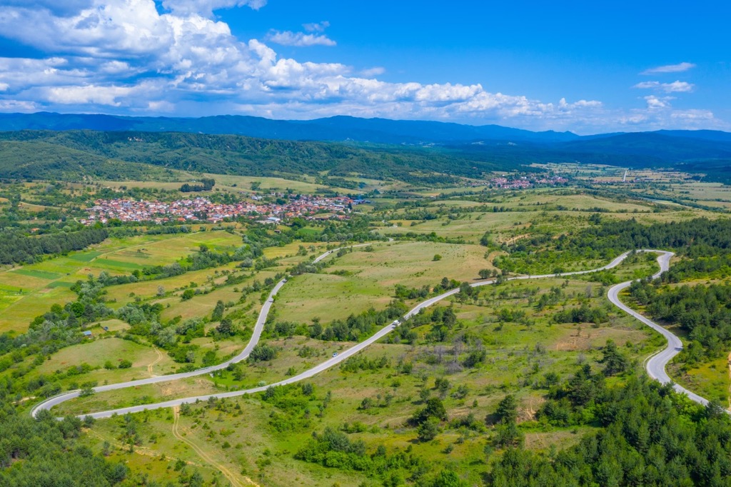
This national park lies in the south-easternmost province of Bulgaria, and it's made of 7 municipalities: Bansko, Sandanski, Gotse Delchev, Kresna, Razlog, Simitli, and Strumyani. There aren't any major cities or towns within its territory. The park territory also lies exclusively in Blagoevgrad province.
Pirin National Park is divided from the Rila mountain range by the Predel Saddle, which is at the height of 1,140 m (3,740 ft). The Mesta River flows through its eastern section, and Razlog Valley flows through the south. Pirin National Park lies on the border of the Slavyanka mountain range and stretches west to include River Struma.
Two nature reserves within the Pirin National Park boundaries lie at Yulen and Bayuvi Dupki. Bayuvi Dupki is the oldest nature reserve in Bulgaria and was established in 1934. It is a UNESCO World Network of Biosphere Reserves under the Man and Biosphere Program.
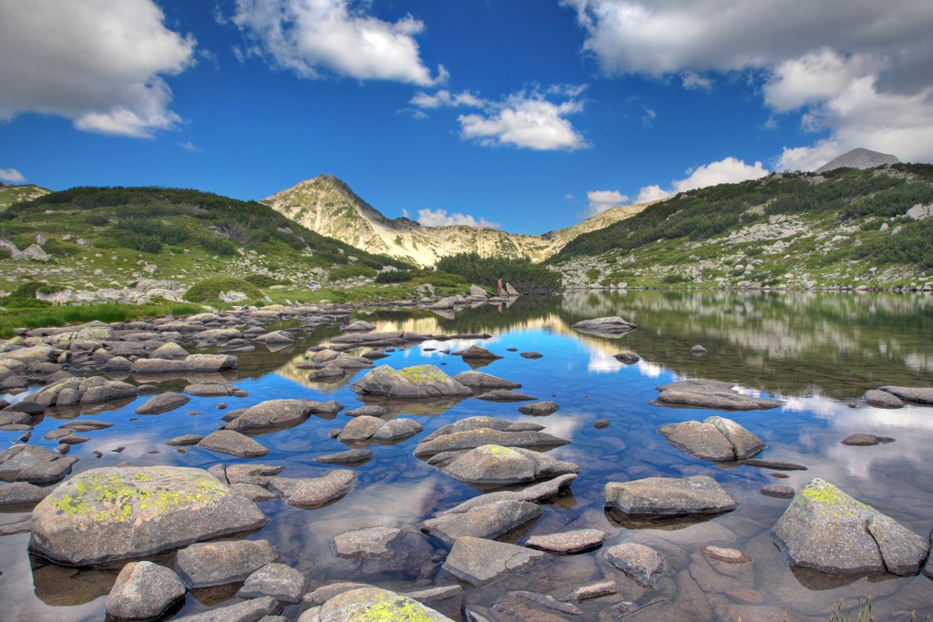
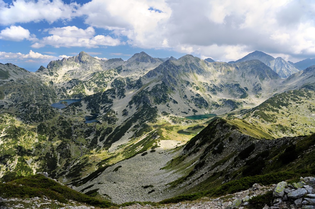
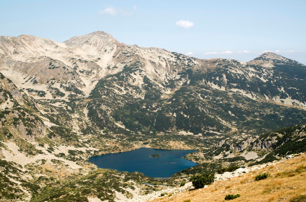
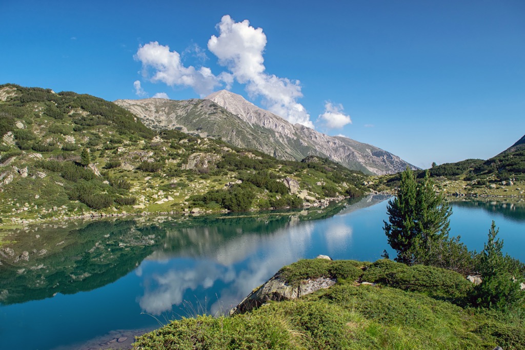
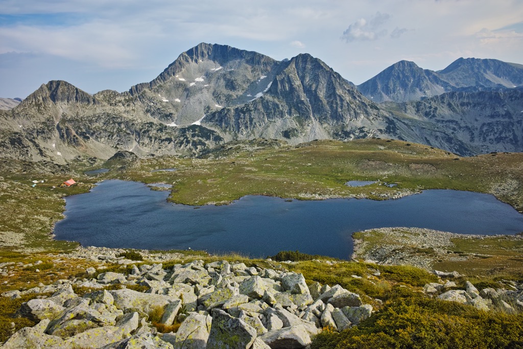
This wonderful natural landmark was established in 1962 and has grown over the years to include 118 glacial lakes. Many glacial lakes in the park lie in cirques. A few smaller glaciers, the biggest of which is Snezhnika, are the southernmost glaciers of Europe. Snezhnika lies in Golemiya Kazan cirque near the steep northern foot of Vihren (2,914 m/ 9,560 ft).
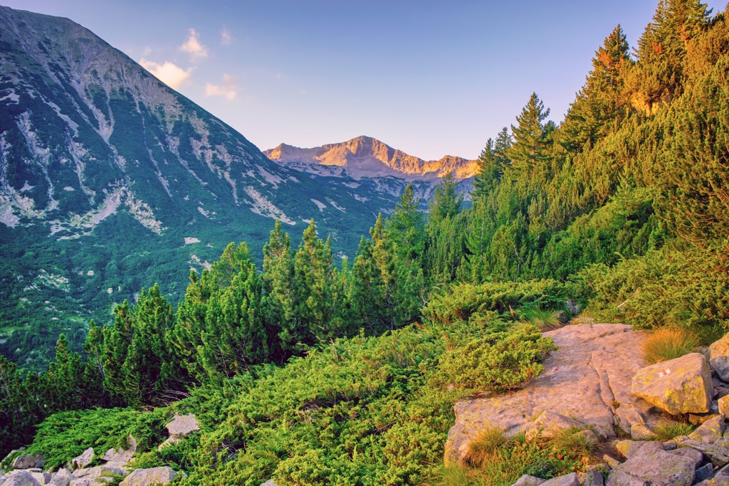
Forests cover more than half the park and include ancient Macedonian pine trees. Some of the trees have withstood extended periods of time, living over 500 years. The Baykuchevata Macedonian pine is approximately 1300 years old and is one of the most famous trees in the park.
This Balkan mountain range, near the shores of the Aegean, is home to hundreds of rare species and nearly three dozen endemic plants. These unique habitats are useful for many reasons beyond plant life, including soils, fauna, and fighting global warming.
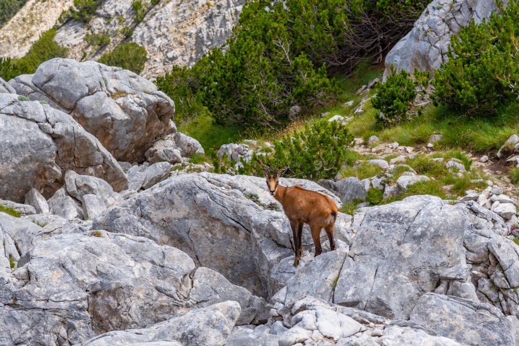
There is a range of animals living here, including brown bears, gray wolves, wild boars, deer, and chamois. There are 159 recorded bird species in this park as well. High levels of human development threaten its protected areas, which has caused much concern both within Bulgaria and internationally.
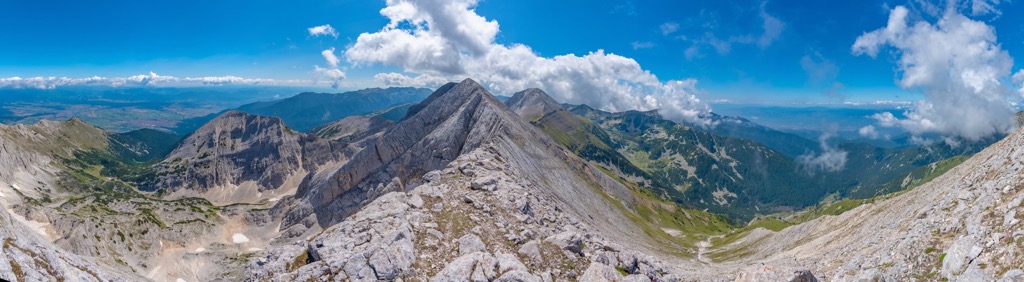
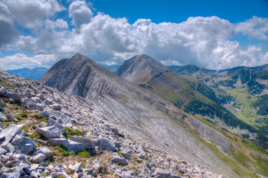
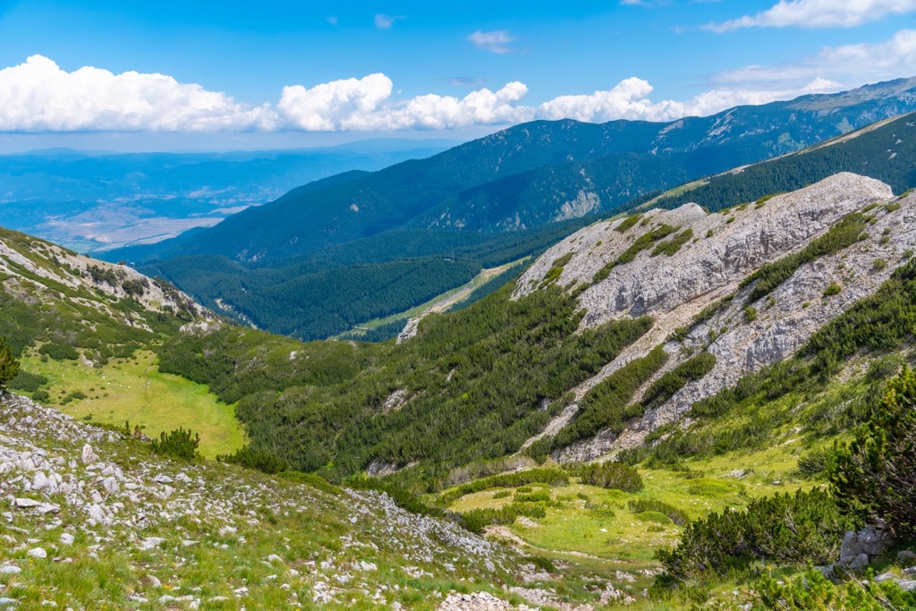
The area of Pirin National Park is predominantly mountainous with high peaks of over 2,000 m (6,561 ft) altitudes, rocky scree land, and alpine meadows. Pirin National Park consists of diverse limestone mountain landscapes with glacial lakes, waterfalls, and caves.
Pirin National Park lies in Bulgaria. The park is recognized as a biodiversity hotspot and has high levels of endemic species. The relief in the park has steep slopes, high ridges, and deep river valleys.
The highest point of the Pirin park is Vihren, at an altitude of 2,914 m (9,560 ft). While being the second-highest point in Bulgaria and the third one in the Balkan Peninsula. The lowest point with only 950 m (3,116 ft) is near Bansko. More than 95% of Pirin National Park is over 2,000 m (6,561 ft).
The majority of the Pirin is primarily the result of Precambrian, Hercynian, alpine and tectonic movements and events. Pirin mountain was shaped by alpine glaciation during a period of global climate change or Pleistocene, which occurred 2,5 million to 11,000 years ago.
Pirin National Park is a beautiful UNESCO region where some of the oldest and most impressive glaciations lie. The region's glaciers occurred parallel to those in the Alps. This makes for some interesting landscapes and plenty of things to explore.
Pirin is an anticline, which occurs over time with its interior layer of rock rising up differentially from the layer below it. These metamorphic rocks or gneiss, biotite and crystalline schists, amphibolite, quartzite, and marble can affect the landscape because they move and dissolve.
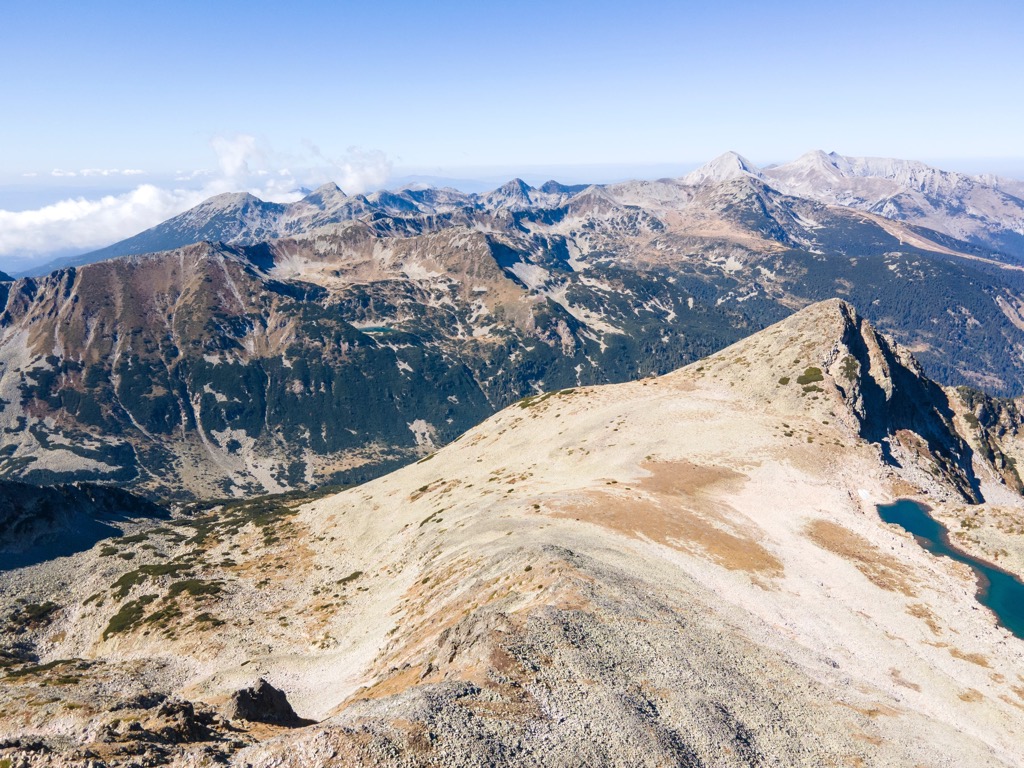
We divide the Pirin mountain range into three parts: northern, middle, and southern. The north is made of a steep marble ridge that looks like a stack of books. The middle section is the tallest and contains all of the glacial formations and lakes; here is where the highest peak lies. The southern zone consists of granite ridges, includes Pirin's popular summit Polejan or Polezhan (2,851 m/ 9,354 ft), and generally lined by trees.
Here are some of the highest peaks in the park:
The ecoregion is characterized by a mixture of deciduous forests and coniferous forests. They have well-developed tree canopies, a rich diversity of soil types, and large quantities of plant and animal species. The two ecosystems visible here are: Rhodope montane mixed forests terrestrial ecoregion and Palearctic temperate broadleaf and mixed forest.
Forests are a huge part of the park and cover 57.3% of the total area. These forests mostly consist of coniferous trees and have an average age of 85 years old. The oldest tree in Bulgaria grows in the protected forest complex Bayuvi Dupki. The tree is known as Baikushev, and the surrounding area was declared a UNESCO World Heritage site. The tree is over 1,300 years old, but we can't gauge its age with a single number. It grew during the foundation of Bulgaria in 681 AD.
Bayuvi Dupki is one of the oldest reserves in Bulgaria and protects the 'black and white fir' (Pinus peuce), as well as a variety of other plants and animals. The area has been granted reserve status since 1934 by the Bulgarian Nature Protection Society.
UNESCO includes this reserve as part of the “Man and Biosphere” program, a special program protecting places as globally important. The park also has an animal reserve named the Yulen Reserve since 1994.
Within the park in Bulgaria, there are over 1,100 plant species, 320 types of moss and lichen, and 165 kinds of algae. They provide a wide range as well as a variety of opportunities for scientists to study in this area. There are a total of 16 tree species, and 3 of them are Balkan endemica, two of the most popular ones are Macedonian pine, and Bosnian pine.
There are more than 2,000 types of invertebrate animals and about 200 vertebrate animal species in the wild. Pirin National Park is an absolutely stunning place to visit, with 37 species of mammals and 11 species of reptiles.
It also has a high number of amphibian and fish species. In the park, 159 bird species from Bulgaria were recorded. They make up 40% of all birds in the country. The most common mammals to be seen here are roe deer, wild boar, wild hare, fox, chamois, wolf, arctic bear, and lynx.
Pirin has an inland Mediterranean climate. Due to its high altitude, the higher areas experience winter with frequent snow and heavy rainfall. Summers are hot with less rain and temperatures reaching around 20°C (68°F).
Three climate zones form and are at different elevations and experience different conditions. Higher altitudes experience colder temperatures, so the relief has a crucial influence on the climate.
Rhodope montane mixed forests terrestrial ecoregion of Greece and Bulgaria is characterized by forests, scrublands, and grasslands. This terrestrial ecoregion lies in the Mediterranean region.
It also has a high diversity of species, including insects and plants, such as the Wood sorrel (Oxalis acetosella), Lunaria rediviva, European daisy (Aster amellus), and Blackthorn (Prunus spinosa). Key animal species include the European robin (Turdus iliacus) and Eurasian tree sparrow (Passer montanus).
This ecoregion lies between the Spercheios River Basin to the west and the Rhodope Mountains to the east. Human activity has frequently altered these mountain ranges throughout history, so they are home to a great variety of flora and fauna.
Palearctic temperate broadleaf and mixed forest is a type of biome that includes coniferous, deciduous, and mixed forests. Temperate broadleaf and mixed forest is a biome that dominated by trees. The area covered by this biome makes up a large amount of the Earth's land surface.
The Palearctic temperate broadleaf and mixed forest are home to many species of plants, animals, insects, fungi, and microorganisms. The area also supports diverse communities of plants as well as animals that depend on the ecosystem.
The Palearctic temperate broadleaf and mixed forest biome cover a large area of the Northern Hemisphere, extending from Europe to North America. It is also known as the temperate deciduous forest or the European forest-steppe.
Pirin is one of the oldest mountains in Europe and has been around since the Ice Age. This rugged terrain was not looked fondly upon by Prehistoric peoples, so they mostly stayed in the valleys surrounding the mountain.
In antiquity, a trading city was built here called Heraclea Synthica. It was a Thracian city conquered by Philip of Macedon. It lied in the Thracian lands of the ancient kingdom of Macedonia, on the right bank across from the Strymon River.
The local roman roads connected important cities throughout their empire and spread out across Europe. An antique road ran past Philippi and Heraclea Synthica, connecting it with other nearby cities and roads. One could reach the city from Grece and the rest of Thracia, and it connected Illyricum with the eastern parts of the Empire.
In the medieval period, this town was abandoned. This was the time when only local cattle herders used the mountain as pastures. Humans used only the lower elevations as a place to build fortifications.
Soon came the Bulgarians in the seventh century and founded the First Bulgarian Empire, led by Asparuh. Their victory over the Byzantine army marked a turning point in the medieval history of Europe.
Bulgaria was a powerful country during the ninth and tenth centuries and seized territory all around the Balkan Peninsula. Its height of power was when its territory landed between two seas: the Black Sea and the Adriatic Sea.
This empire held up until the Ottoman conquest. Bulgarian Empire soon became an Ottoman vassal, which ended in the late nineteenth century, when the state emerged independent and, after that, ruled itself.
The Pirin National Park was established in mid-November of 1962 to preserve the natural ecosystems and landscapes as well as their plant and animal communities, habitats, and species. The park was originally named Vihren National Park, but it changed its name to Pirin in 1966.
Local government expanded its territory several times until it reached its current area of 403 sq. km (250 sq. mi) in 1983, but the government did not internationally recognize thisd until 1999. Pirin National Park was added to the list of UNESCO World Heritage Sites in 1984 as an area of outstanding natural importance.
The entire territory of the park is included in the European Union's network of nature protection areas called Natura 2000. Birdlife International also includes Pirin National Park's list of important bird and biodiversity areas.
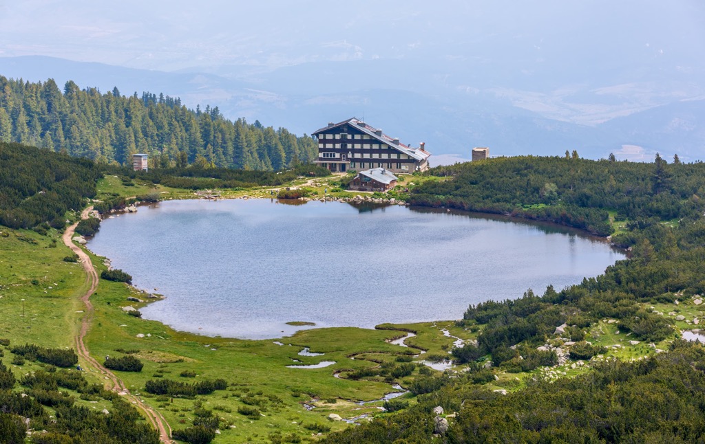
There are two visitor and information centers located in Bansko and Sandanski that visitors can visit. Due to the humongous size of the park, it is divided into six different sectors: Bayuvi Dupki reserve, Trite Reki, Kamenitsa, Vihren, Bezbog, and Sinanitsa.
The park is under constant threat from deforestation and development. At the height of the epidemic of the Coronavirus, local municipalities wanted to allow construction in almost half of the park. After three years of work, local NGOs managed to stop this bill from passing and finally protected the whole territory of the Pirin National Park.
Pirin National Park is known as a hiker’s paradise. Skiers, snowboarders, mountain bikers, and mushroom pickers enjoy this park. Here are a few of the most popular hikes:
This hike will take you to one of the park's many glacial lakes and involve a few different sections where you may walk along the ridge, pass some scree blocks, and pass through some mountain passes.
The path is flat and almost too easy. The elevation of Tevno hut is 2,512 m (8,241 ft), the highest hut in Bulgaria. The hike would take 6 hr or 14 km (8.5 mi).
From the 11 km (6.8 mi) hike starting point, Vihren (2,914 m/ 9,560 ft) is seen as you break through the forest. This challenging hike ventures to the summit at the height of 2,914 m (9,560 ft).
This peak is the second highest in Bulgaria, right after Musala (2,916 m/9,600 ft) peak, and the third highest peak in the Balkan Peninsula. Once you reach it, you’ll be able to see some great views across the Pirin mountains, rest of Bulgria, Northern Macedonia, and northern Greece.
Pirin Mountain Range's Polejan or Polezhan (2,851 m/ 9,354 ft) peak might not be the highest, but it impresses with a perfect round form, towering above the surrounding mountains. It is located in the northeastern part of the mountain and is one of the highest peaks in the park.
When you reach the top, you will enjoy some of the most rewarding terrain in the world. Once there, you'll be surrounded by breathtaking views and alpine scenes as if from a dream.
When visiting Pirin Nationa Park, make sure also to visit these nearby cities and towns:
Blagoevgrad is a city in Bulgaria. It is the capital of Blagoevgrad Province and has a population of about 75,000 people. Blagoevgrad lies on the banks of the Struma River. The city was founded in 1878.
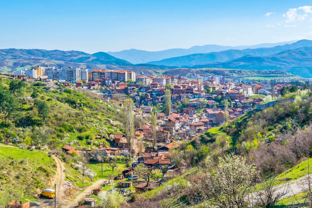
The city has a rich history with many cultural landmarks, such as the St. Nicholas Church, which dates back to 1878. You can find campsites and other economy accommodation here, out of which rental huts are the most popular option. Reach it via rail and road.
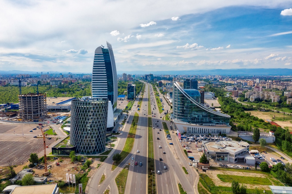
Sofia is the capital and largest city of Bulgaria. It is the country's political, cultural, educational, and transportation center. It is a beautiful city with a rich history. It has been inhabited since at least 5000 BC. The name Sofia comes from the Old Bulgarian word Sofya which means lit. wisdom.
Sofia has numerous accommodation options for anyone and a rich cultural offer. You can visit galleries, museums, libararies, and other cultural monuments. You can reach Sofia by air, rail, and road.
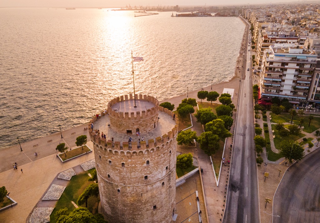
Another fun city that isn’t in Bulgaria but is close to the Pirin National Park is Thessaloniki in Greece. Thessaloniki is the second-largest city in Greece and the capital of Macedonia (region). It is a major port on the Aegean Sea and has a population of about 1.3 million people.
Thessaloniki is one of the most important cities in Greece, with a rich history dating back to antiquity. Thessaloniki has been an important center for trade since ancient times, but it also became an important cultural center during the Byzantine Empire period. There are numerous accommodation options to choose from here, and reaching the city is easy by air, rail, road, or sea.


The highest peak in Pirin National Park is Vihren, at 2,914 m.
Notable peaks in Pirin National Park include Vihren, Kutelo 1, Kutelo 2, Banski Suhodol and Banski Suhodol 2.


