Scan the QR code and open PeakVisor on your phone
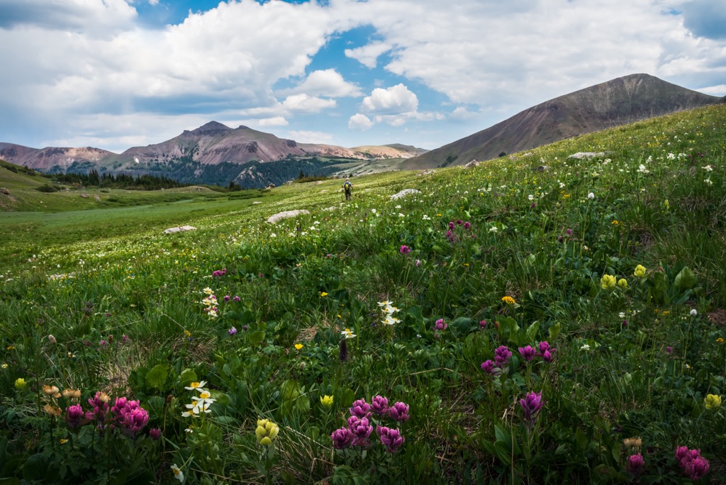
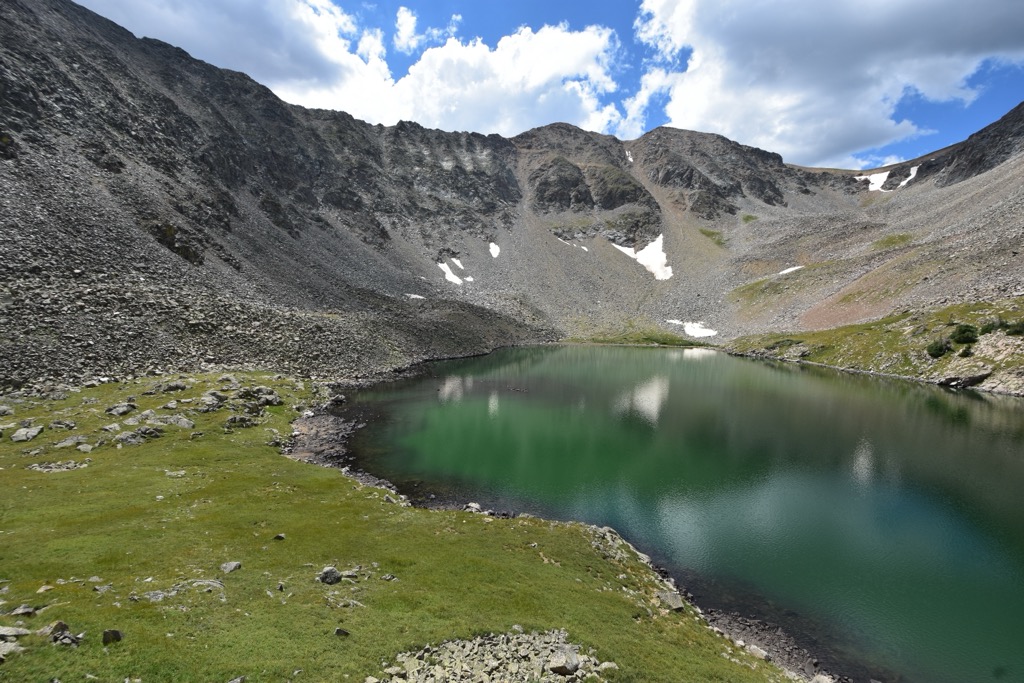
Encompassing forested gulches and peaks covered in snow and clouds most of the year, the scenic Never Summer Wilderness Area is located in northern Colorado, USA and borders Rocky Mountain National Park to its east. There are 19 mountains in the area. Howard Mountain is the highest at 12,815 ft (3,906 m) and Bowen Mountain the most prominent, rising 1,286 ft (392 m) to its 12,543 ft (3,823 m) summit.
The Never Summer Wilderness Area was designated in 1980 and today encompasses 21,090 acres (8,535 ha) in northern Colorado. To its east lies Rocky Mountain National Park and several of the trails into the wilderness leave from within the boundaries of the national park.
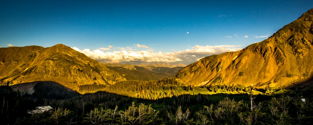
The landscape in the wilderness includes wooded ridges, steep tundra, and deep gulches. Elevations range from around 8,900 ft (2,700 m) to 12,815 ft (3,906 m).
The mountains are part of the Never Summer Mountain range and lie within Arapaho National Forest and very close to Routt National Forest. In addition to bordering Rocky Mountain National Park, the wilderness area also lies in close proximity to Estes Park and Grand Lake.
The tallest peaks in the area are Howard Mountain (12,815 ft/3,906 m), Mount Cirrus (12,785 ft/3,897 m), Mount Cumulus (12,733 ft/3,881 m), and Mount Nimbus (12,680 ft/3,865 m). As these names suggest, the peaks are often covered in clouds and the area receives a lot of precipitation.
Situated just west of Rocky Mountain National Park, the wilderness shares a geologic history with the park.
The precursor to the Rocky Mountains we see today began building around 1.7 billion years ago during the Precambrian era as metamorphic rocks like schist and gneiss formed. 1.6 billion years ago saw a period of magma upwelling. These events are responsible for the base layers of metamorphic and igneous rocks in the area.
During the Paleozoic Era 544 to 245 million years ago, inland seas spreading across the continent deposited sediment that developed into limestone and sandstone. 285 million years ago there was a mountain building event. However, the resulting mountains never exceeded 2,000 ft (610 m). Over millions of years, these mountains eroded away, leaving behind only sediment and debris. About 100 million years ago, the Western Interior Seaway covered the area and left behind more sedimentary deposits that later formed shale and sandstone.
Beginning around 75 million years ago and continuing through the Cenozoic Era (65 to 2.6 million years ago), the Laramide Orogeny uplifted the Rocky Mountains seen today. The mountain building events were followed by volcanism and abundant ash falls and mudflows. This is the reason for the igneous rocks that make up the Never Summer Range.
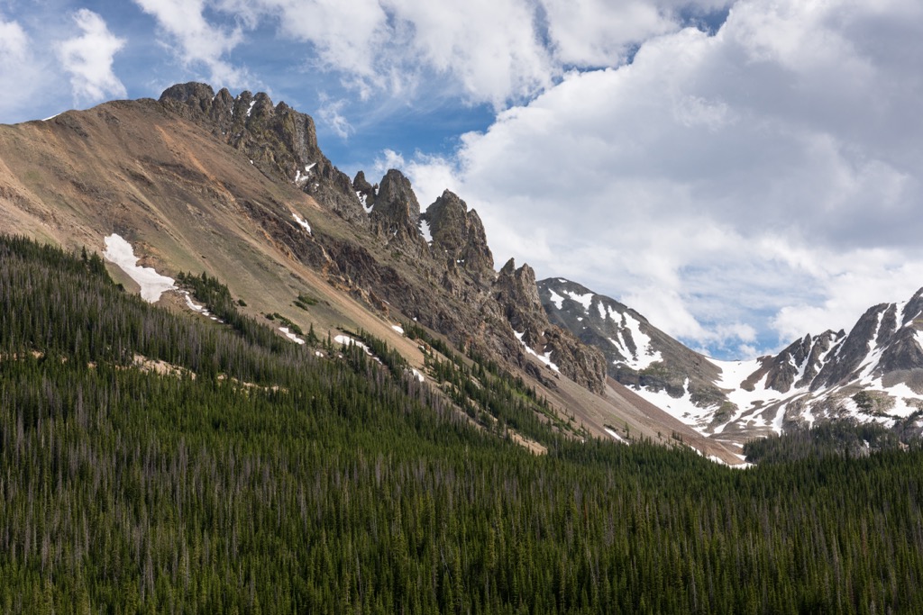
The Never Summer Range is unique from other parts of the Rockies in that it contains the youngest bedrock and the only volcanic rock in the area. It contains high quantities of mafic rocks, which are rich in iron and magnesium, and silicic rocks, which are rich in silica and aluminum. Other rocks include basaltic andesites, rhyolite lavas, ash flow tuff, and intrusive igneous rocks dating back 29 to 27 million years.
The Tertiary Period saw another episode of uplift, raising the Rockies to their current height and exposing older basement rocks. Glaciers also played a role in shaping the landscape. There were two main periods of glaciation – the Bull Lake Glaciation 300,000 to 127,000 years ago and the Pinedale Glaciation Period 30,000 to 12,000 years ago. They left behind U-shaped valleys and moraines, rocky debris deposits from glaciers, that can still be seen today.
The forests of the Never Summer Wilderness Area are filled with spruces, firs, and lodgepole pines. The area receives abundant rain and snow and provides water for three major rivers – the Colorado, North Platte, and Cache la Poudre. Extra moisture gathers in ravines over 10,000 ft (3,050 m) in elevation, and supports trees up to four ft (1.2 m) in diameter and up to 600 years old.
The precipitation in the area also supports ponds and bogs that provide habitat for wood frogs, bog beans, and pygmy shrews. Moose were reintroduced to the area and it is not uncommon for hikers in the area to spot one. Trout live in the lakes and streams. In addition to numerous birds, the area is home to bighorn sheep, black bears, elk, bobcats, mountain lions, and marmots.
The earliest human occupation in the region dates back 11,000 or 12,000 years. Projectile points belonging to the Clovis and Folsom cultures provide evidence of early human activity.
The area around Rocky Mountain National Park is the traditional territory of the Utes, primarily, and the Arapahos. The Utes often camped along Grand Lake in the summer and although the mountains provided some natural barriers, the two tribes were in frequent conflict.
The Colorado Gold Rush began in 1858 and caused the settler population to swell rapidly. The Arapaho felt the impact first and by 1878 had been removed from Colorado and sent to reservations in Oklahoma and Wyoming.
A similar thing happened to the Utes, although it was more prolonged. In the 1860s, the Utes were granted the western third of Colorado. However, this agreement dissolved after gold was found in the San Juan Mountains. By the 1880s, the Utes remained with only a small section of southwest Colorado.
The wilderness area was established in 1980.
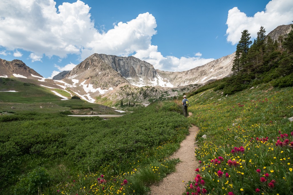
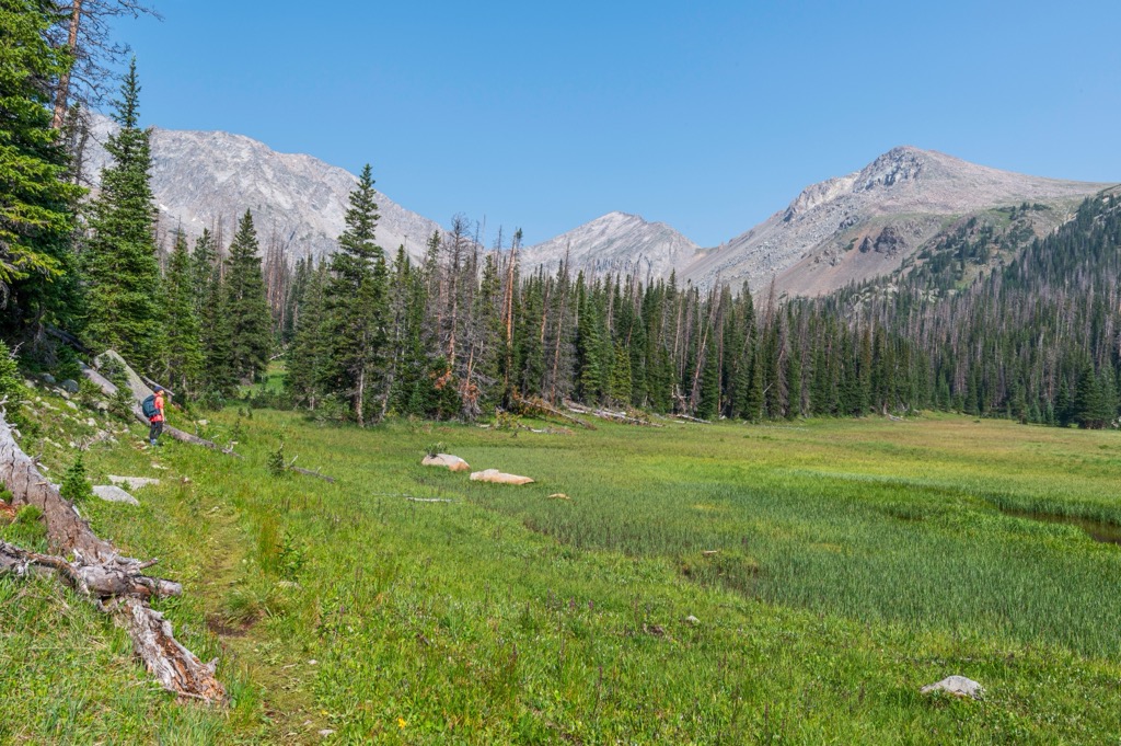
Around 20 mi (32 km) of trails cross the Never Summer Wilderness Area, climbing gulches and following the Continental Divide on two high passes. Fishing for cutthroat trout is allowed in the Blue, Bowen, Ruby, and Parika Lakes, and backpackers can find campsites along the trail for multi-day trips. The scenic wilderness area can be seen from the popular Trail Ridge Road in Rocky Mountain National Park.
For trails that begin in Rocky Mountain National Park, hikers should be aware that the park has timed entry to regulate the number of people in the park and should plan their trip accordingly.
7.4 mi (11.9 km) one way, the Bowen Gulch Trail begins at 8,832 ft (2,692 m) and climbs to 11,465 ft (3,495 m) at Bowen Pass. One must access this trail from Rocky Mountain National Park. This trail provides access to Bowen Pass Trail #118 that leads to the Continental Divide Trail.
The trail from Baker Gulch to Bowen Gulch Lake also begins in Rocky Mountain National Park. It is a loop trail that runs 19 mi (30.6 km) and includes 4,750 ft (1,448 m) of elevation gain. Incredibly scenic, this trail passes abundant wildflowers in summer, alpine lakes, and lookout points with panoramic views. This trail, as with many trails in the area, is best completed in summer as snow, high creeks, and mud make it trickier to traverse earlier in the season.
A 7.2 mi (11.6 km) loop with 2,600 ft (792 m) of elevation gain, the trail from Fairview Mountain to Bowen Pass is considered a challenging loop. The trail may be hard to follow once you pass the summit of Fairview Mountain. If this happens, past hikers say to continue for about a mile (1.6 km) along the divide and from there one can spot the trail below and descend to complete the loop.
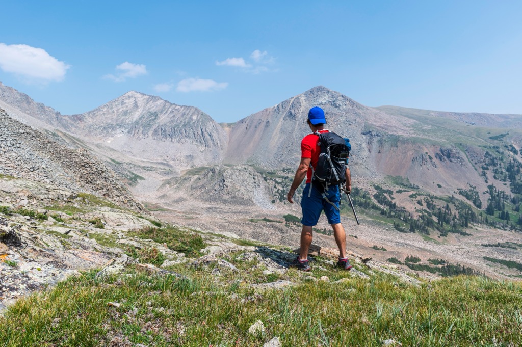
That being said, there is unlikely to be cell service in the wilderness so it is best to have maps and offline navigation available. Some parts of the trail are forested, but much of it runs above treeline so hikers should plan for sun exposure.

Visitors are allowed to backpack and camp in the wilderness. A few guidelines to be aware of – group sizes cannot exceed 15 people and livestock, or 10 people total; no camping or campfires are allowed within 100 ft (30 m) of lakes, streams, and trails; and no campfires are allowed in the alpine area above 10,800 ft (3,292 m). Reservations can be made at numerous developed campsites surrounding the wilderness area.
A 2.5 hour drive away, Fort Collins has a population of 166,000 and a vibrant community scene. There is often live music and a wide selection of breweries as Fort Collins produces a large majority of the state’s craft beers. The city and surrounding area is very biker friendly, including miles long trails along the Cache La Poudre River and Spring Creek, and mountain biking trails near town.
The Horsetooth Reservoir lies at the edge of town with opportunities to swim, boat, fish, and camp. The Horsetooth Recreation Area overlooks the reservoir and has miles of well maintained trails and a variety of routes of different difficulty levels.
The downtown has plenty of boutiques, restaurants offering a variety of cuisines and atmosphere, and lots of community events. You can find hotels, guest ranches, rental properties, and campsites in and around the city.
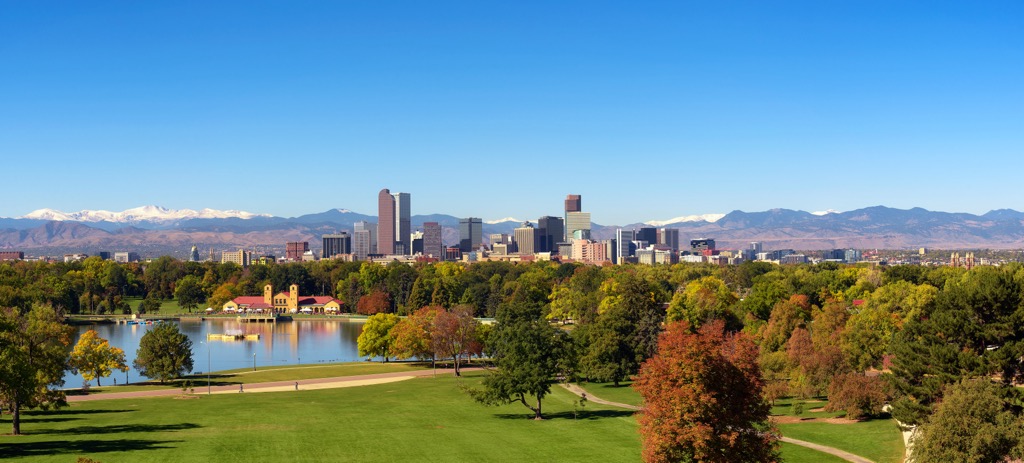
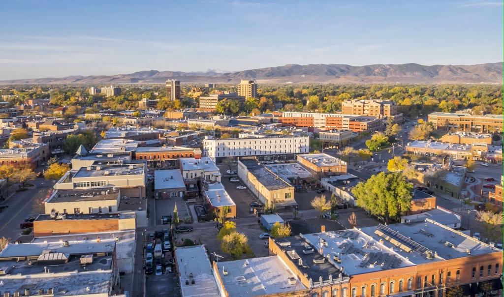
Located three hours away by car, Colorado’s capital has a population of 716,000. One of the best known attractions near the city is Red Rocks Amphitheater. Catch a concert there, go for a movie, hit up the early morning Yoga on the Rocks, or just stop by to wander around the impressive venue.
The Rocky Mountain Arsenal to the east of the city center houses bison and abundant other wildlife. Walk along the trails, fish in the ponds, or go for game drives along quiet roads.
In the city, the First Friday Art Walk takes place on the first friday of each month and showcases arts and artists in the city. The city has a selection of restaurants ranging from international cuisines to breweries to vegan-friendly and more. Speakeasies are quite popular so do a bit of research to find these underground bars and music venues. A range of hotels, B&Bs, rentals, cabins, guest ranches, RV parks, and campsites are located within or close to the city.