Scan the QR code and open PeakVisor on your phone
Bjeshkët e Nemuna National Park is a protected area in Kosovo. In Serbian, Croatian, and Bosnian, it is also known as Prokletije National Park. This rugged park’s name translates literally to ‘Cursed Mountains National Park.’ This name is particularly apt as the park is home to the true rocky backcountry of Montenegro, Albania, and Kosovo. There are 115 named mountains in National Park Bjeshkët e Nemuna, the highest and the most prominent of which is Gjeravica (2,656 m/ 8,713 ft).
National Park Bjeshkët e Nemuna is part of the Prokletije Massif and it is located in the northwestern part of Kosovo. The name Bjeshkët e Nemuna is Albanian for ‘Cursed Mountains’ or ‘Accursed Mountains,’ and it also is called Prokletije National Park in Serbian, Croatian, and Bosnian.
The Prokletije Mountains are part of the Dinaric Alps. They span from the Drin River Valley in Albania and the Lim River Valley in Montenegro to the towns of Peja and Gjakova in Kosovo. The highest peak in the range is Maja e Jezerce (2,694 m/ 8,839 ft).
With respect to the Prokletije Mountains in Kosovo, we see that the mountains make up the whole western border of the country. In fact, the borders between Kosovo, Albania, and Montenegro lie in the National Park Bjeshkët e Nemuna.
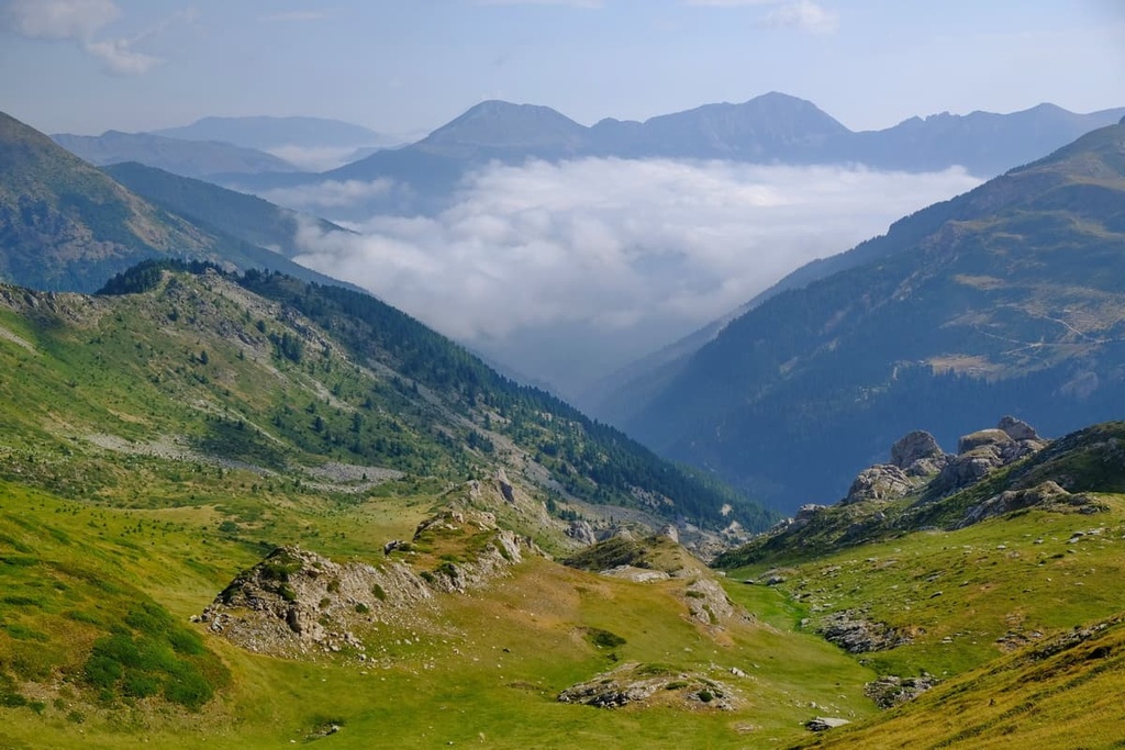
The mountains descend steeply onto the Kosovo plain, where the towns of Peja and Gjakova are located. The natural border between the mountains and the Kosovo plain are located along the Dukagjini Valley and Ibar River.
National Park Bjeshkët e Nemuna is 50 km (32 mi) long and up to 26 km (16 mi) wide. This is not an insignificant patch of land, especially in a small country like Kosovo. The park consists of 62 ha (153 acres) of terrain, which is almost 6% of Kosovo’s territory.
National Park Bjeshkët e Nemuna is located in five municipalities. These are Peja, Decani, Istok, Junik, and Gjakova. The town that is closest to National Park Bjeshkët e Nemuna, and covers most of its territory, is Peja (which is referred to as Peć in Serbian, Croatian, and Bosnian).
Bjeshkët e Nemuna is actually the second-largest park in Kosovo, and it is home to the country’s second-highest peak, Gjeravica (2,656 m/ 8,713 ft). The park could be considered an extension of the Valbonë Valley National Park of Albania and Prokletije National Park of Montenegro.
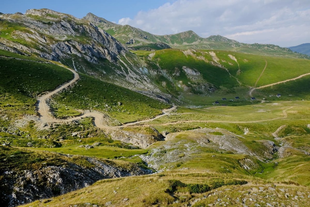
The park possesses numerous lakes, beautiful hiking trails, and alpine landscapes. It protects the local biodiversity, offering a safe haven to various threatened species. Of course, the park also protects the cultural and historical heritage of the area. This park isn’t just important for Kosovo but also for the greater Balkan region.
The peaks of Bjeshkët e Nemuna reach an elevation of over 2,000 m (6,561 ft) and continue toward the end of the Kosovo plain (500–600 m/ 1,640–1,986 ft). The park also protects two steep river valleys of the Lumbardhi and Erenik Rivers.
The greater Prokletije massif, which is partially located in the park, consists of three sections and it falls under the jurisdiction of three countries:
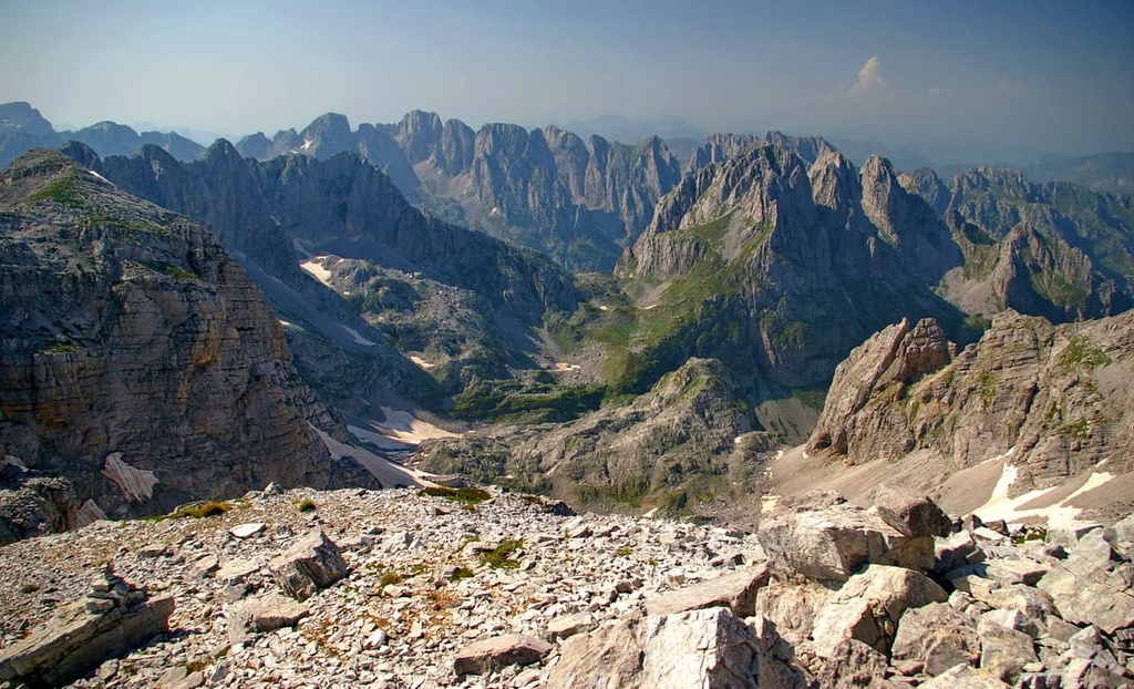
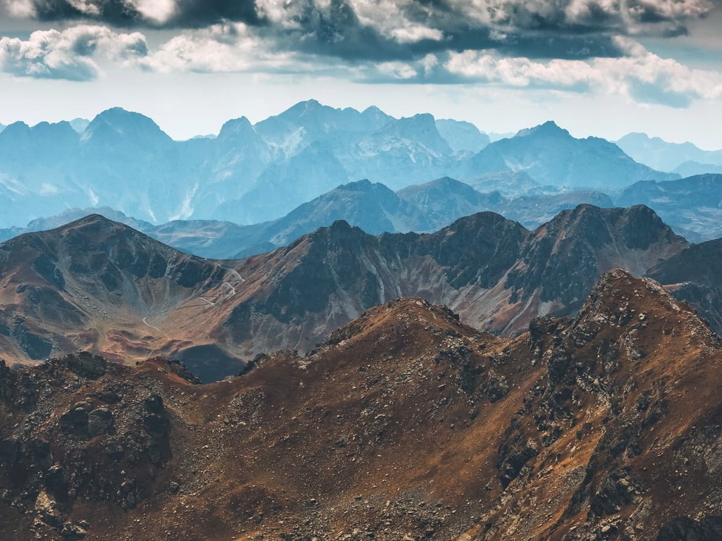
National Park Bjeshkët e Nemuna is a protected area in the Dinaric Alps. It protects the Kosovo part of the Prokletije massif, which is the southernmost part of the Dinarides (if you consider the Dinarides in Albania to be a different mountain range). Rugged geomorphological formations, rocky and barren peaks, and numerous karst reliefs are what make this massif so special.
The Bjeshkët e Nemuna massif, together with National Park Bjeshkët e Nemuna, forms a natural border between the mountains of the Balkan Peninsula and the Kosovo plain. Therefore, its topographic relief and geological origin are particularly interesting.
The oldest geological formations in the park were created during the Paleozoic. Most of the massif’s rocks are of carbonate origin, meaning that they are mostly limestone and dolomite in composition.
Constant chemical and physical dissolution of limestone rocks in the region formed the karst terrain of the Dinaric Alps. This dissolution happened as a result of water running over the region’s soluble rocks.
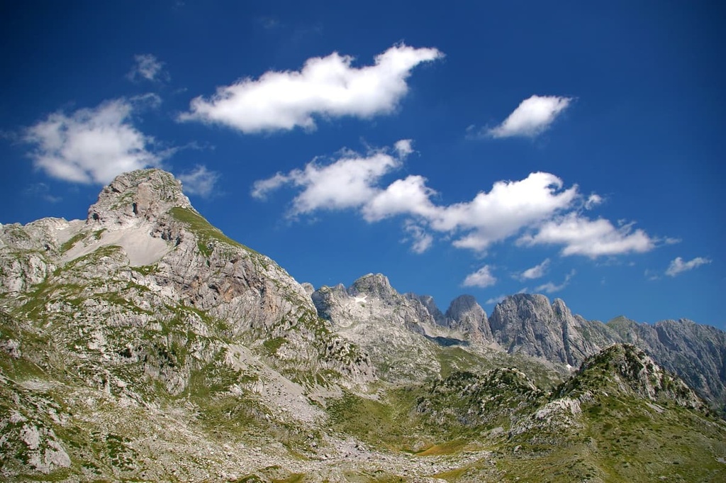
The most common karst landforms found in National Park Bjeshkët e Nemuna are caves, pits, and barren rock fields. That said, while the rest of the mountain might be almost exclusively grasslands and a few patches of forest, the higher peaks are always barren in this part of the Dinarides.
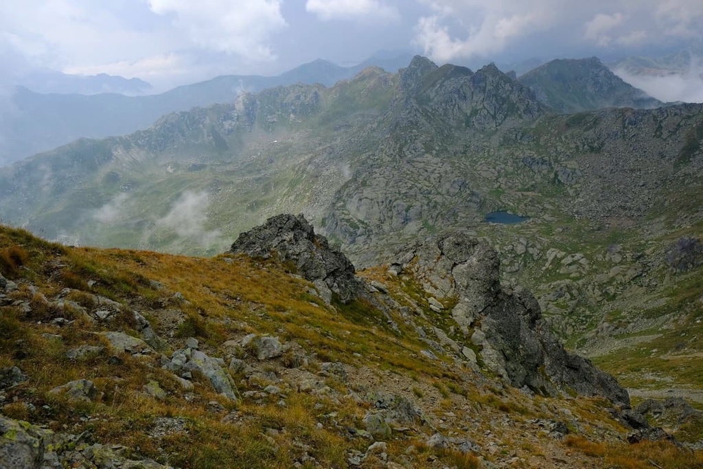
The peaks of Bjeshkët e Nemuna can hold snow throughout the year, meaning that you can encounter patches of snow even in the summer months. The snow on the peaks slowly melts and feeds the region’s many water sources.
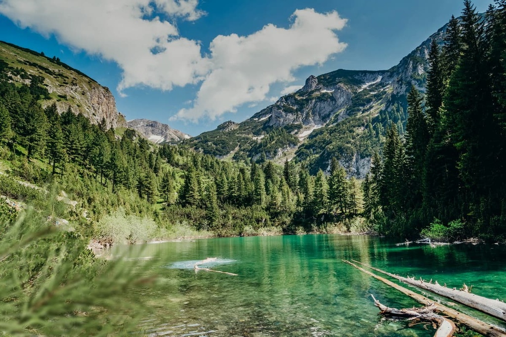
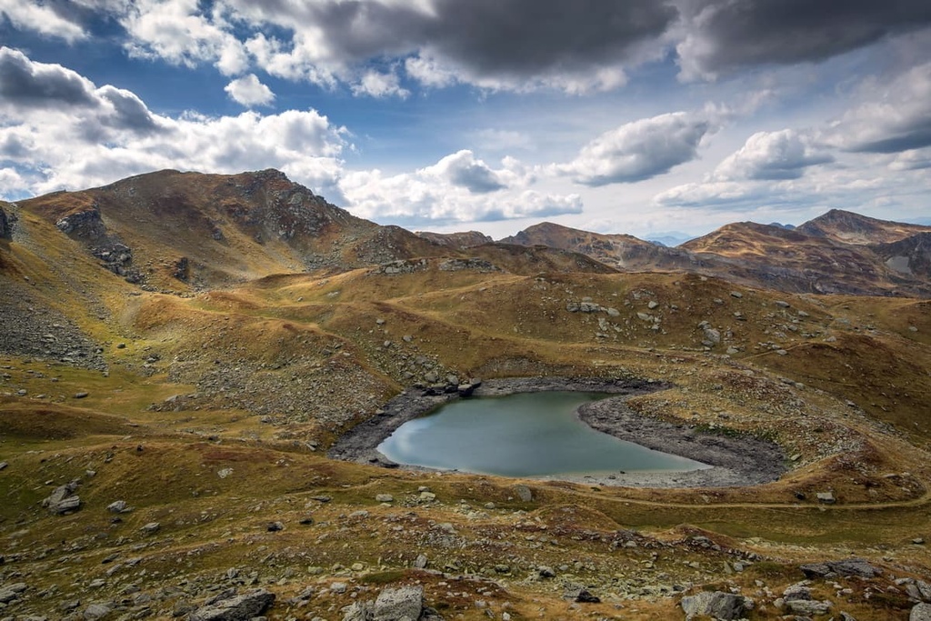
There are two important lakes located inside National Park Bjeshkët e Nemuna. These are Gjeravica Lake and Leqinat Lake, both of which lie below their namesake mountains. Gjeravica Lake is the most interesting of the two lakes since it is situated at an elevation of 2,200 m (7,217 ft), which is just below the peak of Gjeravica (2,656 m/ 8,713 ft).
Another popular tourist destination here is the karst formation of Rugova Canyon, which lies inside National Park Bjeshkët e Nemuna. It is 25 km (15 mi) long, and in some places, the canyon is up to 1,000 m (3,280 ft) deep. The canyon was created by the Peja Bistrica River and the retreat of the Peja Glacier.
National Park Bjeshkët e Nemuna contains a part of the Prokletije massif. The highest peaks found in the park include:
National Park Bjeshkët e Nemuna is home to a mix between the Mediterranean and continental climates, so it is a particularly biodiverse place. The forests in the park are part of the Balkan and Dinaric mixed forests ecosystem, which is the most widespread terrestrial ecosystems in Kosovo.
The drastic elevation changes and rugged topography of National Park Bjeshkët e Nemuna means that there's a diverse range of life found in the region. Some endangered species of flora and fauna are found only in the park, while others thrive here as a result of the region’s ruggedness.
In fact, the park is home to 33 endemic plant species and 170 different bird species. There are also 10 reptile species, 129 butterfly species, and around 40 mammal species found in the park.
What most tourists find interesting about Bjeshkët e Nemuna are the 170 bird species. In fact, National Park Bjeshkët e Nemuna is a popular bird sanctuary as it is an important resting place for birds traveling from Central Europe to the south and back every year. Therefore, bird watching is popular here. The most common species here are the imperial eagle (Aquila heliaca), mountain eagle (Aquila chrysaetos), and capercaillie (Tetrao urogallus).
When it comes to the 40 species of mammals, park visitors may spot brown bears (Ursus arctos), Eurasian lynx (Lynx lynx), and chamois (Rupicapra rupicapra). That said, keep an eye out for the venomous horned viper (Vipera ammodytes), which is commonly found in these mountains.
So far, research has identified more than 1,000 species of flora alone in this area. The plant species in National Park Bjeshkët e Nemuna have changed over time due to natural evolution and climate change.
The vegetation here is split into six different zones, according to elevation. They include:
The area that is now part of National Park Bjeshkët e Nemuna has been inhabited for thousands of years. The first people that lived here were ancient Illyrians and Celts. Numerous tribes called these mountains their home and they generally lived below the mountains with their livestock.
Of course, none of these people ever truly ventured to the summits of the mountains. They did, of course, let their cattle eat from the lush mountain pastures. This way of life prevailed even during the Roman conquest of the area. The area of today's Albania, Kosovo, and Montenegro was part of the Roman Province of Illyricum.
In the medieval period, the local kingdoms still looked up to the mountains of Bjeshkët e Nemuna but never climbed them. Only a few locals dared to live below the mountains. At that time, the locals believed the mountain tops hosted ghosts and other beings that could kill humans.
This was when the Prokletije or Bjeshkët e Nemuna mountains started to become well-known. According to tradition, people who stole or committed other crimes in the communities below the mountains were expelled. They were bound to live in the mountains all by themselves.
These people were called Prokleti, which translates as ‘damned’ or ‘cursed,’ and they were never allowed to return to their homes in the valleys. Therefore, the mountains they were cursed to live in forever were called the Prokletije or Bjeshkët e Nemuna.
The mountain’s name doesn’t just describe how people were treated there. The Prokletije or Bjeshkët e Nemuna mountains have long been known for their steep peaks. The locals believed them to be cruel and unforgiving mountains, and were mostly afraid of the region.
In fact, there is a folk tradition in Montenegro that says the Prokletije got their name from a family whose three sons were lost in the mountains. Fairies lured them into the unforgiving terrain, and their mother was forced to live alone. It is said that one can still hear their mother cursing the fairies and her voice echoing in the mountains and saying: Prokletije! (which translates literally as ‘Be damned!’).
After the medieval period, the Ottomans took over the land that is now part of Bjeshkët e Nemuna National Park and all of today’s Kosovo. During the First World War and Balkan Wars, locals fought numerous battles in the Bjeshkët e Nemuna mountains. There are landmarks and monuments to the fallen soldiers of Kosovo in the mountains to this day.
After the end of these wars, Kosovo, Montenegro, and Serbia all became part of the State of Slovenes, Croats and Serbs. Soon, this kingdom became the Kingdom of Yugoslavia and then the Socialist Republic of Yugoslavia.
These changing borders haven’t made much of a difference in National Park Bjeshkët e Nemuna or to the locals. You can still meet ethnic Montenegrins, Albanians, Serbs, and Bosnians living in peace here, just like they did back then.
The only major thing that Yugoslavia brought to this part of the republic was better transportation and infrastructure. That said, the state did originally protect the Prokletije or Bjeshkët e Nemuna mountains inside nature and national parks.
The history of Kosovo itself is long and complicated. It had been a part of Serbia for centuries, but it was not until the end of the twentieth century that it became an autonomous province. In 1999, NATO intervened and ended the conflict between Serbian forces and Kosovo Albanian rebels. Kosovo declared itself an independent country in 2008.
After the declaration of Kosovo’s independence, the state started focusing on the natural beauties of the land. This is why the Bjeshkët e Nemuna massif is protected within National Park Bjeshkët e Nemuna. This park opened its figurative doors to visitors in 2012.
Of course, hiking in National Park Bjeshkët e Nemuna is a must-do for all visitors. In addition to hiking, you can also go biking, camping, and birdwatching in the park. Here are some of the most popular hikes to check out in National Park Bjeshkët e Nemuna.
Gjeravica (2,656 m/ 8,713 ft) is Kosovo’s second-highest peak and the highest peak in National Park Bjeshkët e Nemuna. The hike up the mountain is relatively straightforward, and it is beginner-friendly. The trailhead is located at Gropa Erenikut, and the hike is 14 km (8 mi) long.
This trail takes you through alpine fields above the treeline and passes by two glacial lakes. In one of these lakes, below the peak of Gjeravica (2,656 m/ 8,713 ft), you can take a dip after finishing the hike.
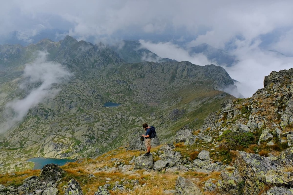
This is a spectacular loop hike from Gjeravica (2,656 m/ 8,713 ft) that takes you to Gusan (2,539 m/ 8,330 ft) in Albania. The hike starts at Gropa Erenikut and passes above the treeline onto barren rocky fields. There, you will see three lakes: Liqeni Zemer, Small, and Big Gjeravica Lakes.
After that, you’ll climb the second-highest peak of National Park Bjeshkët e Nemuna, Gusan (2,539 m/ 8,330 ft), and proceed with the descent. You’ll descend along the beautiful ridge of Gusan, which takes you back to Gropa Erenikut.
Marijash/Bogdash is another popular hiking trail that takes hikers from Montenegro to Marijash/Bogdash (2,533 m/ 8,310 ft) in Kosovo. This is a strenuous hike that covers 19 km (11 mi) of terrain and has 1,200 m (3,937 ft) of elevation gain.
The peak itself is located in Kosovo, but the trailhead is situated in Plav in Montenegro and takes one from deep and lush forests to barren rocky peaks. That said, this hike is not for everyone because it is both long and rugged.
You can reach National Park Bjeshkët e Nemuna from Montenegro, Albania, and Kosovo. The park is located 47 km (29 mi) away from Peja, 55 km (34 mi) away from Gjakova, and 120 km (74 mi) away from Priština. Here’s what you need to know about each of these cities.
Peja is a city in Kosovo and it is the closest city to National Park Bjeshkët e Nemuna. The city has a population of around 50,000 people, and it was founded by King Stefan Milutin in 1321. The name Peja is derived from the Serbian word pek, which literally translates as ‘furnace.’
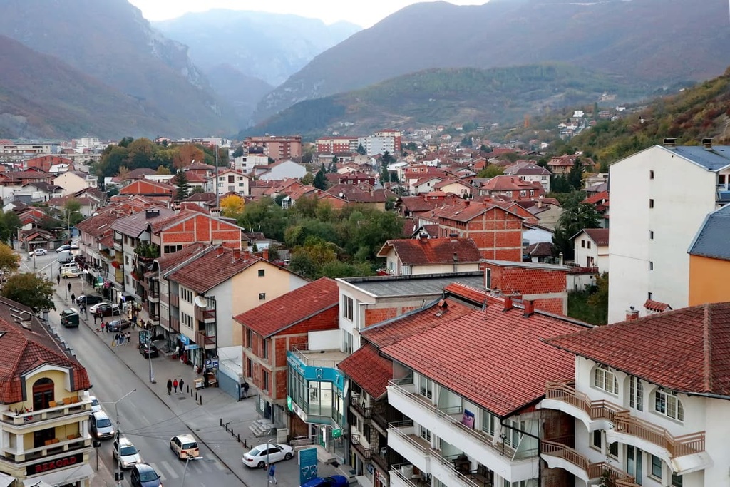
The economy of Peja is primarily dominated by agriculture, trade, and industry. The most important industries in the city are textile production and food processing. Since this is a relatively big city, one can find hotels and other types of accommodation here. You can also get to Peja via air and rail.
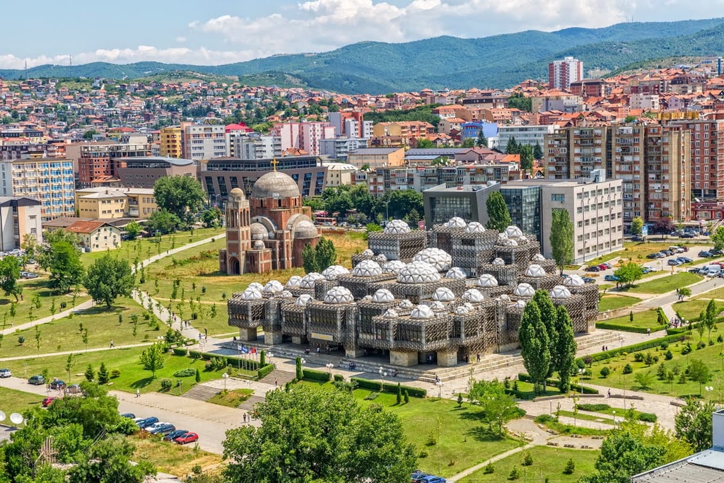
Priština is the capital and largest city of Kosovo. It is the center of the Priština District and the seat of the Priština municipality. Priština is located in a valley surrounded by mountains, and the city has a population of around 210,000 people.
The name Priština derives from Prishtinë, which means ‘spring of water.’ The name stuck due to its location at a crossroads along an old trade route between Skopje and Constantinople.
Today, Priština is a modern city with a large university that offers all kinds of accommodations and attractions to visitors. You can also reach the city via road, rail, and air.
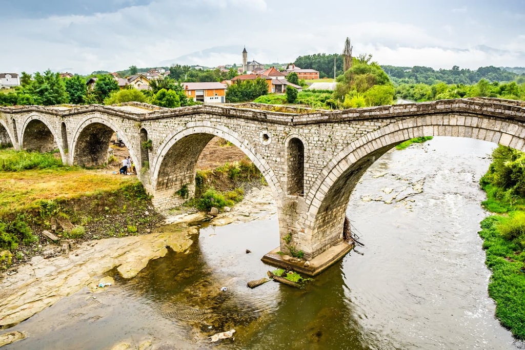
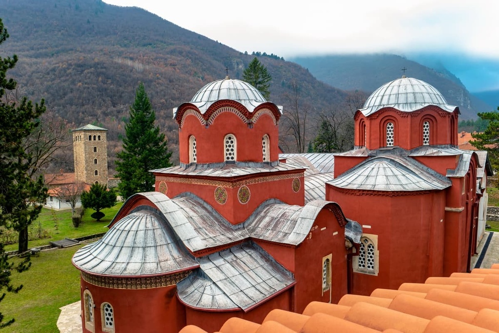
Gjakova is the second-largest city in Kosovo. It is located on the banks of the Drin River. The city has a population of around 40,000 people, and it is one of the most important tourist cities in Kosovo because it has a large number of cultural monuments.
The most famous monument in Gjakova is the Church of Saint Anthony of Padova. The church has an interesting history because it was destroyed by an earthquake and then rebuilt with help from UNESCO.