
Scan the QR code and open PeakVisor on your phone
Hat Head National Park has 4 named peaks. The highest is Big Smoky at 313 m. Other notable peaks include Little Smoky, Hat Hill and Hungry Hill.
Hat Head National Park is a protected coastal region in New South Wales in Australia. Lying on the Mid North Coast of the state, it’s located 462 km (287 mi) north of the city of Sydney. The park is home to just 4 named mountains, of which the highest and most prominent is Big Smoky at 313 m / 1027 ft.
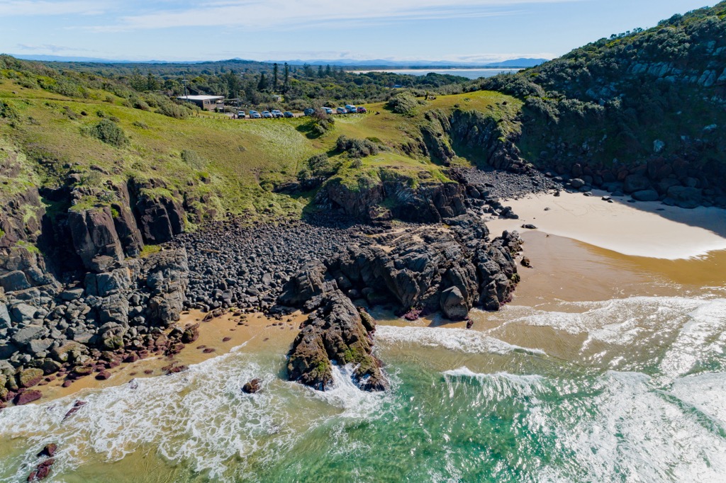
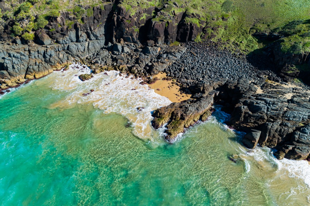
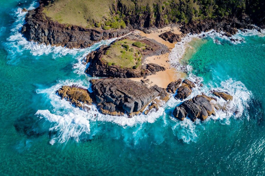
Hat Head National Park protects around 7,400 hectares (18,286 acres) of the Mid North Coast in New South Wales. The coastal park is home to numerous beaches, sand dunes, rocky headlands, wetlands and forest. Bordering Arakoon National Park, it protects two large bays of the South Pacific Ocean and two major headlands.
Being a low coastal park, the highest mountain in the national park, Big Smoky, reaches just 313 m (1027 ft). It joins the eastern part of the Great Dividing Range, which traverses the entire eastern side of Australia.
Hat Head National park is close to many other national parks in the Mid North Coast region, including Arakoon National Park, Yarrahapinni Wetlands National Park, Yarriabini National Park, Gaagal Wanggaan (South Beach) National Park, Maria National Park, and Limeburners Creek National Park.
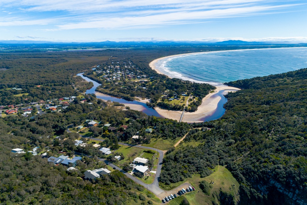
Being located almost halfway between major coastal towns of Port Macquarie and Coffs Harbour, Hat Head National Park is a popular spot for many outdoor activities, including hiking, swimming, surfing, fishing, and camping.
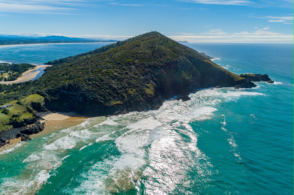
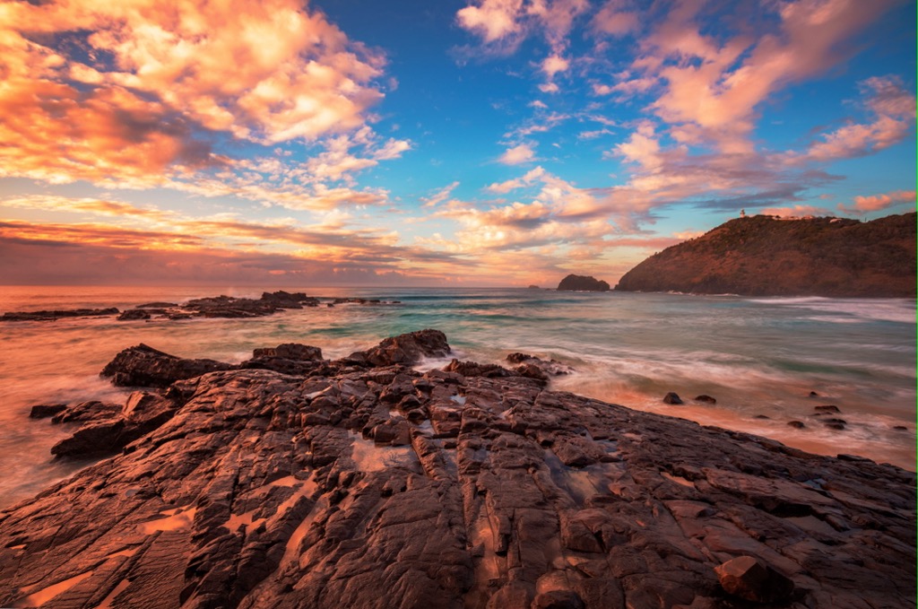
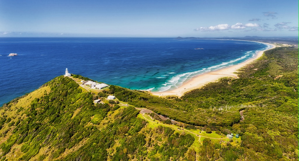
The coastal headlands that dominate Hat Head National Park are Permian sedimentary rock with a small outcrop of Permian granite. The Smoky Cape Range is the dominant feature of the park, with Big Smoky (313 m / 1027 ft) and Little Smoky (216 m / 708 ft) the two prominent peaks, joined together by a north-south ridgeline.
The northern part of Smoky Cape Range is composed of intruded rock types adamellite and aplite, while the southern part is composed mostly of sedimentary rocks from the Kempsey Beds. The contact zone of both rock types is visible just north of Gap Beach.
Behind the two main beaches in the park, Smoky and Killick Beaches, there are extensive sand dunes which run into narrow freshwater wetlands. The dunes are slowly pushing further inland and intruding on the wetlands by up to a meter (3.3 ft) per year.
Hat Head National Park has rich biodiversity, known in particular for its marine animals and birdlife. It is part of the much bigger Hastings-Macleay Important Bird Area, which runs along a portion of the Mid North Coast of New South Wales. It’s home to kookaburras, herons, fantails, egrets, glossy black cockatoos, black swans, and honeyeaters, as well as hawks, falcons and eagles soaring above the capes.
In terms of wildlife, you can find swamp wallabies, eastern grey kangaroos, sugar gliders, short-beaked echidna and grey-headed flying fox. The regent skipper butterfly can only be found in Hat Head National Park and nearby Limeburners Creek National Park.
During the cooler months from August to October, you may also be able to spot whales off the coast on their southern migration. Humpbacks and southern right whales are the most commonly spotted. Hat Head National Park is known as one of the best whale watching locations in the Mid North Coast region.
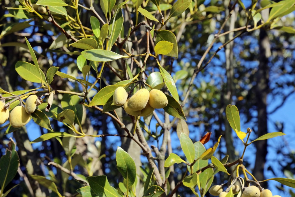
The variety of flora found in the park make it a fascinating place to explore. From the coastal grasslands to inland wetlands and mangroves, the variety is quite extensive. The higher areas along the cliffs are dominated by eucalypt woodlands, with more moist rainforest and subtropical plant species like palm forests found lower down.
Hat Head National Park is located on the custodial land of the Dunghutti Aboriginal people. The area remains a significant place for the Traditional Owners, as it still contains important ceremonial grounds, burial sites, and campsites. Some of the shield trees on display in the Australian Museum in Sydney were originally removed from the Smoky Cape Range.
In May 1770, Captain James Cook sailed along Australia’s east coast. He named it Smoky Cape because of the fires he saw on the headland. It wasn’t until 1817 that the first European, John Oxley, traversed the area on land.
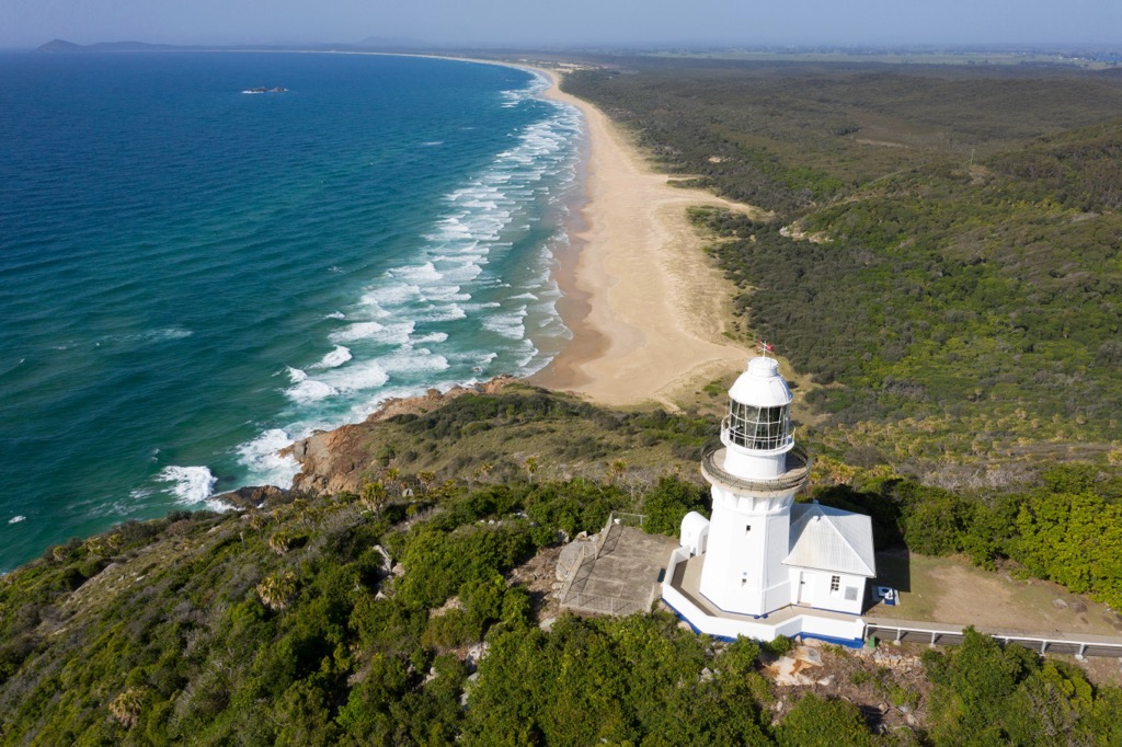
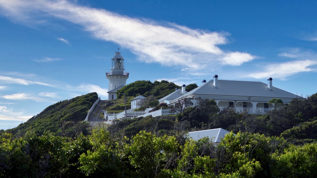
In 1891, Smoky Cape Lighthouse was built on the narrow headland known as Smoky Cape, now inside the national park boundary. It was one of the last to be designed by the Colonial Architect, James Barnet. Standing tall on the cape, its light is the highest in New South Wales. In 1962, the light was electrified and in 1988, it was fully automated, rendering the traditional keeper’s job obsolete. In 1998, the lighthouse was opened for visitors by NSW Parks and Wildlife Service, and the Keeper’s Cottage is now available to rent.
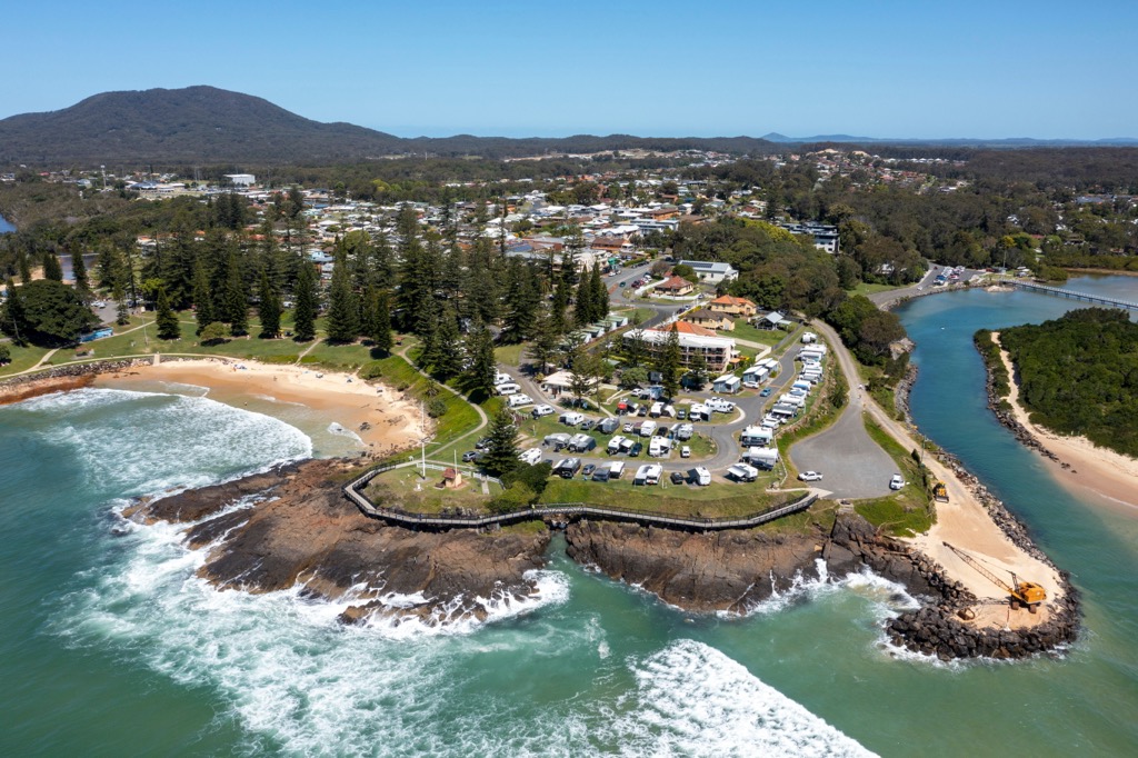
Just outside of Hat Head National Park, you’ll find the remnants of Trial Bay Gaol. The gaol opened in 1886 and its prisoners were used to construct a breakwater to make the bay a safe harbour between Sydney and Brisbane. The concept failed, but the remains can be seen from the guard tower.
During World War I, the gaol was used as an internment camp for people of German descent who were feared to be enemy sympathizers. The camp was eventually closed in 1918 and was dismantled in 1922. It was then resurrected and declared a recreation area in 1946. It’s now surrounded by a lovely campground used by people visiting Hat Head National Park.
Hat Head National Park was reserved for protection as a national park in 1972.
Hat Head National Park is home to various walking trails, between beaches and headlands, including Smoky Cape Lighthouse. With short trails to lookouts to longer day hikes joining one cape to the next, there’s plenty of options for everyone.
Here are some of the best hikes to do in Hat Head National Park on your next visit.
For adventurous hikers looking for a challenge, the Smoky Cape Range Walking Track is one of the longest tracks in the national park. It takes you from Little Bay all the way to Smoky Cape Lighthouse. It’s a beautiful walk along the coast and through the dense forest as you climb up and down the folds of the land.
Once you make it to Smoky Cape, you’ll be rewarded with magnificent views across the ocean from the Smoky Cape Lighthouse and Captain Cook Lookout. This walk is 6 km (3.7 mi) one way, but unless you have two cars, you’ll have to return the same way, making it a decent 4-5 hour effort.
There are options along the way to take extra detours to Gap Beach and Green Island Track, if you want to extend your walk.
This rough walking track will take you to a secluded beach known as Gap Beach. Starting from Little Bay, you’ll be able to follow the Smoky Cape Range Walking Track at first, until the turn-off to Gap Beach. It’s a very steep walk down to the beach, but the wonderful spot is perfect for a break, before the return trek. The beach is popular with 4x4 drivers and fishermen.
This walk is 5.5 km (3.4 mi) return and should be reserved for moderately fit hikers.
Another moderate hike in the national park, Green Island Walking Track takes you out to an incredible viewpoint on the edge of the coast. From there, you’ll be able to see Green Island, as well as the Smoky Cape Lighthouse. It’s also a great walk for keen birdwatchers, as it’s common to spot shore birds such as egrets, spoonbills and pied oystercatchers.
First, you’ll have to follow the Smoky Cape Range Walking Track from Little Bay, before reaching the turn-off for the Green Island Lookout. A return hike is 8.5 km (5.3 mi) or around 3 hours.
At the southern end of the park, this walking track around Hat Head is a wonderful short walk to do for all ages. You’ll get panoramic coastal views as you encircle the headland on the skinny walking trail. If you’re visiting in the cooler autumn months, you may also spot whales off the coast as you take your time following the 3.2 km (2 mi) loop.
Heading south from Hat Head, Connors Track is a longer option that offers wonderful views of the national park looking south. Tracing the coastline, the walking trail heads to two different beaches frequented by fishermen, O’Connors Beach and Third Beach.
It then heads to Kemps Corner, where you’ll find a small cape offering the perfect spot for a picnic lunch while attempting to spot some whales off the coast. From there, you can also look south to the impressive sand dunes of Hat Head National Park.
The 6.5 km (4 mi) return walk can either be started at The Gap Carpark on Hat Head or Hungry Gate Campground.
If you want to relax and spend more than a day in Hat Head National Park, there are plenty of accommodation options. Camping is a popular pastime in the park, with three different campgrounds to choose from. Otherwise, there are also a couple of cottages within the national park to stay. All sites require booking through the NSW National Parks and Wildlife Service website.
The campgrounds in Hat Head National Park include:
Just outside the Hat Head National Park boundary, this large campground is a popular base for exploring the park and coast.
If you prefer something more comfortable, then you can try booking one of the cottages available.
Hat Head National Park is a very accessible park, from various towns and cities on the east coast of Australia. You can easily stock up on supplies or stay in a nearby town for convenience.
These are the main towns near Hat Head National Park:
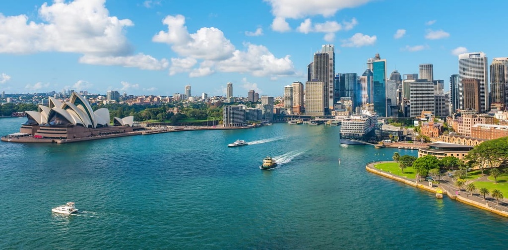
Being on the Mid North Coast of New South Wales, Hat Head National Park is close to both Sydney and Brisbane. No matter which east coast city you’re beginning your road trip from, Hat Head is not too far away.
As Australia’s largest city and capital of New South Wales, Sydney is well-known for its famous harbor and surrounding coastline and beaches. There are plenty of attractions in the city, including the Sydney Opera House, Sydney Bridge, Darling Harbor, Royal Botanic Garden, and Bondi Beach. There are also plenty of famous national parks on the city’s doorstep, including Royal National Park and Blue Mountains National Park.
Hat Head National Park is located 462 km (287 mi) north of the city center of Sydney. It’s the perfect destination for a North Coast road trip, with many places to stop en route.
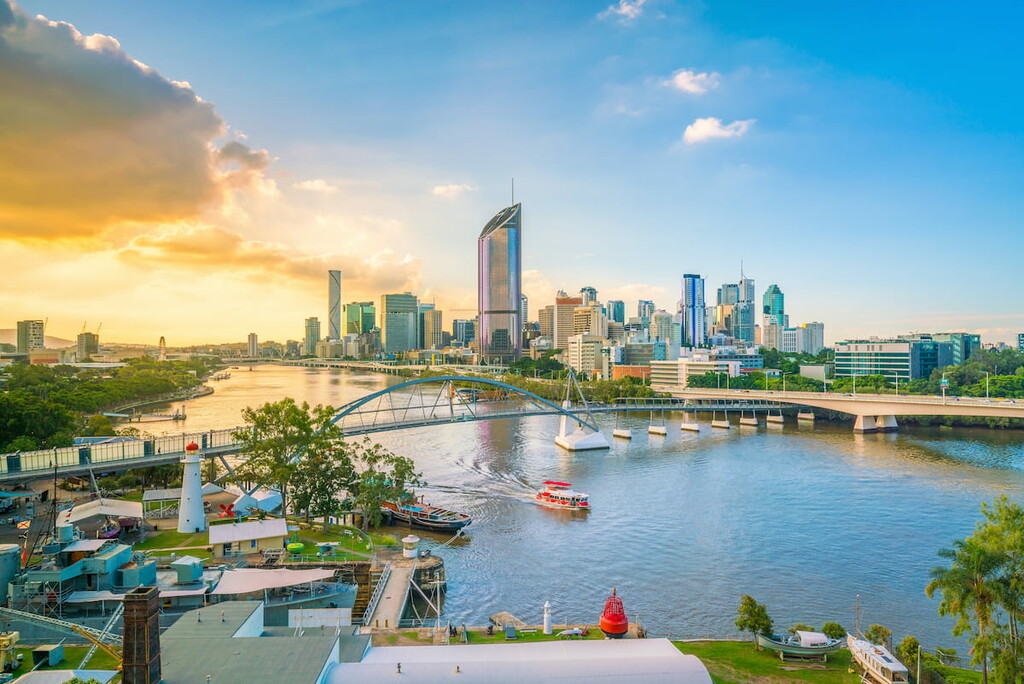
The next major city close to Hat Head National Park is Brisbane, which is located across the state border in Queensland. The park is situated just 493 km (306 mi) to the south of Brisbane city center, making it a nice road trip destination down the coast.
Brisbane has a domestic and international airport and is easily accessible by road on major national highways. This means you can easily use Brisbane as a starting point for your trip to the Mid North Coast of New South Wales.
Additionally, Brisbane is the capital of the state of Queensland, and it’s located on the eastern coast of Australia along the banks of the Brisbane River. It’s a laid-back city that is best known for its proximity to other national parks, such as Lamington National Park, Springbrook National Park, Border Ranges National Park, and Mount Barney National Park.


The highest peak in Hat Head National Park is Big Smoky, at 313 m.
Notable peaks in Hat Head National Park include Big Smoky, Little Smoky, Hat Hill and Hungry Hill.


