
Scan the QR code and open PeakVisor on your phone
Nestled in southern Spain, Geoparque de Granada (Granada Geopark) is a stunning outdoor recreation destination located just outside the city of Granada. The park contains 666 named mountains, the highest and most prominent of which is La Sagra at 2,386 m (7,821 ft) in elevation and 1415 m (4,642 ft) of prominence.
Geoparque de Granada is situated in the southern region of Spain in the province of Granada. The expansive park spans 4,722 square kilometers (1,823 square miles) across southern Spain, though it is actually a network of numerous smaller protected parks and the land between them rather than its own contiguous area.
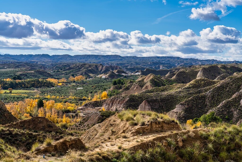
Because the park spans across such a large region of land, there are a diverse amount of landscapes, much of which is classified as semi-desert.
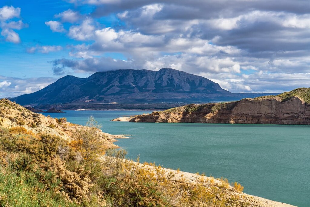
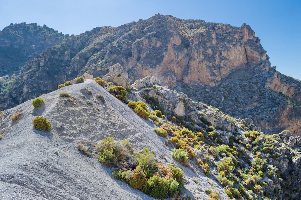
The Sierra Nevada mountains (not to be confused with the Sierra Nevada of California and Nevada in the United States) run throughout the park, as does a network of badlands and steep gullies.
Furthermore, some canyons in the park reach depths of 250 m (820 ft). Many of the canyons in the park are marked by fertile plains on either side. Many of the badlands of the park have rugged red-colored rock formations.
Additionally, Geoparque de Granada is located near a large number of other popular outdoor recreation areas.
This includes the Parque Natural Sierra de Andújar (Sierra de Andújar Natural Park) and Parque Natural Sierra de Cardeña y Montoro (Sierra de Cardeña y Montoro Natural Park) to the northwest as well as Parque Natural de la Sierra de Cazorla, Segura, y las Villas (Sierras de Cazorla, Segura y Las Villas Natural Park) to the north.
Boasting a collection of stunning topographical features, the bulk of what we see today in Geoparque de Granada formed over the course of the last 5 million years.
Much of the land that is now in the park was recently part of the floor of an ancient inland sea. Over the course of millions of years, the sediments that collected at the bottom of this sea floor consolidated and formed the many sedimentary rocks that we see in the park today.
In fact, Geoparque de Granada is now home to one of Europe’s best-preserved layers of sediment from the last 5 million years, making it a vital resource for geologists in the region. Erosion of these sedimentary rocks over the course of millions of years also resulted in the valleys, badlands, and gullies that we now find in the park.
Major peaks within the park include La Sagra, Morro del Buitre, Mojón Alto o Tornajuelos, and Cerro Jabalcón.
The flora and fauna of the region varies greatly from one section of the park to another.
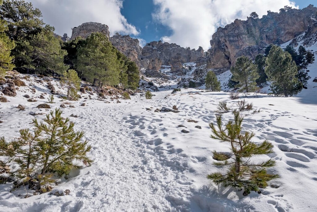
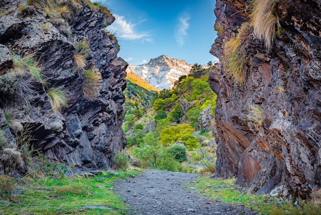
Indeed, some sections are marked by the rugged limestone peaks of the Sierra Nevada while forests of oak and maple span up to the foothills. Higher elevations are home to Aleppo pine and black pine trees.
The park is a particularly biodiverse area. In fact, the park is home to both a wide variety of native plants and grasses, which are found along the plateaus and with the deep gullies of the land. However, other regions of the park are used for commercial farming, so they may not have as many native plant species as other sections.
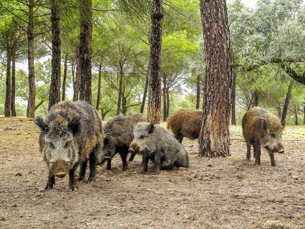
Animals can be found at all elevations in the park. Some of the most common wildlife in the park includes wild boar, sheep, Iberian ibex, and deer. Foxes and badgers also live throughout the park though they are not seen as regularly.
The skies of the park are home to a wide range of bird species. Golden eagles, royal owls, along with other birds of prey are quite common in the park.
The region in and around Geoparque de Granada was inhabited by humans for thousands of years before the park was established in 2020.
For thousands of years many of the caves within the park boundaries had been inhabited, particularly before and during the early Middle Ages.
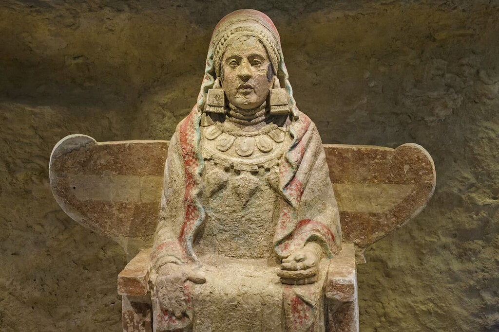
In fact, just outside the city of Baza within the geopark, there is a famous archeological site known as Basti, which is an ancient Iberian Roman fortified town and necropolis. Although there is some debate as to when the town was founded, some researchers believe that it was established between the eighth and fourth centuries BCE.
The town quickly became a walled settlement that was then developed into a sizable village by the Romans when they arrived in the third century BCE. However, the town was abandoned during the fourth century CE when the residents moved to a nearby site that was easier to defend from attackers.
Interestingly, Basti is particularly famous for being the home of the Dama de Baza (Lady of Baza), a beautiful limestone sculpture that dates back to the fourth century BCE. The sculpture was discovered in 1971 and it is now found at the National Archaeological Museum in Madrid.
The park became an UNESCO Global Geopark in 2020 because of the rich human history of the land. However, the process of becoming a geopark was long and arduous. Local organizations, including the Provincial Council of Granada and the Geological and Mining Institute of Spain worked for years to help the park gain approval from UNESCO.
Geoparque de Granada is home to numerous trails. Here are some of the top hiking areas to visit in the park:
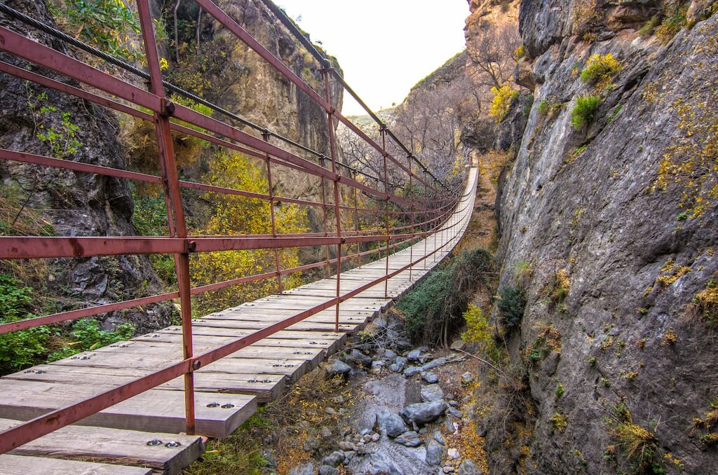
The most popular hike in the park is the Cahorros de Monachil. The loop trail is 7.2 km (4.5 miles) and has 363 m (1,191 ft) elevation gain. The hike begins in the city of Monachil and passes along waterfalls, bridges, Las Palomas cave, and river banks. Wildflowers and fruit trees adorn the popular hike through the park.
The Circular del Rio Monachil is also located near the city of Monachil. The loop trail totals 9.8 km (6.1 miles) with 633 m (2,076 ft) elevation gain. The trail follows along the riverbed below before climbing up to a viewpoint above the forest and gullies down below.
Located along the northern end of the Sierra Nevada National Park, the Vereda de la Estrella is a 16 km (10 miles) long route with 946 m (3,103 ft) of elevation gain. The loop hike offers stunning views of the Sierra Nevada range. This longer route passes through sections of dense forests, water ways, iconic 100-year-old chestnut trees, and even abandoned mining locations.
Looking for a place to stay near Geoparque de Granada? Here are some of the best cities and villages to check out in the region:
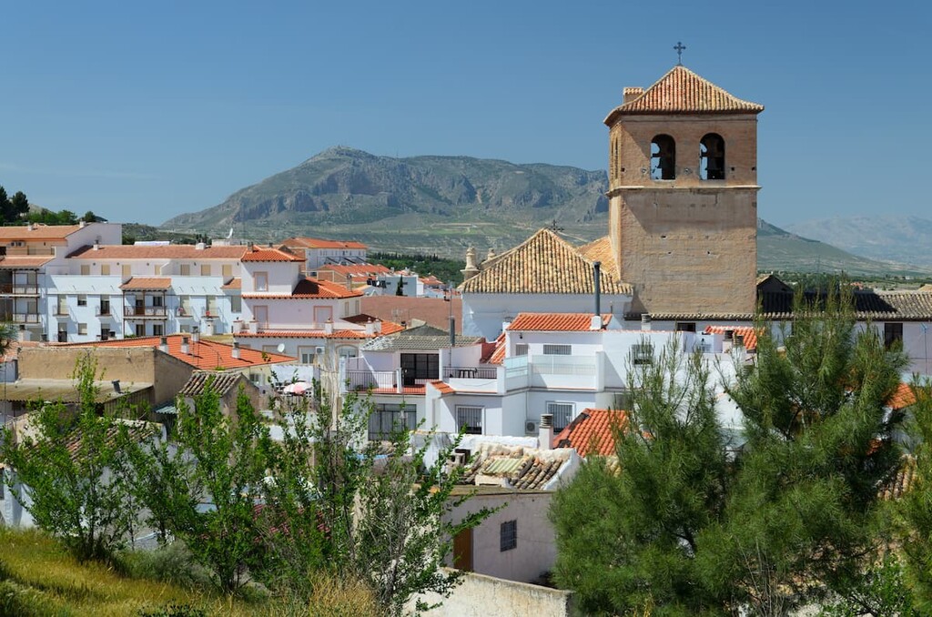
The city of Baza is located within the boundaries of Geoparque de Granada. It has a population of around 22,000 and it is situated in one of the major valleys of the Sierra Nevada range. The town shares the name of the Sierra de Baza nearby.
The Lady of Baza, a prehistoric artifact, was discovered in the city during the 1970s. Humans have inhabited the region of Baza for thousands of years and today the small city is known for being a quaint community not far from Granada.
The city Granada is the capital of the province of Granada. The urban population is around 475,000, making it the thirteenth largest community in Spain. Granada is surrounded by mountain ranges that sit on the Vega de Granada plain.
Granada is known for being the cultural and historical hub of the region and province, home to numerous museums and festivals. The city is also home to numerous parks including the gardens of Alhambra and Generalife, and the Federico García Lorca Park.


