Scan the QR code and open PeakVisor on your phone
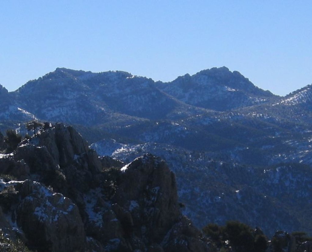
Nestled in southern Spain, lies Parque Natural de la Sierra de Cazorla, Segura, y las Villas (Sierra de Cazorla, Segura, y las Villas Natural Park); a stunning outdoor recreation destination known for its forested peaks and deep valleys. The park contains 356 named mountains with Empanada being the highest at 2,105 m (6,906 ft). The most prominent mountain is Blancillo with 638 m (2,093 ft) of prominence.
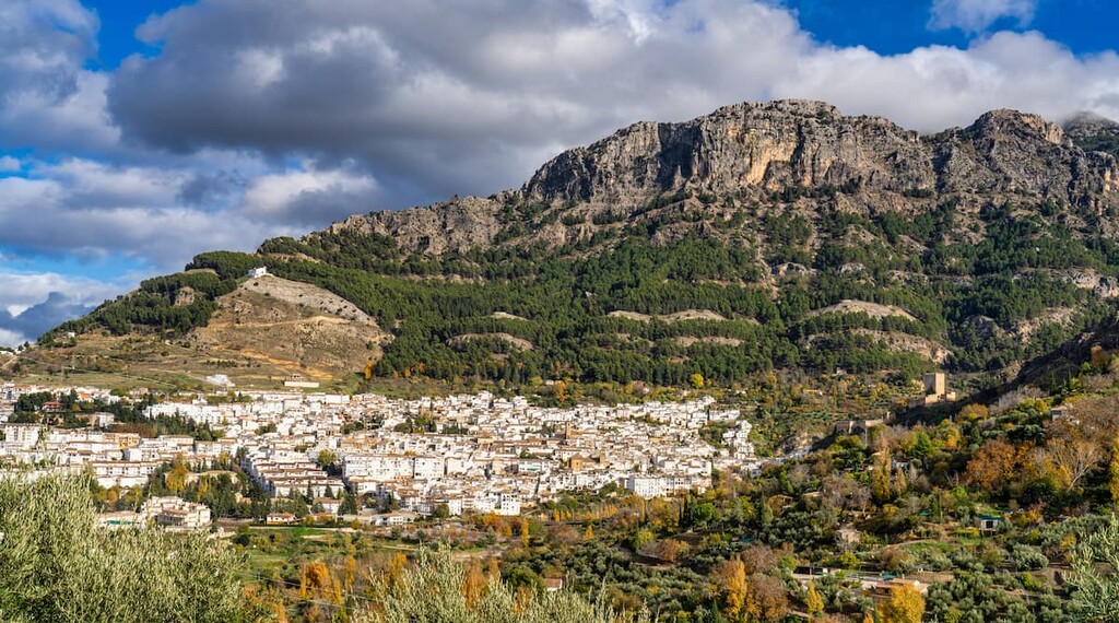
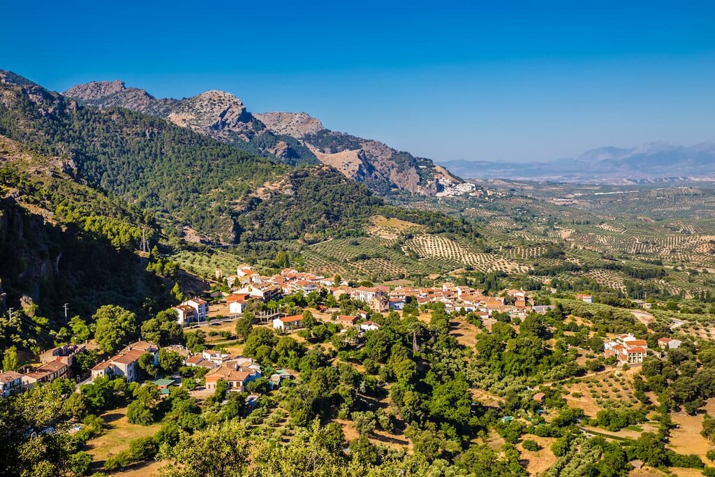
Parque Natural de la Sierra de Cazorla, Segura, y las Villas is situated in the southern region of Spain in the Jaén province. Both the Sierra de Cazorla and the Sierra de Segura mountain ranges run throughout the park. Between the two ranges lie numerous valleys and plains full of communities, open fields, and pristine lakes.
Elevations in the Parque Natural de la Sierra de Cazorla, Segura, y las Villas range from around 500 m (1,640 ft) up to the summit of Empanada. The park spans 2,099 square kilometers (810 square miles) across southern Spain.
Additionally, Parque Natural de la Sierra de Cazorla, Segura, y las Villas is located near a large number of other popular outdoor recreation areas. This includes the Sierra Nevada National Park (Parque Nacional de Sierra Nevada) to the southwest, Cabo de Gata-Níjar Natural Park (Parque Natural Cabo de Gata-Níjar) to the southeast, and the Parque Natural Sierra de Baza (Sierra de Baza Natural Park) to the south.
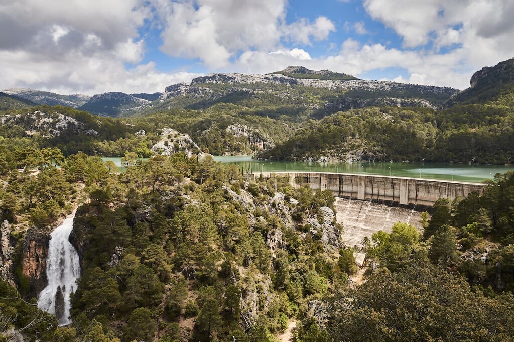
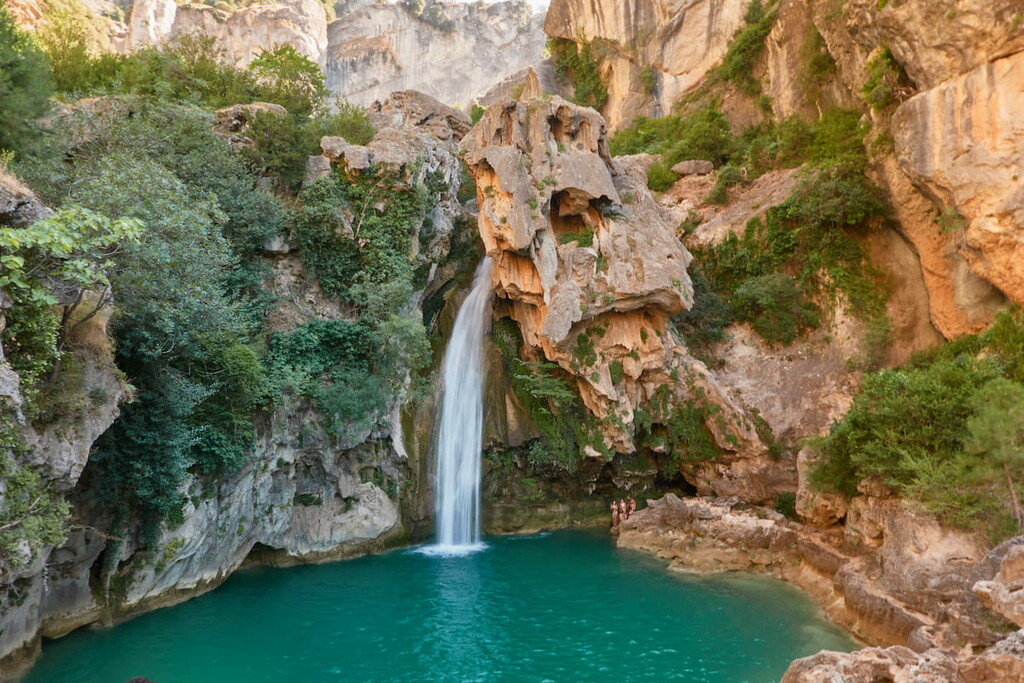
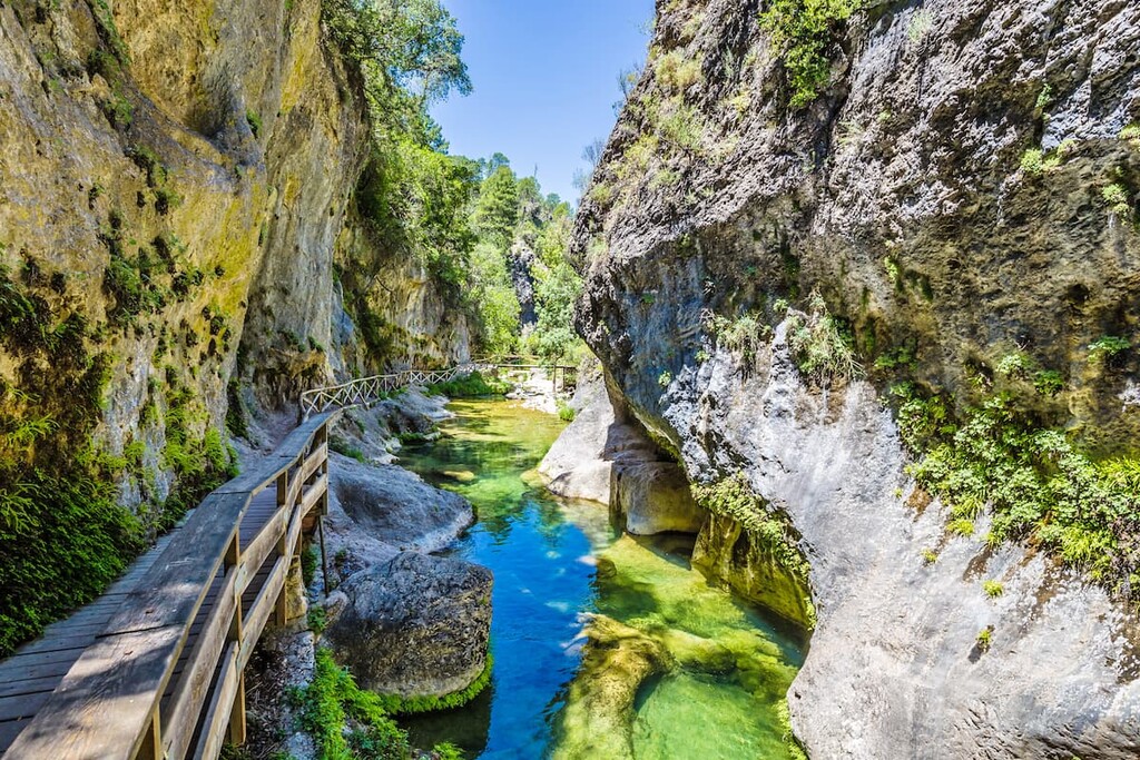
Similar to much of the surrounding landscape, the rugged peaks of the park are made of dolomitic limestone. Millions of years of erosion have left behind distinct karstic formations within the park boundaries.
One of the most iconic examples of this is what is known as La Toba. The natural stairway is made of white travertine and has numerous caves along the banks of the Segura river. Another prime example of the karstic formations can be found near the Anchuricas Reservoir.
The rugged peaks of the park were originally formed when the African and Eurasian tectonic plates collided. The sediment left along the slopes of the mountain ranges have allowed flora and fauna to flourish.
Major peaks within the park include Empanada, Blancillo, Alto de la Cabrilla, and Morra de la Vaga.
While the peaks of the park define the landscape, within the park boundaries lies the largest pine forest in all of Spain. Numerous types of pine trees are found throughout it with the most common being the European blakc pine.
At lower elevations the forest consists of Aleppo pine, mastic, and strawberry trees. At higher elevations the forest is dominated by holm oak, Portuguese oak, and maritime pine. Along the waterways are often willows, reeds, cattails, ash, providing an abundant habitat for smaller mammals.
There are over 2,100 different species of plants throughout the park and 34 that can exclusively be found within the park boundaries. The vast array of biodiversity allows for fauna to thrive as well.
Deer and abundant throughout the park along with wild boars, Spanish ibex, sheep, and fallow deer. Many of the deer species have been introduced for hunting purposes along with packs of wolves in more recent decades. The park is also home to over species of invertebrates endemic to the region.
Human civilization dates back to 2000 BCE in the region. Prehistoric Rupestrian painting has been found along the Segura River that runs through the park. Protection of the region began in the 1960s when 700 square kilometers (270 sq miles) was set aside for hunting purposes. This region was vastly expanded with the establishment of the park in 1986 to help protect and preserve biodiversity.
Parque Natural de la Sierra de Cazorla, Segura, y las Villas is home to numerous trails. Here are some of the top hiking areas to visit in the park:
The Salto de los Órganos via Rio Borosa is one of the most popular hikes in the park. The route totals 19 km (11.8 miles) with 728 m (2,388 ft) elevation gain. The trail follows along the Rio Borosa before crossing a bridge and climbing in elevation.
This route follows along the San Gines gorge, running parallel to the stream by the same name. The wide trail then winds through the iconic pine forest of the park before reaching the Collado del Perezoso. While hikers have a view of the region from this small hill, the route continues up to the summit of Blanquillo, which is also known as Pedro Miguel.
The El Aguardentero hiking route winds through one of the most scenic sections of the La Villas mountain range in the park.The trail follows along the River Aguascebas Chico that leads to a large waterfall and basin. Open fields are sprinkled throughout the route allowing for viewpoints of the massif towering above.

Looking for a place to stay near Parque Natural de la Sierra de Cazorla, Segura, y las Villas ? Here are some of the best cities and villages to check out in the region:
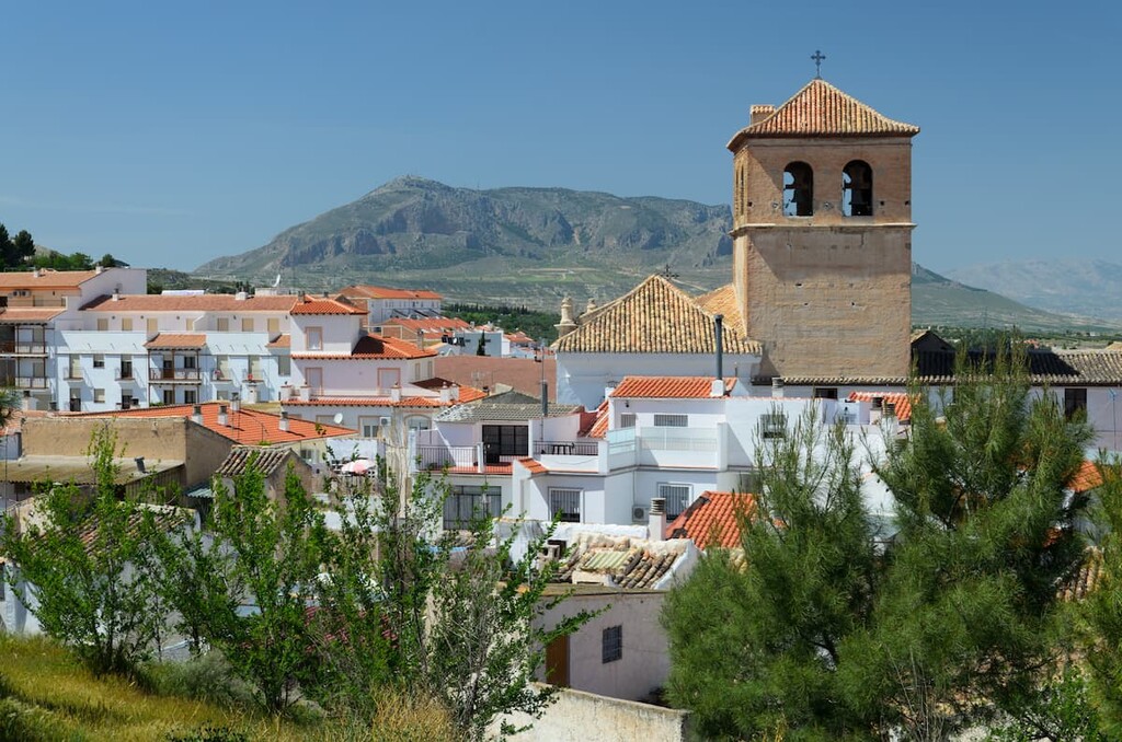
Located at the southern end of the park lies the city of Baza. The city has a population of around 22,000 and lies within the valley of the Sierra Nevada range. The town is named after the protected park which in turn was named after the iconic peaks.
The Lady of Baza, a prehistoric artifact, was discovered in the city during the 1970s. Humans have inhabited the region of Baza for thousands of years and today the small city is known for being a quaint community not far from Granada.
The city Granada is the capital of the province of Granada. The urban population is around 475,000, making it the 13th largest in Spain. Granada is surrounded by mountain ranges and sits on the Vega de Granada plain.
Granada is known for being the cultural and historical hub of the region and province, home to numerous museums and festivals. The city is also home to numerous parks including the gardens of Alhambra and Generalife, and the Federico García Lorca Park.