
Scan the QR code and open PeakVisor on your phone
Fort Sill has 67 named peaks. The highest is Mount Sherman at 670 m. Other notable peaks include Cross Mountain, Mount McKinley and Arapaho Point.
Fort Sill is a US Army post that’s located in the southwestern region of the US state of Oklahoma. Today, the fort is designated as a National Historic Landmark and is surrounded by protected land. There are 67 named peaks in the fort, the highest and most prominent of which is Mount Sherman at 2,198 ft (670 m) in elevation and with 676 ft (206 m) of prominence.
Fort Sill is situated in the southwestern corner of Oklahoma within Comanche County. The protected area that surrounds the fort covers 94,000 acres (38,000 ha) of land, including part of the Wichita Mountains.
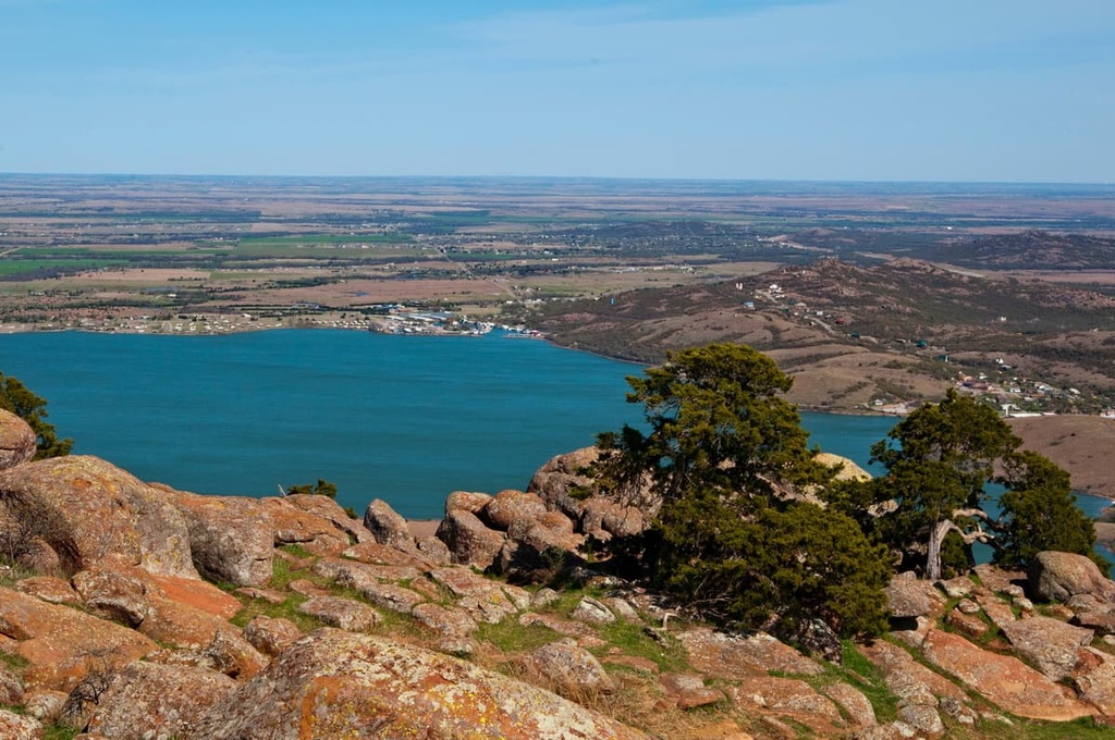
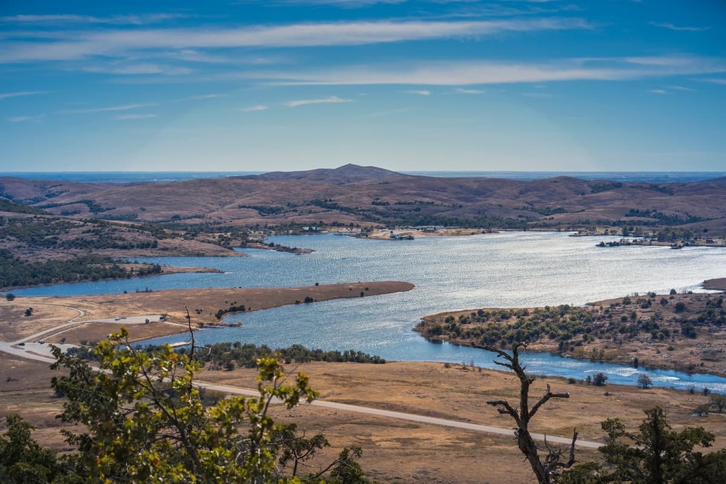
Small lakes, creeks, streams, and prairies are scattered throughout the mountainous landscape of Fort Sill. Elevations at the fort range from lows of around 400 ft (122 m) up to the summit of Mount Sherman at 2,198 ft (670 m) above sea level. Lake Lawtonka also lies just to the north of the fort’s northern boundary.
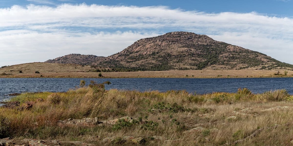
The Wichita Mountains extend to the north and west of the fort, though a majority of the fort’s protected landscape is situated in the rolling foothills of the range. Other bodies of water that are located in the region around the fort include Lake George, West Balmer Lake, Ketch Lake, Engineer Pond, and Medicine Creek.
Although it was originally established during the American Indian Wars, today, the fort serves as the home for the US Army Field Artillery School, the US Army Air Defense Artillery School, the 75th Field Artillery Brigade, and the 31st Air Defense Artillery Brigade. It also serves as an Army Basic Combat Training location. There is even a US Marine Corps Detachment stationed at Fort Sill that primarily trains Marines in artillery MOS (military occupational specialty) fields.
The fort is surrounded by a number of areas for outdoor recreation. The Wichita Mountains National Wildlife Refuge lies to the northwest of Fort Sill along with the Narrows Wilderness Area and Charon's Garden Wilderness Area. Other nearby areas of interest include Quartz Mountain State Park, Black Kettle National Grasslands, and the Lyndon B. Johnson National Grasslands to the south in the state of Texas.
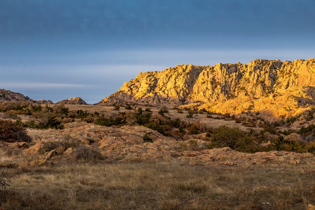
The landscape of Fort Sill is defined by the Wichita Mountains, which is one of the most rugged landscapes in the entire state. The mountains consist primarily of rhyolite, granite, and gabbro that solidified into rock around 525 million years ago.
After these rock formations solidified, the range was slowly thrusted upward between 330 and 290 million years ago, bringing them to their current height. The following millions of years slowly eroded the range, leaving behind the jagged ridgelines and steep valleys that are visible today.
Limestone, granite, sand, gravel, and dolomite are all common sights throughout the range. The surrounding region is still mined for granite. In fact, this region produces a majority of the granite that’s mined in the state of Oklahoma.
In the past, the Wichita Mountains were used for mining both iron and gold, too. However, the gold rush was short-lived, and it only lasted from around 1901 to 1904.
Major peaks located within the fort include Mount Sherman, Signal Mountain, Rabbit Hill, Mount McKinley, Carlton Mountain, and Mount Hinds.
Today, Fort Sill is home to around 53,000 residents. The relatively large population of the fort and the impact of regular military training exercises has drastically reduced the ecological diversity of the region.
That being said, native plant and animal species can be found in the Wichita Mountains National Wildlife Refuge, which lies directly to the northwest. Many of these animal species live in the more rugged portions of the Wichita Mountains.
Some of the main large mammals that live in the region include populations of elk, white-tailed deer, plains bison, and Texas longhorn cattle. The white-tailed deer have continued to thrive while these other species were reintroduced when the nearby refuge was established.
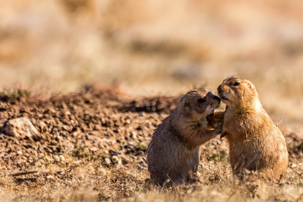
Rocky Mountain elk, nine-banded armadillos and black-tailed prairie dogs are also common in the mountainous regions in and around Fort Sill. The bison that now thrive in the range were reintroduced to the region in 1907. At the time, just 15 bison were released. Their population numbers are estimated to be around 650 individuals.
The rugged ridgelines of the Wichita Mountains feature minimal flora, as the range boasts only small amounts of lichen. The forested areas on the fort consist of bigtooth maple and various oak species. Meanwhile, the lower elevations primarily feature seasonal wildflowers and low-growing grasses.

The lands in and surrounding Fort Sill have been inhabited by humans for thousands of years. The region is part of the traditional territory of the Kiowa Indian Tribe, Comanche Nation, Apache Tribe, and Fort Sill Apache Tribe.
Historically known as the “Lords of the Plains,” the people of the Comanche Nation are closely related to other Shoshone Tribes. Around the end of the seventeenth century, the Comanche separated from the rest of the Shoshone Tribes and eventually settled throughout what is now southwestern Oklahoma.
The Comanche people are known for their early mastery of horseback riding, which historically enabled them to travel throughout the Wichita Mountains and surrounding Great Plains. The tribe would also breed horses and use them regularly when trading.
Though they are recognized as one nation today, traditionally, the Comanche people did not form a unified nation. Rather, they consisted of small bands who shared a similar language and belief system.
As US settlers began traveling westward, they came into contact with the Indigenous peoples who were living in the region. The settlers regularly tried to attack, displace and kill the various tribes of the region, which resulted in frequent outbreaks of violence.
This series of battles was part of American Indian Wars, most of which occurred between 1609 and 1924. In the early 1800s, the arrival of European diseases such as smallpox and measles decimated the tribes as they had no natural immunity to these illnesses.
In 1869, the US government scoped out Fort Sill as a camp to further attack and displace the Indigenous tribes who were living in the region. During this time, the US began forcing the tribes onto reservations via the Treaty of Medicine Lodge.
The Comanche resisted the US efforts in a series of battles that was later known as the Second Battle of the Adobe Walls. In 1874, following the Red River War, the remaining Comanche, Apache, Kiowa, Arapaho, and Cheyenne people were forced onto a single reservation that covered less than 5,000 sq. miles (13,000 sq. km) of terrain.
In the following decade, settlers hunted the region’s buffalo to the verge of extinction. This ultimately forced the Tribes to end their hunting practices and traditional ways of life. The remaining Comanche surrendered in 1875 and were forced to move to the Fort Sill Reservation in Oklahoma.
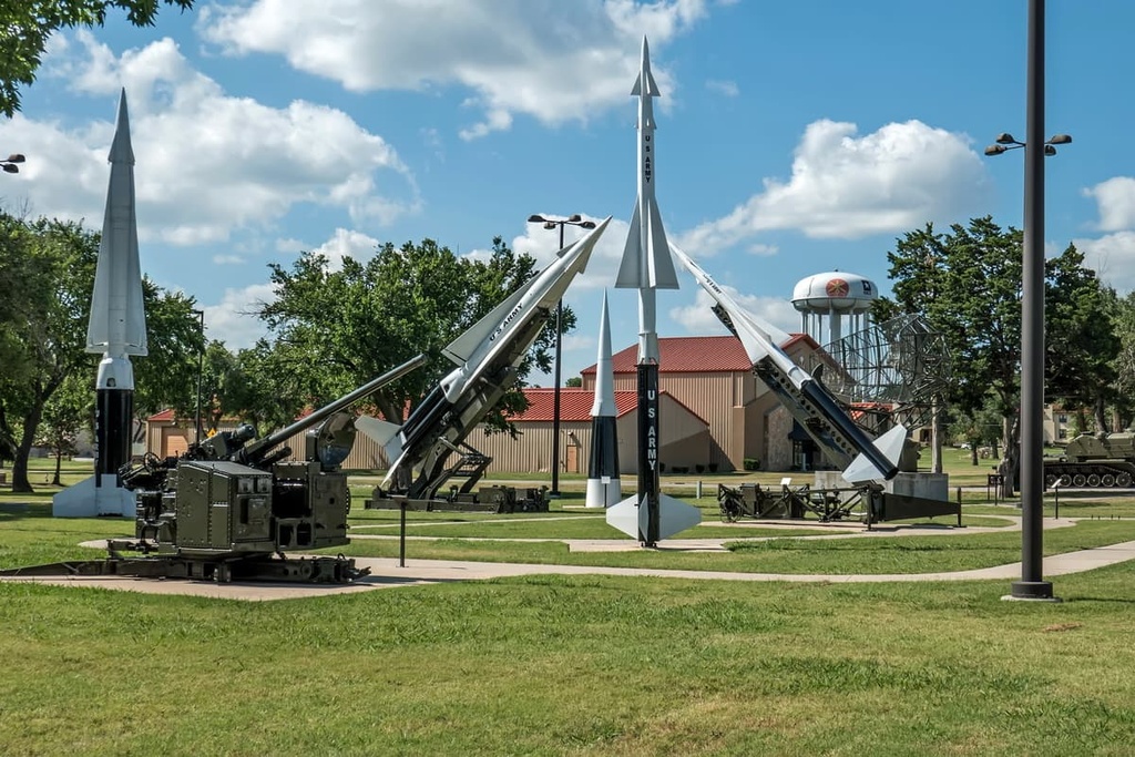
Fort Sill has also served as an important military post since the early twentieth century. The first artillery battery to be stationed at Fort Sill arrived in 1902. In 1911, the US Army Field Artillery School was also opened at Fort Sill, where it continues to operate to this day.
Over the years, many units and specialty training schools have been stationed at Fort Sill. The current residents of the fort include the US Army Field Artillery School, the US Army Air Defense Artillery School, the 75th Field Artillery Brigade, and the 31st Air Defense Artillery Brigade. The US Army also uses the fort as one of its Army Basic Combat Training locations and the Marine Corps uses it for field artillery training.
Fort Sill currently has around 53,000 residents, which includes around 20,000 military personnel and 33,000 military family members. This makes it one of the largest communities in the immediate area.
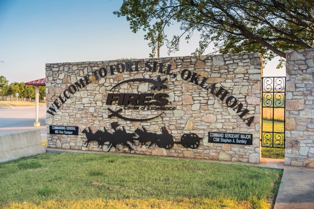
As is the case with many military bases, access to Fort Sill is highly restricted and the military base itself isn’t generally open to the public. However, since the fort is also a national historic site, there are some areas that visitors can check out during the Fort Sill National Historic Landmark and Museum’s open hours.
If you want to visit Fort Sill, you need to get a visitor access pass card. You can get a pass card from the Visitors Control Center on your way to the historic site or anywhere else on post. However, getting an access pass requires completing a background check, so doing it on the day of your trip can add quite a bit of time to your journey. You can normally apply for a pass in advance, but check the Fort Sill website for more detailed instructions.
A majority of the hiking trails in the Fort Sill region can be found in Wichita Mountains National Wildlife Refuge as the fort itself isn’t typically open to hikers. If you are hiking in the area around the fort, be sure to stay well away from the fort’s official boundaries so that you do not accidentally trespass on restricted federal land.
With that in mind, here are a few hikes that you can find in the area around Fort Sill that are worth checking out during your next visit to the region.
The Martha Songbird Nature Trail is a short loop hike that is located at Fort Sill. This gentle trail follows a well-established path through a park and features multiple educational signs. Hikers on this trail have the opportunity to view the native flora and fauna of the region.
This trail is situated along the northern edge of the community of Lawton, and it is 0.8 miles (1.3 km) in length. The route was named after the last-known passenger pigeon, Martha, who died in 1914.
The Medicine Park Orange Trail Loop is located along the northern border of Fort Sill near the shores of Lake Lawtonka. This loop trail winds its way through towering rock formations, grasses, shrubs, and wildflowers.
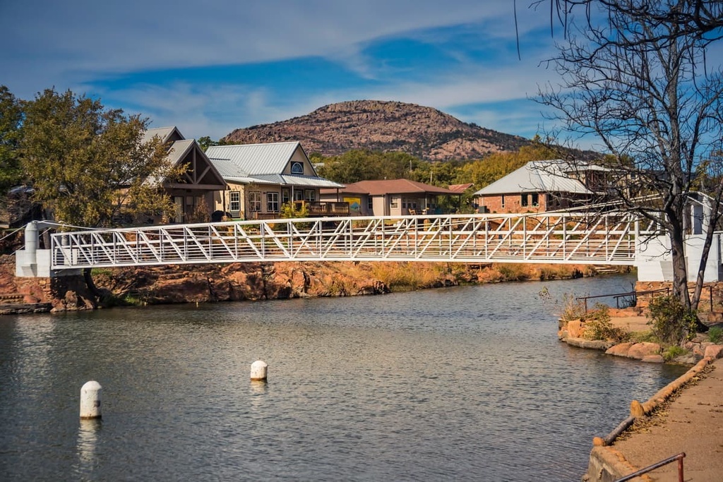
From this trail, you can enjoy views of Lake Lawtonka and the Wichita Mountains. This loop trail is 2.5 miles (4 km) in length and it has 255 feet (78 m) of elevation gain. Hikers on this trail also have the option of extending the route to include some of the other paths that are found in Medicine Park.
Elmer Thomas Park is a community recreation area that’s situated in the heart of Lawton. The park offers a number of trails, including its namesake Outer Loop.
While parts of this trail are paved, hikers can also explore the numerous other gravel trails that wind through the center of the park. Native plants and animals can often be spotted throughout this region, too, making it a nice option for a family outing.
This paved pathway passes along the shores of Lake Helen. In total, the Elmer Thomas Park Outer Loop trail is 1.8 miles (2.9 km) in length and it has 52 feet (16 m) of elevation gain.
Looking for a place to stay near Fort Sill? Here are some of the best cities and towns to check out in the region.
The city of Lawton lies just south of Fort Sill. The headquarters for the Comanche Nation are situated in the city while Wichita Mountains National Wildlife Refuge lies just to the northwest. As it is home to around 95,000 residents, Lawton is the fifth-largest city in Oklahoma.
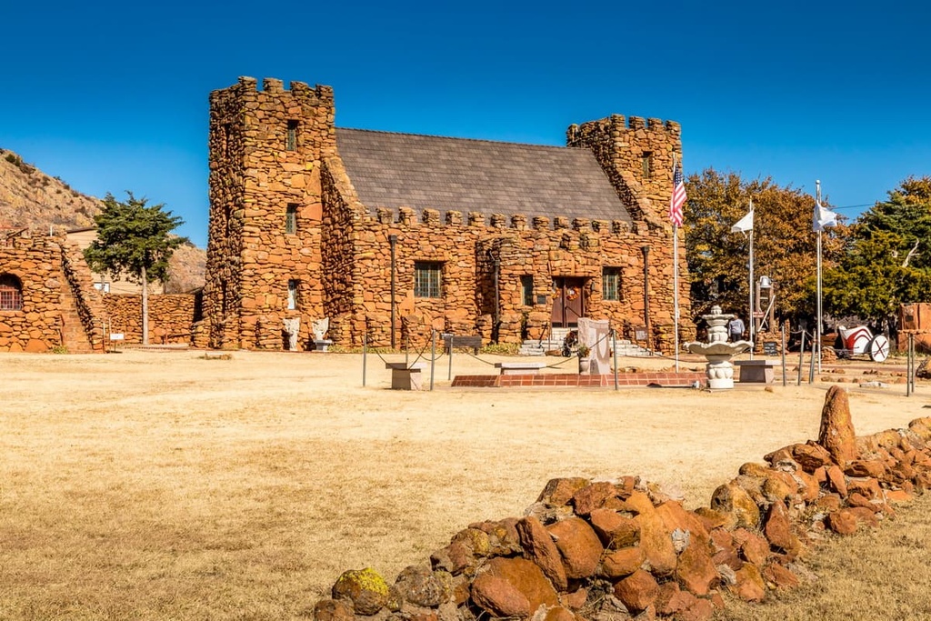
The close proximity of Lawton to the Wichita Mountains has made the city a common stopping point for those visiting the region. Downtown Lawton is home to the Comanche National Museum and Cultural Center and the Museum of the Great Plains.
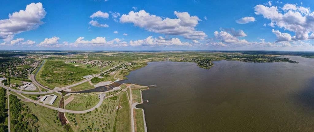
Additionally, the many lakes that surround Lawton, including Elmer Thomas Lake, Lake Ellsworth, and Lake Lawtonka, provide residents and visitors alike with ample opportunities of fishing, swimming, boating, and camping.
Wichita Falls, Texas lies an hour’s drive to the south of Lawton. Home to 104,000 residents, Wichita Falls is the closest major city to Fort Sill. Local breweries, art galleries, and coffee shops line the downtown streets of Lawton alongside numerous art murals.
Besides its relatively close proximity to the Wichita Mountains, Wichita Falls is also known as a popular place for cyclists. Mountain biking trails, such as the Wee-chi-tah Trail, that follow the Wichita River, are also located within the city limits. Every year, the city also hosts the Hotter’ N Hell Hundred, which is the largest 100-mi (160 km) bike ride in the country that’s completed in a single day.
Oklahoma City, Oklahoma, lies to the northeast of Fort Sill. The city is home to over 680,000 residents, and it is both the most populous city and the capital of the state of Oklahoma.
The downtown streets of Oklahoma City are home to the National Cowboy and Western Heritage Museum, Oklahoma City National Memorial and Museum, Oklahoma City Museum of Art, and Scissortail Park. The Stockyards City is a part of Oklahoma City that is modeled to look like the “Wild West,” making it a popular attraction for tourists.

The Oklahoma River runs through the city, allowing for kayaking and white-water rafting opportunities in the surrounding region. Hiking trails are common in the parks surrounding the city, too, so there’s plenty for everyone to love during a trip to the region.


The highest peak in Fort Sill is Mount Sherman, at 670 m.
Notable peaks in Fort Sill include Mount Sherman, Cross Mountain, Mount McKinley, Arapaho Point and Costain Hill.


