Scan the QR code and open PeakVisor on your phone
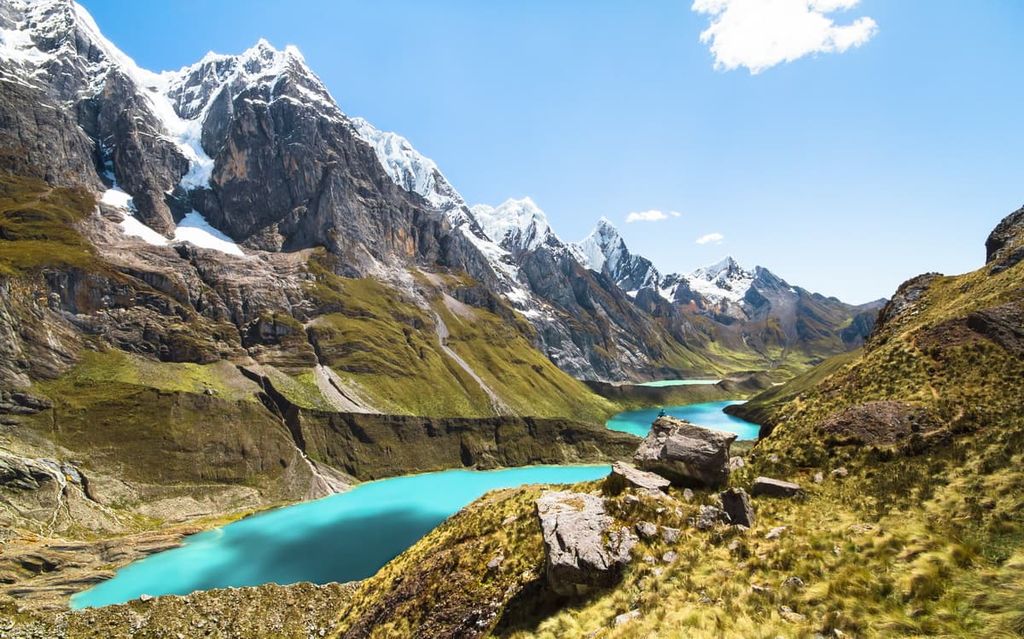
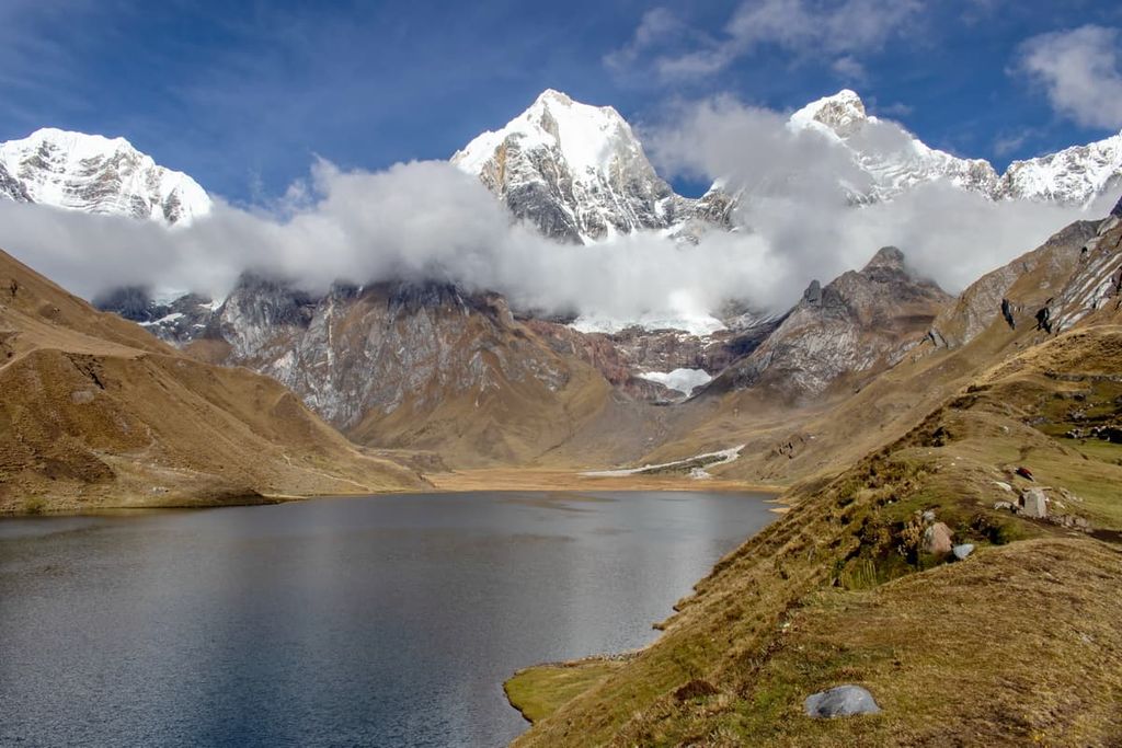
Protecting one of the most stunning mountain ranges in the world, the Cordillera Huayhuash Reserved Zone encompasses 106 peaks in the central Andes of Peru, including seven peaks above 6,000 meters (19,685 ft). At 6,635 m (21,768 ft), Yerupajá is the tallest mountain in the reserved zone and the highest point in the entire Amazon watershed.
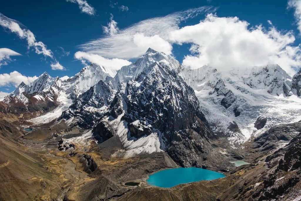
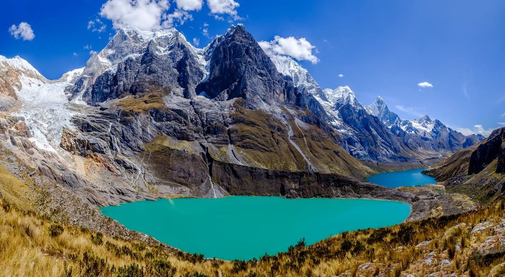
The Cordillera Huayhuash lies within the Andes of central Peru along the boundaries of the departments of Áncash, Lima, and Huánuco. While the range forms a cluster of peaks only about 30 km (18 mi) in diameter, they’re considered some of the most beautiful mountains anywhere in South America.
The alpine routes in the Cordillera Huayhuash have a reputation as some of the most dangerous and technical on the continent, particularly on Jirishanca, Siula Grande, and the range’s high point, Yerupajá. At the time it was first summited in 1950, Yerupajá was the highest unclimbed peak outside of Asia.
The Cordillera Huayhuash Reserved Zone, which was officially designated in 2002, covers 67,500 ha (ac.) of high-alpine territory. The reserved zone protects communally-owned lands belonging to the local communities in the Huayhuash. The local residents use the high mountain areas for grazing livestock.
In the reserved zone, scientific, recreational, and traditional economic activities are allowed, while mining and large-scale development is prohibited. The local communities manage their respective areas and collect small fees from hikers for the use of their land.
In contrast to the more famous Huascarán National Park, which is located some 50 km (30 mi) to the north, the Cordillera Huayhuash features fewer low alpine valleys and has a higher average elevation. Even valley floors in this area exceed 3,000 m (9,842 ft) and there are multiple passes above 5,000 m (16,400 ft). Much of the reserved zone is above the snowline, which lies at around 5,000 m (16,400 ft).
This rugged terrain and the difficulty of access in the region mean the mountains in the reserved zone have been left mostly untouched by both locals and visitors. Tourist infrastructure is still extremely minimal in the reserved zone, although the number of visitors increases every year.
In past decades, the Cordillera Huayhuash was a stronghold of the Shining Path (Sendero Luminoso) guerilla group. Nevertheless, the range has been largely safe for tourists since the early 2000s, thanks in part to the local villagers instituting a system of escorts and small protection payments for hikers passing through the range. Remains of a guerilla camp can still be seen near Lake Viconga.
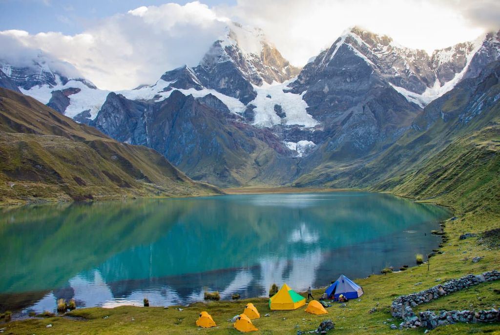
Visiting the Cordillera Huayhuash means trekking or climbing in it—there are no cable cars or mountain lodges here. The most popular way to see the range is the Huayhuash Circuit, a 130+ km (80+ mi) loop that circumnavigates the mountains. There’s both a high alpine route and a lower elevation route for trekkers to choose from.
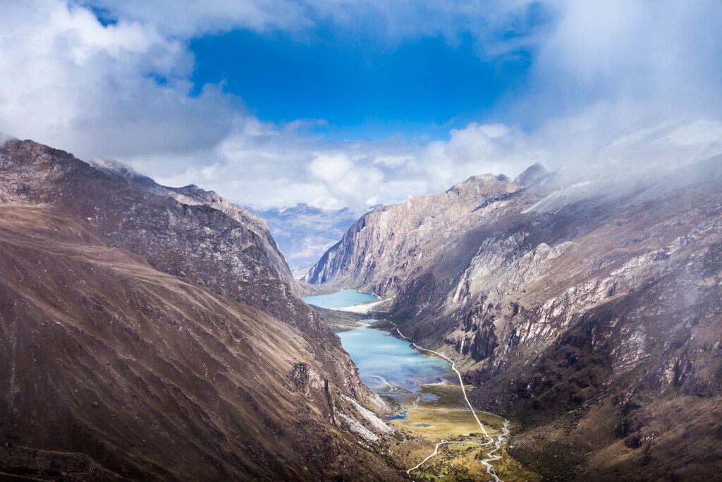
The Cordillera Huayhuash Reserved Zone is located right in the heart of the central Andes, surrounded by world-class hiking and climbing opportunities. Huascarán National Park, which is home to Peru’s highest mountain Huascarán Sur, is only about 50 km (30 mi) to the north.
If you’re looking for additional adventure, Huascarán National Park park is a popular destination to visit if you want to acclimatize and warm up on some of the less challenging peaks in the Cordillera Blanca before heading to the Cordillera Huayhuash Reserved Zone.
The Cordillera Huayhuash is a subrange of the Andes, the longest mountain range in the world. While the Andes run almost 7,000 km (4,350 mi) down the entire western coast of South America, the Cordillera Huayhuash is only about a 30 km (18 mi) chain of peaks.
The Andes are rising due to the subduction of the Nazca Plate under the South American continental plate. This subduction likely created the granite batholith that forms the core of the range.
Most of the bedrock in the Cordillera Huayhuash is heavily folded Mesozoic sedimentary rock, overlain by volcanic rock and intruded by granite plutons. The limestone, shale, and sandstone deposits in the area often contain tiny marine fossils from an ancient seabed that existed before the mountains began to uplift.
The most recent major geological force in the Cordillera Huayhuash was glaciation. The mountains still hold year-round snowpack, although the glaciers here are rapidly receding and the snowline is rising.
In addition to glaciers, the Cordillera Huayhuash still experiences volcanic and seismic activity, especially near the Puscantrurpa group. There are several hot springs along the Huayhuash circuit, the most famous (and developed) of which is located near Laguna Viconga.
While the Cordillera Huayhuash is almost completely above treeline. As such, it is dominated by permanently snow-covered peaks, though it still has abundant plant and animal life. The range is part of the Central Andean wet puna ecoregion, which occurs above 3,500 m (11,500 ft) across the Andes in Peru and Bolivia.
There are over 270 species of plants documented in the Cordillera Huayhuash, most of which are grasses and low-lying plants adapted for high altitude and extreme temperature changes.
In terms of animal life, there are 61 species of birds and about a dozen species of mammals in the Cordillera Huayhuash. Weasels, which are called huayhuash in Quechua, are likely the source of the range’s name.
People have lived in the Cordillera Huayhuash for thousands of years. The land is the traditional territory and ancestral homelands of the Quechua, many of whom continue to live in small communities throughout the range.
Many centuries ago, ethnic Quechua people from the area around Cusco, Peru about 1,000 km (620 mi) south of the Cordillera Huayhuash rose up to form the Inca Empire. At its height, the empire controlled the Cordillera Huayhuash along with a 4,000 km (2,500 mi) section of coastal South America from modern-day Colombia into Chile.
During the height of the Inca Empire from around 1400 to 1533, the empire had about 40,000 km (25,000 mi) of roads and a population of up to about 12 million people. The closest Inca city to the Cordillera Huayhuash was Huánuco Pampa, an administrative center on the high altitude Inca highway between Quito in modern-day Ecuador and Cusco. The town had over 4,000 stone buildings.
After the fall of the Inca Empire, the local economy was dominated by large plantations and silver mining. Mining remains a major concern in the Cordillera Huayhuash today. The area was designated as a Reserved Zone in 2002 in part to protect communal land used by the local residents from destruction and degradation at the hands of mining interests.
Until the mid-1990s, the Shining Path guerrilla group (Sendero Luminoso) used the remote range as a base, sometimes kidnapping local residents and foreign trekkers. While there were several incidents of serious violence and armed robbery against hikers in the early 2000s, the range is considered to be much safer now. Hikers now pay a nominal fee to the locals whose land they’re hiking and camping on, which has created a safer environment.
The Cordillera Huayhuash is also known as the setting of one of the most famous mountaineering survival stories of all time. In 1986, British climbers Joe Simpson and Simon Yates summited Siula Grande, then experienced a disastrous descent where Simpson broke his leg and fell deep into a crevasse. After the fall, Yates had to make the difficult decision to cut the rope leading to Simpson to prevent both of them from perishing in the depths of the crevasse.
Remarkably, Simpson managed to escape the crevasse and crawl 8 km (5 mi) back to base camp on his own with a shattered leg. He went on to write a best-selling book about the experience, Touching the Void, which was later adapted into a feature film. Both Simpson and Yates continued mountain climbing after the incident.
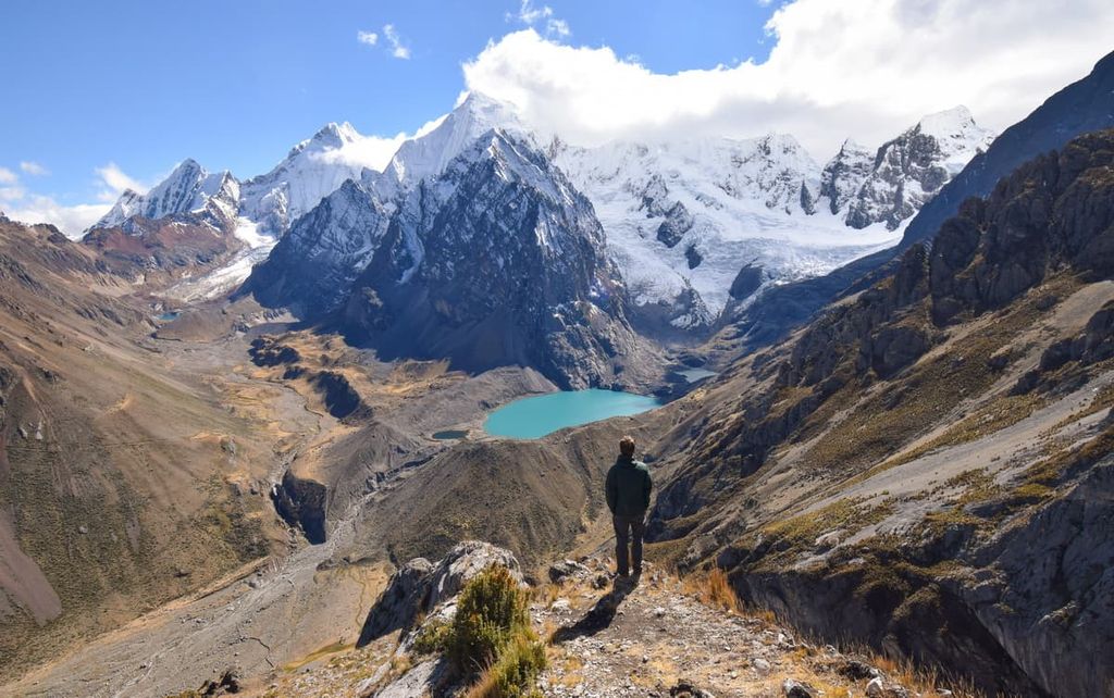
While there are multiple hiking routes in the Cordillera Huayhuash with distances between 45–165 km (30–100 mi), the Huayhuash Circuit is the premier route. Here’s what you need to know about trekking in the range:
Most hikers take 8–12 days to finish the Huayhuash Circuit, which varies in distance and elevation depending on the exact route taken. The most standard route, which begins and ends in the small town of Llamac, covers about 130 km (80 mi) with a burly 11,500 m (37,850 ft) of elevation gain over the whole trek.
There are multiple paths that transit the Cordillera Huayhuash in different areas, and hikers have the option to make side trips off the main trail. There’s also a high-elevation route that has become increasingly popular as more people visit the range.
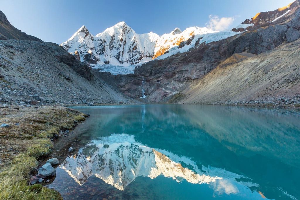
Along the way, hikers will encounter hot springs, glaciers, dozens of glistening alpine lakes, and some of the most beautiful mountain scenery anywhere in the world.
Here are some key trekking logistics to keep in mind when planning a trip to the Cordillera Huayhuash:
Seasons – Most visitors come in the dry season, which runs from May to September. Temperatures frequently fall below freezing at night, but days are usually mild clear. It does still rain during the dry season, so bring waterproof clothing. It’s possible to hike in the rainy season if you’re ok with precipitation and clouds.
Transport – Most people reach the Cordillera Huayhuash from Huaraz, the closest major city. There are numerous tour companies in Huaraz that take you directly to the range from the city.
If you’re hiking the range without a tour group, you’ll need to take a bus from Huaraz to the town of Chiquián, and from there find transport for the final three hours of dirt road to the small town of Llamac. There are buses, taxis, and small mini buses called collectivos in town.
Tickets & Fees – While the Cordillera Huayhuash Reserved Zone isn’t a national park with entrance tickets, you’ll need to pay the local communities for the right to camp and hike on their land. As of 2019, the fees totaled about 270 Peruvian Soles, or about $70 USD.
The individual campsites on the Huayhuash Circuit are managed by local communities along the route, with some campsites offering dug latrines, local guards, and escorts for certain sections of the trail. These fees preserve the safety of the hike and support the local communities that are allowing visitors to use their land.
Guided vs. Unsupported Hiking – While it’s possible to do the trek unsupported, most opt to hike the Cordillera Huayhuash with an organized group. Some tour companies will simply arrange transportation and guide the hike, while others will outfit hikers with everything they need from gear to cooks and pack animals.
If you’re in good shape and experienced with high elevation, long-distance hiking, it’s possible to do the trek unsupported. Be sure you’re prepared to navigate on your own and carry enough food and supplies. There’s only one spot on the trek where you can purchase more food.
Most people start the Cordillera Huayhuash Circuit from the small town of Llamac or nearby Matacancha. If you need to spend the night before the trek, there are a few campsites in Llamac and locals who rent out beds. If you’re looking for a more formal place to stay, these are the best options.
Chiquián is a beautiful small mountain town and a gateway to the Cordillera Huayhuash. While it’s a few hours down the road from the starting point for the hike, it’s got far better facilities and tourist infrastructure than the villages near the circuit.
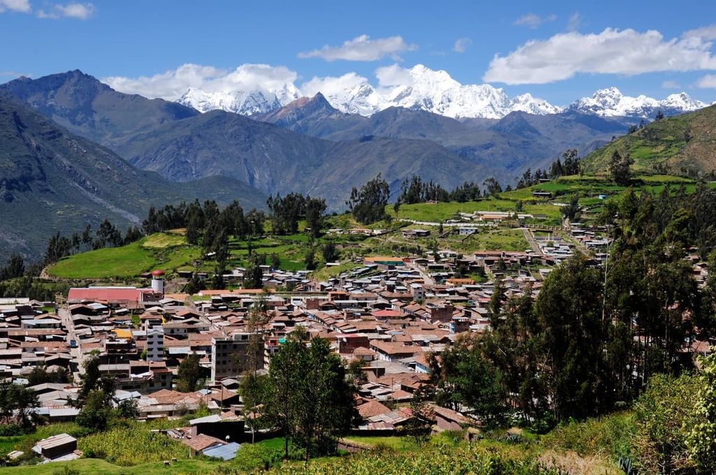
While you shouldn’t count on finding camping supplies here, there are plenty of restaurants and grocery stores where you can stock up for your hike. There are also a few small hotels and hostels if you want to get a good night’s sleep before the trek.
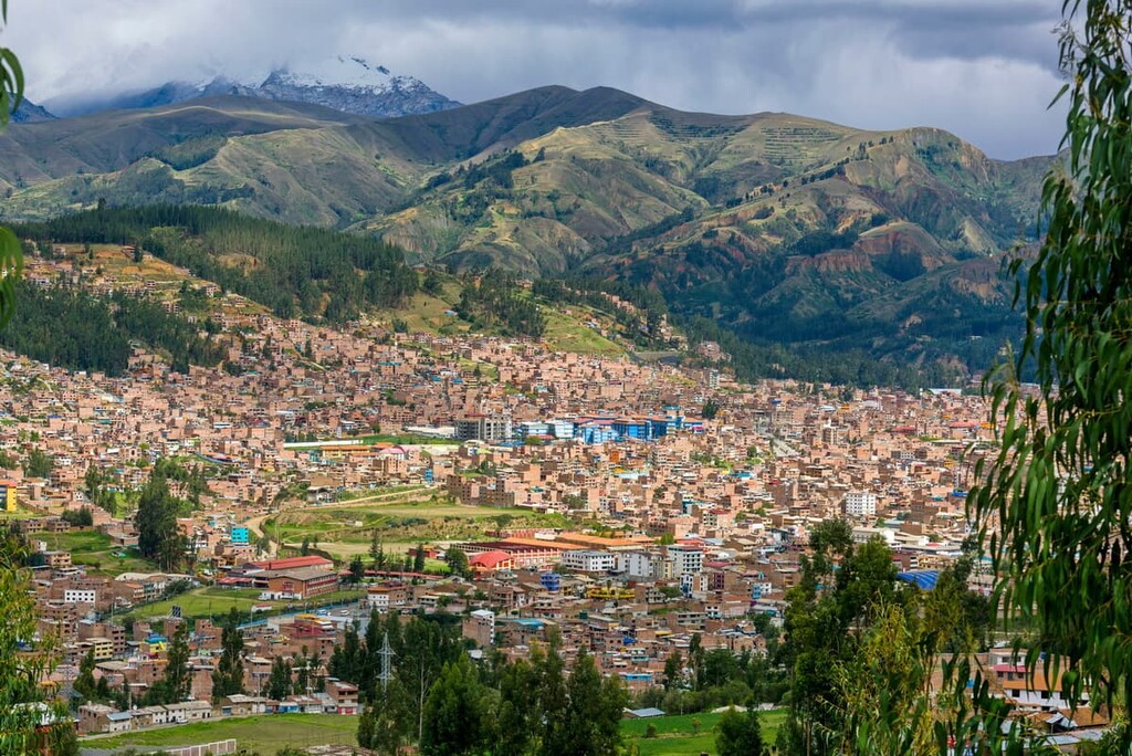
Located about 150 km (90 mi) from the Cordillera Huayhuash, Huaraz is the closest major city to the range. About 120,000 people live in Huaraz, which serves as a major jumping-off point for trekkers and climbers heading into the central Andes.
Huaraz sits at the foot of the Cordillera Blanca, offering good access to Huascarán National Park as well as the Cordillera Huayhuash. If you’re in need of gear for the hike, Huaraz is the only town nearby where you’ll reliably be able to purchase trekking gear (though outfitting in your home country is almost always the better choice).
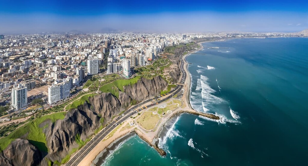
Lima is Peru’s capital and largest city, with nearly 10 million residents. While it’s nearly 400 km (250 mi) from Lima to the Cordillera Huayhuash, most visitors will pass through the coastal city on their way to the mountains, especially if you’re arriving in Peru via airplane.
Lima is a historic city that dates back to 1535. It offers beautiful architecture (both historic and contemporary), excellent museums, and some of the best dining and nightlife in South America.