
Scan the QR code and open PeakVisor on your phone
Clarence Fahnestock Memorial State Park is a state park in New York’s Hudson Highlands. The 14,086-acre wilderness area has 5 named peaks. With casual hiking, nature trails, picnic tables, campgrounds, boat rentals, and a lake beach, the park offers plenty of activities for hikers and day trippers alike.

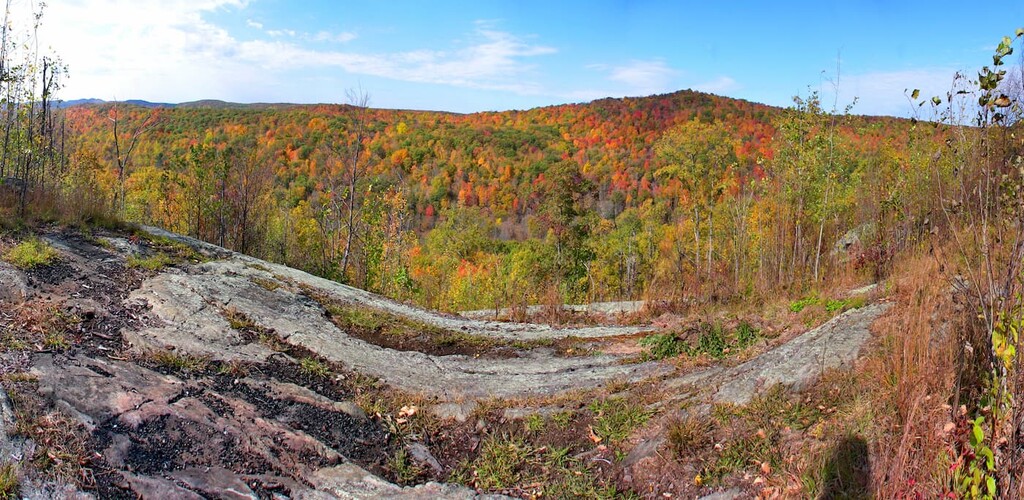
The highest point in the park is Moose Hill, with an elevation of 1,089 feet. The most prominent peak, Candlewood Hill, has an elevation of 988 feet.
The park is conveniently situated in the Hudson River Valley. Just a few miles off of Interstate-87, the park is just an hour drive from New York City. It sits within a subrange known as the Hudson Highlands, which are part of a larger Appalachian subrange stretching from northern Pennsylvania to western Connecticut. Called the Reading Prong, the bedrock for this mountain range is among the oldest on earth, dating back least one billion years.
With nearly 20 other state parks in the region, the Hudson Valley is an extremely popular destination for hikers, outdoorsmen, and nature enthusiasts. Six miles to the west of Clarence Fahnestock Park is Hudson Highlands State Park. Another two miles west, on the west bank of the Hudson River, is Storm King Mountain and the park of its namesake. Further south you’ll find Bear Mountain State Park, Stony Point State Park, and Mohansic State Park, among others.
Clarence Fahnestock Memorial State Park has 31 hiking, running, cycling, and forest trails, totaling more than 50 miles. It features a variety of lakes, ponds, streams, and other impressive sights, with opportunities for boating, hunting, fishing, and birding. With a sprawling campground along the western shore of Pelton Pond, the park has dozens of campsites available for reservation.

A nine-mile section of the Appalachian Trail passes through Clarence Fahnestock park, ferrying thru-hikers on their 2,190-mile journey from northern Georgia to northern Maine.
The park is also home to Fahnestock Winter Park and the Taconic Outdoor Education Center. The winter park offers more than 11 miles of groomed and tracked trails for cross-country skiing and snowshoeing, as well as a sledding hill, an outdoor fireplace, and a warming lodge where visitors can rent skis or have a meal. At an elevation of 1,100 feet, snow tends to accumulate fairly easily, helping the park remain open through most of winter.
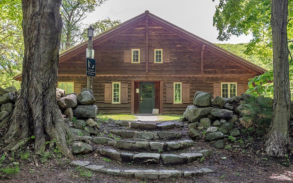
The Taconic Outdoor Education Center (TOEC) offers a variety of environmental education programs, including scout badge programs, maple sugaring, business conferences, team building exercises, field trips, and conservation camps. The TOEC includes a rustic lodge with dining, interactive nature exhibits, a maple grove and farm, a nature shop, and winterized cabin rentals.
As the peaks of Clarence Fahnestock Memorial State Park are more hills than mountains, the hiking is generally less strenuous than others in the region. This makes the park a popular destination for casual hikers.
One of the most popular journeys is the 4.9-mile Catfish Loop trail, which gives hikers a chance to explore a variety of landscapes and terrains. The trailhead is accessed via Dennytown Road, just south of the main parking area.
Another popular hike is the Candlewood Hill Trail—a 2.3-mile loop of moderate difficulty that will take you to the summit of the park’s most prominent peak.
A somewhat longer and more strenuous journey can be found in the Round Hill/East Mountain Loop, which summits Round Hill and East Mountain. The trail features a number of bridges, historic stone walls, and a waterfall.
Two popular hikes traverse sections of the Appalachian Trail. The Three Lakes and Appalachian Trail loop passes a scenic lake and the remains of an old iron mine dating to the mid-19th century before catching up with the Appalachian Trail along a forested ridge. This trip totals roughly five miles.
A slightly longer loop can be found by following the Appalachian Trail from the parking area for several miles before reaching the Sunken Mine Road and returning south via the Blue Trail. This loop follows an old railbed once used for iron mining, and includes a number of scenic ridge views.


