
Scan the QR code and open PeakVisor on your phone
Cima di Piano Cavallo - Bric Cornia has 21 named peaks. The highest is Cima di Pian Cavallo at 1,896 m. Other notable peaks include Cima Cantalupo, Monte Cimone and Bric Scravaglion.
One of the four main protected areas within the Ligurian Alps Natural Regional Park, in Liguria, Italy, Cima di Piano Cavallo - Bric Cornia offers a distinctly Alpine environment just a stone’s throw away from the Italian Riviera. There are 21 named mountains in Cima di Piano Cavallo - Bric Cornia. The highest and the most prominent mountain in the area is Cima di Pian Cavallo (1,896 m/6,220 ft).
Located in the northern portion of the Ligurian Alps Natural Regional Park, Cima di Piano Cavallo - Bric Cornia sits in the northwestern Italian region of Liguria, on the region’s border with Piedmont.
The protected area is one of the four principal protected area located within the Ligurian Alps Natural Regional Park, along with Dorsale Sacarello - Fronté Monega, Comprensorio Gerbonte - Toraggio/Pietravecchia, and Foresta di Gouta - Testa d’Alpe.
The area is a site of community importance under the European Commission’s Habitats Directive (SIC) within Natura 2000, the EU network for the conservation of biodiversity. This is due to its extensive woodland, sites of geological interest, and wildlife.
The protected area stretches around 45 sq. km (17 sq. mi) across the municipalities of Cosio d’Arroscia, Mendatica, and Pornassio in the province of Imperia. It is also situated in the Ligurian Alps.
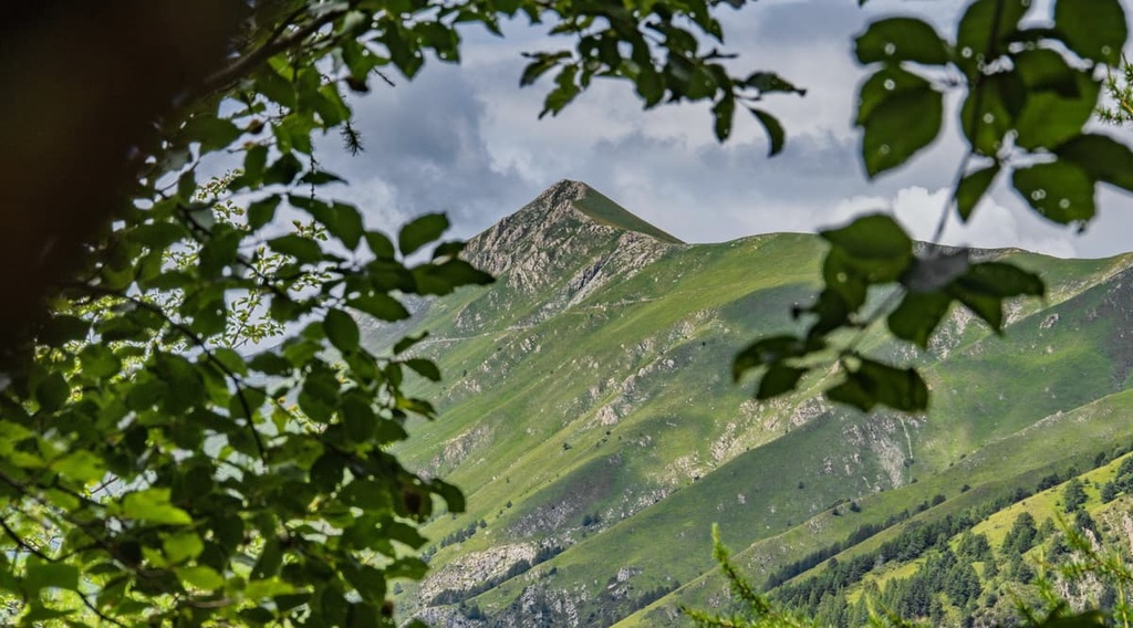
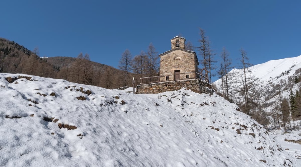
The site of Cima di Piano Cavallo - Bric Cornia is one of Liguria’s most beautiful areas, and it is a world away from the nearby coastline. Rich in forests and streams, meadows, and dolomitic walls, it’s characterized by its distinctly Alpine environment.
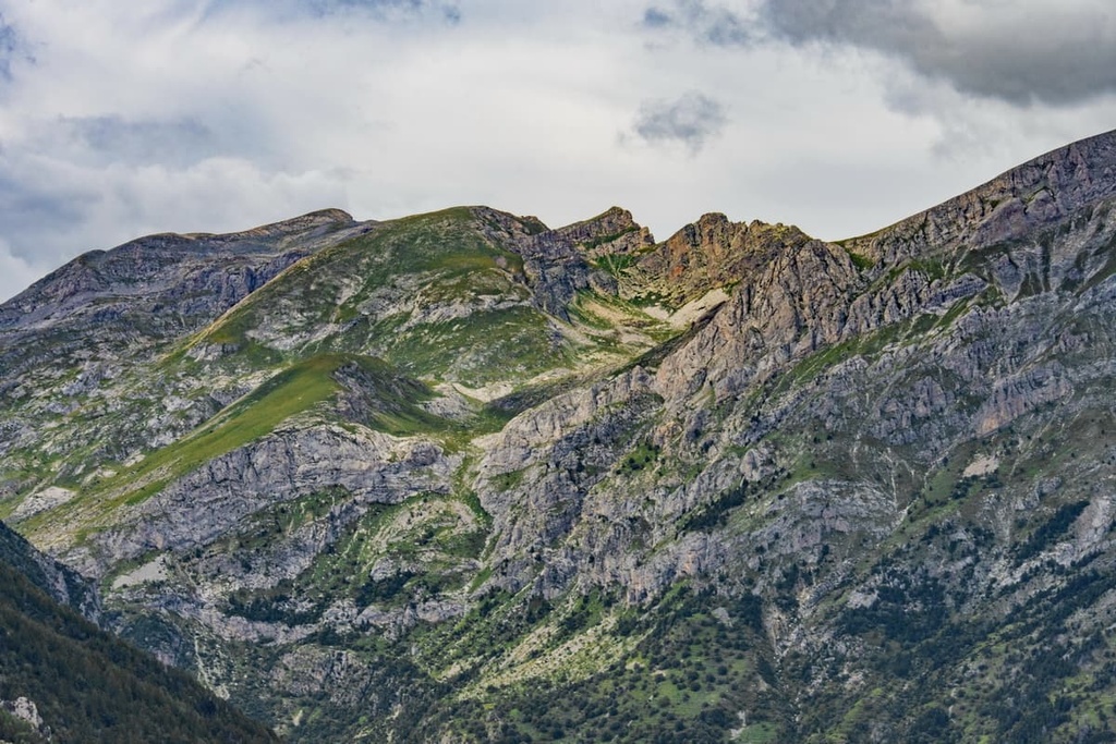
The area is home to a mix of different geological formations, particularly rocks belonging to the Sanremo - Monte Saccarello unit (Flysch of Sanremo). It also features an abundance of calcareous rocks, marls, arenites, argillite lithotypes, and Jurassic dolomitic quartzites and limestones.
One of the most significant features in the landscape is the ridge between Cima di Piano Cavallo - Monte Cimone - Bric Cornia - Rocca Pennina. Other impressive geological features in the region include dolomitic walls, which dominate the right side of the Negrone stream.
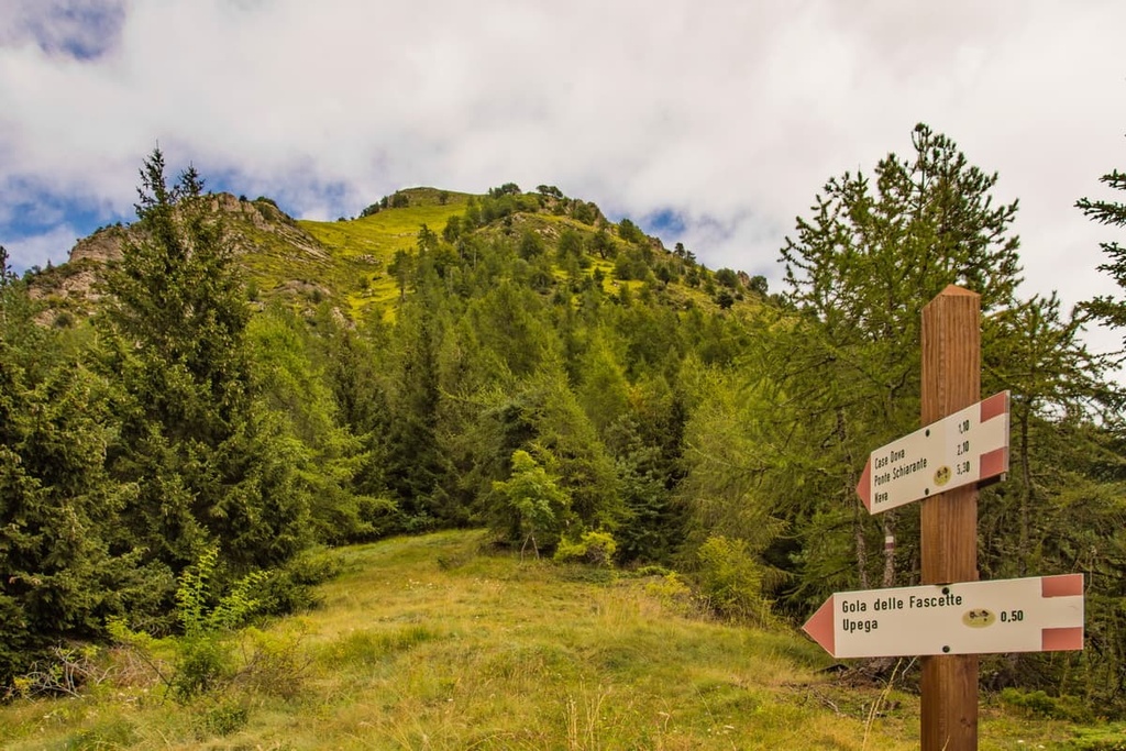
There are also interesting karst morphologies in the protected area, including sinkholes, resurgences, and overflow activated by melting snow, such as the incision gorge in Gola della Fascette. The gorge is around 600 m (1,968 ft) long and follows the Negrone and Tanarello streams.
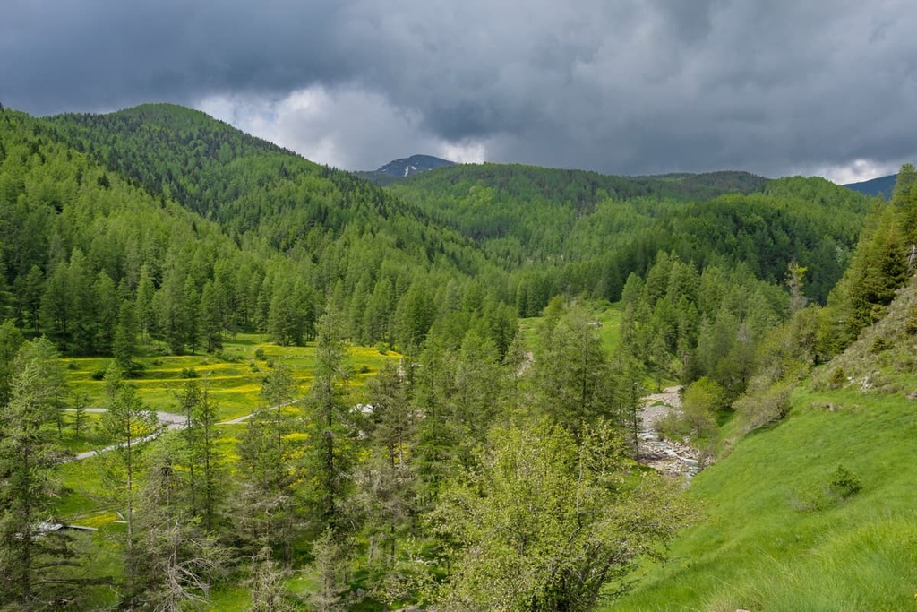
Many waterways run through the area, the most significant of which are the Negrone and Tanarello streams. These two streams ultimately give rise to the Tanaro River.
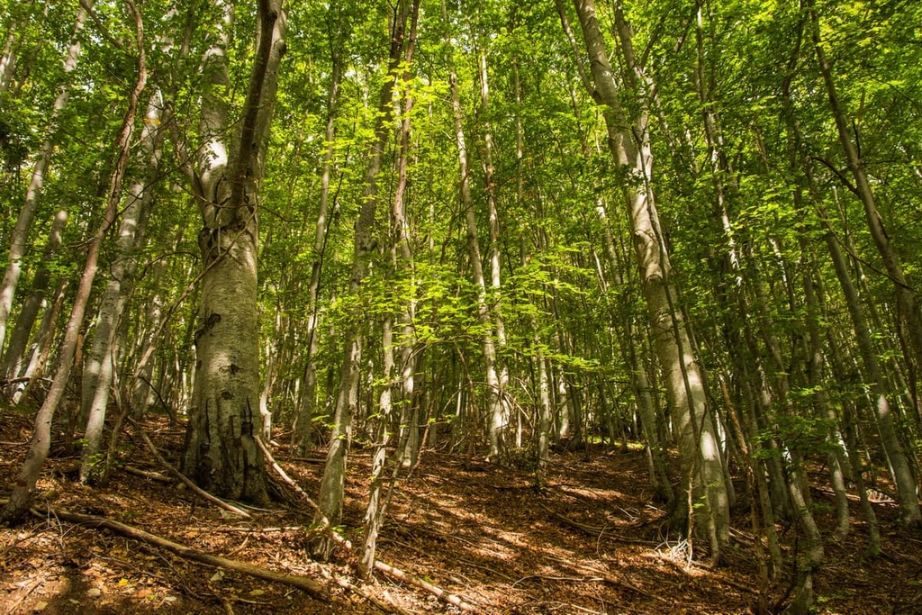
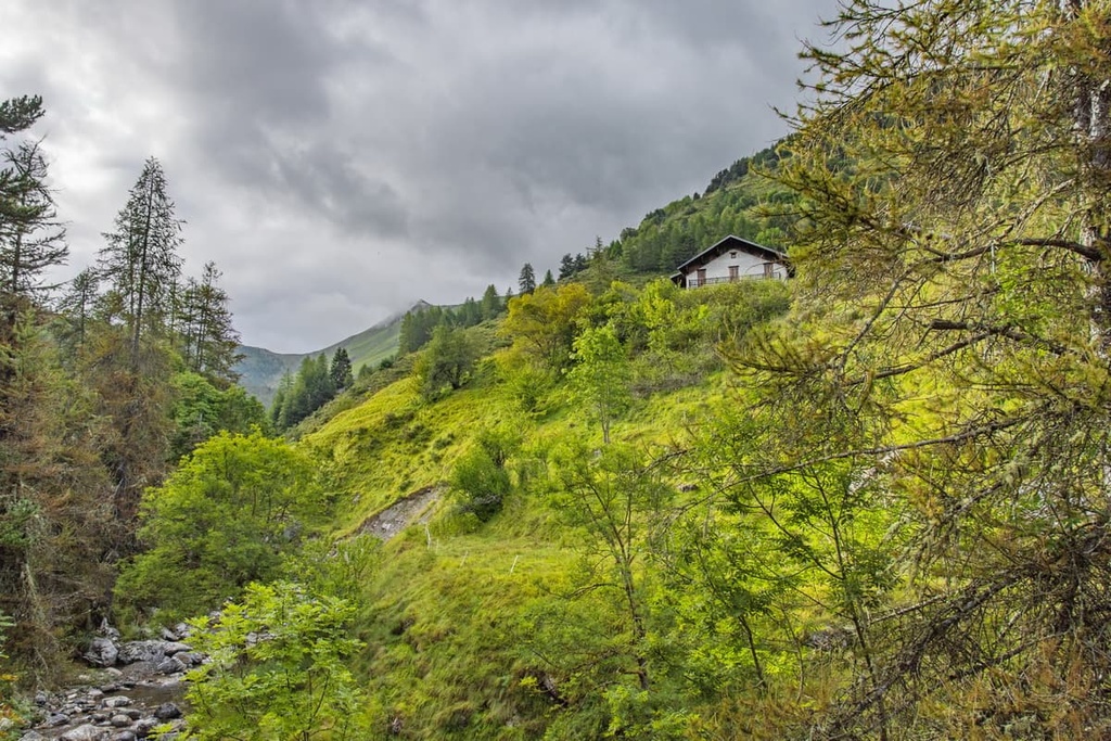
The Cima di Piano Cavallo - Bric Cornia site is composed of extensive forests with a variety of tree species, such as the larch forest in the Bosco delle Navette, as well as Scots pine, fir, and beech woodlands.
The site has typical alpine habitats, such as alpine and hay meadows, as well as shrublands composed of blueberry and rhododendron. There are also many endemic species that live in the protected area such as Ligurian gentian (Gentiana ligustica), limestone saxifrage (Saxifraga callosa), tender sedge (Carex tendae), and a variety of orchid species.
There are many different bird species that live in the area, too, including both migratory and resident species. Some of the many birds that inhabit the region include black woodpeckers, wallcreepers, choughs, black grouse, and golden eagles.
Several mammals call the area home, predominantly chamois, as well as ermine and hare. The extensive underground cave systems in the protected area are also home to bats, as well as several rare invertebrate species (particularly different species of beetle).
Human activity in the Cima di Piano Cavallo - Bric Cornia site can be traced back for centuries. The chestnut trade was traditionally important in the area surrounding Cima di Piano Cavallo - Bric Cornia, as were the stone cutting and shepherding industries.
In the past, larch wood from the Bosco delle Navette woodlands was used for the construction of boats and ships. The republic of Genoa even used this wood to construct the masts for its own naval fleet.
This larch wood was used commercially up until the middle of the last century. Today, the woodlands are protected on the Ligurian side by the Ligurian Alps Regional Natural Park and by the Maritime Alps Natural Park in Piedmont.
As it is part of the Ligurian Alps Regional Natural Park, the Cima di Piano Cavallo-Bric Cornia site offers plenty of nearby hiking destinations for visitors to enjoy. Be sure to check out these hiking areas during your next visit to the region.
The Ligurian Alps Regional Natural Park has a huge network of hiking paths to explore from family walks to day hikes and multi-day routes. The Ligurian High Route (Alta Via dei Monti Liguri), Via Alpina, and GTA all pass through the park close to the protected area.
Divided between Piedmont and Liguria, the Bosco delle Navette woodlands offers hikers a variety of trekking itineraries where you can enjoy and discover the region’s beautiful larch forests. The best time to visit the woodlands is either in spring when everything is in bloom or in fall when the leaves of the larch trees turn yellow and the rowan trees turn red.
There are several different hiking routes that can take you up to the top of Liguria—Monte Sacarello—from nearby Monesi or Verdeggia. Regardless of which route you initially take, eventually, you’ll join the Ligurian High Route, which crosses the peak of Monte Sacarello before it continues onwards.
This 3–4 hour out-and-back route starts in Upega and passes by Gola delle Fascette. It then takes you through larch woodlands to Colla Bassa before it traverses a summit ridge and arrives at both Cima di Piancavallo and Cima Cantalupo. From here, you can enjoy views across the peaks of the Ligurian Alps, as well as the Upega basin below.
Although there aren’t any major cities located close to Cima di Piano Cavallo - Bric Cornia, there are plenty of small towns, refuges, and B&Bs to stay in. The closest airports to the protected area are found in Nice and Genoa.
Here are a couple of larger communities to consider visiting when traveling to Cima di Piano Cavallo - Bric Cornia.
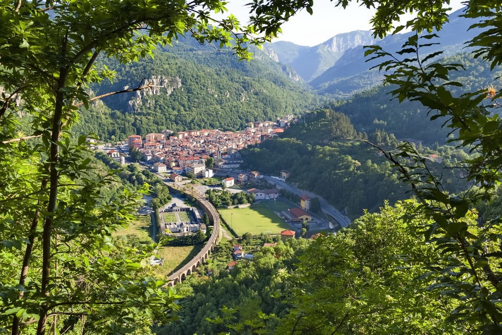
Set on the coast in the western Italian Riviera, Imperia is best known for its flower and olive cultivation industries. The town is composed of two harbors and has many different restaurants and bars to choose from.

Imperia is located between the border with France and the Italian province of Savona; therefore, there are many beautiful beaches to enjoy in the region along both the French and Italian rivieras. From Imperia, you can also reach the Cima di Piano Cavallo - Bric Cornia protected area in less than an hour by car.
Ormea is a community located just across the border in Piedmont, within a short distance of the protected area. Here you can find all necessities, as well as a tourist office.
The town of Ormea is situated around the corner from the Cima di Piano di Cavallo - Bric Cornia site, and it also offers good access to the nearby Monte Galero. There are, therefore, plenty of hiking and cycling opportunities in the immediate vicinity, as well as in the wider area of the Ligurian Alps.


The highest peak in Cima di Piano Cavallo - Bric Cornia is Cima di Pian Cavallo, at 1,896 m.
Notable peaks in Cima di Piano Cavallo - Bric Cornia include Cima di Pian Cavallo, Cima Cantalupo, Monte Cimone, Bric Scravaglion and Poggio Agnelli.


