
Scan the QR code and open PeakVisor on your phone
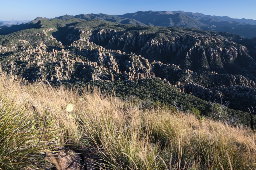
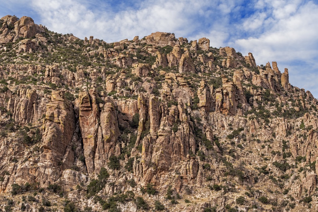
The deep canyons, rock pinnacles, and jagged peaks of Chiricahua Wilderness are part of the Chiricahua Mountains, an isolated cluster of mountains in southeast Arizona, USA. There are 38 named peaks in the wilderness. The tallest and most prominent is Chiricahua Peak. It rises 9,751 ft (2,972 m) with a prominence of 5,135 ft (1,565 m).
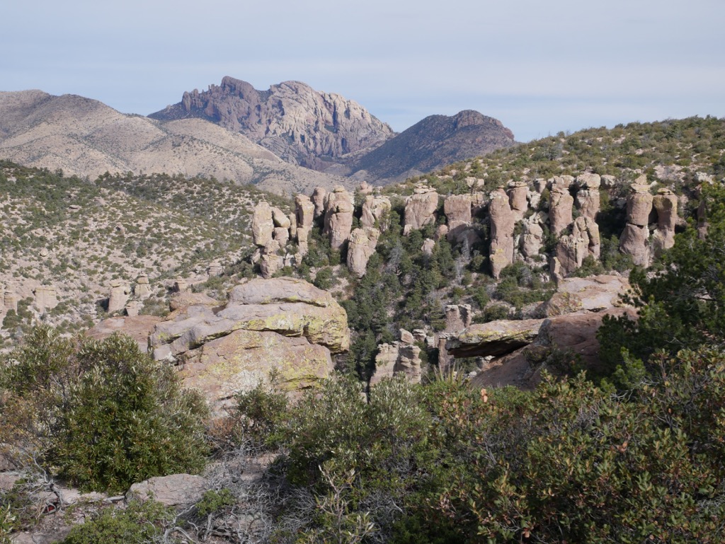
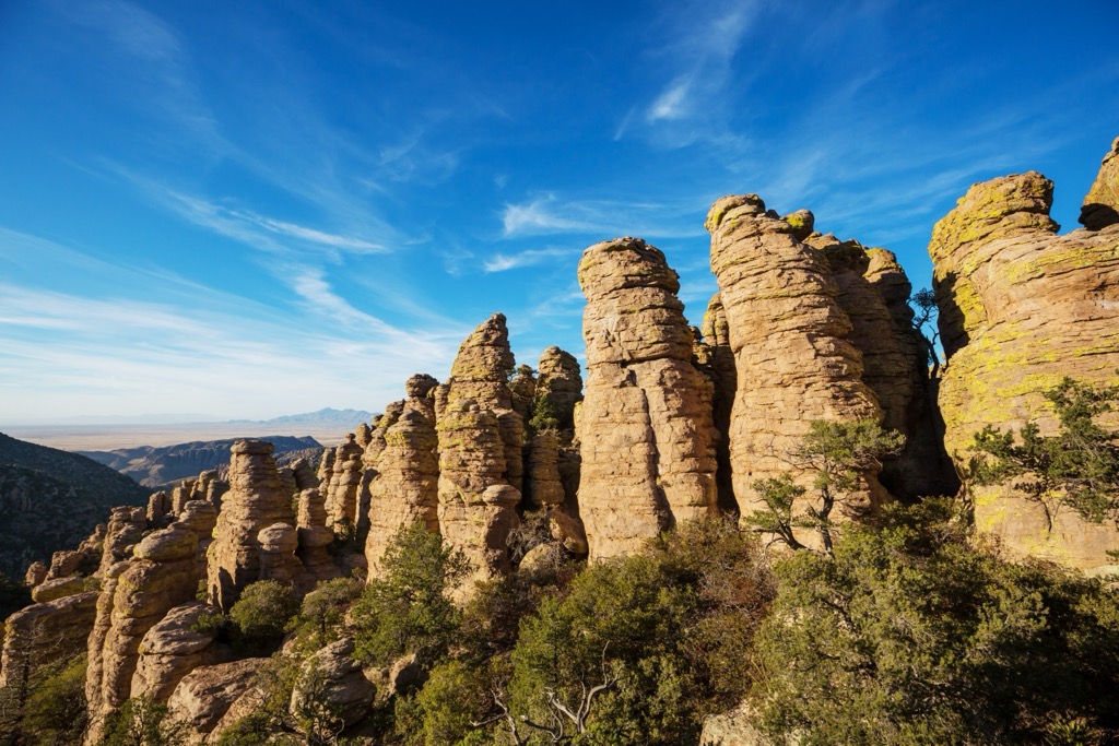
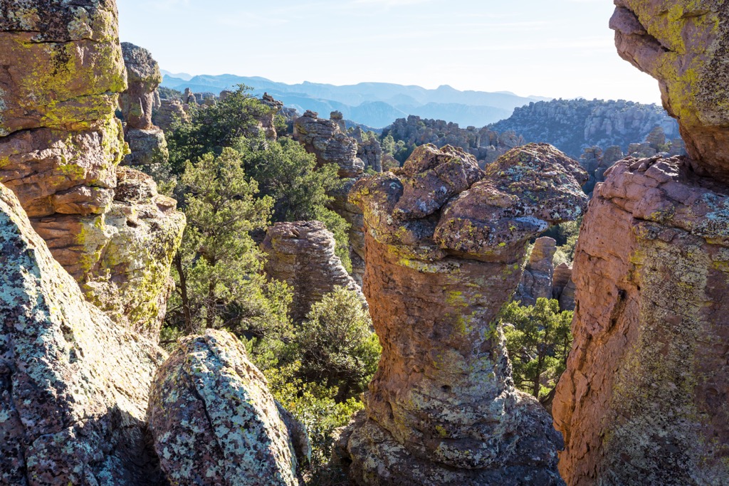
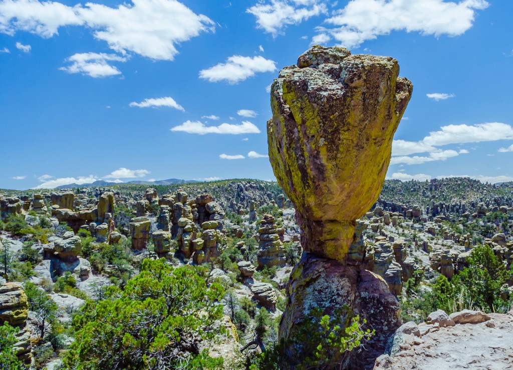
Established in 1964, the Chiricahua Wilderness protects 87,000 acres (35,208 hectares) of the upper slopes and inner canyons of the Chiricahua Mountains in southeast Arizona. It borders Chiricahua National Monument, a 12,000 acre (4,856 hectare) area set aside to preserve the unique rock pinnacles in the region.
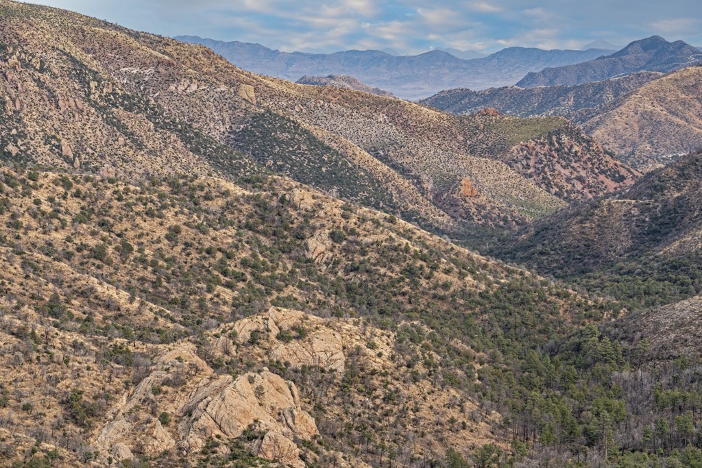
The Chiricahua Mountains are the largest range of the Sky Islands in Arizona – a series of isolated mountain “islands” that rise up from the desert floor across the United States’ southwest and northern Mexico. These dispersed mountains, numbering 17 ranges in 12 separate units in Arizona, are managed by the Coronado National Forest.
The tallest peaks in the wilderness area are Chiricahua Peak (9,751ft/2,972 m), Fly Peak (9,665 ft/2,946 m), Snowshed Peak (9,656 ft/2,943 m), and Aspen Peak (9,649 ft/2,941 m).
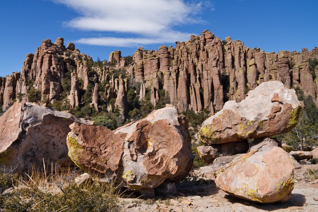
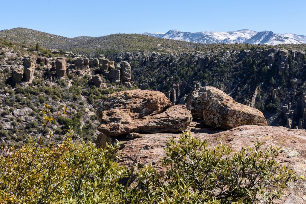
The Chiricahua Mountains formed during an enormous volcanic eruption around 27 million years ago. The eruption spewed ash and molten debris at incredibly high speeds thus creating the 12 mi (19 km) wide Turkey Creek Caldera. The ash and debris cooled and compacted to form rhyolite tuff. As this material fissured and eroded with time, it formed the pinnacles seen in the monument today.
In addition to the caldera and the rhyolite pinnacles, the eruption left behind caves, faults, and ancient lava flows that are seen throughout the Chiricahua Mountains. Water flows only intermittently on the surface but the park contains part or all of five major watersheds. Groundwater supplies the national monument operations. The combination of these water sources supports a diverse array of flora and fauna in the region.
The Chiricahua Wilderness is home to five biomes – desert, grasslands, chaparral, deciduous forest, and coniferous forest – where four major ecosystems converge. The Rocky Mountains, Sierra Madre, Sonoran Desert, and Chihuahuan Desert meet here, giving life to an enormous range of plants and wildlife. Average annual precipitation along the base of the mountains is 15 in (38 cm) but the mountaintops can see nearly double this.
Engelmann spruce hits its southernmost limit in this mountain range. Ponderosa pine, Douglas fir, and white fir grow along the upper elevations, with Douglas and white fir appearing primarily on the northern slopes and ponderosa pine evenly distributed. At lower elevations, in addition to the higher elevation trees species, forests consist of Apache pine, Chiricahua pine, Engelmann spruce, aspen, juniper, pinion, madrone, and oak. Sedges, gramas, yuccas, sagebrush, thistles and milkweeds are just a few of the common plants found among the grasslands here.
The animals that call the Chiricahua Wilderness home are diverse, occupying the many ecological niches the multi-biome landscape provides. Common mammals include mule deer, white-tailed deer, coyotes, foxes, bobcats, mountain lions, black bears, javelinas, coatis, skunks, weasels, racoons, bats, kangaroo rats, rats, mice, squirrels, and rabbits.
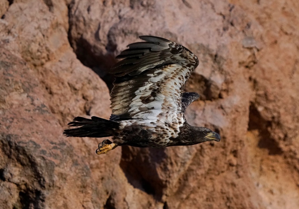
Numerous hawks, gold and bald eagles, harriers, hummingbirds, swifts, doves, kingfishers, roadrunners, falcons, kestrels, quails, tanagers, jays, owls, and woodpeckers thrive here. There are also plenty of lizards, skinks, snakes, toads, and salamanders living in the forests and canyons of the wilderness area.
The wilderness is the traditional territory of the Chiricahua Apaches, a warrior tribe with the famous leaders Cochise and Geronimo. They are an Athabaskan people, which means they originated in northwest North America and likely migrated south due to warring between tribes. The Chicicahua Apaches arrived in the southwest between 1400 and 1500.
The Chiricahua Apache were nomadic, typically spending winters on the plains and summers at higher elevations. As excellent warriors, they often carried out raids on neighboring tribes or settlements. Once Europeans began settling in the southwest and northern Mexico, this raiding naturally created tension that peaked in the 1770s. In response, the Spanish erected a series of forts and began handing out rations, temporarily decreasing raids.
After Mexico gained independence in 1821 and stopped manning the forts and handing out rations, conflict increased again. The Mexican American War ran from 1846 to 1848, with the US being ultimately victorious. The Treaty Of Guadalupe-Hidalgo, and later the Gadsden Purchase, officially incorporated the southwest into the United States.
The Apache Wars between the Apaches and the United States ran through the mid-1800s, and ended with Geronimo and his tribe’s surrender and their deportation to reservations in Florida. With Apache numbers lower, the region opened up for prospectors, loggers, and ranchers to move in. The Chiricahua Wilderness received its official designation of wilderness in 1964.
No motorized or mechanized vehicles are allowed, including mountain bikes. Water may be available in most canyons year round and purification is recommended. Many of the peaks are clustered together and several trails take in multiple peaks in one go. Because of thick brush, steep canyons, and undependable water outside of known routes, most hikers stay on the 13 established trails within the wilderness area. Although water may be available on trail, it is best to come prepared with a sufficient supply.
A full list of trails and maps can be found here.
The trail from Rustler Park to Chiricahua Peak is 11.7 mi (18.8 km) out and back and gains 2,309 ft (704 m) in elevation. The trail itself is fairly well maintained, though with some loose rocks and downed trees, but a high clearance vehicle is recommended to access the trailhead. Portions of the trail are shaded but others are exposed. The exposed parts are partially due to wildfire in 2011, and the open patches now fill with a beautiful display of wildflowers in the summer.
Those looking for a loop route can take the 9.6 mi (15.4 km) trail that begins in Rustler Park. Gaining a total of 1,814 ft (553 m), the trail follows Crest Trail to Fly Peak before looping back along Bear Wallow to Centella Point. A great loop to take in some of the wilderness area’s scenery and biodiversity.
Crest Trail #270 is a 19 mi (30.6 km) trail that gains about 5,950 ft (1815 m) in elevation. It is an out and back trail that leads to the summit of Sentinel Peak at 9,009 ft (2,746 m).
There are a handful of campsites within the Chiricahua Mountains that provide quick access to the wilderness area. Several small towns are within one to one and a half hours drive, and the cities of Tucson and Phoenix are two and a half and four hours drive away respectively.
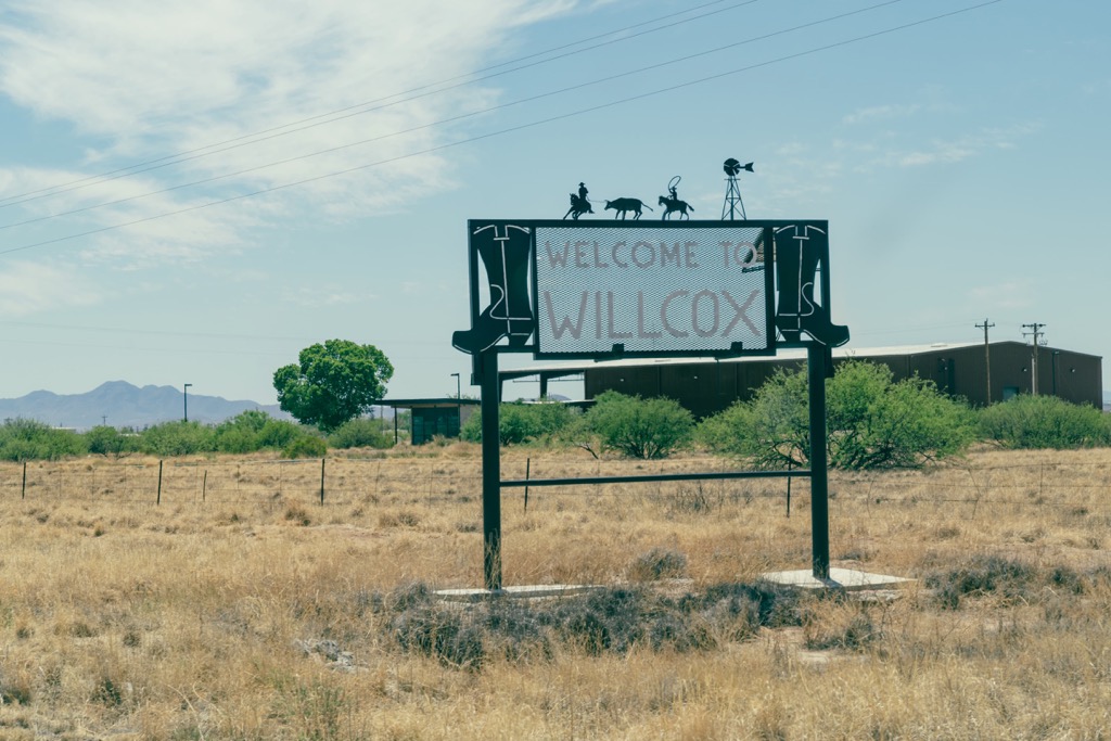
Just over an hour from the wilderness area, Willcox has a population of 3,500 and will cover all your basic needs. You can sleep over at one of the local hotels, motels, or RV parks, and there are a few restaurants such as Mexican, a steakhouse, and a tavern, in addition to grocery stores. If you find yourself with extra time here, grab a pair of binoculars and go birding, visit one of the local wineries, or check the local events calendar for rodeos, live music, and drive-in movies.
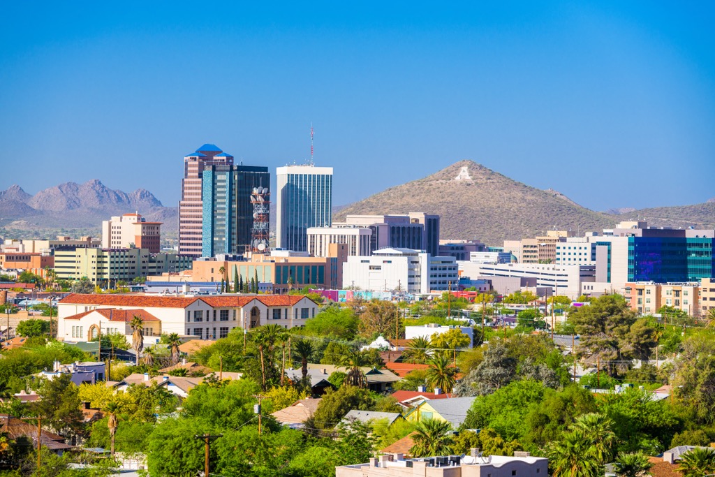
Tucson is home to 545,000 people and located two and a half hours from the Chiricahua Wilderness in the middle of the Sonoran Desert. The opportunities to explore outside of town are endless with Saguaro National Park, Coronado National Forest, and Sky Island mountain ranges located nearby. Those looking for less active options can relax at a spa or check out the art scene where the desert has deeply inspired and influenced art, performance, and film.
Finding something to eat around town will only be difficult because of all the choices. It’s easy to find top-notch Mexican food, or farm-to-table restaurants offering foods with a local twist like prickly pear glazed ribs or breads made from native seeds and grains. From hotels to guest ranches, B&Bs to spas and vacation rentals, there are options for all budgets to stay over in Tucson.
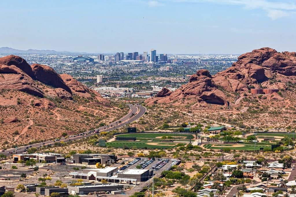
A four hour drive from the Chiricahua Wilderness, this city with 1.7 million inhabitants is rich both culturally and scenically. Popular outdoor locations near the city include Camelback Mountain with views across the Phoenix Mountain Preserve, Papago Park with miles of trails winding through its red rock buttes, and South Mountain Park and Preserve with nearly 50 mi (80 km) of trails through the Sonoran Desert.
There’s plenty to do in town from visiting museums, the botanical gardens, or the famous architect Frank Lloyd Wright’s winter home, Taliesin West. Restaurants come in all shapes and sizes and it won’t be hard to find some amazing BBQ, Mexican eats, cute coffee shops, and a wide variety of international cuisines. Those looking to spend a night or two here can find anything from urban in the heart of the city to scenic at a nearby ranch or resort.


ultra
arizona-20-20-challenge
southern-arizona-hiking-club
southern-arizona-hiking-club-emblem
southern-arizona-hiking-club-coronado-12
arizona-ultras
arizona-fire-lookouts
arizona-20-20-challenge
southern-arizona-hiking-club
southern-arizona-hiking-club-emblem
ultra
arizona-20-20-challenge
southern-arizona-hiking-club
southern-arizona-hiking-club-emblem
southern-arizona-hiking-club-coronado-12
arizona-ultras


