
Scan the QR code and open PeakVisor on your phone
Founded in 1985, Antola Natural Regional Park (Parco Naturale Regionale dell’Antola) is a protected area located in the Italian region of Liguria between Genoa and Rapallo. There are 43 named mountains in Antola Natural Regional Park. Monte Carmo (1,642 m/5,387 ft) is the highest point in the park while the most prominent mountain in Antola is Monte Antola (1,597 m/5,240 ft).
Antola Natural Regional Park is situated in the Ligurian Apennines. It is located in the Italian region of Liguria, close to the region’s border with Piedmont to the north and Emilia Romagna to the east.
Antola Natural Regional Park covers 48 sq. km (18.5 sq. mi) of land across the municipalities of Busalla, Crocefieschi, Fascia, Gorreto, Montebruno, Propata, Ronco Scrivia, Rondanina, Savignone, Torriglia, Valbrevenna, and Vobbia.
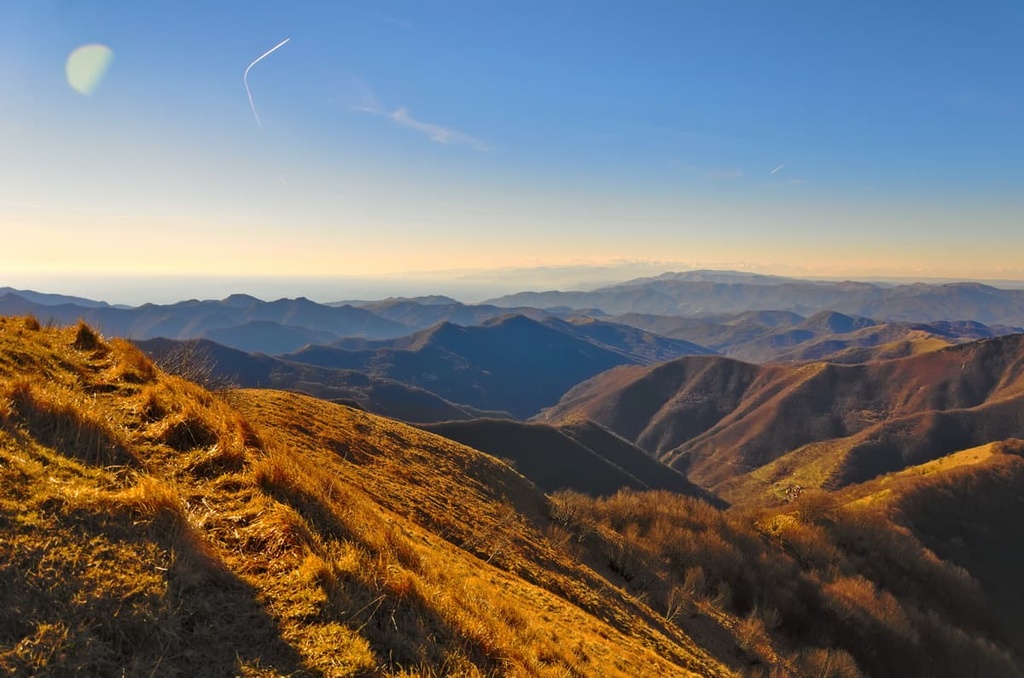
On a clear day, views from Monte Antola (1,597 m/5,239 ft), which is situated on the ridge connecting the upper Scrivia valley with the upper Trebbia valley, span from the Mediterranean Sea across to the peaks of the northwestern Alps such as Monviso, Monte Rosa, and Mont Blanc.
Other interesting peaks in the Antola Natural Regional Park include:
Antola Natural Regional Park is home to two valleys: the upper Trebbia Valley and the upper Scrivia Valley. Each valley is home to its namesake river—the Trebbia and the Scrivia, respectively. Both of these rivers are tributaries of the river Po.
Antola Natural Regional Park is characterized by two main rock formations: conglomerate, and Monte Antola’s marly limestone.
The park’s conglomerates are seen in its steep rocky slopes, canyons, and rocky towers. It is best seen in the Vobbia Valley by the Rocche del Reopasso, as well as in caves formed by cavities in the conglomerate.
This conglomerate consists of outcrops of marine sediment that date back around 30 million years ago to the Oligocene epoch. The conglomerate consists of rounded pebbles that are mainly made up of calcareous-marl.
Meanwhile, the limestone of Monte Antola dates back to around 90 and 55 million years ago and consists of alternating layers of varying thickness interspersed with clays and sandstones. Deep sea fossils have been found within these limestone layers.
The limestone of Monte Antola is characterized by gentle slopes. It is also seen along the coast between Chiavari and Genoa, as well as in the Portofino Natural Regional Park, where its fractured and folded layers can be seen from the sea.
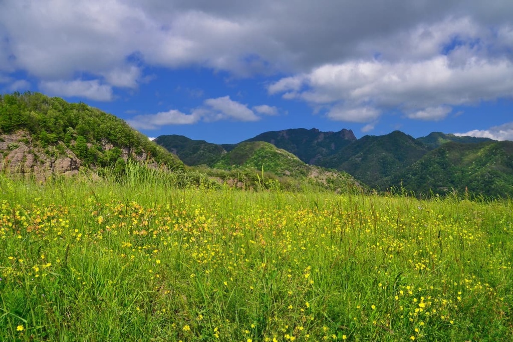
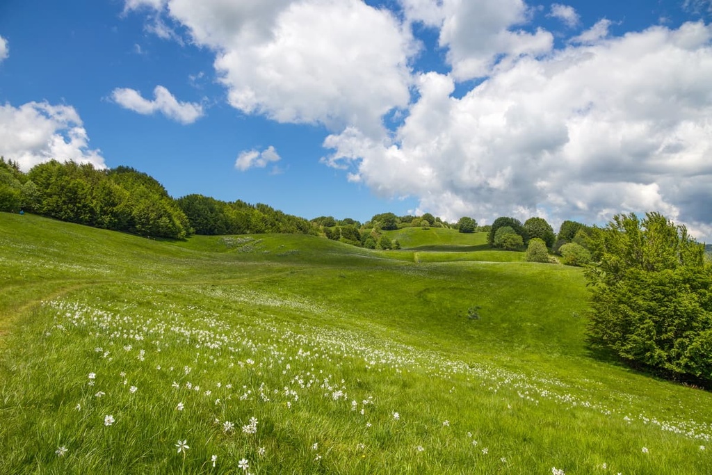
Due to its proximity to the coast, Antola Natural Regional Park is a particularly biodiverse place. The park consists of a huge variety of different environments, including mountainous peaks, panoramic valleys, and streams. It also features chestnut, oak, and beech woodlands that give way to open pastures, rocky ridges, and rugged slopes.
The number of environments and microclimates in the park allow for a huge variety of plant species such as daffodils, orchids, gentians, lilies, buttercups, and columbines.
The Antola Natural Regional Park is also home to 20 rare Ligurian or endemic species such as the dark vanilla orchid, plum iris, dragon’s teeth, marsh helleborine, mountain arnica, elder-flowered orchid, and northern firmoss.
The Antola Natural Regional Park is also home to plenty of fauna, including wild boar, roe deer, and 16 different species of bat. Fallow deer have colonized the Brugneto and surrounding valleys and have even become an attraction for tourists.
Wolves have also made the Antola Natural Regional Park their home. The park even features a visitor center, Il Lupo in Liguria, which offers an interactive experience to teach visitors about wolf behavior, monitoring techniques, and conservation. It also offers up-to-date data on the presence of wolves in Liguria.
Additionally, bird watchers in the park might spot the green European woodpecker, common woodpecker, red-legged partridge, and peregrine falcon.
There are also around 780 different species of insects and moths in the park. The sheer number of insects found in the region is one of the reasons why Antola Natural Regional Park is sometimes referred to as the “butterfly park.” In fact, it is one of the prime butterfly conservation areas in Europe.
Antola Natural Regional Park is located at a historic crossroads between the coast in Liguria and the interior regions of Piedmont and Emilia Romagna. The ancient mule tracks and paths in the region were once trodden by merchants and travelers who exchanged goods between the regions, such as the salt brought in from the coast.
The vast chestnut woodlands in Antola Natural Regional Park were a main source of income in the region for centuries. The fruits of these trees were ground into flour while the wood o was used for firewood and for building.
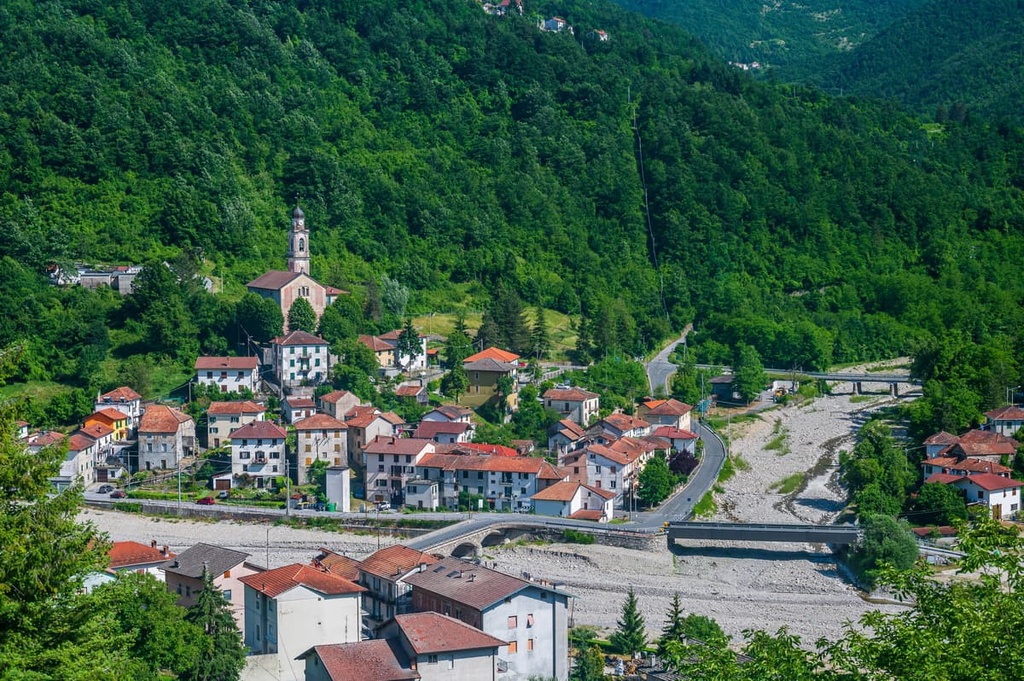
Along with the chestnut trade, Antola Natural Regional Park was also used for agriculture. Indeed, you can see many remnants of this pastoral life in the local rural villages that still retain their old mills and stone buildings. The pastures in the park are still used for grazing cattle during the summer months.
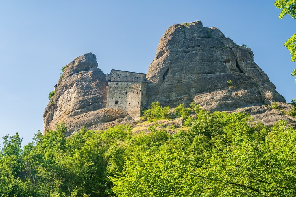
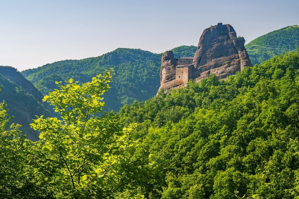
An interesting historical building in the park is the Pietra di Vobbia Castle (Castello della Pietra), an impressive medieval castle perched between two pudding-stone towers. Accessible only by foot, the castle is also often open to visitors who can explore its dungeons and patrol walkways.
Along with historic buildings, Antola Natural Regional Park also offers environmental education to schools.
Education activity isn’t only limited to the ground, there’s also an astronomical observatory and planetarium in the park in the municipality of Fascia. The observatory was built in the park due to the area’s low population density and subsequent low levels of light pollution. It was built for higher education and scientific research and is also home to one of Italy’s largest telescopes
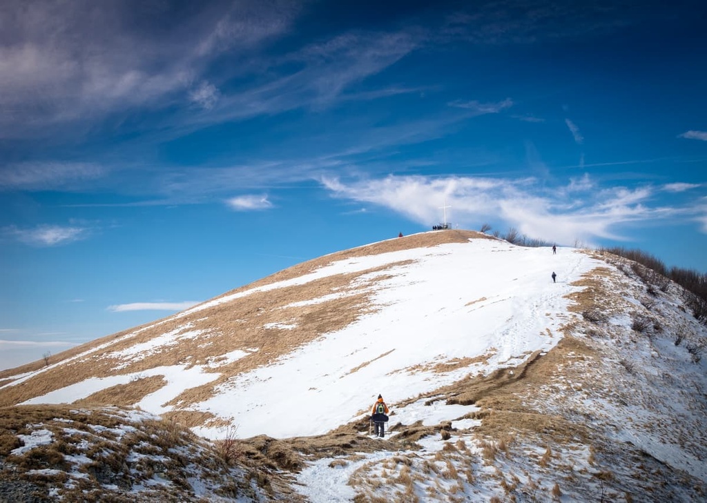
Antola Natural Regional Park is also a popular destination for activities such as hiking, sport climbing, sport fishing, mountain biking, paragliding, and even horse riding in the summer months. In the winter, the park lends itself to snowshoeing, winter hiking and cross country skiing.
Antola Natural Regional Park contains around 270 km (167 mi) of hiking trails that are accompanied by signposts and informational notice boards. The park is accessible to all levels of hikers, from beginners, to the more experienced.
Hikers can find accommodation at the rifugio Parco Antola, which is located at 1,460 m (4,790 ft) in elevation near the summit of Monte Antola.
There are plenty of day hikes to enjoy around the Antola Natural Regional Park, as well as some multi-day routes that pass through such as the Ligurian Salt Path (via del sale). Here are some of the best treks to check out in the region.
The Ligurian Salt Path was a trade route between the coast and inland. The Salt Path historically connected Genoa and Pavia, and it can now be walked between Nervi (in Genoa) and Piacenza.
Most people take about 5 days to complete this trek, which covers 139 km (86 mi). However, this route is recommended for more experienced hikers due to its difficult uphills, lack of facilities, and limited water sources. It’s also best not to tackle the route in the winter months due to the high potential for rain or snow.
The Lake Brugneto loop (Giro del Brugneto) is a 13 km (8 mi) circular route that follows the perimeter of Lake Brugneto.
Along the way, hikers can find remains of ancient farming settlements. The park also organizes guided tours along this route as part of its environmental educational activities.
The Castellan Path (Sentiero dei Castellani) is a two hour long hiking route that takes you along a canyon that was formed by the Vobbia torrent. It ends at the Pietra di Vobbia Castle (Castello di Pietra), which is wedged between two natural conglomerate towers.
The hike starts at Torre in Vobbia where hikers will find an informational panel about the route. The path is marked by a yellow cross.
While there are plenty of towns and villages around Antola Natural Regional Park that are worth checking out during your stay. To maximize your experience consider staying near the coast so you can enjoy both the mountains and the sea. With that in mind, here are some of the best cities and towns to check out in the region:
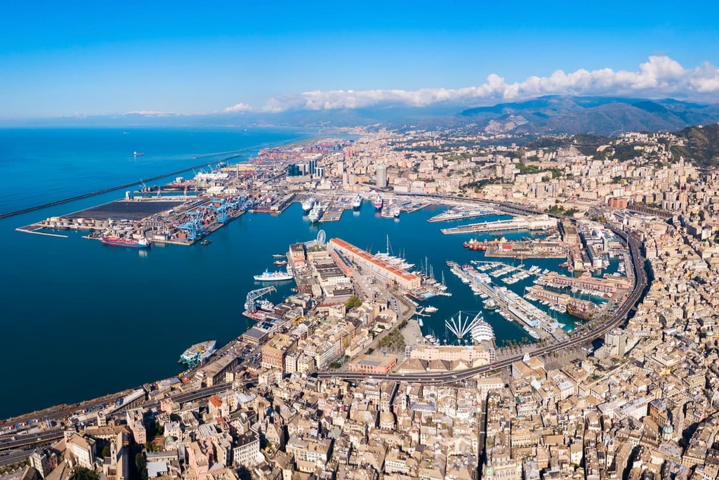
Genoa is the capital of the region of Liguria and a good place to base yourself for a visit to Antola Natural Regional Park.
Genoa offers access to the beautiful towns of the Mediterranean Sea, as well as the quickest route from the coast to reach the park. Staying in Genoa will also give you the option to visit both the Beigua and Portofino natural regional parks, too.
Genoa itself has much to offer, with a mix of Medieval, Renaissance, Baroque, and Gothic architectures, historical sites such as the palazzi of via Garibaldi, the Palazzo Ducale, and its many winding medieval streets.
Torriglia is a small town located in the upper Trebbia Valley, some 20 km (12 mi) to the northeast of Genoa. Although small, the town gives easy access to Antola Natural Regional Park and offers an abundance of B&Bs in the surrounding area.
Additionally, Torriglia is also known as the UFO capital of Italy. It got this nickname due to an alleged alien abduction in the 1970s of an Italian night watchman named Pier Fortunato Zanfretta.


