The San Gotthard Pass Classic is the Perfect Spring Ski Adventure
Introduction
The well-traveled among you will know the San Gotthard Pass well. After all, it's known to be one of the snowiest locales in Europe, catching snow from all directions in a range where towering peaks block snow from each other. San Gotthard is nearly smack dab in the middle of the Alps, and with the additional orographic advantage of a major pass through the central alpine spine, it picks up ridiculous amounts of snow at relatively low elevations.
Gotthard Pass is also proximate to the legendary resort of Andermatt. This off-piste paradise has gained more notoriety in recent years, after a Vail buy-out and inclusion on the Epic Pass. Andermatt is also subject to a much higher annual snowfall than the rest of the Alps, though Gotthard gets more due to favorable orographics.
Needless to say, Gotthard Pass is Europe's express ticket to some late-season turns. The pass doesn't even open until mid-May! When you can finally sneak a vehicle through, expect to see some impressive snowbanks, sometimes reaching several meters in height. You know those pictures of mountain roads in Japan that turn into snow tunnels in the winter? You can find that at Gotthard after a particularly good season.
With vehicle access up to the top at 2,106 meters, skiers and riders who know how to earn their turns can get a much-needed boost into the alpine zone. By the time the pass opens, it's usually several hundred meters of hiking with skis on your back to reach the snowline, even though there is still great snow up high.
Culturally, the place is also interesting. That's because it's a geographic border between Switzerland's Italian and German-speaking regions. It's all German in Andermatt, while Airolo south to Lugano is Italian-speaking.
Pizzo Lucendro and Pizzo della Valetta
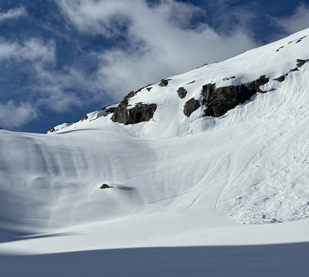
This past season was a dry one in the Central Alps, but there was still plenty of snow to ski right down to the road, even at the end of May. With meters of snow, steep mountain walls shimmering in the late-May sun, and verdant green valleys below, the contrast was astonishing.
Better yet, there are a few restaurants at the top of the pass, all open for business by this time. There's nothing better than stopping for a beer and a morsel after a long romp.
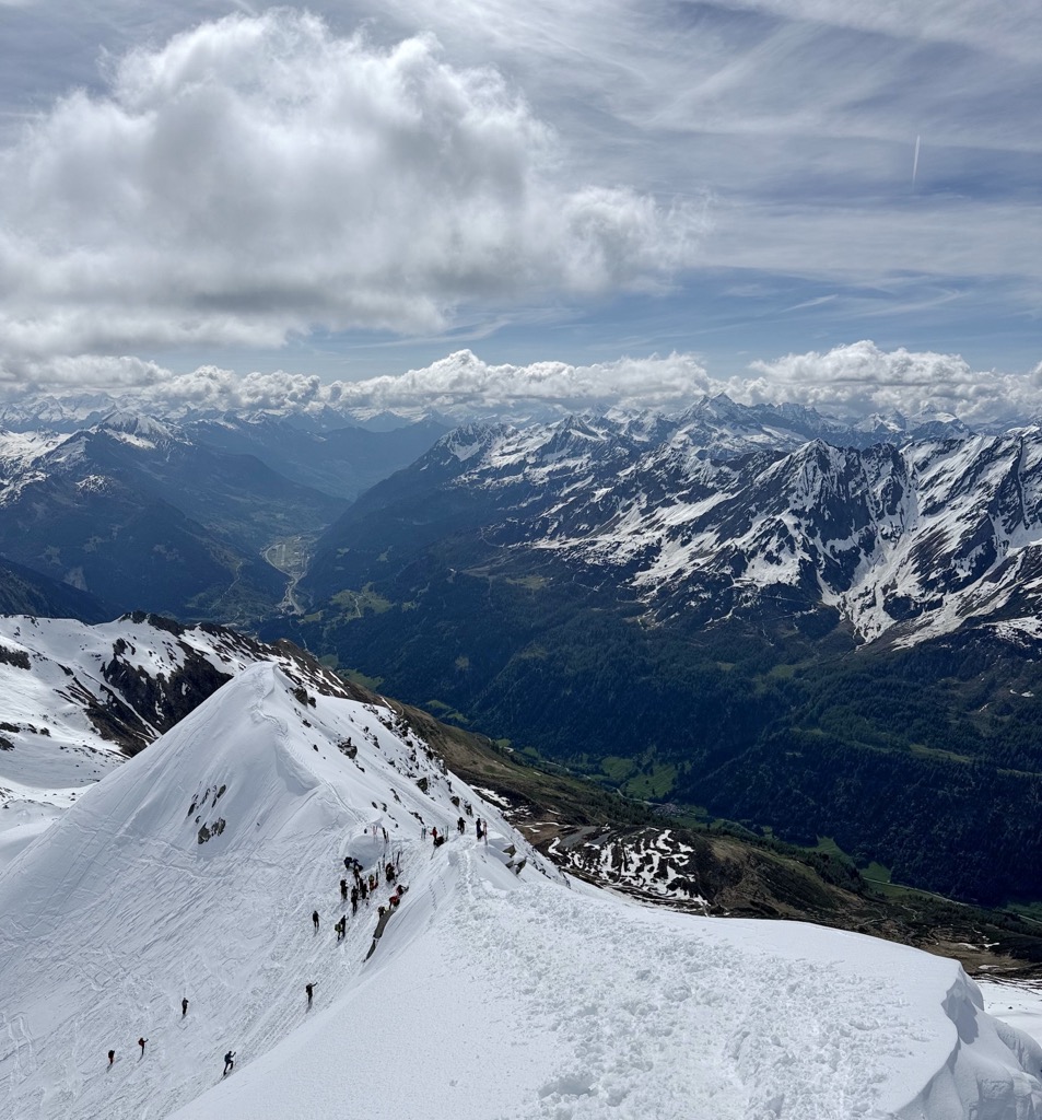
Look, there's no way around it, this place is pumping on the weekends around this time of year. There's still plenty of space to spread out, but you're not exactly going to get it untracked on the main descents if it hasn't snowed in a while.
But who can get upset? It's only natural that there are plenty of backcountry enthusiasts looking to make some nice curves before hanging up the skis for the summer. It's crowded for a reason: easy access, parking, and great ski terrain are just a few of the advantages.
So, where to sample the goods? There are numerous itineraries in the area—just take a look at the ski touring map. Let's go over a few of the classics (with the routes linked to our ski touring map). We've got Monte Prosa (2,737 m) and Giübin (2,776 m) to the east, and Fibbia (2,739 m), Pizzo della Valletta (2,758 m), and Pizzo Lucendro (2,963 m) to the west.
I opted for a loop tour. First, Pizzo Lucendro, via the Lago Lucendro, an artificial lake near the top of the pass. Then I made my way up a beautiful skin track on Lucendro's north face. The summits of both Lucendro and della Valetta were almost laughably crowded, but the skiing was halfway decent. It wasn't powder, and it wasn't perfect spring corn, but it was certainly skiable.
Next, I skied down the east face of Lucendro and skinned up to the Pizzo della Valetta. From there, it was a fun ski back to the car over undulating terrain.
I would recommend carrying an ice axe and crampons, though I didn't need them for this mission. I imagine the snow can get mighty crusty after a couple of freeze-thaw cycles, so they're good tools to have, especially for the final ridge walks to the summits.
Most people start quite early (7 a.m. or earlier), and I doubt you'd be able to find a parking spot after 8. Spending on the temperature and aspect, you can expect the daily corn cycle to begin sometime around mid-morning, so 7 a.m. is a great starting time for the classic itineraries I've listed above.
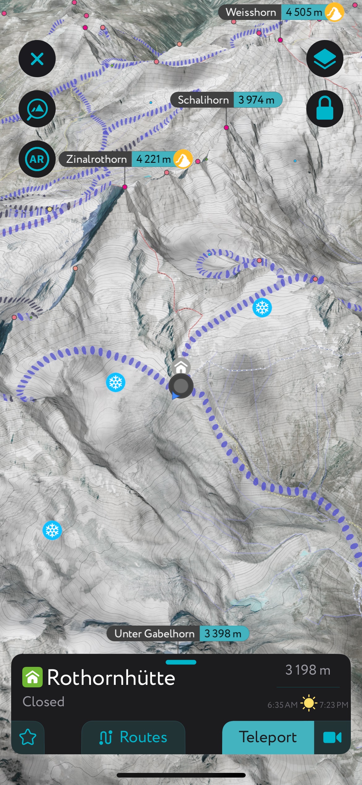
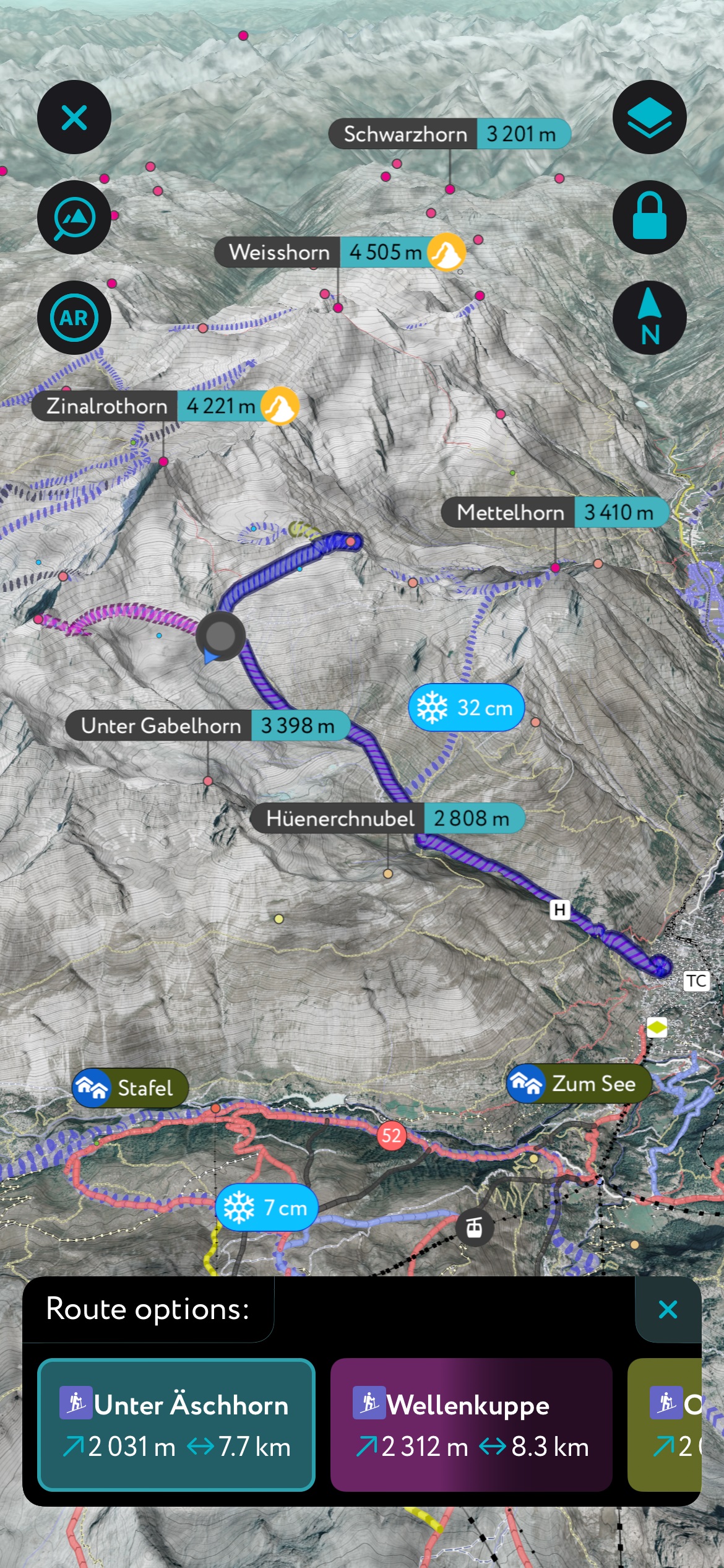
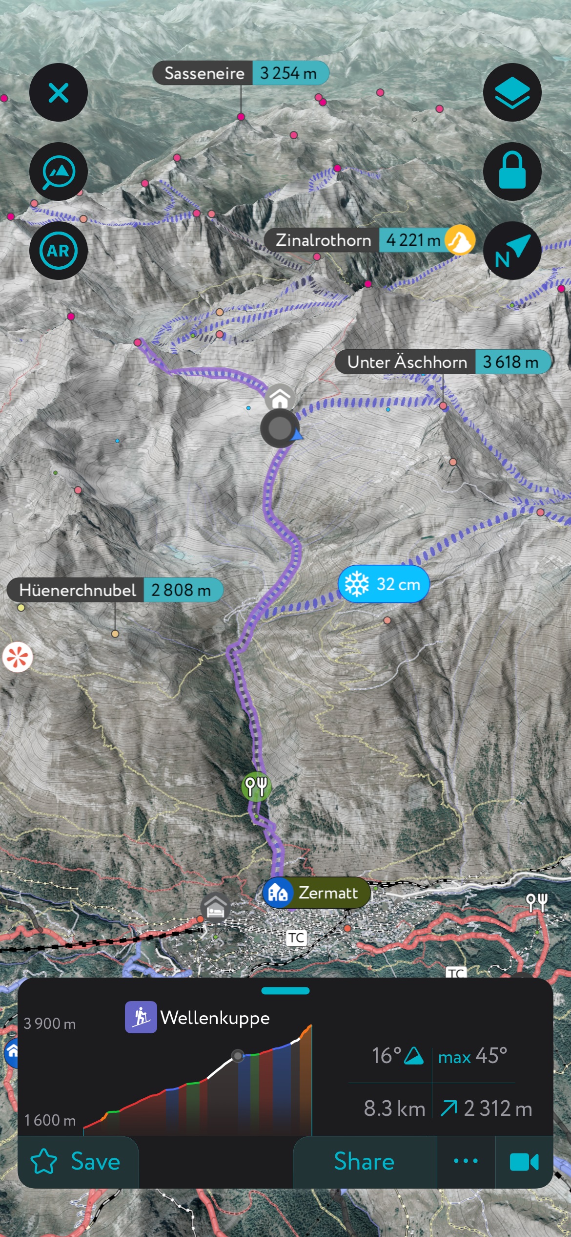
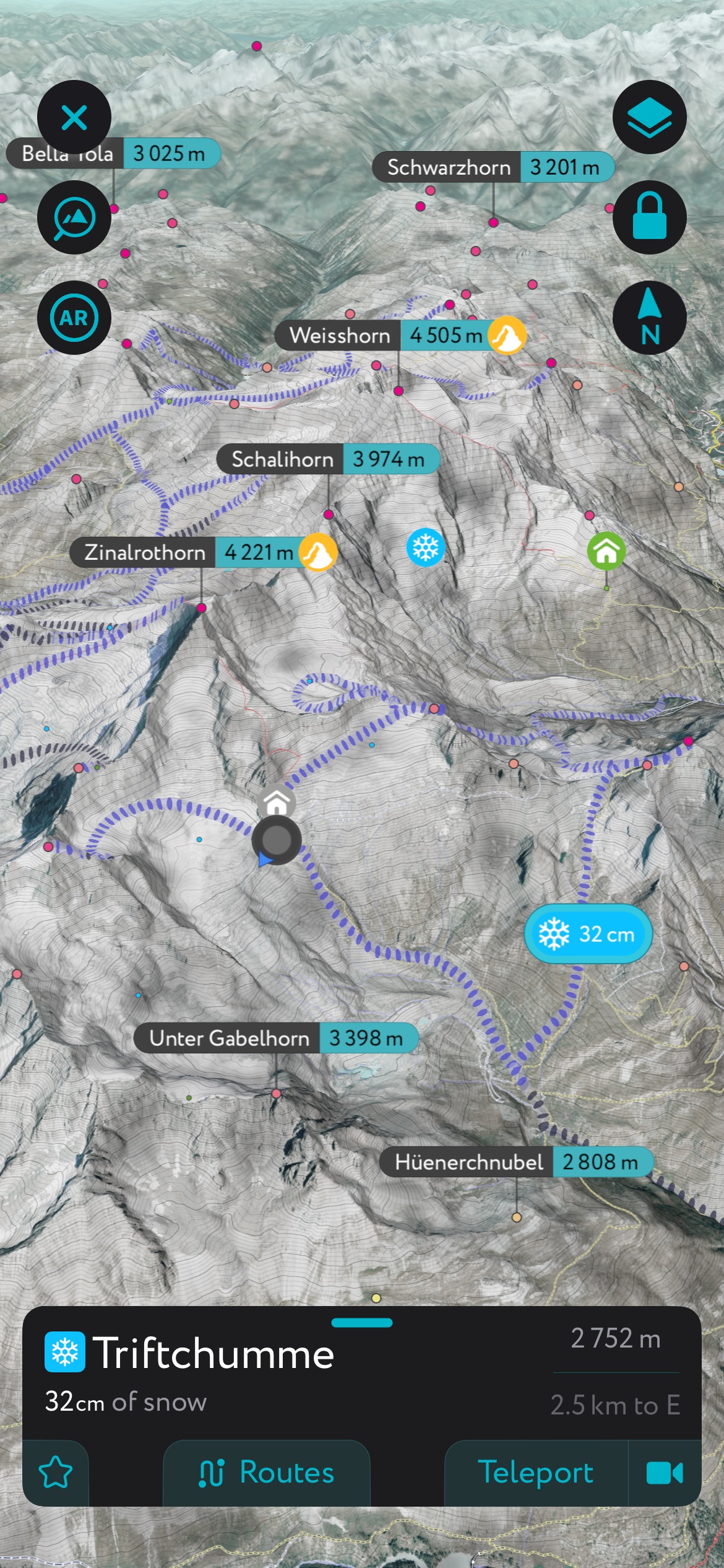
Using the PeakVisor App
If you liked this story, you should know that it was brought to you by the one and only PeakVisor App. PeakVisor is a leader in the augmented reality 3D mapping space; we’re the product of nearly a decade of effort from a small software studio smack dab in the middle of the Alps.
I use the app to track activities, navigate with exquisite 3D maps, and learn the surrounding peaks’ names. I’m all for tools that help quicken the pace in the mountains, and the PeakVisor App greatly accelerates things. It’s also critical for planning, whether I’m headed into the backcountry or searching for off-piste goodies at a new ski resort. Read on for a breakdown of some of the app’s best features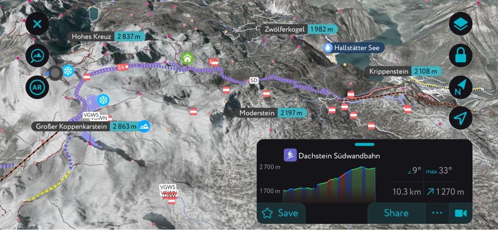
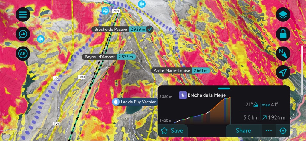

PeakVisor Features
In addition to the visually stunning maps, PeakVisor's advantage is its variety of tools for the backcountry:
- Thousands of ski touring routes throughout North America and Europe.
- Slope angles to help evaluate avalanche terrain.
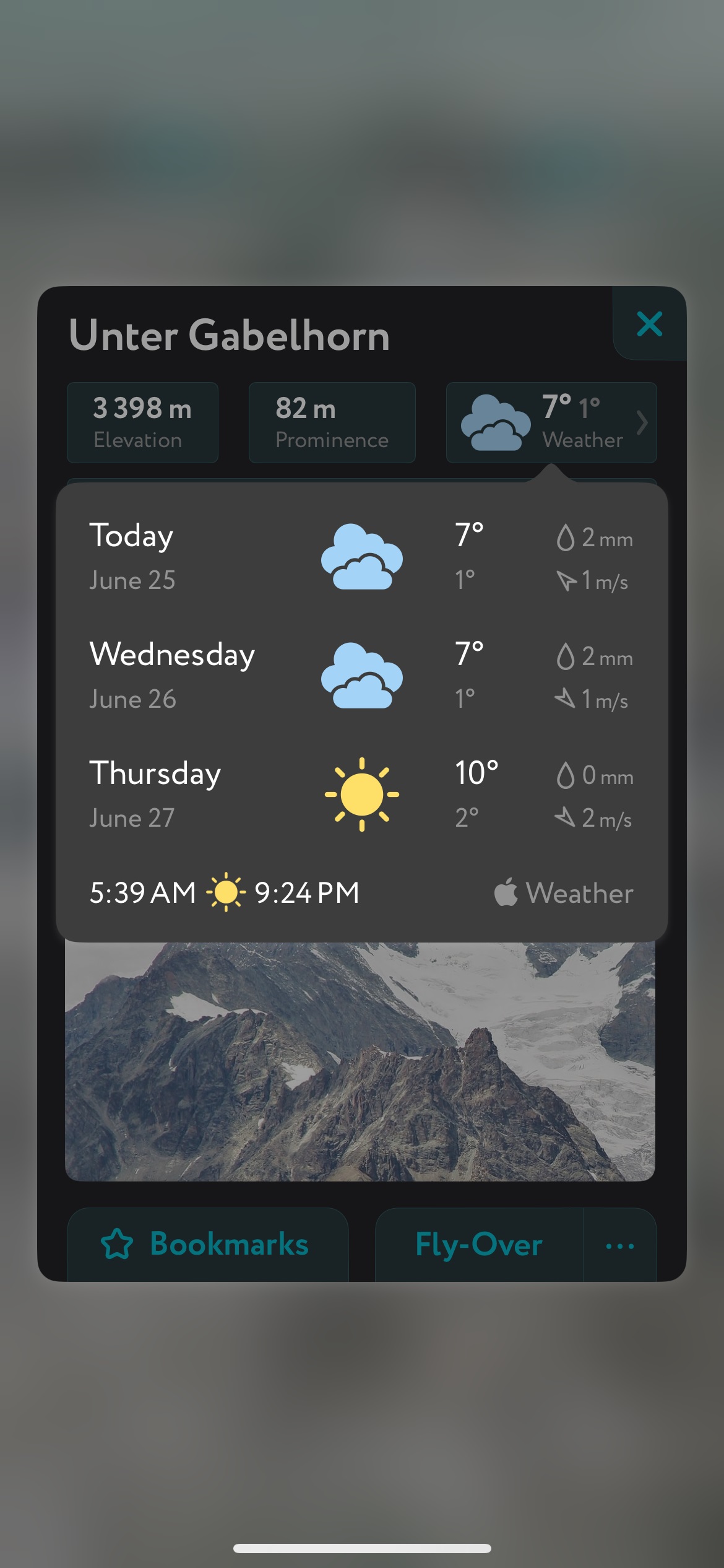
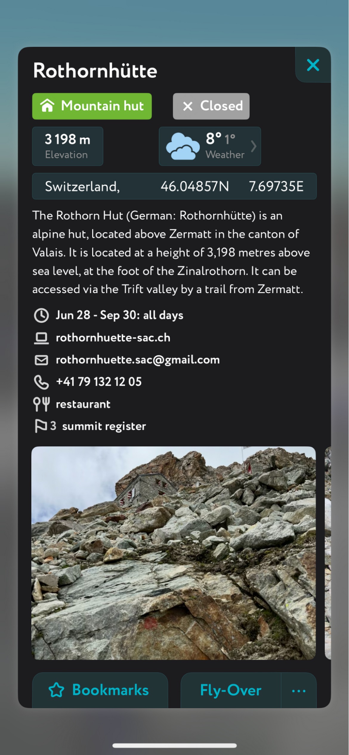
- Mountain hut schedules and contact info save the time and hassle of digging them up separately.
- The route finder feature generates a route for any location on the map. You can tap on the route to view it in more detail, including max and average slope angle, length, and elevation gain.
- Up-to-date snow depth readings from weather stations around the world.
- A point weather forecast for any tap-able location on the map, tailored to the exact GPS location to account for local variations in elevation, aspect, etc., that are standard in the mountains.
- You can use our Ski Touring Map on your desktop to create GPX files for routes to follow later in the app.