
In the early 20th Century, the Scottish author Arthur Conan Doyle visited a distant land at the junction of present-day Venezuela, Guyana, and Brazil. The place was covered in towering mesas (known as tepuis), often over 2,000 feet tall, with an extensive system of plateau tablelands at the summits. These sandstone tepuis are the remnants of the supercontinent Gondwana; their prehistoric nature inspired A. Conan Doyle to write The Lost World.
The book envisions the tablelands of these tepuis as home to a surviving ecosystem of dinosaurs, untouched and cut off from the rest of the world by towering, (nearly) unscalable cliffs. The Lost World became one of the classics of science fiction literature, eventually inspiring Michael Crichton and the Jurassic Park movies.
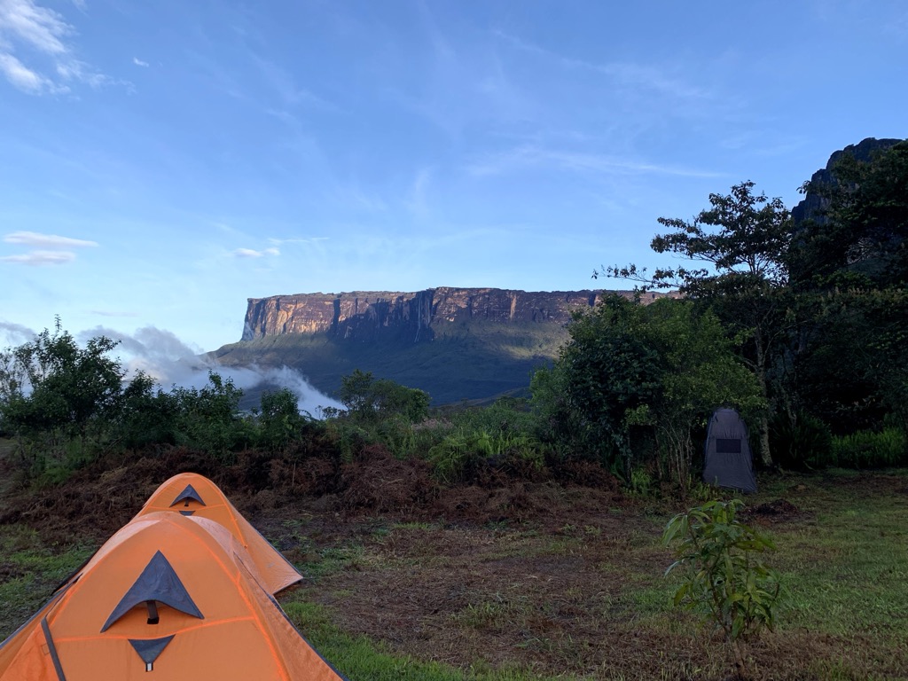
Recently, one of PeakVisor’s DevOps engineers took a trip down here to discover the lost world for himself. Mount Roraima is the very same tepui that inspired A. Conan Doyle, and it has become one of the most famous destinations for visitors. The mountain sits at the crossroads between Venezuela, Guyana, and Brazil; our trip took us to Canaima National Park in Venezuela (most of the tepui is located in Venezuela). We’ll recount the journey and share photos and routes for anyone else interested in checking out this incredible destination.
Regarding the Travel Warning
Citizens of most countries don’t need a visa to visit Venezuela for short stays, but most Western governments advise against travel there. If you’re a U.S. citizen in particular, you’re gonna want to appreciate the photos and pass on actually coming here.
Crossing the Border
It would be challenging to pass through Venezuelan border control without local guides. We had to sit for a video-recorded interview where border officers asked us questions in Spanish, which our guides translated. The officers didn’t speak English, and we don’t speak Spanish. The videos are then sent to a mysterious third party, who ultimately decides if you will pass through or not.
Our guides explained that the tourist spots are safe because tourists bring money. They also explained that the entire industry is controlled by a “mafia”; they have to pay a certain amount of their earnings to the controlling parties.
Otherwise, our experience was straightforward. We traveled to Manaus, Brazil, before crossing into Venezuela. The national parks surrounding the tepuis are safe, sparsely populated, and home mostly to indigenous tribes. There’s an established infrastructure for camping and trekking. We had local guides and felt safe for the duration of the trip. There was nobody around except tourists and indigenous locals, many of whom made their living from the tourists.
Our Mission
We embarked on a seven-day camping trip to explore the Roraima Tepui and the surrounding tablelands. It was August, the middle of the rainy season (May to December), but it wasn’t unmanageable. The area is north of the Amazon rainforest and receives much less rain, though it still rained a lot.
If you want to do a comprehensive trip to discover all of the most interesting points atop the summit, you’ll have to spend a full ten days at the top. We only had two full days.
We hired local guides for the duration of our time in Venezuela. We spent one night in the city of Santa Elena de Uairén. The hotel was clean, with spacious rooms and an abundance of hot water. We went to a restaurant to try Venezuelan cuisine, specifically a soup made from the Amazon region's Tambaqui fish (Colossoma macropomum), accompanied by local bread and chili with ants. We didn’t feel that the city was dangerous. There were a few tourists, and we didn’t see any gangs or suspicious-looking individuals. Nevertheless, we didn’t walk around at night.
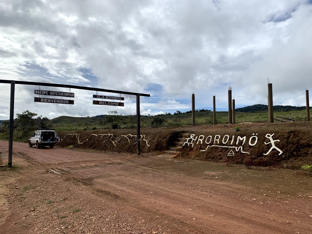
Next, we headed for the indigenous village of Paraitepuy, ascended the Roraima tepui, and spent a few days exploring before returning to the village. All told, we spent seven days on the trail and a few more in the towns.
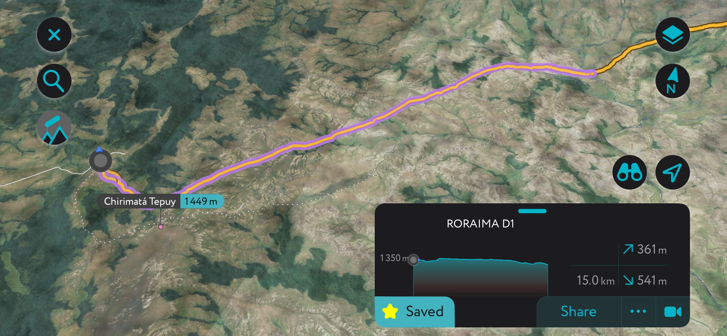
Check out the links to our routes on PeakVisor’s desktop hiking map and route planner. They’re all placed in the headings: Day 1, Day 2, etc. You’ll find stats, notes, pictures, detailed maps, and more. You can also export the GPX files for each day’s route.
Day 1
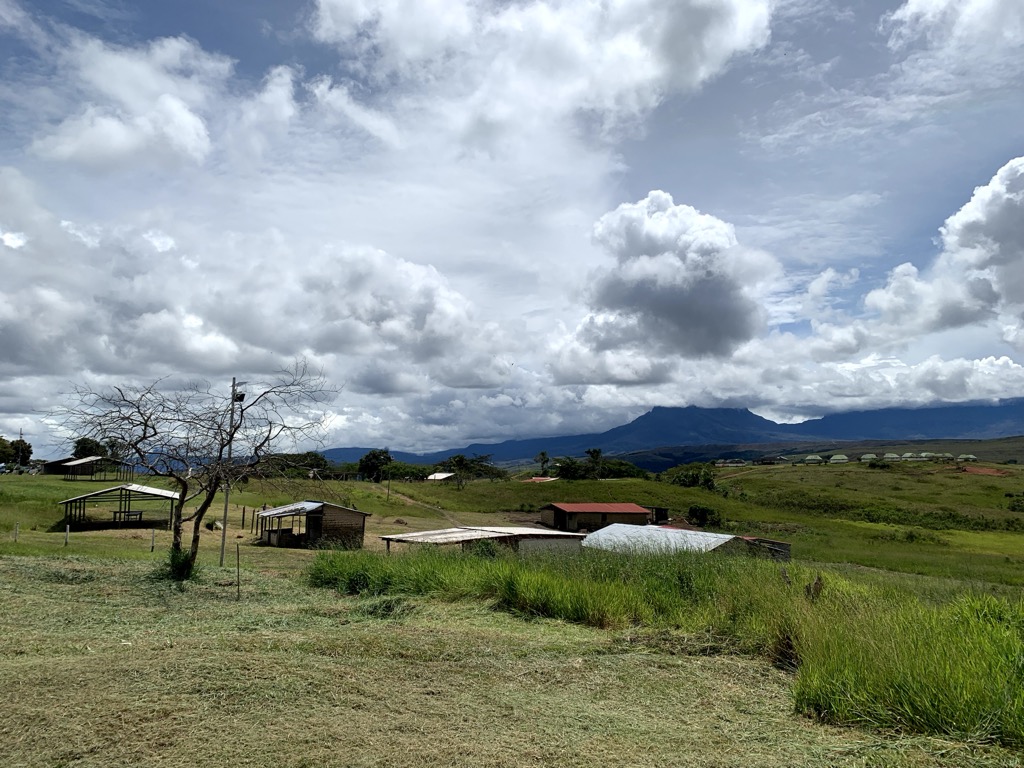
Our first day consisted of a long approach from the indigenous village of Paraitepuy to the tablelands of Roraima. We reached the village via Land Cruiser on unsealed roads, then set out on foot. We put in 15 kilometers (9.3 miles) on the first day to reach camp on the Kukenan River.
You can stop before that, at the Campamento Rio Tek, which is a bigger site, but we opted to go farther. You have to cross rivers to reach these camps, and there are no bridges. We took off our shoes to cross, but it’s also best to have some footwear you don’t mind getting wet for the plateau; we brought Crocs. Our pants got wet but it wasn’t a big deal as it doesn’t get cold until you reach the summit of the plateau, days later.
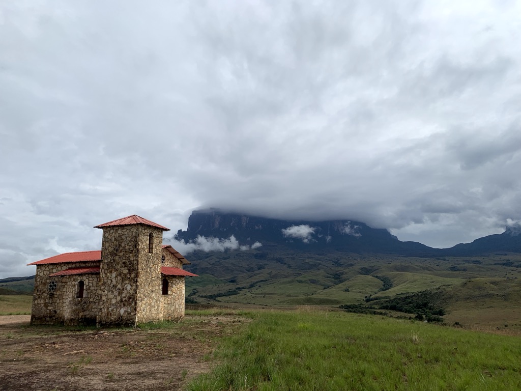
Between the two camps is the Ermita de Santa Maria de Tokwono Chruch, built on the site of an old Indigenous village. The village relocated closer to the road as soon as civilization appeared. All that remains are the church and many stones bearing the inscriptions of the Natives.
Day 2
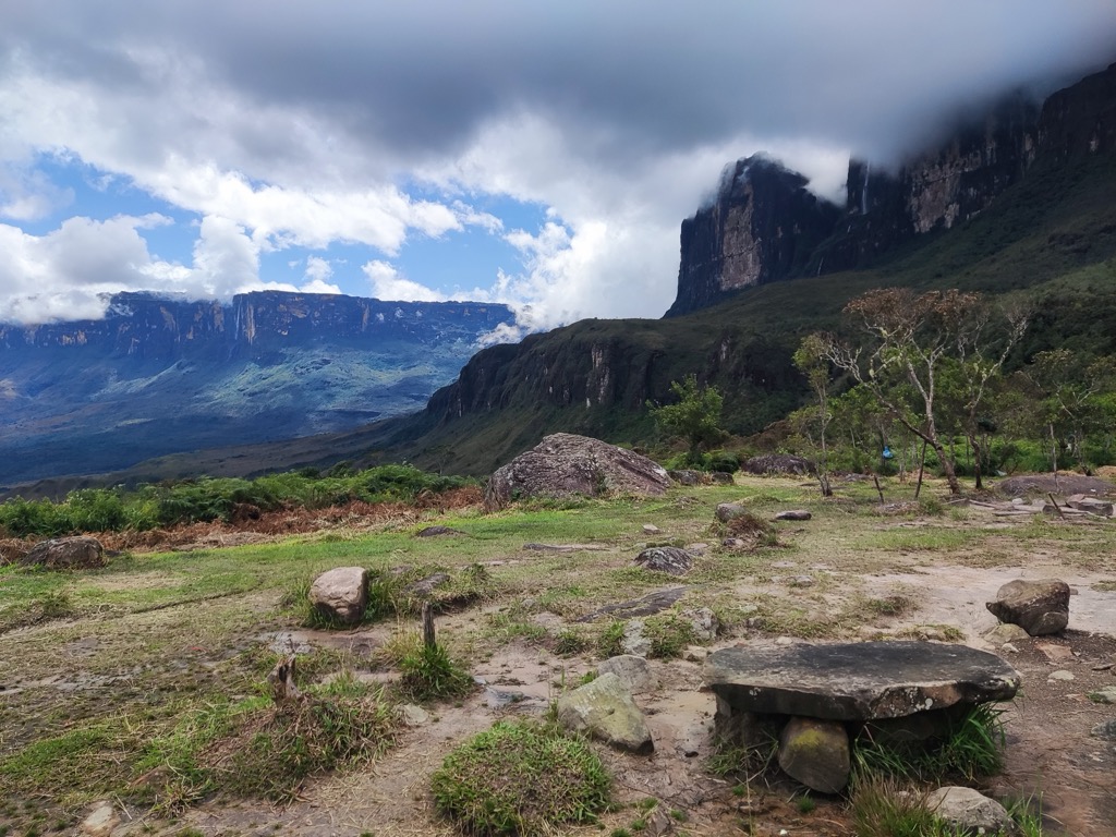
Our second day was short but steep. We put in less than 8 kilometers (5 miles) but gained 800 m (2,640 ft) of elevation to reach camp at the base of Roraima.
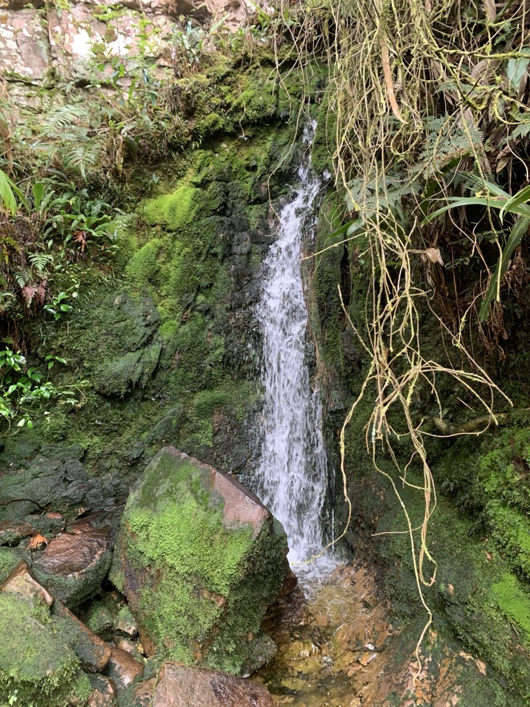
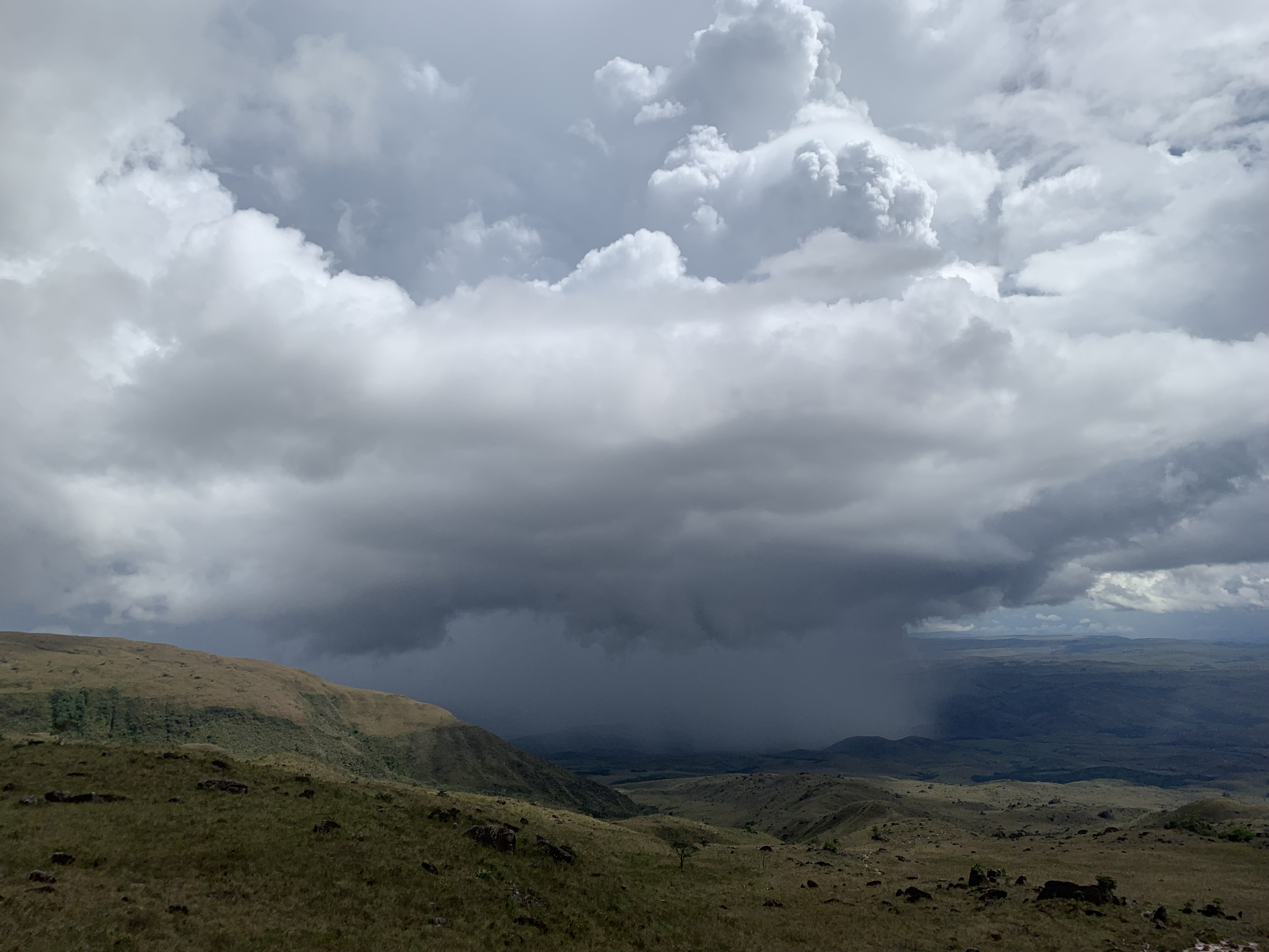
The camp sits beneath the towering sandstone walls of the tepui, with waterfalls visible. These tepuis are conducive to the formation of massive waterfalls. In fact, the world’s tallest—Angel Falls—pours off a neighboring tepui about 100km from Roraima. Kukenan Falls is the region’s second-tallest and flows into the Kukenan River, which we crossed earlier. Roraima Falls is the tallest on Mount Roraima.
Day 3
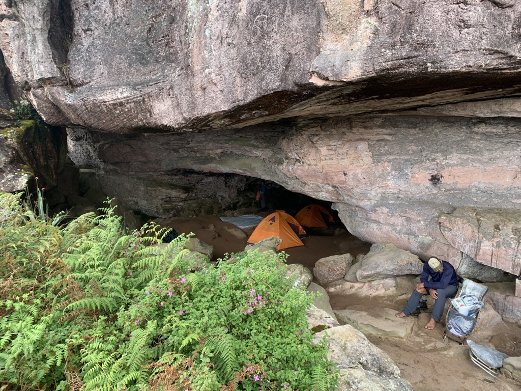
Our third day was our first on the Roraima Tepui. We put in another 700 or so meters of climbing to reach the plateau to reach camp, which is lovingly named Hotel Jacuzzi.
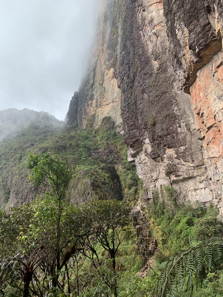
It’s worth noting that the path here diverges from the publicly available dataset that you’ll find on PeakVisor and other mapping apps. It runs along the vertical wall of the cliffs, which you can see in my route (we’ll change this on the app). It’s another good reason to have local guides.
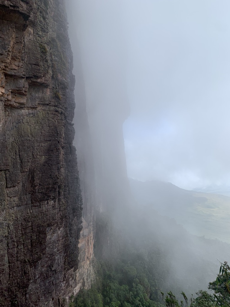
This day was the most challenging part of the trip, marked by a climb through a waterfall at the end, before reaching the plateau. The campsite is unique; a cave with several rooms makes for a cozy night.
Day 4
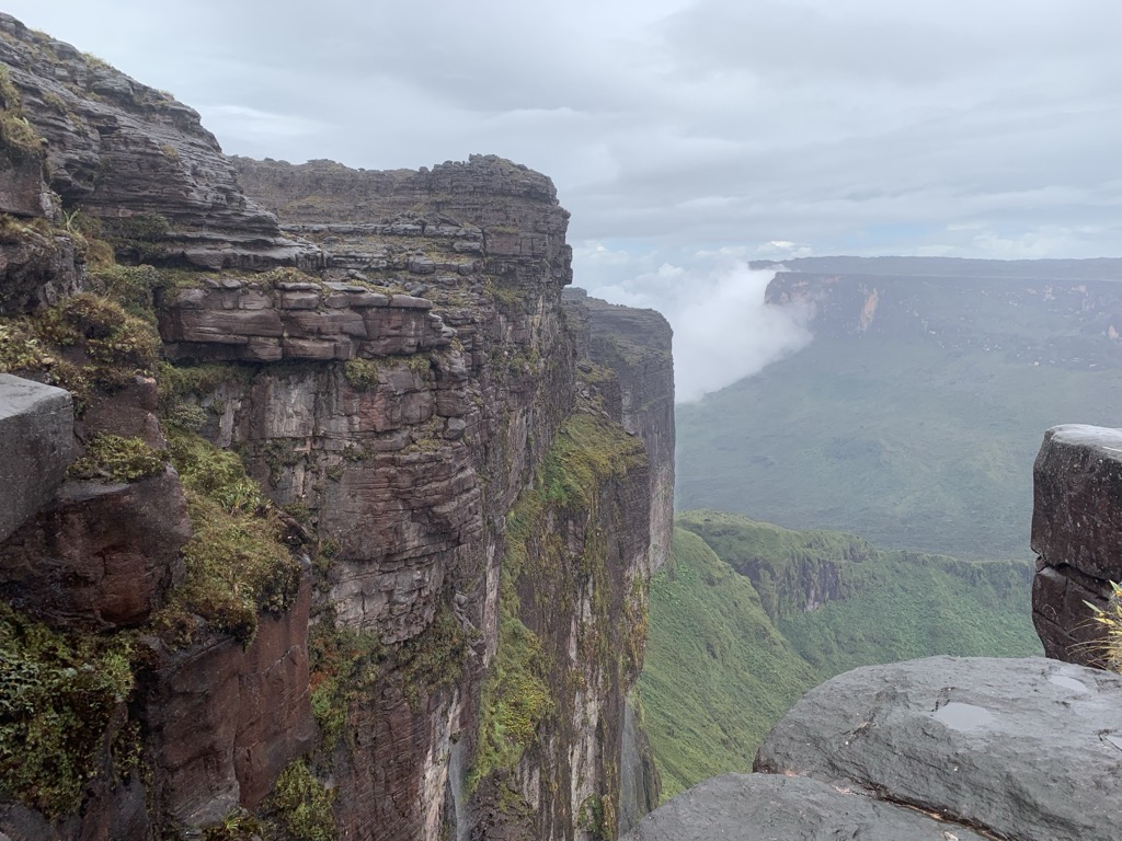
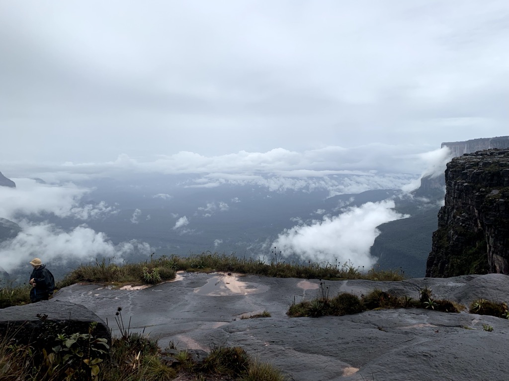
This was our first day atop the Roraima plateau. After two strenuous days, we had a relatively chill hike to the Ventana viewpoint on the northern edge of the tepui, starting out from the viewpoint near our camp, which overlooks the tepui’s southern edge.
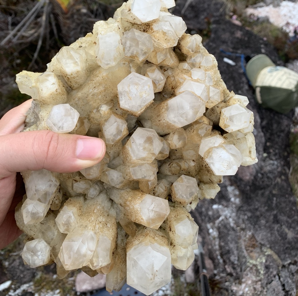
Along the route, you can find lots of exposed quartz crystals. Additionally, there are springs throughout where you can go swimming. They’re basically small caverns or depressions where rainwater collects. If you come here during the wet season, as we did, there’s plenty of good swims to be had.
Don’t expect to ever truly dry off, though. With humidity of 90% or higher, you’ll be damp for the duration. It also gets quite cold at night, around 13 ℃ (55℉). That makes sense when you consider that you're over 2000 meters above sea level.
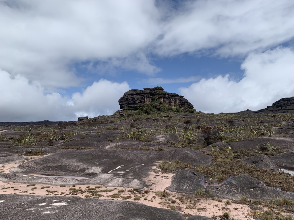
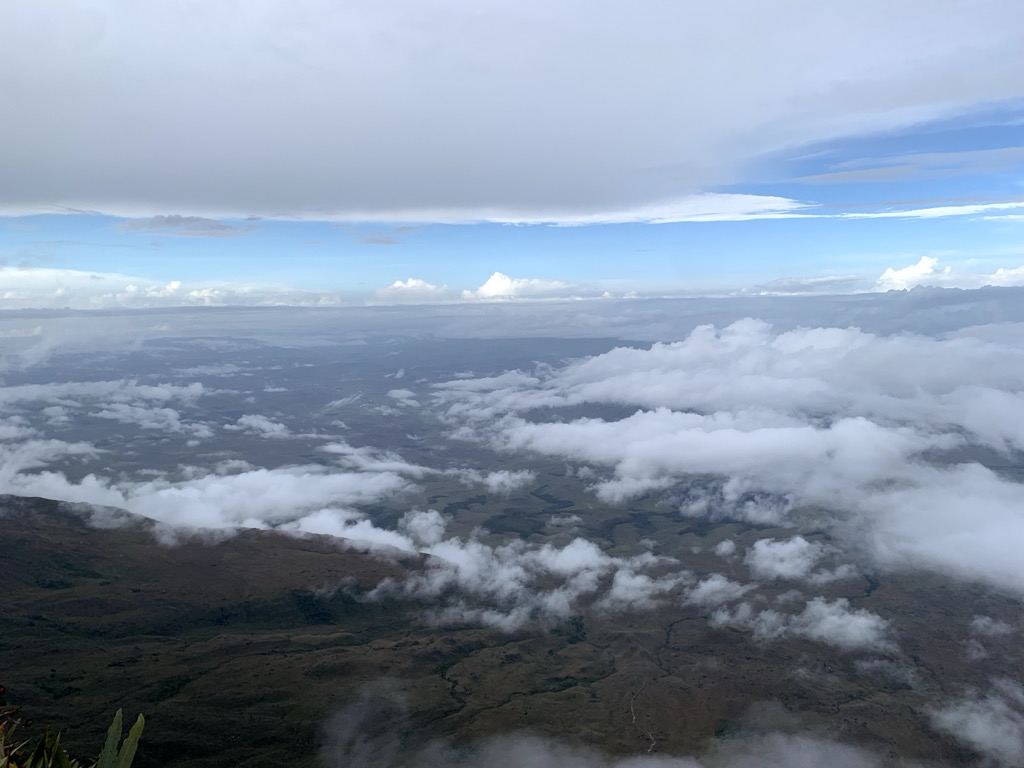
You come to realize the fiction of A. Conan Doyle’s novel when you see the plateau.
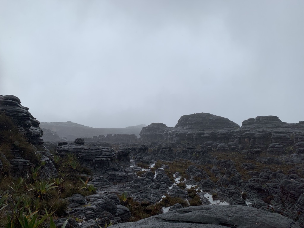
Rather than a mystical forest harboring thousands of large herbivores, this place is more like a moonscape, where only a few hardy plants and animals can survive. It’s mainly the rock. There’s little to no topsoil. You can certainly see the inspiration from the bottom, where it seems that the tablelands must surely harbor some mysterious place.
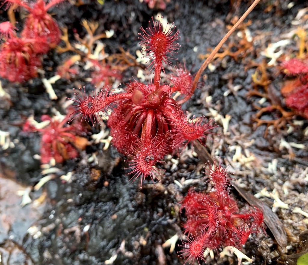
While we regret being the ones to break the news that there are no dinosaurs here, there are undoubtedly many endemic plants and animals that have evolved to survive on the unique conditions of the plateau. For example, because the soil is low in nitrogen, many plants are carnivorous! Animals on the plateau are small. The largest is the coati, a raccoon-like creature that weighs up to 8 kg (17 pounds).
Day 5
Our second day on the top featured a long hike to the triple border between Venezuela, Guyana, and Brazil. It was a long day, with over 16 km (10.7 miles) of walking and over 800 meters of total elevation gain. After all, we were essentially traversing the entire plateau.
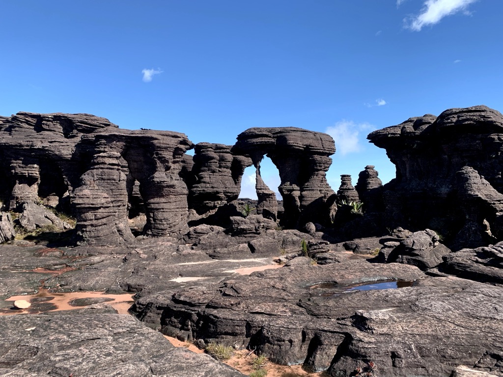
First we passed through Star Wars-esque landscapes. These fascinating sandstone formations were otherworldly.
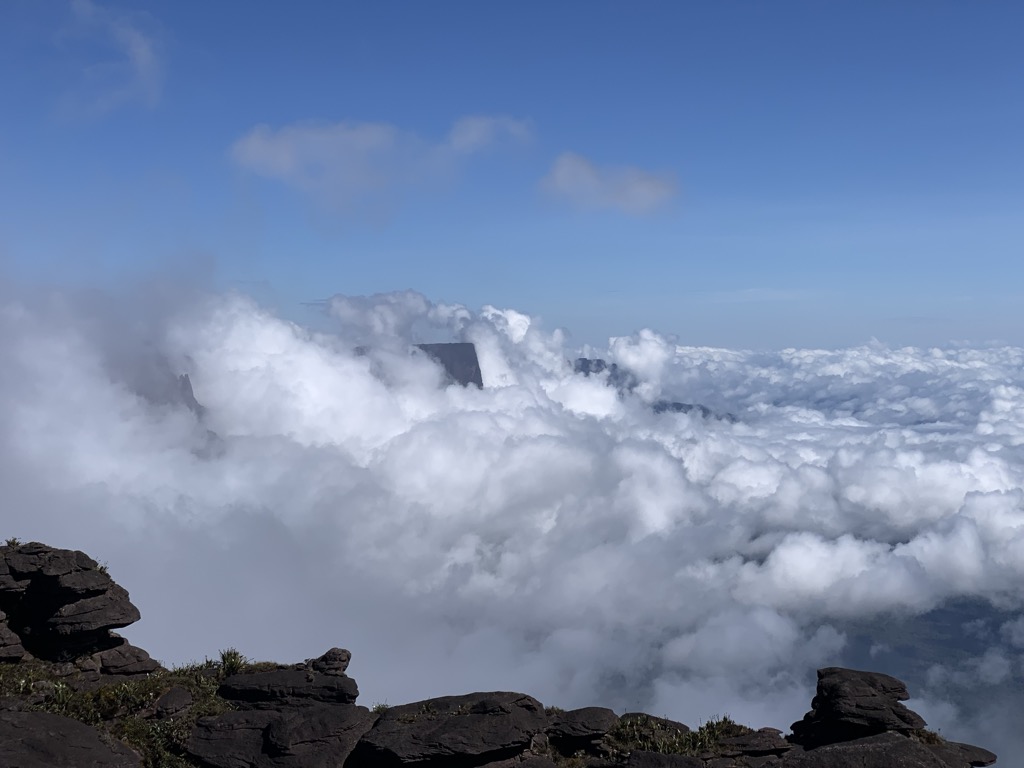
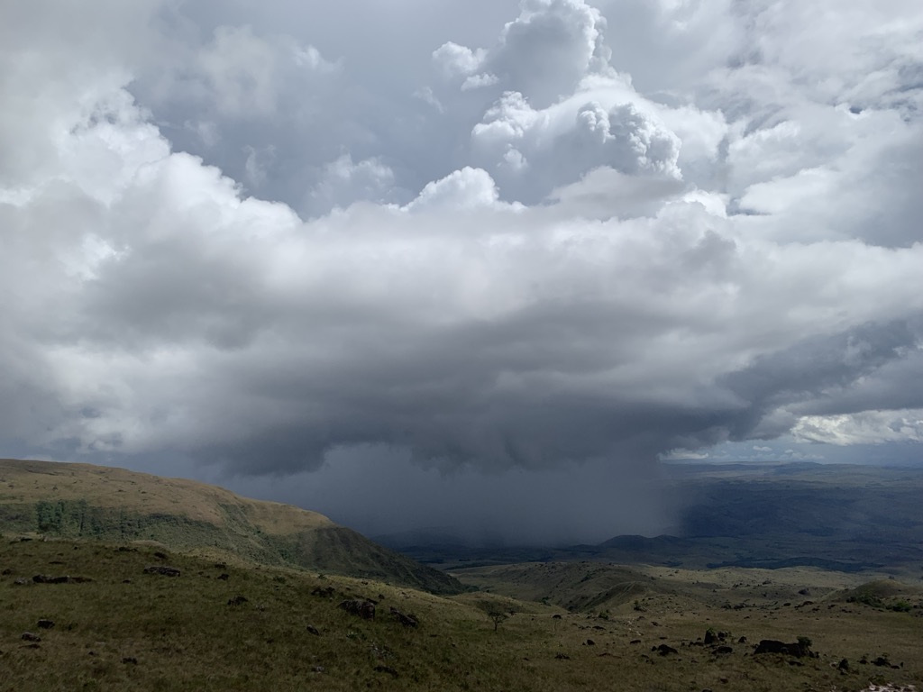
Next, we came to a viewpoint, where mystical clouds butted their way up to the rim of the plateau. I was distracted by all the scenery and cut my foot on sharp rocks. Watch out!
A simple cairn marks the border. It’s not the most exciting thing, but it’s a destination. It’s all about the journey on this one.
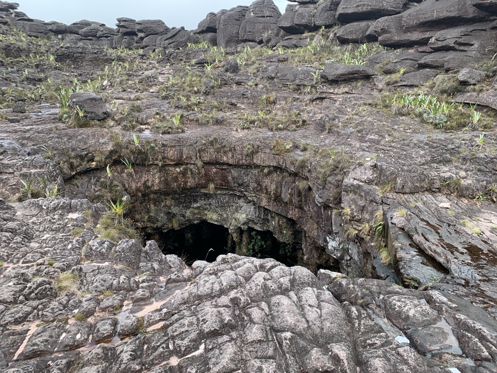
Next, we head to Brazil to a valley full of crystals. We returned to Venezuela for lunch near a large cave, essentially a hole in the ground. Lunch is notable; our cook would carry a mobile field kitchen to a specific location. They would communicate by radio with our guides and agree to meet at a specific spot on the plateau.
Many of the plants and flowers that survive on the tepuis are endemic species; they exist only on the tablelands and nowhere else.

Days 6 and 7
Departing from Hotel Jacuzzi, our home for the last few days, we returned the way we came over the course of two days. We still had some great views, but we were also plagued by heavy rainfall. We had to cross the rivers with ropes, as the flow had become quite strong due to the rainfall.
After reaching Paraitepuy, we spent one night in the village, then headed back to Brazil.
Using the PeakVisor App
You can plan and track your adventures on our mobile app. When planning a trip, you can view all the statistics for each hike, including vertical gain, length, and estimated time to completion. You can also use our desktop planner to explore on the big screen, seamlessly saving routes to your profile on the mobile app.
Even if you use a guiding company, like we did, it’s still fun to keep track of your hikes and pinpoint your location on the mountain at any given time.
The app is a treasure trove of information, featuring thousands of routes, trails, peaks, cabins, and parking areas worldwide. It’s all on here. In addition to planning your own route, you can also upload .gpx files if we don't have a trail on our servers. The PeakVisor app is available for iOS and Android; give it a shot and discover our visually stunning 3D Maps, adding a new dimension to your alpine adventures.
Check out our previous release — Next-Gen Route Planner and Track Insights — for snap-to-skitours, drag-and-drop GPX import, and the full Planner/Elevation/Pace analytics workflow.